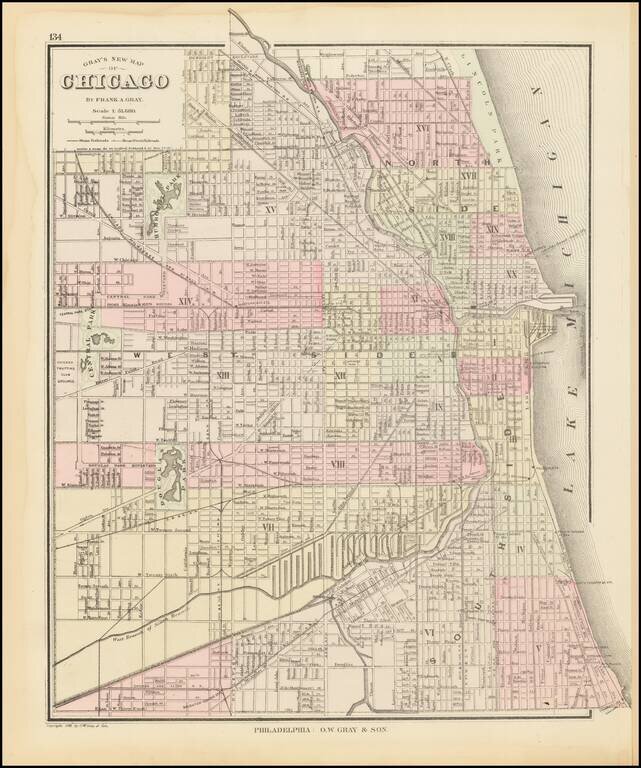
Detailed map of Chicago, published by O.W. Gray & Son. The map is colored by wards and showing streets, rail lines, parks, buildings, stations and a host of other details. One of the earliest maps of Chicago to appear in a commercial atlas.
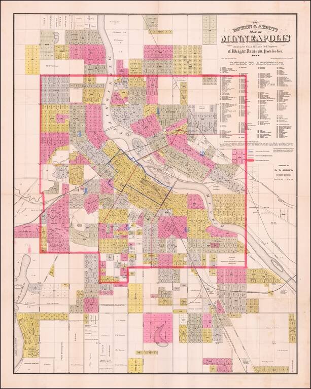
Detailed, locally-published antique map of Minneapolis, lithographed by Johnson, Smith & Harrison in Minneapolis in 1881. Three types of boundaries are shown on the map: Fire Limits, Ward Boundaries, and City Limits. Wards are identified with...
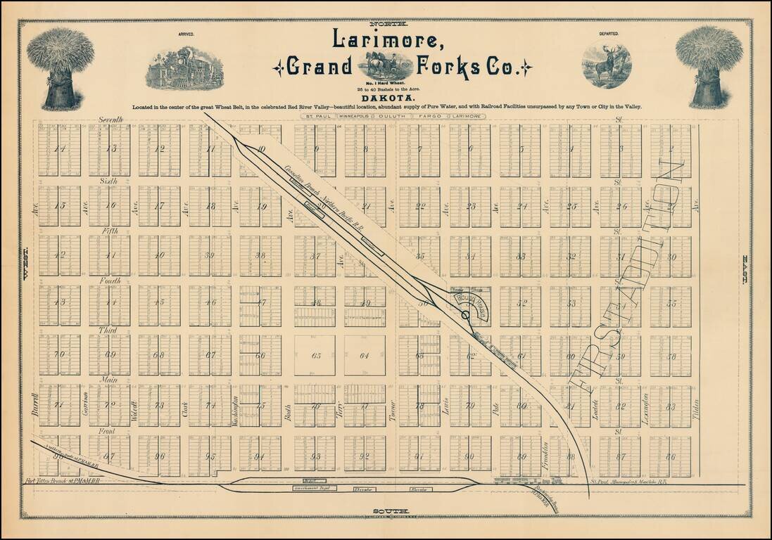
Fine early plan of Larimore, in Grand Forks County, North Dakota. The town of Larimore was formed in 1881 with the arrival of the Northern Pacific Railroad. The map notes that Larimore is: Located in the center of the great Wheat Belt, in the...
![Colorado [with Indian Territory on verso]](/map/small/71186.jpg)
Highly detailed map of Colorado [and Indian Territory on the back side], hand colored by counties and showing townships, towns, roads, mountains, rivers, lakes, mines, plateaus, railroads, etc. One of the most detailed maps of the period for each of...
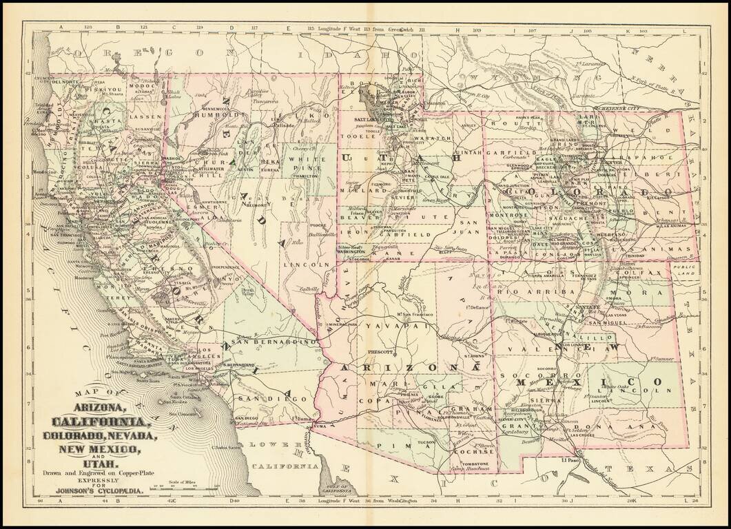
Detailed map of California and the Southwest, colored by Counties.
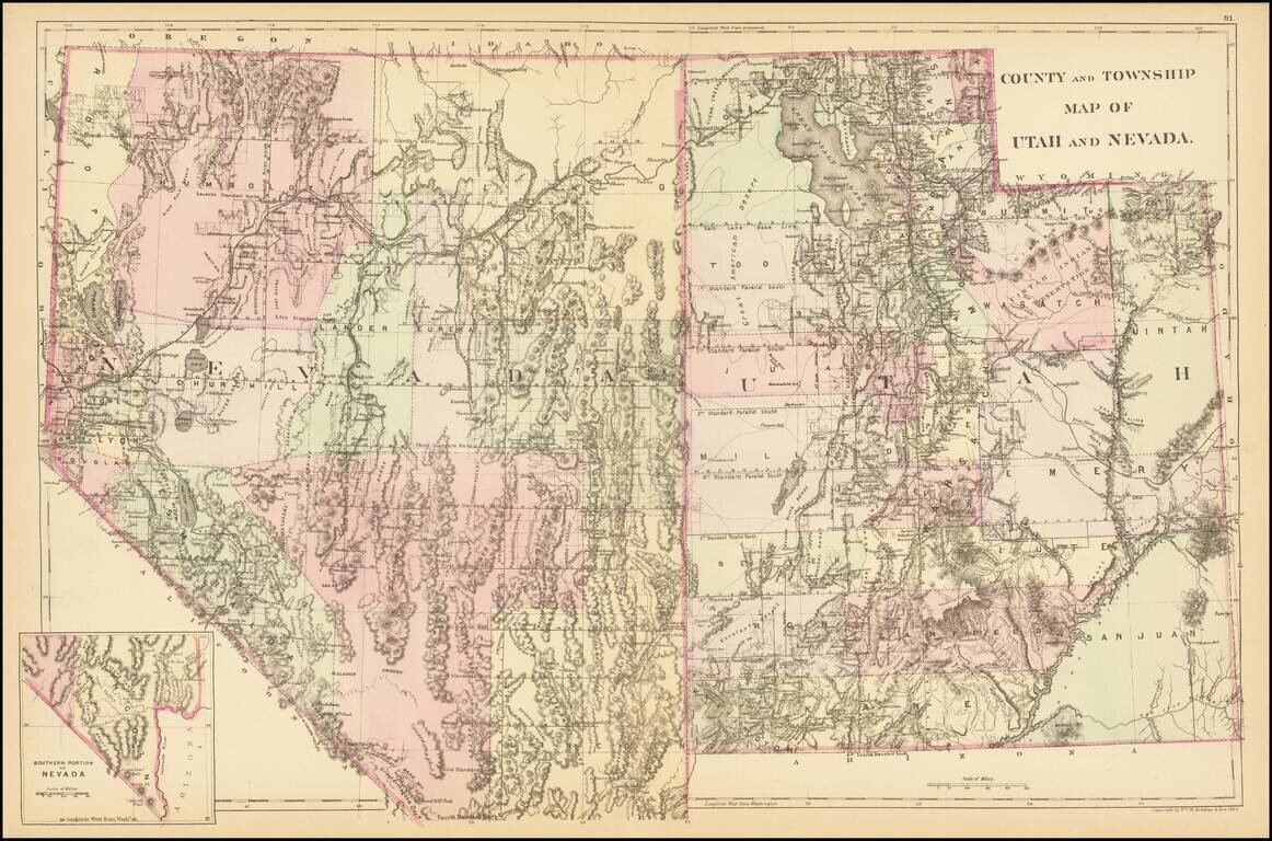
A detailed map of Utah and Nevada, colored by counties and showing towns, roads, railroads, rivers, lakes, and a host of other details. While earlier editions of the map include all of Utah but lack the southern tip of Nevada, this 1884 edition adds...
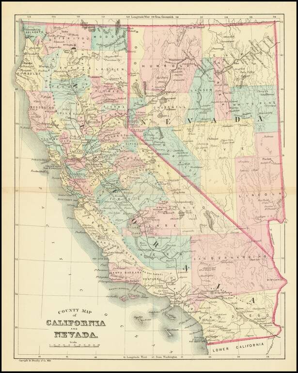
Detailed map of California & Nevada, published by William Bradley. The map is colored by counties. Pre-dates the formation of a number of Southern California Counties, including Orange, Riverside and Imperial Counties.
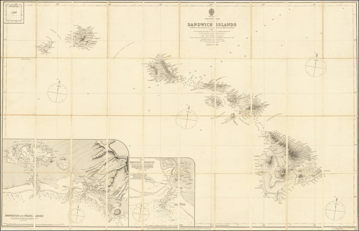
Fine and Rare Admiralty Chart of the Sandwich Islands from the First Government Survey of Hawaii Good example of Admiralty chart of the Hawaiians Islands, then known as the Sandwich Islands, with input from the first trigonometric survey of the...
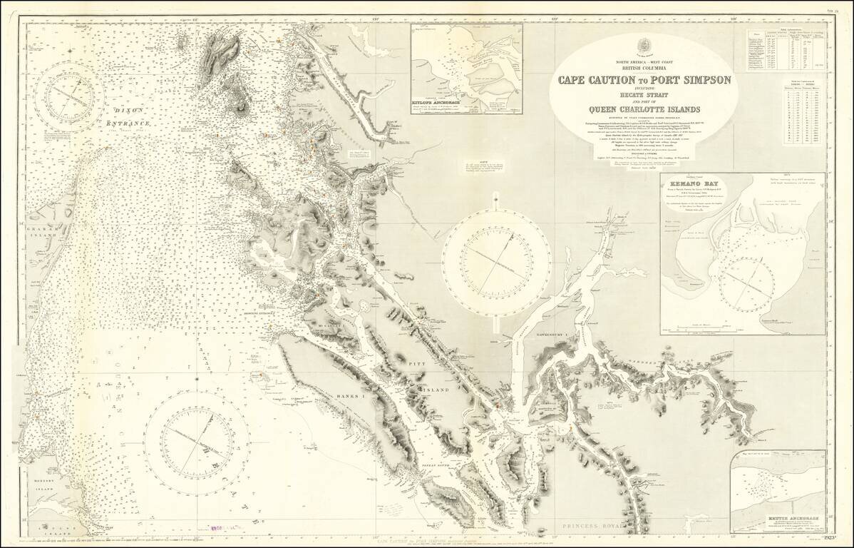
Large engraved chart of the Pacific coast of British Columbia just below the border with Alaska. The map covers the area known as the Hecate Strait between Graham Island and the archipelago to the east. There are extensive soundings and some...
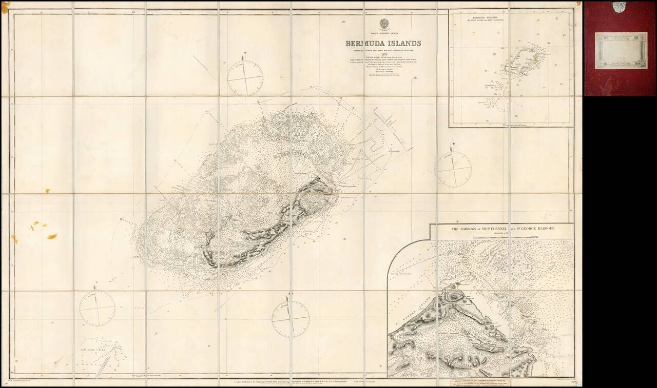
Finely detailed separately issued sea chart of Bermuda, with a large inset plan of St. George Harbour, first published by the British Admiralty in London in 1877. The inset of St. George's Harbour is of particular note, one of the largest and most...
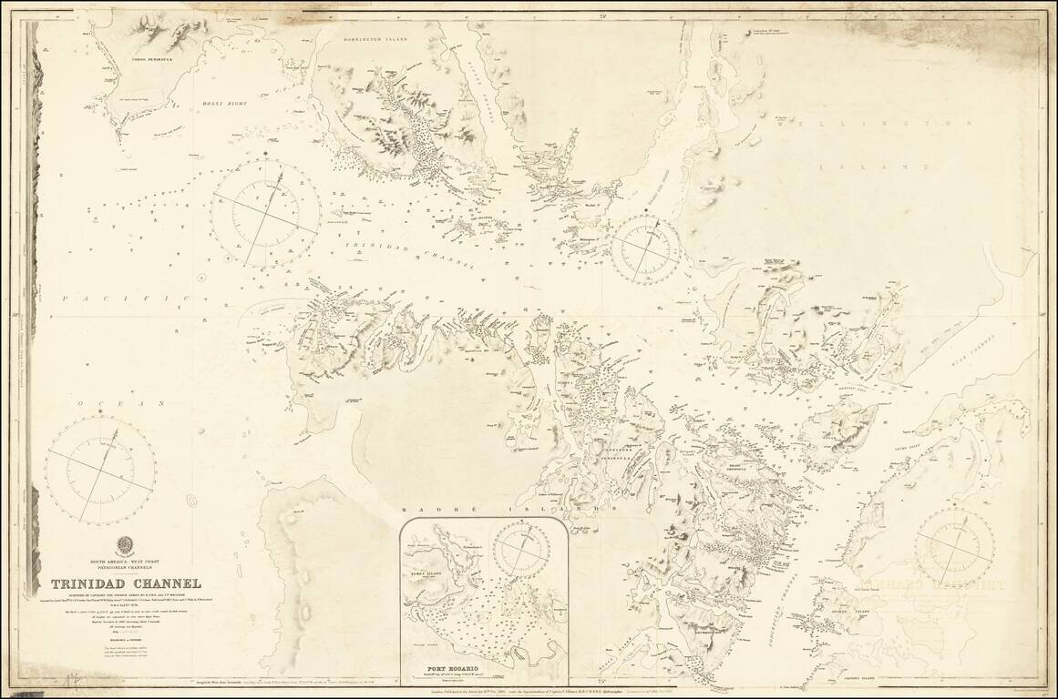
Detailed British Admiralty chart of a western section of the Strait of Magellan, illustrating the Trinidad Channel. The following report appeared in surveys of the Admiralty for 1879: On the western coast of South America, H.M.S. Alert, with an...
![[Plan of the City of Moscow] Планъ Города Москвы](/map/small/61305.jpg)
Detailed color-printed antique map of Moscow, published in 1881. The map divides Moscow into a grid with 127 sections (though not all are shown). It is signed by the Major General in charge of the Moscow City Police. At the top of the map is the Coat...
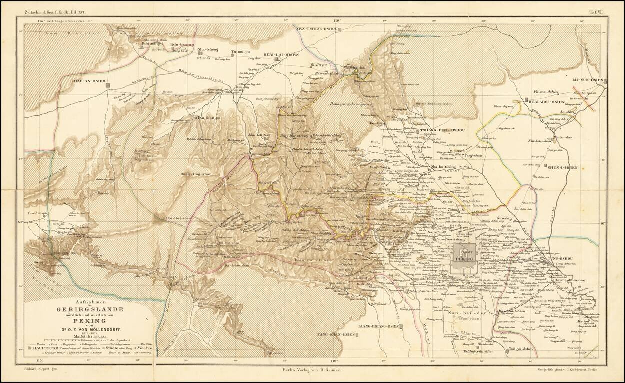
Fine map illustrating the area north and west of Beijing, as explored by Dr. O.F. von Mollendorff. Paul Georg von Mollendorff Paul Georg von Möllendorff (1847 – 1901) was a German linguist and diplomat. Möllendorff is mostly known for his service...
![Карта Афганистана и Сопредѣльныхъ Странъ [Map of Afghanistan and the Bordering Countries].](/map/small/59123.jpg)
Russian Military Map of Afghanistan - Dating from The Great Game. Historically significant, rare military Russian map of Afghanistan and surrounding countries, compiled in the midst of the Great Game in Central Asia and outlining the new Russian lands...
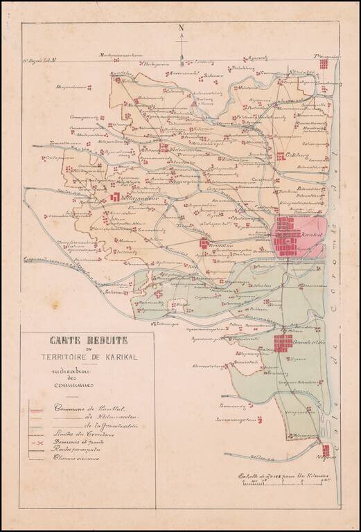
Manuscript Map of the Newly Created Administrative Territory of Karikal and its 3 Communes Fine french manuscript map of the Territory of Karikal, showing the territory as newly divided into divided into communes under the Decree of March 12, 1880....