Map size in jpg-format: 96.0459MiB
Click to open in high resolution (open in new tab).

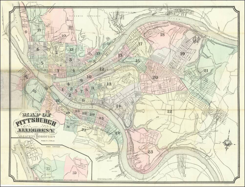
Large antique hand-colored lithographed folding map of Pittsburgh, Pennsylvania, initially published by Krebs & Brother in 1869, here in an edition updated to 1880 by J.R. Miller.
The map is hand-colored and numbered by ward. It extends as far east as Wilkinsburgh, and as far west as Brunot Island. In the lower-left corner is an inset plan of the Bellevue neighborhood.
Rarity
Evidently very rare; we were unable to find any examples of any edition of the map in OCLC.
If you are a student, write to us in telegram: @antiquemaps and indicate what material you need and for what work you need a map in high detail. We are ready to provide material on special terms. For students only!