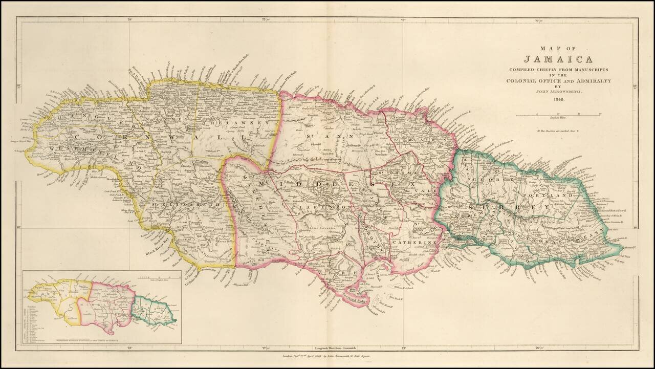
Detailed map of Jamaica, published in London by John Arrowsmith. The map is divided into three parishes, with fine details showing topography, towns, roads, rivers and other details. A smaller inset map at the bottom left corner.
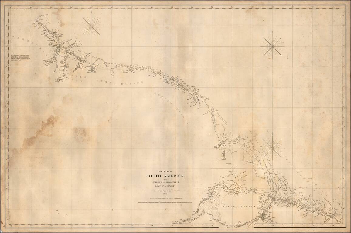
Rare separately published American Sea chart of the Northeastern coastline of South America, drawn by Charles Copley and published by Blunt. The map extends from the Orinoco River, Essequibo River and Demarara River in Venezula to Ilha Marajo, Belem...

Large and highly detailed map of the Netherlands, hand colored by regions. Shows towns, railways, canals, rivers, lakes, coastal details, etc. Decorative piano key border. Scarce full color example, from Johnston's National Atlas.
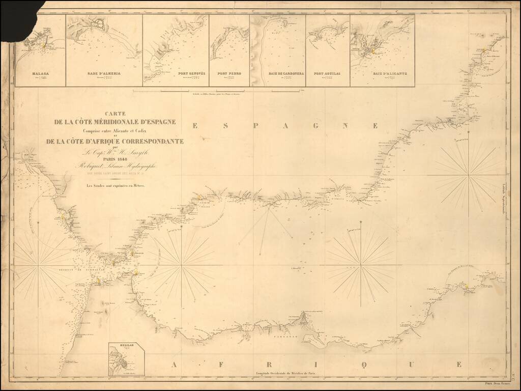
Rare separately published sea chart of the Strait of Gibraltar coast of Southern Spain and the corresponding coast of North Africa, published by Robique. Small inset maps of: Malaga Rade D'Almeria Port Genoves Port Pedro Baie de Carbonera Port...
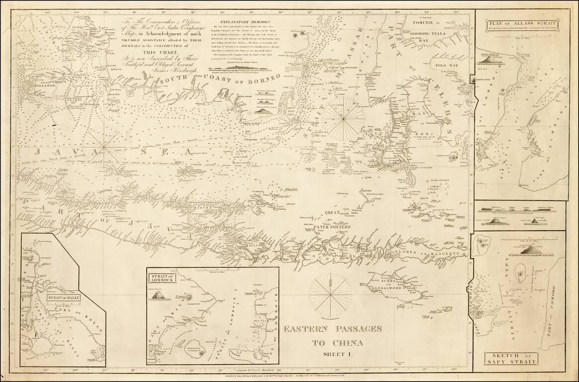
Detailed sea chart of the region extending from Southern Borneo and Java to the Celebes and Borneo, with 2 large insets, published by the East India Company in 1848. The need for more accurate charts was forcibly brought home to James Horsburgh on May...
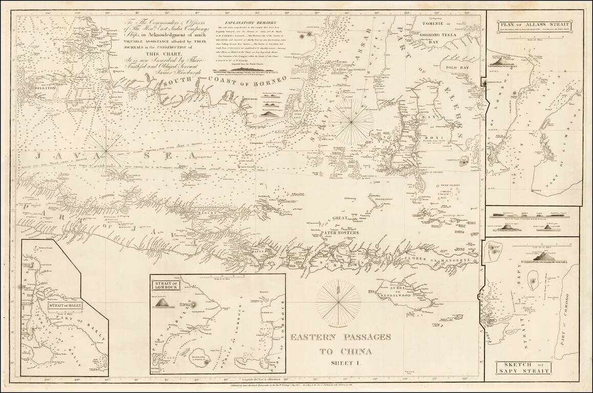
Detailed sea chart of the region extending from Southern Borneo and Java to the Celebes and Borneo, with 2 large insets, published by the East India Company in 1848. The need for more accurate charts was forcibly brought home to James Horsburgh on...
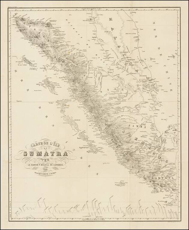
Nice example of this rare chart of Sumatra and the Straits of Malacca, based upon the surveys of Baron Melvill, which appeared in the Moniteur des Indes. Pieter, Baron Melvill van Carnbee (1816,-1856, Batavia), was a Dutch naval officer and...
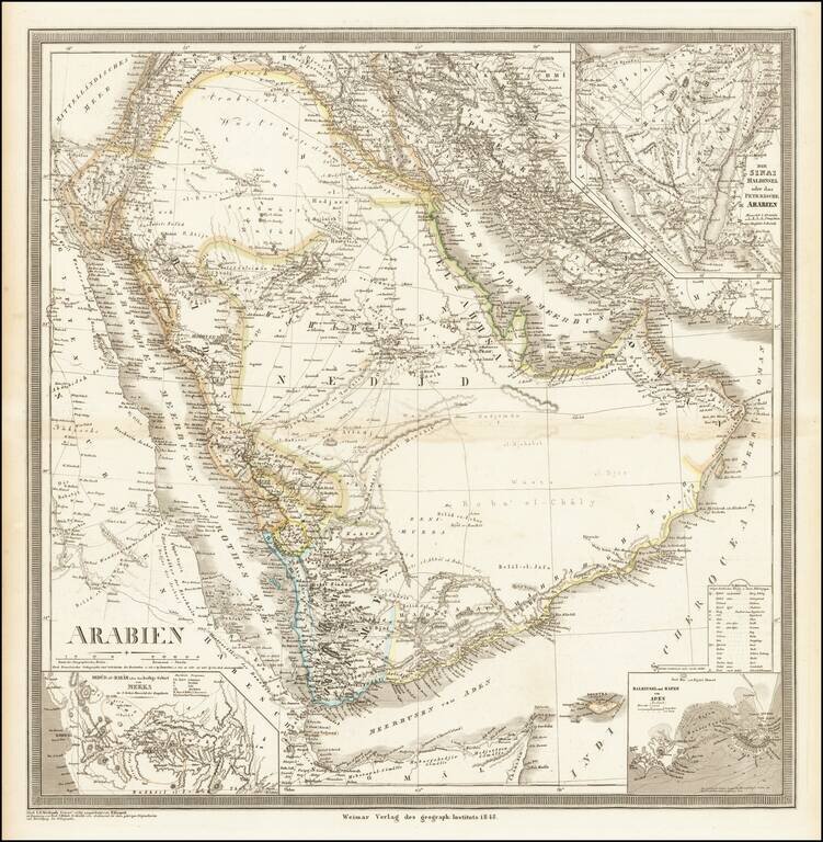
Striking, Detailed Map of the Arabian Peninsula Fine large map of the Arabian Peninsula and its environs, published by German mapmaker Heinrich Kiepert in Weimar. Keipert's map of Arabia is one of the most detailed and accurate maps of the period....
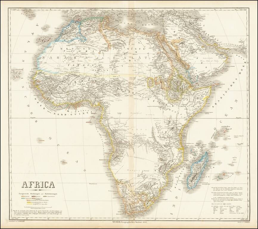
Fine large map of Africa, published by German mapmaker Heinrich Kiepert in Weimar. The map is colored to illustrate the various local and colonial powers (Britain, Spain, Netherlands, France and Portugal). The color coding also locate the...
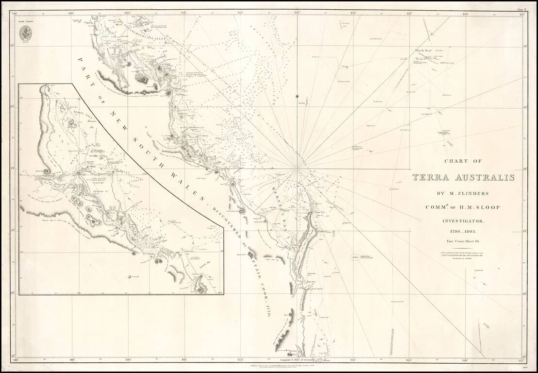
Fine example of the 1848 edition of the British Admiralty Chart of a large section of the East Coast of Australia, revised and improved to 1848. The chart is based upon the surveys of Matthew Flinders, between 1799 and 1803, including the tracks of his...