Map size in jpg-format: 2.79917MiB
Click to open in high resolution (open in new tab).
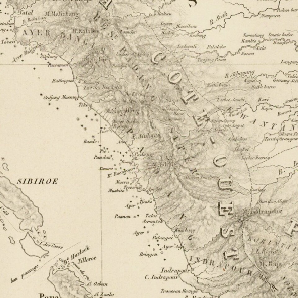
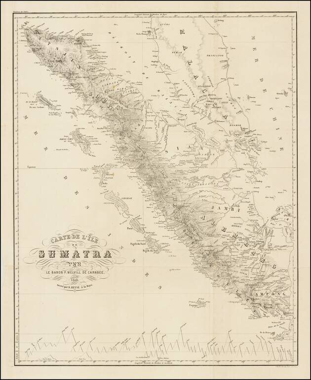
Nice example of this rare chart of Sumatra and the Straits of Malacca, based upon the surveys of Baron Melvill, which appeared in the Moniteur des Indes.
Pieter, Baron Melvill van Carnbee (1816,-1856, Batavia), was a Dutch naval officer and geographer. Melville van Carnbee first worked as a surveyor on his first voyage to the Dutch East Indies in 1835. In 1839 he took a position with the hydrographical bureau at Batavia, where he compiled a map of Java in five sheets, accompanied by sailing directions (Amsterdam, 1842).
He remained in the region until 1845 collecting materials for a chart of the waters between Sumatra and Borneo (two sheets, 1845 and 1846). On his return to the Netherlands, he worked for the naval department and also undertook, in connection with Philipp Franz von Siebold, the publication of the Moniteur des Indes, a series of scientific papers on the foreign possessions of Holland, which was published for three years.
If you are a student, write to us in telegram: @antiquemaps and indicate what material you need and for what work you need a map in high detail. We are ready to provide material on special terms. For students only!

![[Sunda and Lilliput, etc. from Gulliver's Travels]](/map/small/54927.jpg)
