![[New General Map of North and South America Showing the Routes of Kruzenshtern and Lisyansky] НОВАЯ ГЕНЕРАЛЬНАЯ КАРТА СѢВЕРНОЙ И ЮЖНОЙ АМЕРИКИ СЪ ПОКАЗАНІЕМЪ ПУТЕЙ КРУЗЕНШТЕРНА И ЛИСЯНСКАГО](/map/small/58490.jpg)
A Superb Russian Map of the Americas, Made to Highlight the Explorations of Kruzenshtern and Lisyansky in the Pacific. In Alaska, the map notes Lisyansky's landfall on Kodiak Island and at New Archangel (Новоархангелѣскъ, i.e.,...
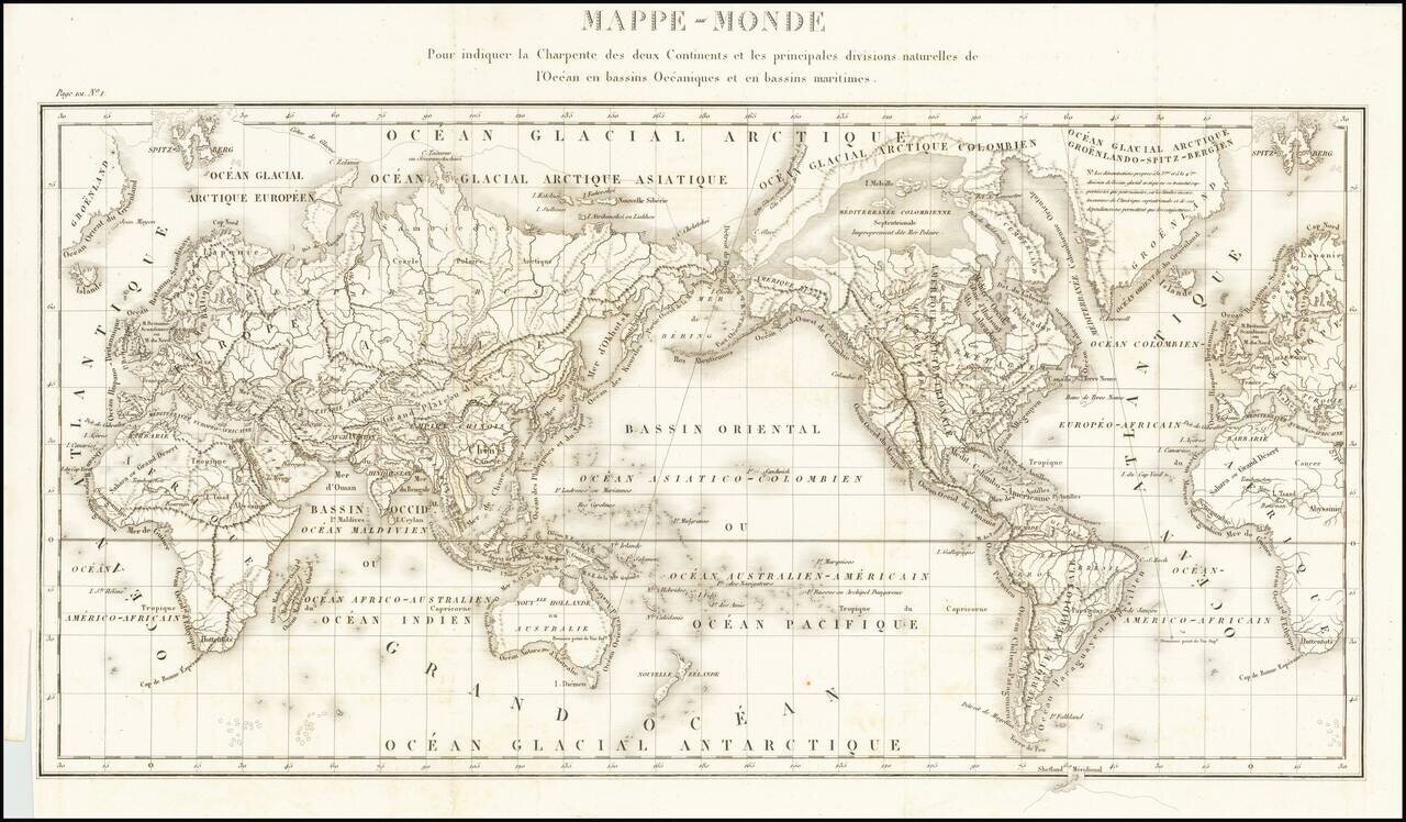
Fine General Hydrographical World Map Striking world map showing the world’s maritime basins. It was part of a geographic system meant to teach an overview of the world’s hydrography. The map was featured in Mémorial topographique et militaire...
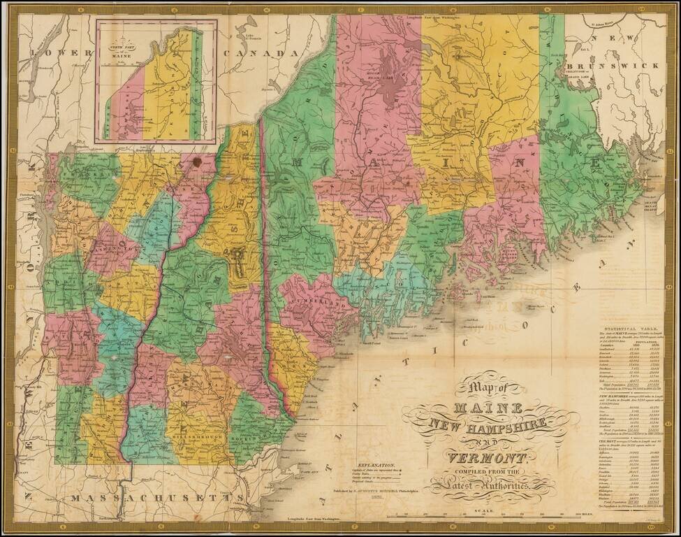
Scarce folding example of the map of New England from Finley's New American Atlas, published in 1826. The atlas was a response to the success of Tanner's seminal 1822 New American Atlas, which re-defined the standard for American Commercial...

Fine example of Finley's map of Massachusetts. The map is colored by counties and shows towns, roads, rivers, mountains and other geographical features.
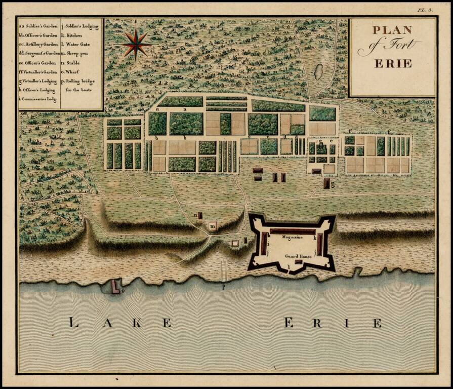
Important early plan of Fort Erie, from Collot's monumental Voyage dans l'Amerique Septentrionale ou Description des Pays Arroses par le Mississippi, l'Ohio, le Missouri, et Autres Riveres Affluentes, published posthumously in 1826, but based upon...
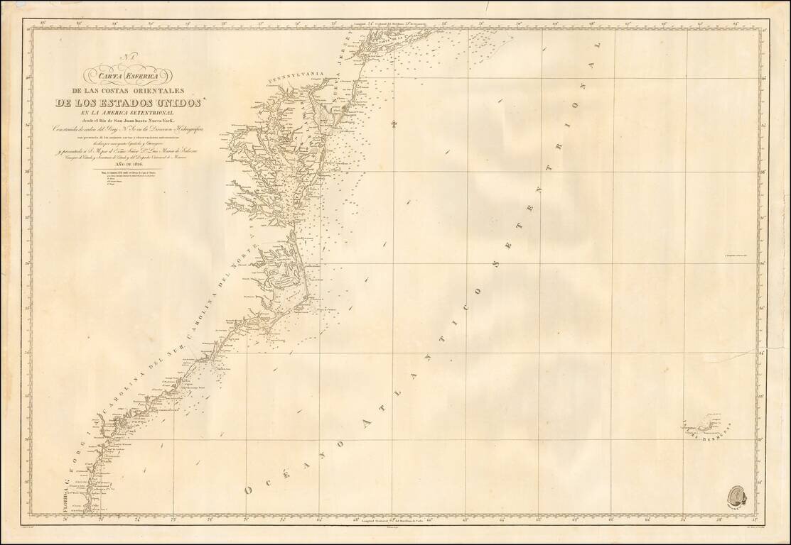
Scarce coastal chart of the United States Coastline, published in Madrid. The map shows the region between New York and Long Island in the north to the San Juan River in Florida. Spanish Sea Charts of this region in the early-19th Century are quite...
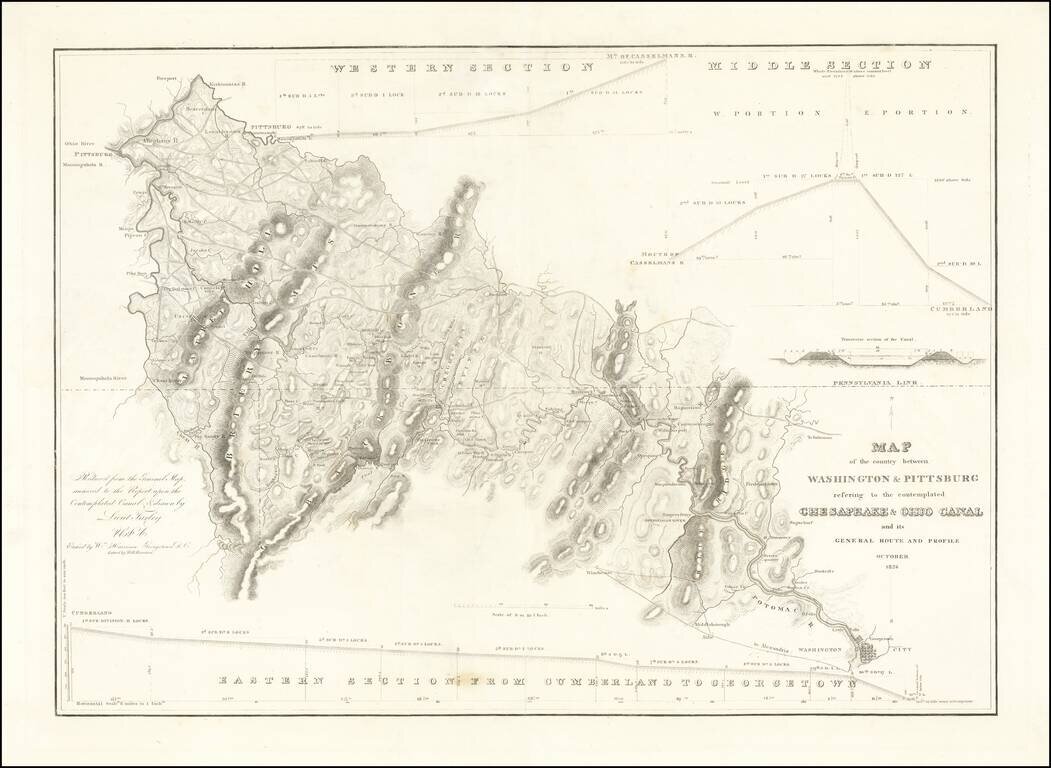
Rare separately issued map showing the route of the proposed Chesapeake and Ohio Canal, likely published as a presentation piece. After the Revolutionary War, George Washington was the chief advocate of using waterways to connect the Eastern Seaboard...
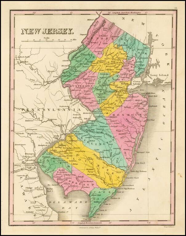
Striking map of the state of New Jersey, from Finley's New General Atlas. The map is hand colored by counties and showing towns, roads, rivers, mountains and other geographical features.
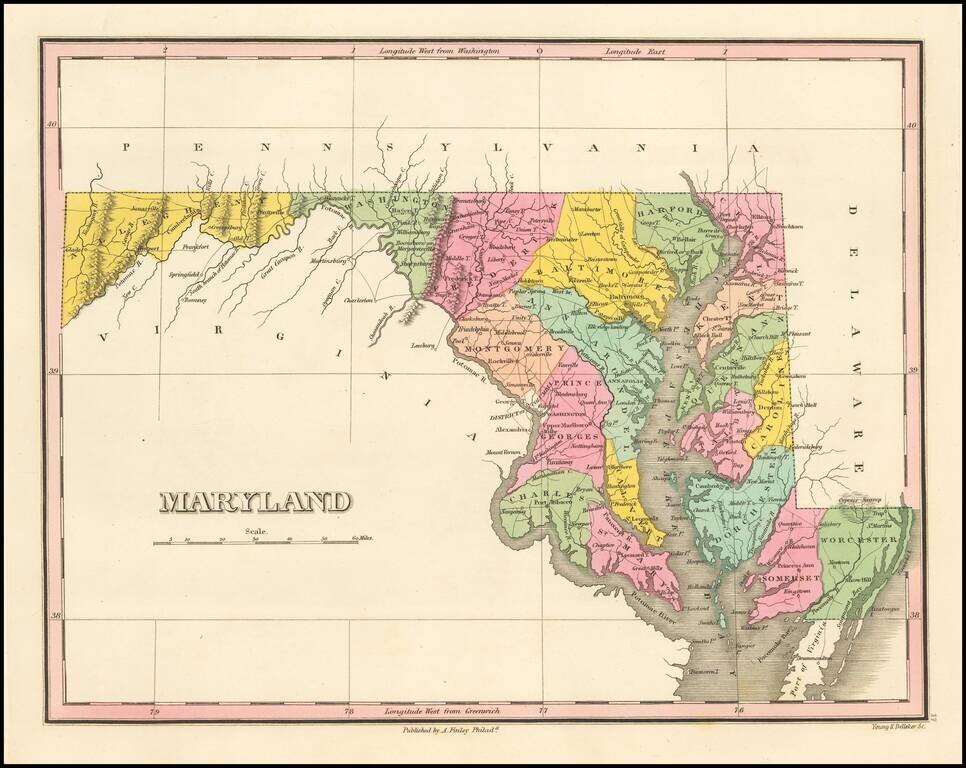
Map of Maryland, from Finley's General Atlas. The map is hand colored by counties and showing towns, roads, rivers, mountains and other geographical features.
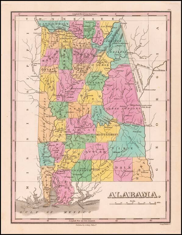
Nice example of Anthony Finley's early map of Alabama from an early edition of Finley's General Atlas, one of the earliest obtainable separate maps of Alabama. The map is hand colored by counties and showing towns, roads, rivers, mountains and other...
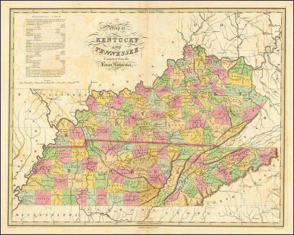
Fine early map of Kentucky and Tennessee, from Finley's New American Atlas. Includes a statistical table, roads and other early details. While the map occasionally appears on the market in pocket map form, it is especially desirable in this atlas...
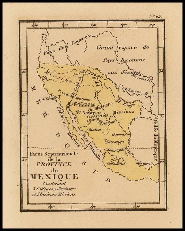
Rare map of Texas, Upper California and Mexico from Louis Denis' Atlas Universel indiquant les établissemens des Jésuites: avec la manière dont ils divisent la terre, suivi desévénemens remarquables de leur histoire. Denis' atlas illustrates the...
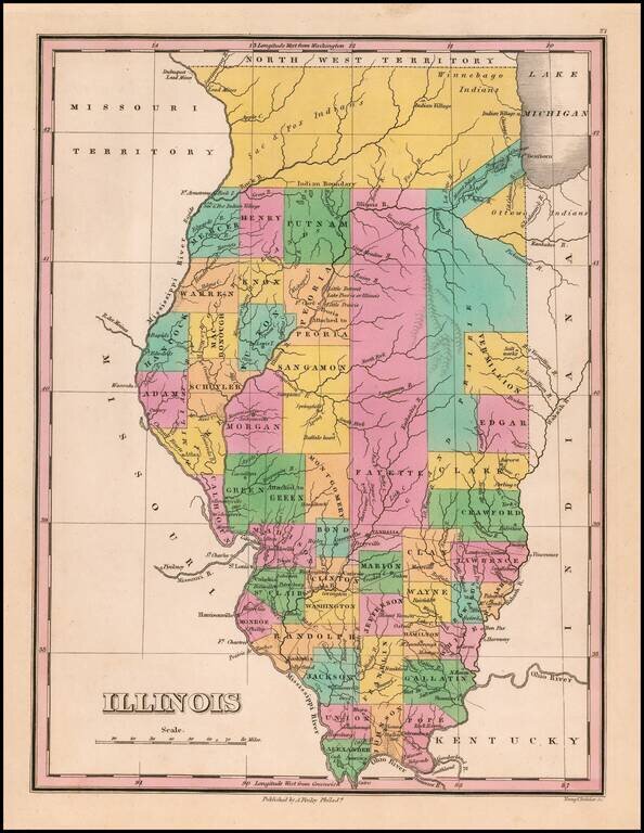
Great example of this early state of Finley's map of Illinois, hand colored by counties, with much of the northern lands still dominated by Indians. Includes a number of oversized counties and several unnamed counties. Cook County is not yet shown. A...
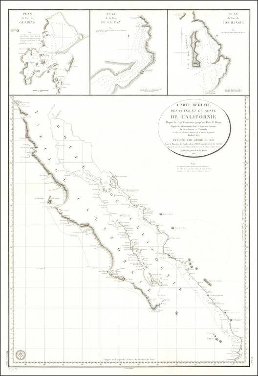
Baja California Immediately After Mexican Independence Rare large scale map Baja California, prepared by the French Government, based upon a Spanish Chart published the preceding year. In addition to all of Baja California, the map depicts the area...
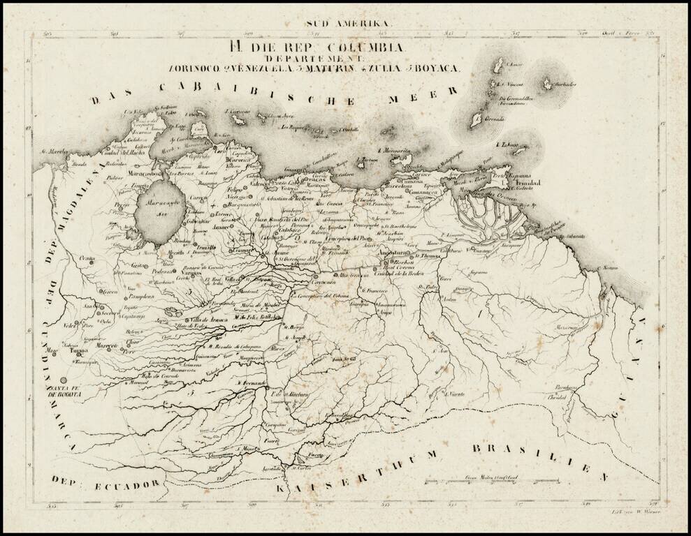
Rare map of the Republic of Colombia, divided into Departments, at a time when it included Venezuela. On December 17, 1819 the Congress of Angostura declared Gran Colombia an independent country. After two more years of war, the country achieved...
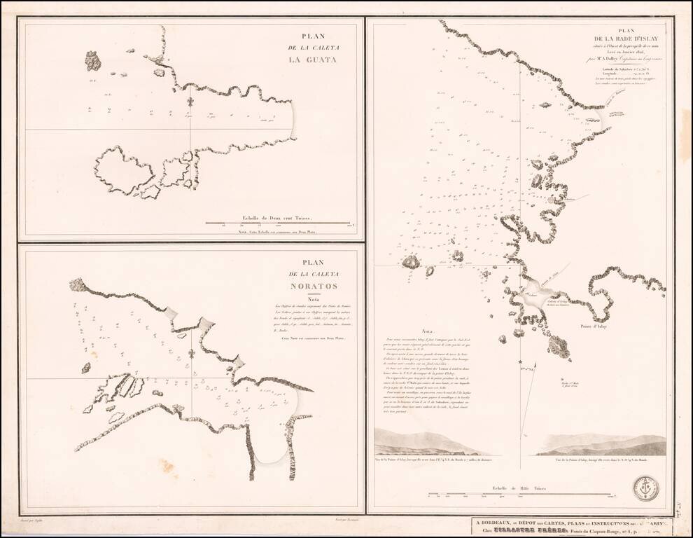
Nice set of three harbor plans from this scarce separately published sea chart.