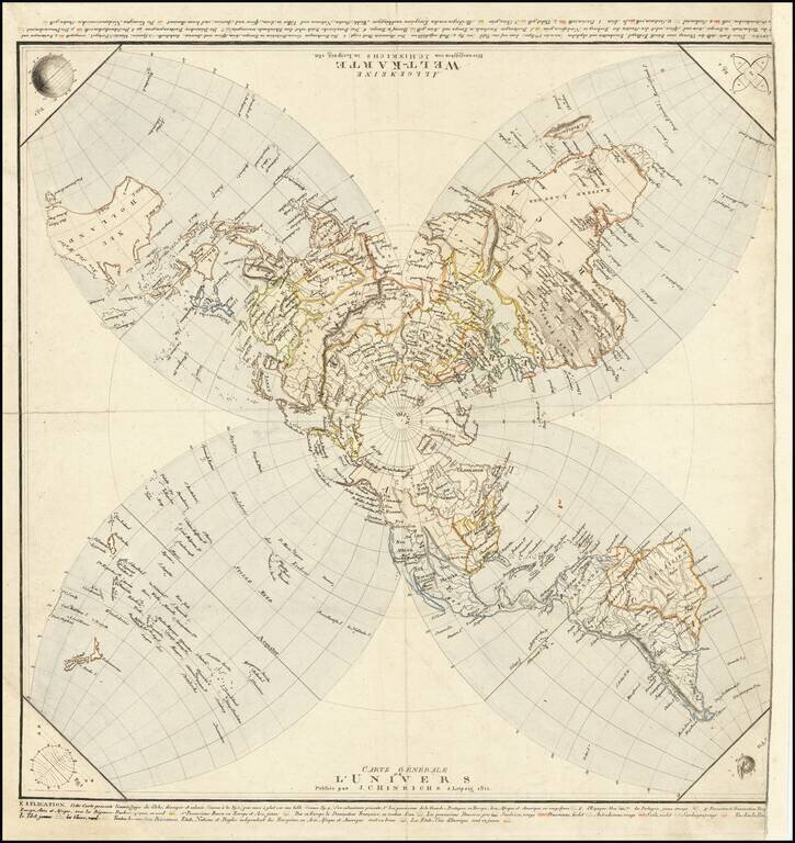
Striking, Innovative German World Map -- Projecting The Globe on A Flat Surface Distinctive world map published by German publisher Johann Conrad Hinrichs. It is an unusual azimuthal stereographic projection, which is then split into four lobes -- an...
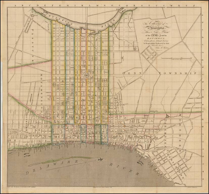
Rare early plan of Philadelphia, which appeared in published by John Paxton and engraved by William Harrison of Philadelphia. The map shows West at the top and provides a very different treatment of the City, when compared to predecessor plans such as...
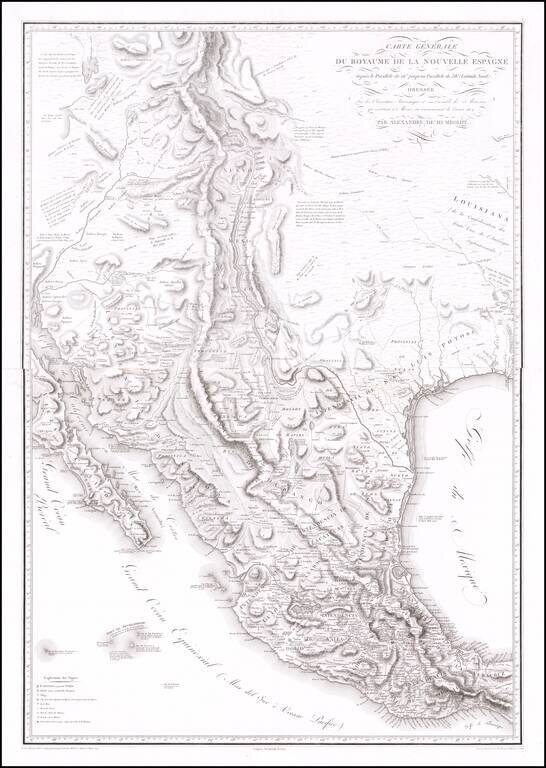
The Most Important Map of the Mexico From The Early 19th Century, By The Father of Modern Geography Nice example of Alexander von Humboldt's monumental 2-sheet map of New Spain. Humboldt's map of New Spain is the first modern geographical treatment...
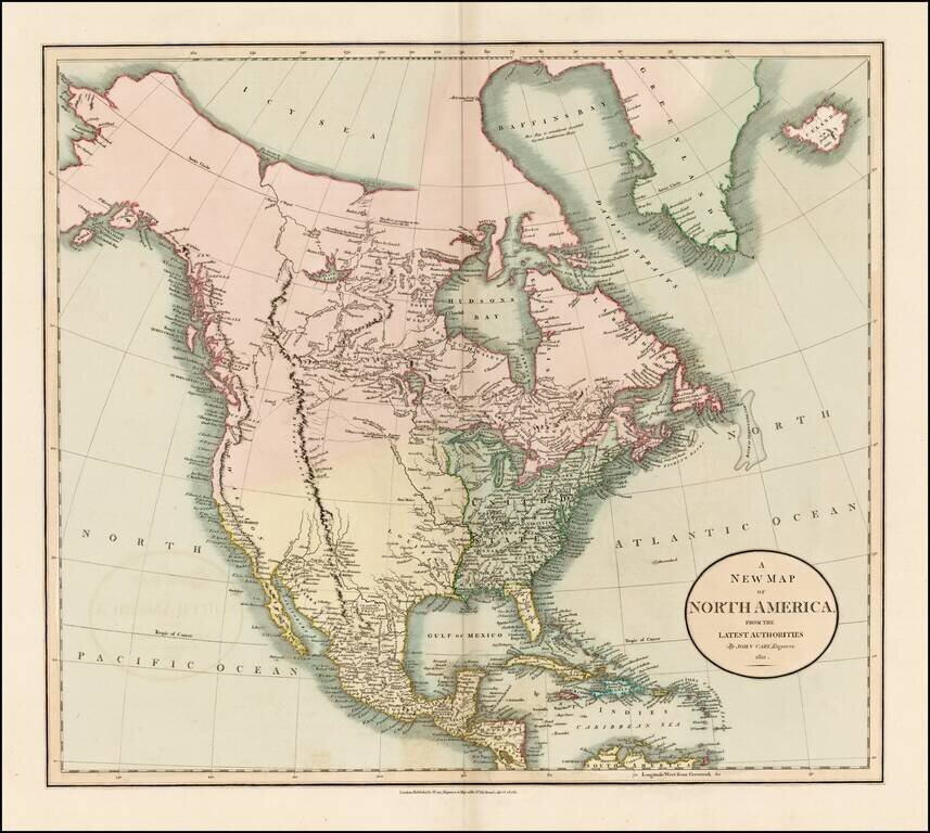
Fascinating map of North America, reflecting the knowledge of the American West on the eve of the publication of the first official account and map of Lewis & Clark's expedition from the Missouri River to the mouth of the Columbia River. Excellent...
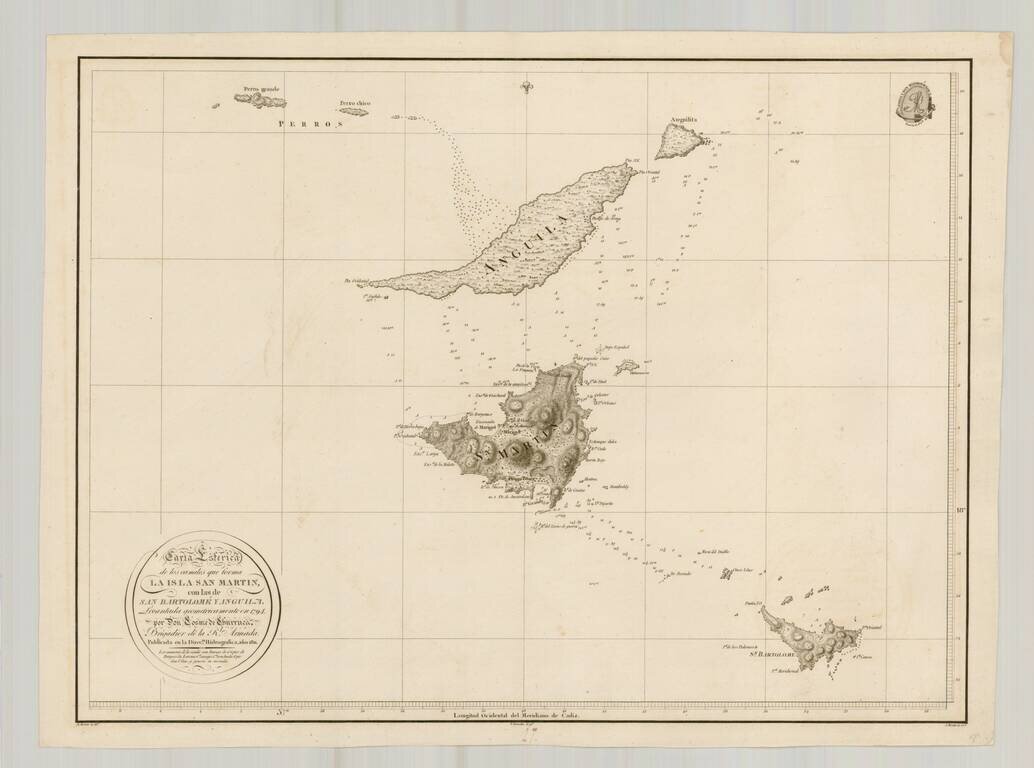
Rare separately issued chart of St. Barts, Anguila and St. Martin, published by the Direcion Hidrografica in Madrid. The chart is one of the few charts or maps to focus on these islands and the only Spanish chart published in the 18th Century to treat...
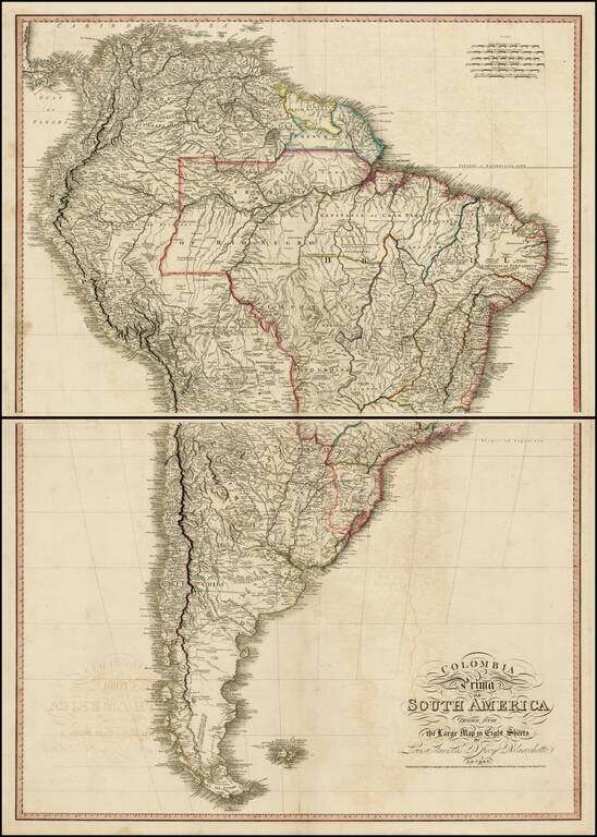
Exceptional map of South America, at the outset of its Century of Independence. The map is a fine large format two sheet version of one of the great maps of South America, drawn from Faden's 8 sheet map of South America, issued in 1807. One of the...
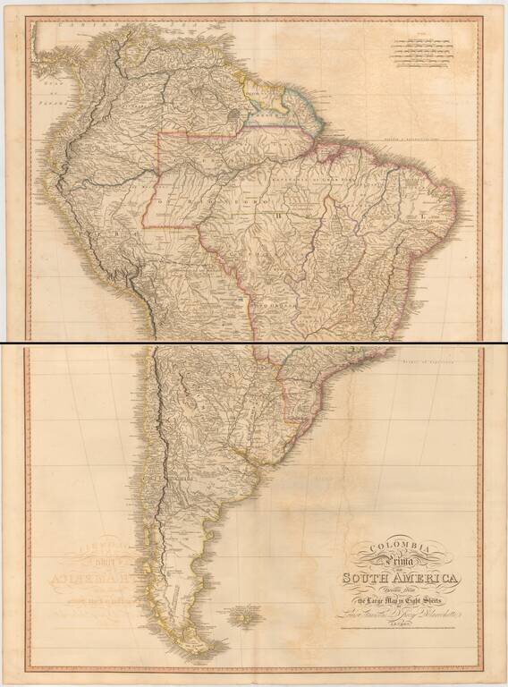
Two sheet edition of this exceptional map of South America, at the outset of its Century of Independence, without question the finest large format commercially published map of South America published in the early 19th Century. The map is based upon...
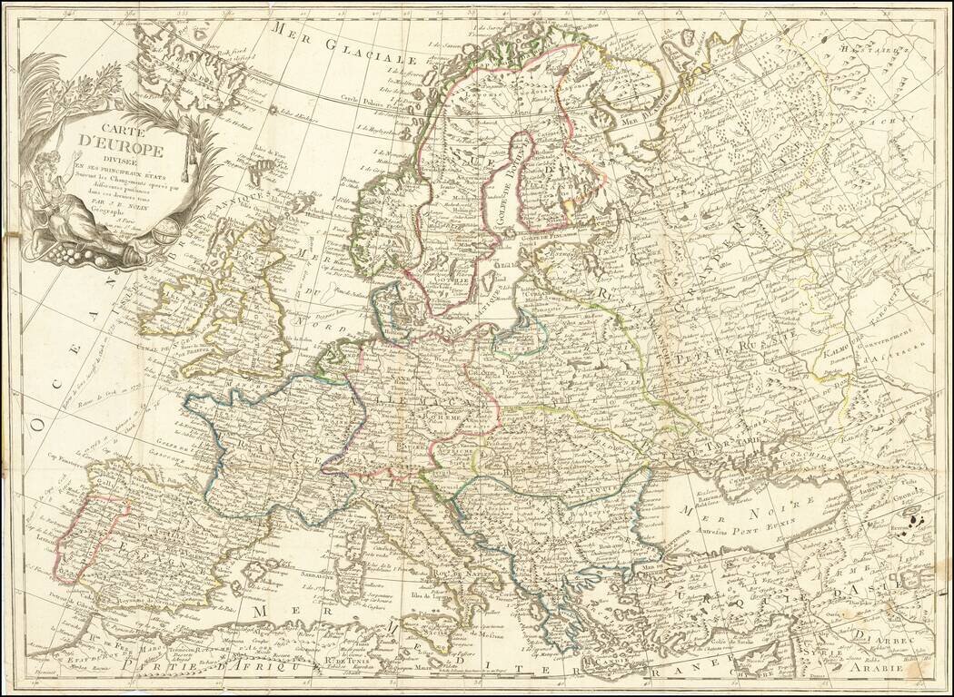
Scarce 19th Century JB Nolin map of Europe.
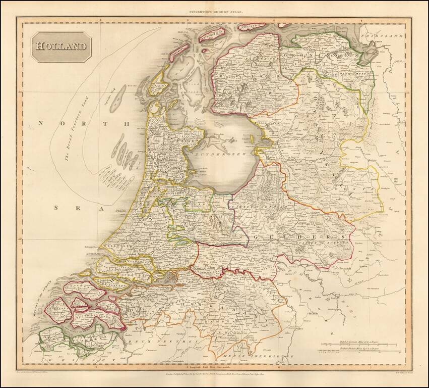
Detailed map of the Netherlands, from the rare Philadelphia edition of John Pinkerton's Modern Atlas. The map is colored by regions and shows towns, roads, rivers and a host of other details.
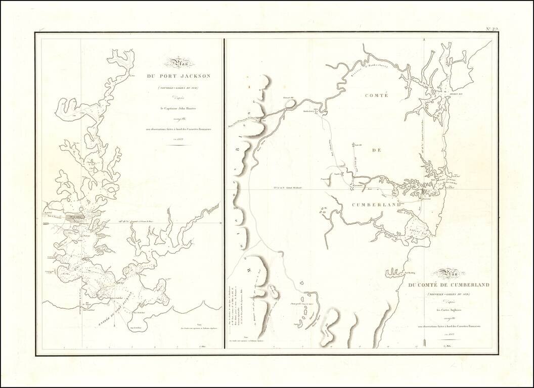
One of the Earliest Maps of Port Jackson - From the Expedition of Nicholas Baudin The two maps reflect one of the earliest scientific surveys of Port Jackson and the area around Sydney Harbor, undertaken by the French in 1802. During Nicolas Baudin's...