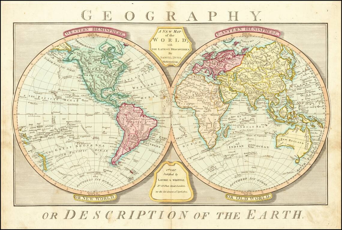
Rare Late Edition Showing Matthew Flinder's Discoveries in Australia Detailed double hemisphere map of the World, showing tracks of some of the contemporary explorers, including James Cook and George Anson. The map shows the "Corean Sea," along with...
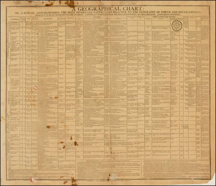
Rare American Geographical Chart & Teaching Aid Extremely rare broadside "Geographical Chart," published in Albany by the Albany Register in 1805. The chart provides a marvelous multi-column presentation of information concerning America, the...

Fascinating engraving showing natives driving Indian Elephants into a Keddah, based upon an oil painting by Samuel Howett.
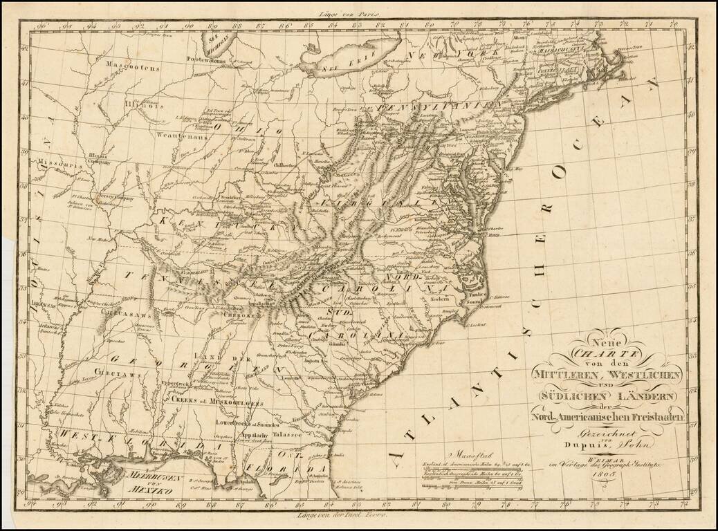
Rare early German map of the United States, in the first decade of the 19th Century. One of the most striking features of the map is the excellent treatment of the major western roads. The map provides and excellent treatment of the Indian Tribes...
![Charte von Den Vereinigten Staaten von Nord-America nebst Louisiana . . . 1805 [Rare 1st State of Gussefeld's Louisiana Purchase Map]](/map/small/63496.jpg)
Rare first state of Gussefeld's map of the United States, published in the same year as the Louisiana Purchase and highlighting Jefferson's United States on the eve of the expedtitions of Lewis & Clark, Zebulon Pike, etc. Following the Louisiana...
![[Mohawk River, New York] (Two manuscript maps of Cosbys Manor, Mohawk River, with other documents related to the same.)](/map/small/59703.jpg)
Early 19th-Century Manuscript Maps and Court Papers Concerning the Disposition of Lands on the Mohawk River in New York. Together, two manuscript map sheets, showing thousands of acres of land on the Mohawk River. One of the maps shows lot numbers...
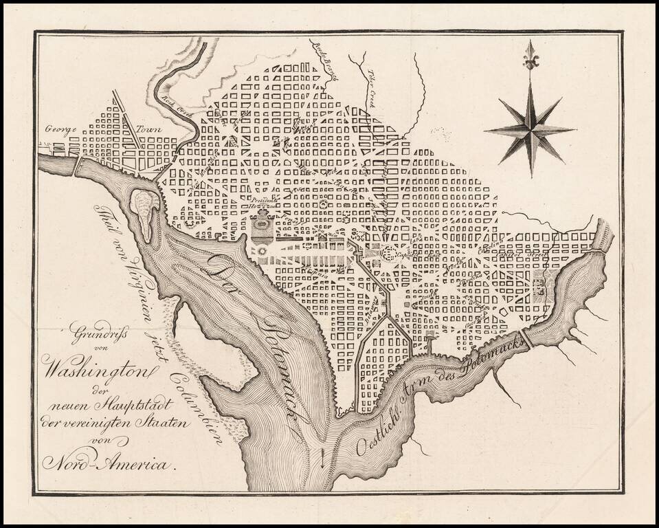
Rare German map of Washington DC, based upon Andrew Ellicott's plan, first published in 1792. The map appeared in Zimmermann's rare Taschenbuch der Reisen...
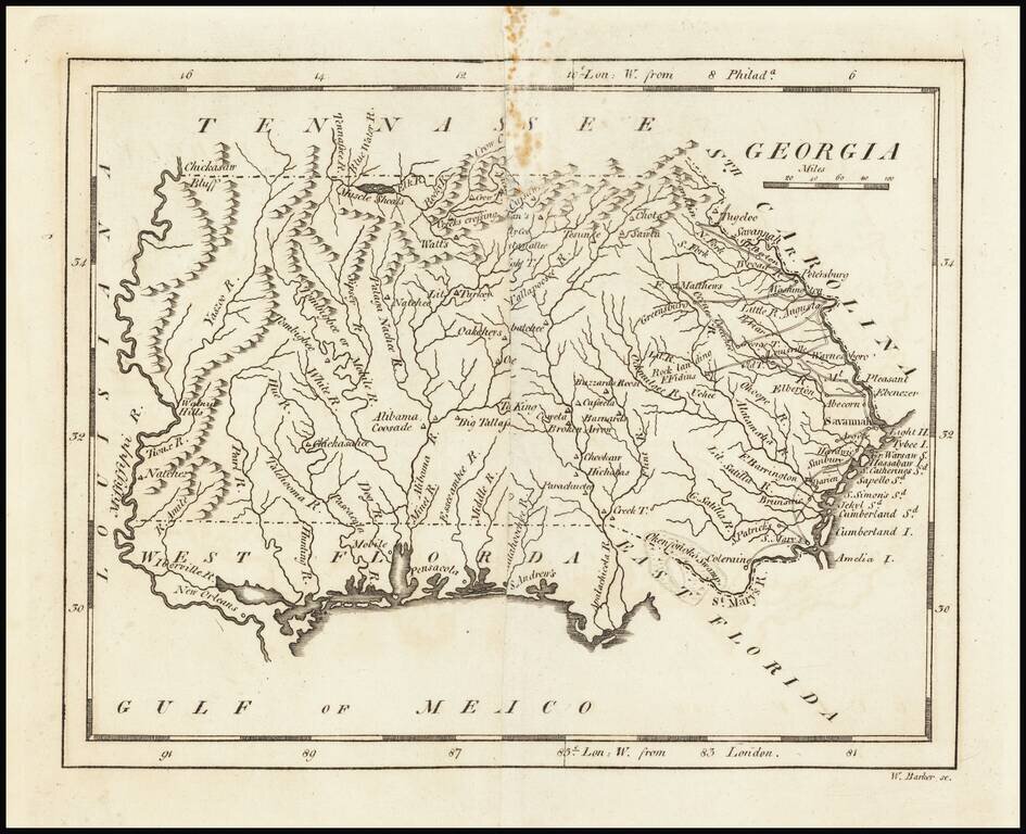
Nice example of Carey's map of Georgia, prior to the creation of Mississippi Territory. A highly detailed map, which includes towns, roads, rivers, mountains, and many other details.
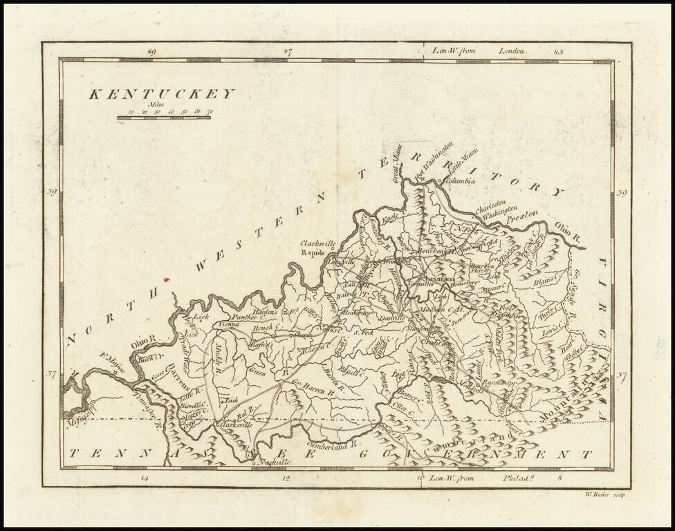
One of the earliest printed maps of the State of Kentucky. The map provides a fine and extensive treatment of Kentucky's early roads. Numerous towns and courthouses are also shown, along with the Rapids below Louisville on the Ohio River. Includes...
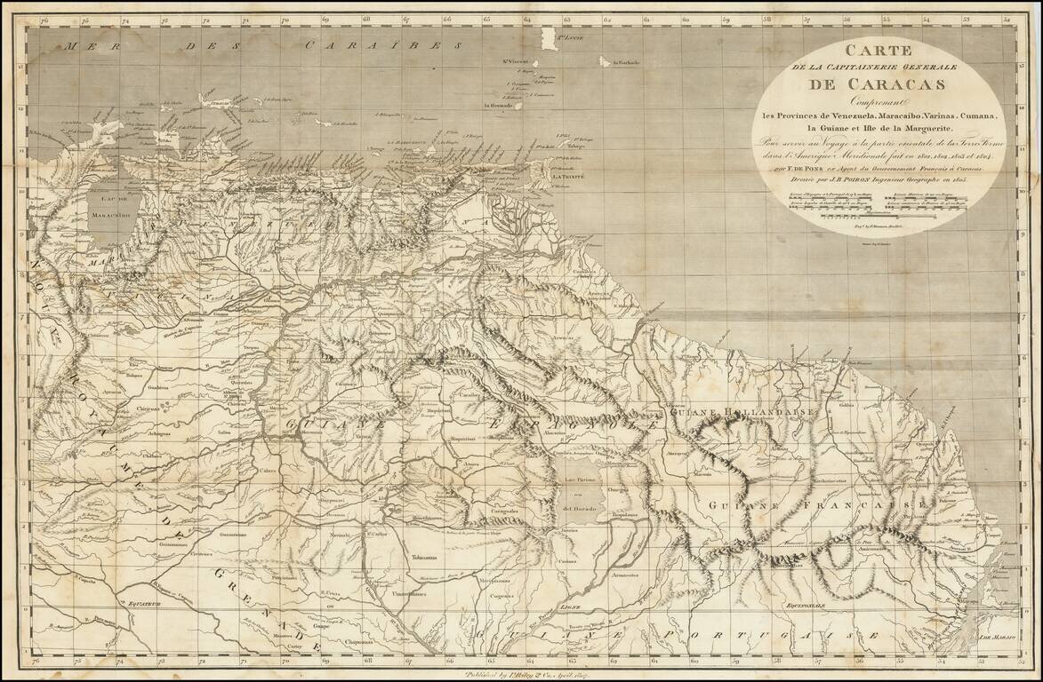
A Rare Early New York Imprint -- Includes A Reference To El Dorado Scarce and highly detailed map of the Captaincy of Caracas, published by I Riley & Co, April 1807. The map covers the area from Maracaibo and Curacao to the mouth of the Amazon...
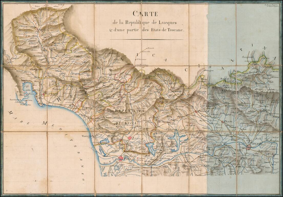
Finely Executed Manuscript Map of the Republic of Lucca and Part of Tuscany From the Collection of General Nicholas Charles Oudinot Fine manuscript map of the Republic of Lucca and part of the State of Tuscany, drawn during the period where the...
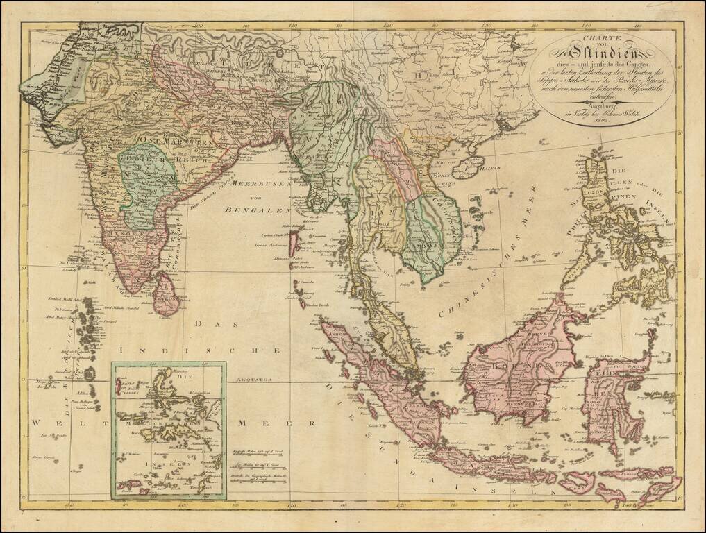
Scarce large format map of India, Southeast Asia and the Philippines, published in Augsburg by Johann Walch. The map gives a fine image of the Philippnes. Tonkin, Cochinchina (Vietnam), Laos, Siam (Thailand) and Camboja (Cambodia).
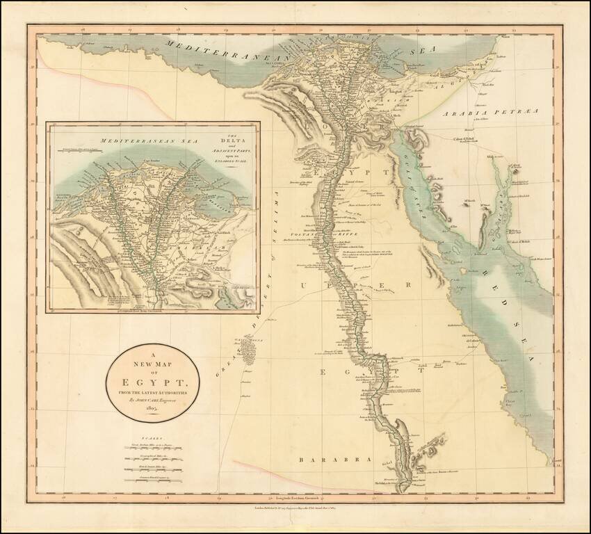
Fine example of this striking map of Egypt, the Gulf of Suez, Red Sea and the Course of the Nile, with a large inset of the Nile Delta, published by John Cary in London. Extends from Oasis Magna and Shek Haled to Arabaia Petraea. Includes various trade...
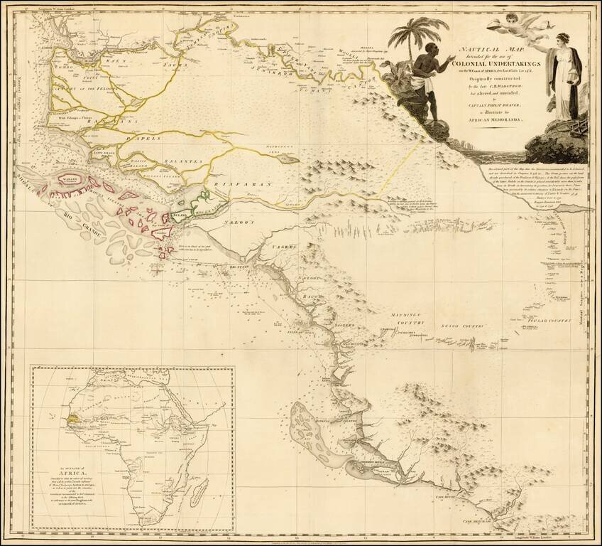
Detailed map of the region bounded by the Gambia River in the north and Cape Mezurado (Liberia) in the south, covering the countries of Gambia, Guinea, Sierra Leone and part of Gambia, which appeared in Captain Philip Beaver's A frican Memoranda:...