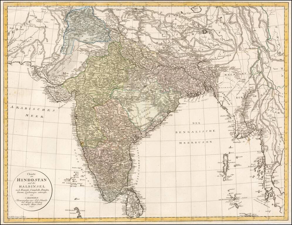
Rare late 18th Century map of India and environs, extending to Kandahar and Kabul in the west and Siam and Malaca in the east. Includes Sri Lanka and the northern part of the Maldives. A highly detailed map, which credits the prior work of James...
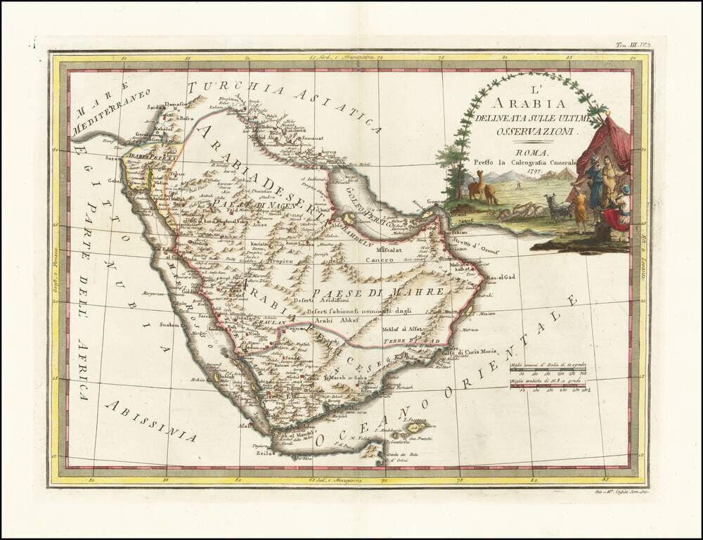
Decorative 18th Century map of the Arabian Peninsula, published in Rome by Cassini. The map extends from the Red Sea to the Persian Gulf, Straits of Hormuz and Indian Ocean, centered on Arabia, which is divided into several regions, including Paese di...
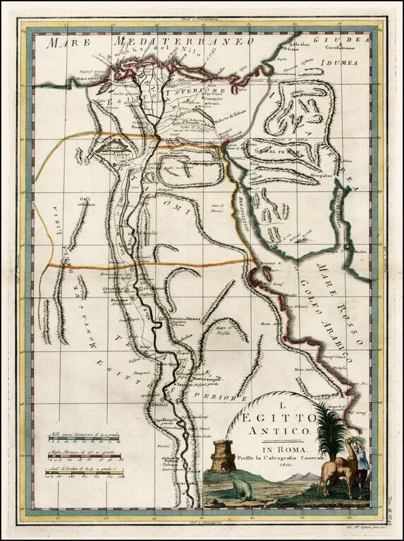
Fascinating early map of Ancient Egypt and the course of the Nile River, from Nuovo Atlante Geografico Universale. published by Cassini in Rome.
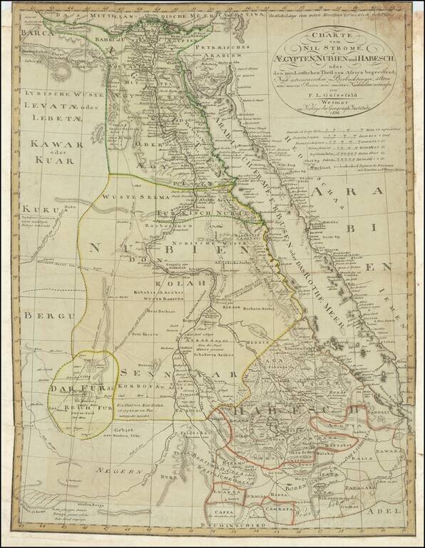
A detailed chart of Egypt, Sudan, and Ethiopia focused on the course of the Nile. Extensive detail is shown, with the many towns along the Nile, Red Sea, and other areas all labeled. Trade routes are shown through the desert and the mountain ranges of...
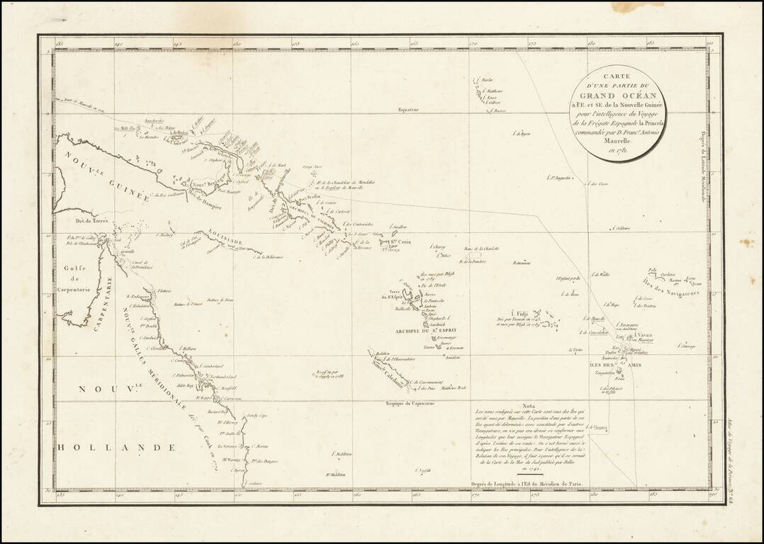
Interesting chart of Eastern Australia and part of the south-western Pacific, showing the routes taken by the Spanish explorer Don Francisco Antonio Maurelle in 1781 along the northern coast of New Guinea and across the Pacific to Fiji and Tonga,...