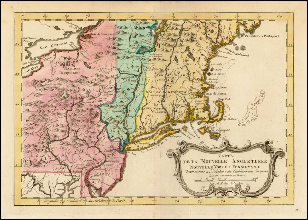
An excellent early map of the region bounded by New England, Lake Ontario and the northern Chesapeake River, centered on New York and Connecticut from a Dutch edition of Bellin's Histoire Generale des Voyages. Shows towns, roads, mountains, rivers,...
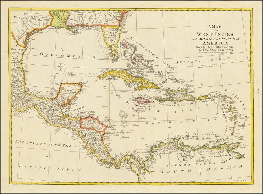
Detailed map of Florida, the Gulf Coast and Caribbean, centered on Cuba colored by regions. Florida is shown as an Archipelago. Georgia extends to the Mississippi River. Massive Kingdom of Leon (Texas). Nice detail in the Bahamas.
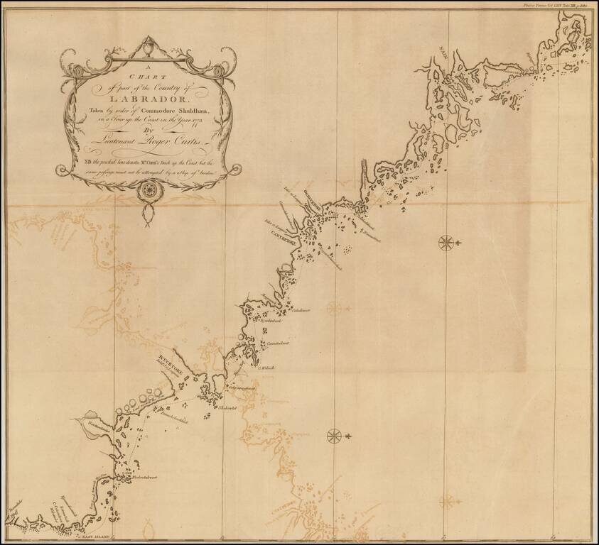
Fine map of the Coast of Labrador, showing the region explored by Roger Curtis, under instructions from Commodore Shuldham in 1773. Admiral Sir Roger Curtis, 1st Baronet, GCB (1746 - 1816) was an officer of the British Royal Navy, who saw action in...
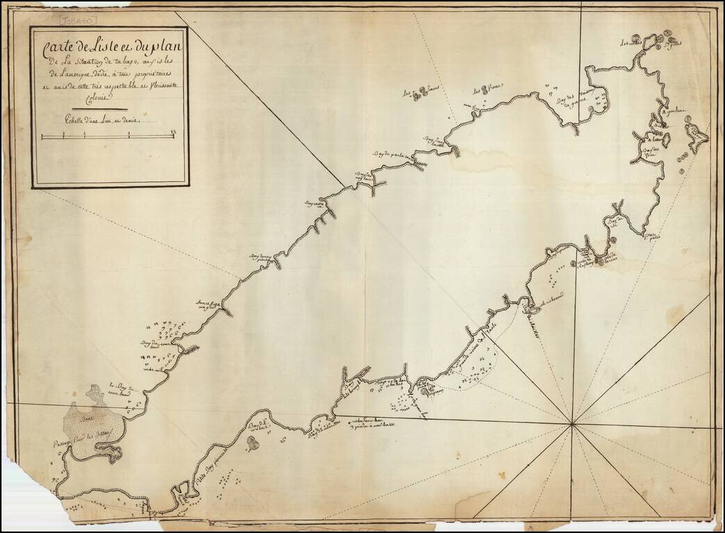
French Manuscript Map of Tobago Revealing its Complex Colonial History Manuscript map showing the island of Tobago and revealing its complicated history of European settlement. The map shows continued interest in Tobago across Europe and could have...
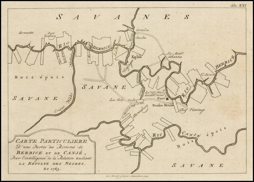
Scarce plan of Berbice, Surinam, illustrating the town at the time of the Slave Revolt of 1763. The Berbice Slave Revolt began in February 1763 and lasted into 1764. The uprising began on Plantation Magdalenenberg on the Canje River in Berbice. The...
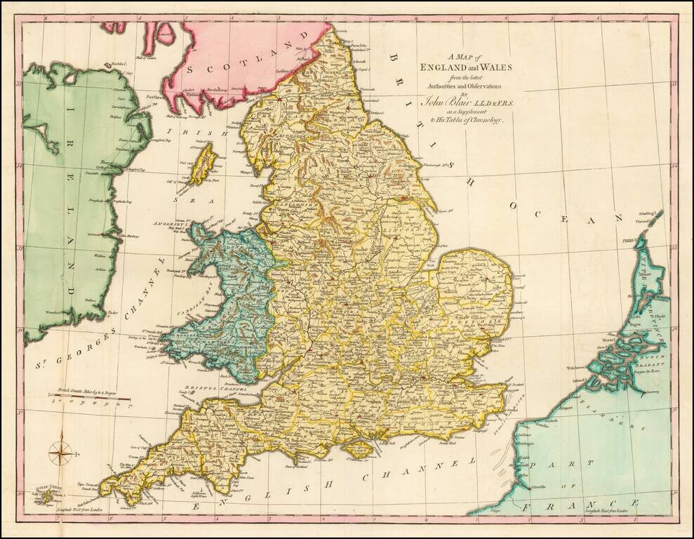
Gorgeous large format map of the England and Wales. Includes a decorative compass rose. From John Blair's Chronology and History of the World, first published in 1754.
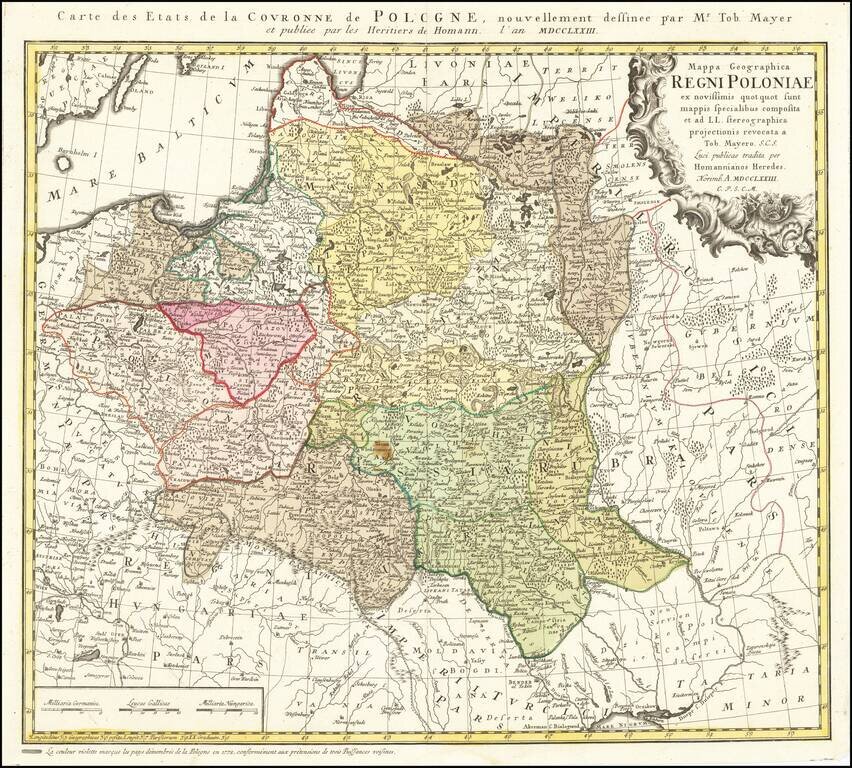
Detailed map of Poland, by Tobias Mayer, dated 1773 in the title cartouche. Poland extends from Glogau and Breslau in the west, to Braclaviensis in the south along the Dniestr River, east to the Dniepr River and Mscislaw and north to include parts of...
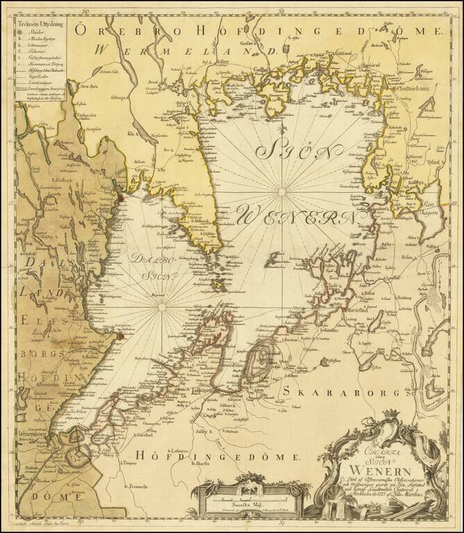
Uncommon map of the Vänern Sea region by the Swedish cartographer Nils Marelius (1707-1791). The map was published as a separate map in Stockholm, 1773, by Kongliga Lantmäteri Contoiret (Royal Institute of Surveyors) and engraved by C. Bergquist.
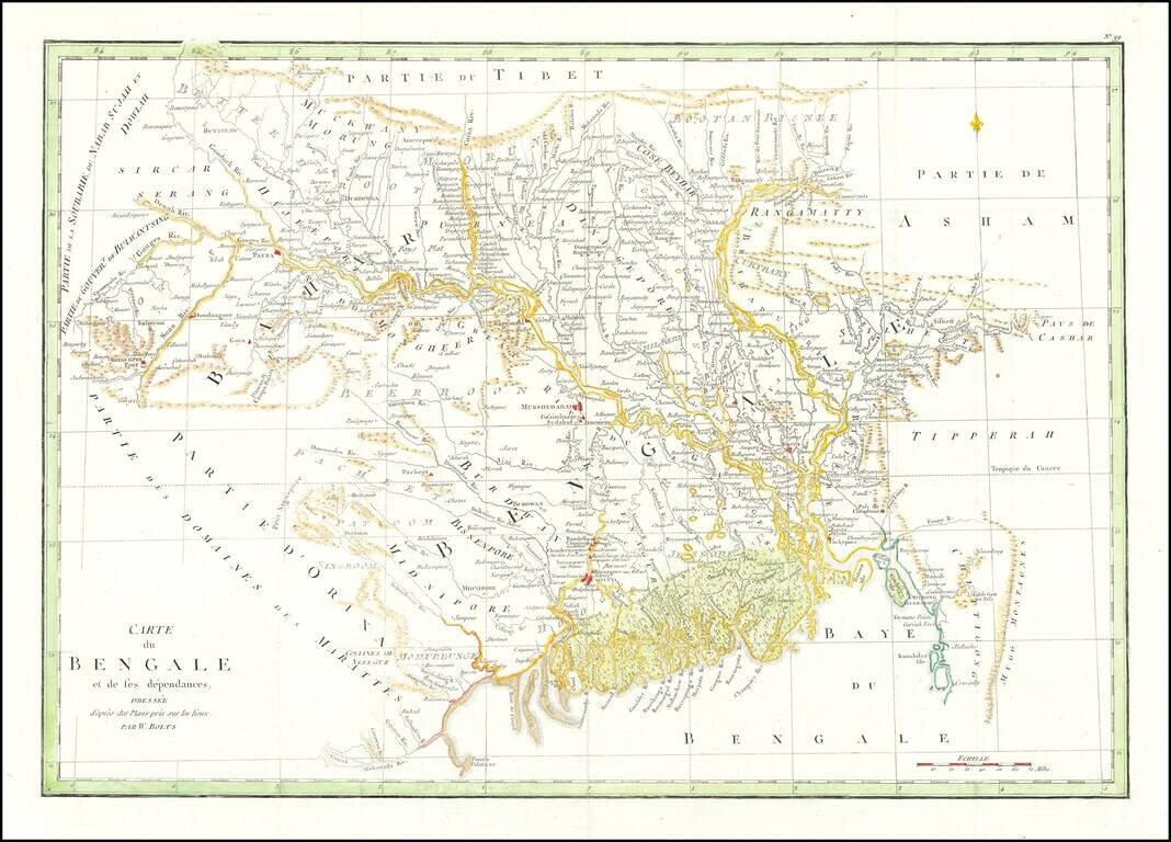
Striking map of Eastern India and Bangladesh, published in Paris. Extends from the Calcutta region in the west to Bangladesh. The map illustrates the work of William Bolts. William Bolts (1739-1808) was a Dutch-born eighteenth-century merchant active...
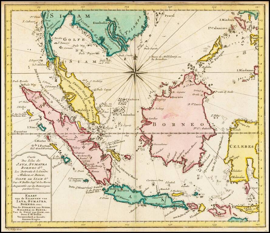
Detailed map of the Region from Siam and Mindoro to Sumatra, Java and the Straits of Maskasar, centered on Borneo. Decorative compass rose. Nice full wash color.