![[Venice] Nuova Pianta Elevata Della Nobile e Cospicua Citta di Venezia](/map/small/61397.jpg)
A Fine Late 18th Century Plan of Venice An exceptional 2-sheet Plan of Venice published by Lodovico Furlanetto, a publisher and dealer of prints in Venice, active between 1763 and 1784. Furlanetto's large plan of the lagoon city of Venice, includes...
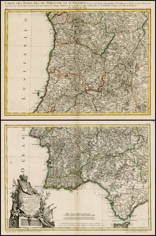
Scarce double page map of Portugal in original color, from Rizzi-Zannoni, the Royal Geographer of France. One of the most highly detailed large format maps of Portugal published in a commercial atlas during the period. Includes exceptional detail,...
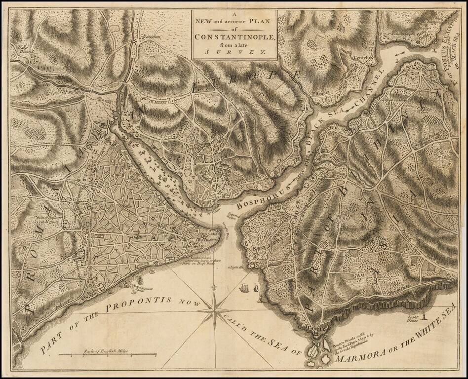
Detailed plan of Constantinople, published in the Universal Magazine. Includes fine topographical detail, compass rose, roads, fortifications, etc.
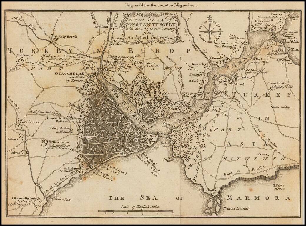
Detailed map of the area around Istanbul, published in the London Magazine. The map shows the area of Istanbul, and the Bosphorus Straits, with a number of roads and smaller towns, much of which is now a part of the sprawling Istanbul Metropolis.
![Charta ofwer Upstaden Wadstena No. XLVIII [with] Charta ofwer Upstaden Skeninge No. XLIX.](/map/small/70095.jpg)
A detailed collection of two plans of Swedish cities on one sheet. This antique engraved map was produced by Jonas Brolin in Stockholm in 1770. The map includes plans of Wadstena and Skeninge, as well as a regional map a the bottom. Important...
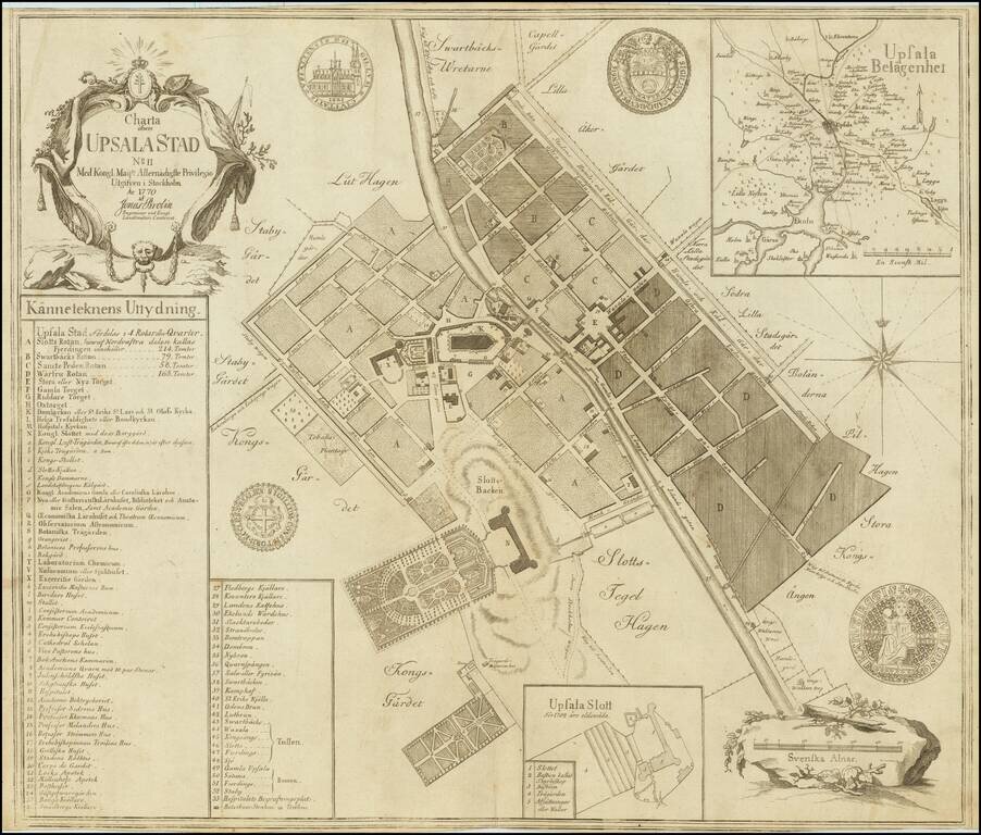
A detailed engraved plan of the Swedish city of Upsala. This antique engraved map was produced by Jonas Brolin in Stockholm in 1770. The town is shown in remarkable detail in the city, including of its street names, old fortifications, gardens, etc....
![Charta ofver Upstaden Carlstad No. XXXVII [with] Charta ofver Upstaden Christinehamn No. LXVII [with] Charta ofver Bergstaden Philipstad No. LXXIX](/map/small/70207.jpg)
A detailed collection of four plans of Swedish cities on one sheet. This antique engraved map was produced by Jonas Brolin in Stockholm in 1770. The map includes plans of Karlstad, Kristinehamn, Filipstad, and an inset of the region around Karlstad.
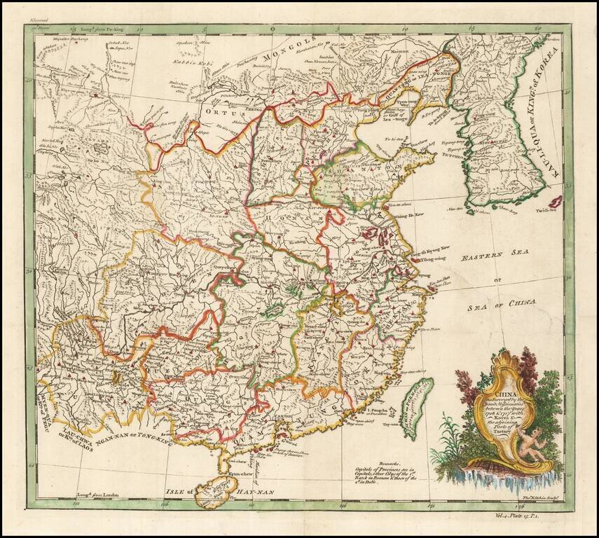
Based on a Jesuit Map of China Finely executed map of China and Korea, originally drawn from Jesuit Sources. The Qing Emperor Kangxi commissioned a ground of Jesuit surveyors to map China from 1708 to 1716. The resulting maps were published as the...
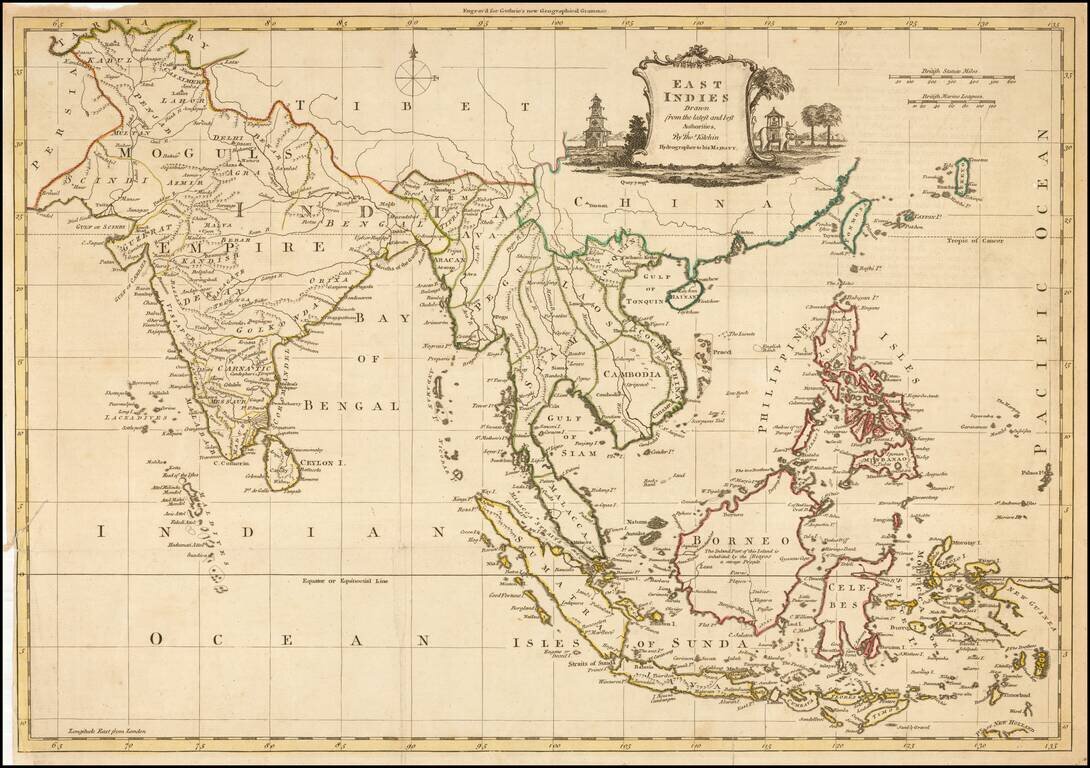
Decorative map of China, Korea, Southeast Asia, the Philippines, and India, published in Guthrie's New Geographical Grammar.
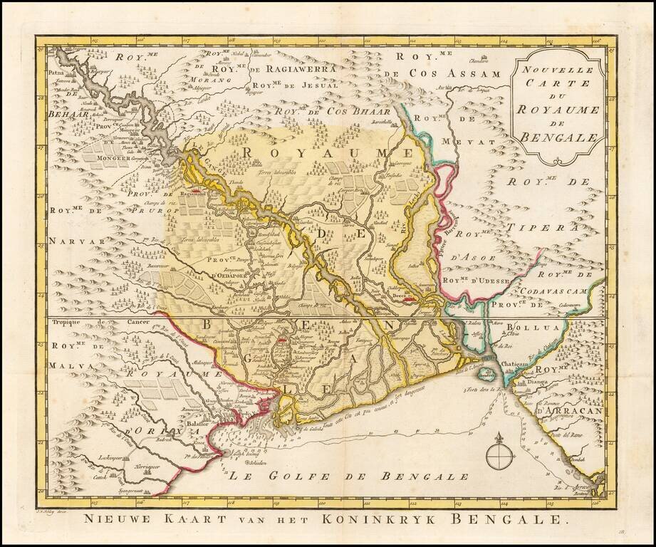
Detailed regional map of the Gulf of Bengal and the lower Ganges River. Marvelous detail.
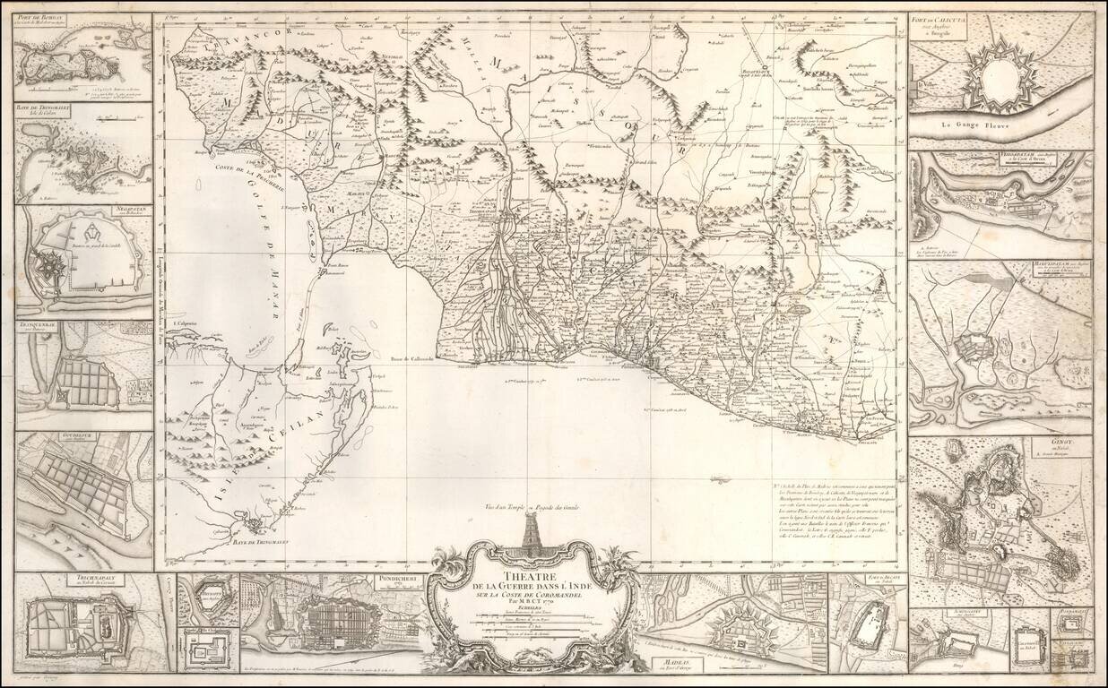
An Indian Theater of War Rarity Very beautiful and large map showing the coast of Coromandel, south-east of India, engraved by Jean-Baptiste Croisey. A fine large-scale map of the Indian coast from Madras to Cape Comorin, with east at the top, and...
![A Map of the Coast of Coromandel from the River Gadevari, to Cape Comorin [Sri Lanka]](/map/small/62976.jpg)
Detailed regional map of Southwestern India and Sri Lanka, published by Kitchin. The map is drawn primarily from D'Anville's map, as augmented by Kitchin using English sources, including: "The Route from Tritchinapoly to Tinevelley; as ascertained...
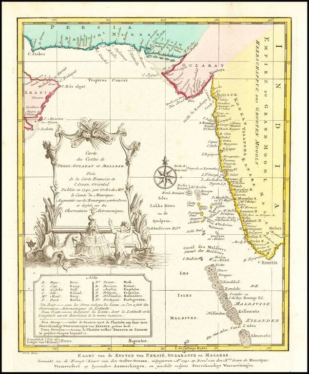
Detailed map of the region from the mouth of the Persian Gulf to the Maldives. Includes large decorative cartouche and compass rose.
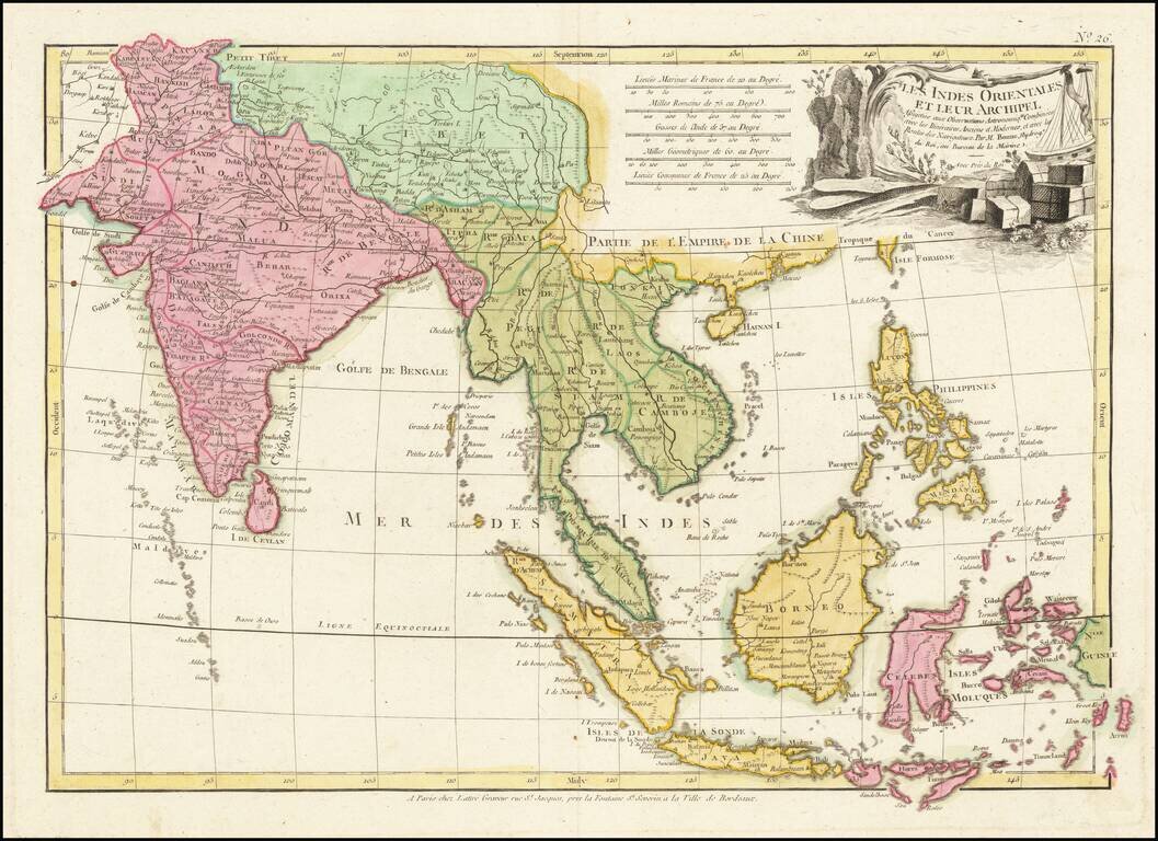
Scarce map of Southeast Asia, the Straits of Malacca, Philippines, Sumatra, Java, India etc., extending north to Canton and Macao, from Jean Lattre's Atlas Moderne. Includes a decorative allegorical cartouche showing the region as a place of commerce.
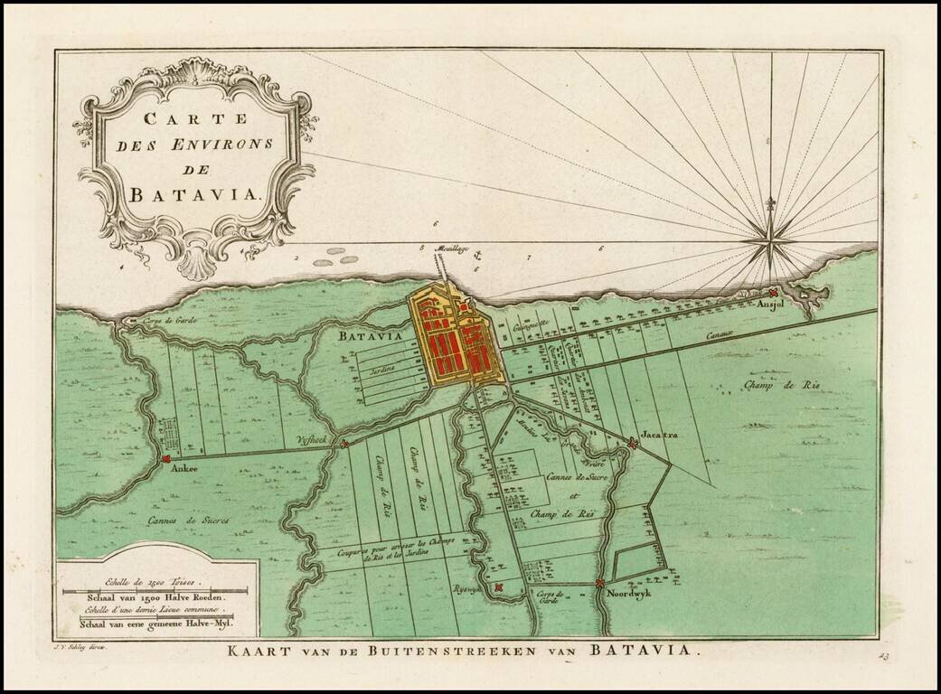
Detailed plan of the area around Batavia, including a small area southeast of the town plan which is named Jacarta. Includes notes on the Gardens, roads, rivers and other features around what is now Jakarta.
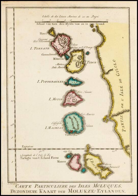
Detailed map of the Molucas. One of the maps produced for the Dutch edition of Bellin's work.