![[Niagara Falls] Wasserfall von Niagra](/map/small/69038.jpg)
Fine small image of Niagara Falls. The image is a close derivative of the first image of Niagara Falls by Louis Hennepin, which originally appeared in 1697. The main difference is that the image has been reversed. Also, one of Hennepin's four...
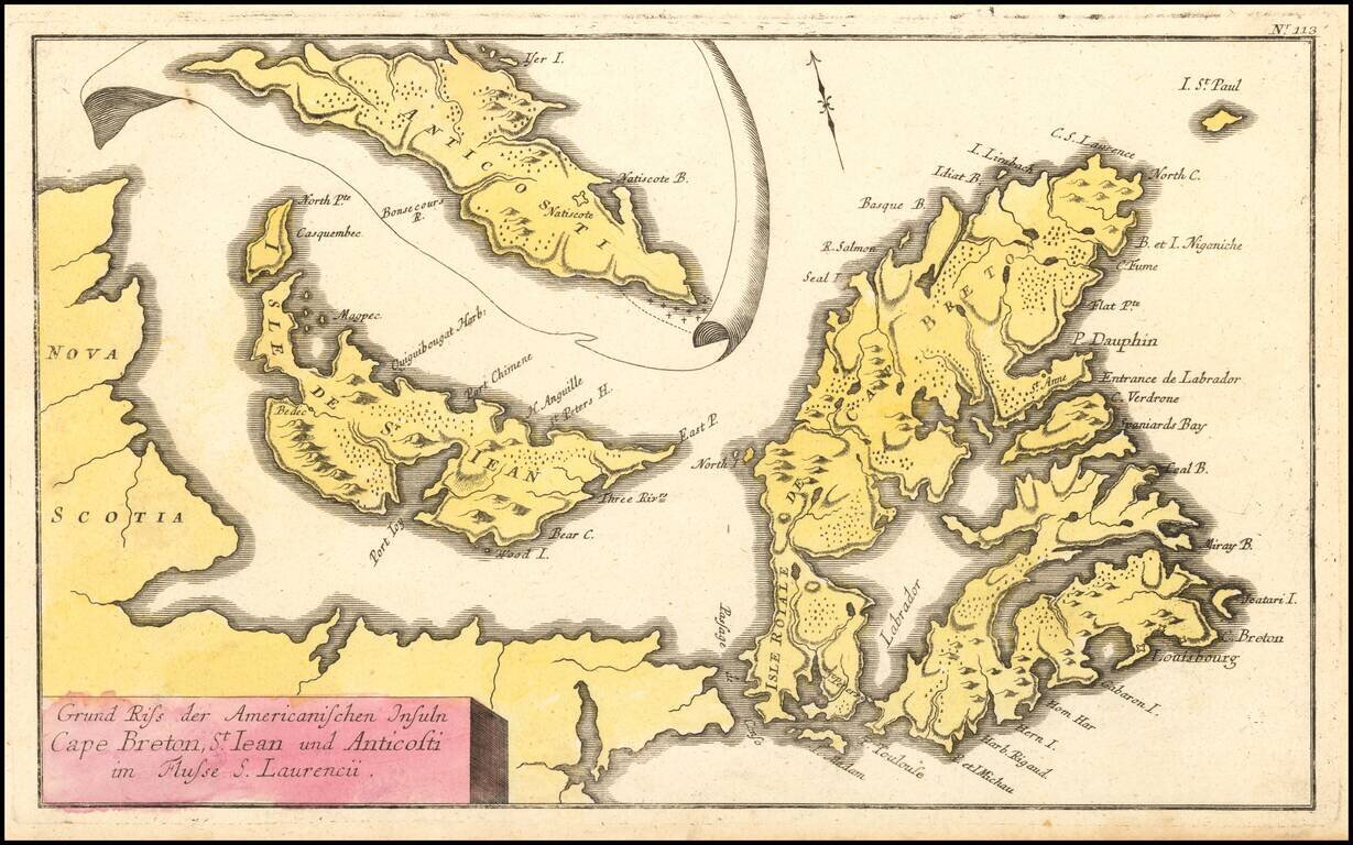
French & Indian War Map of NE Canada Detailed map of Northeastern Canada, including the eastern part of Nova Scotia, namely Cape Breton and Prince Edward Islands, published by Raspe in Nuremberg. The map includes an inset map of Anticosti Island...
![Carte Reduite des Isles Antilles Dressee au Depost des Cartes et Plans de la Marine… [Large Inset of Virgin Islands]](/map/small/68206.jpg)
Large engraved sea chart of the Lesser Antilles, with a detailed inset of the Virgin Islands, published by Jacques Nicolas Bellin in 1758. The Virgin Islands inset at the left is titled "Carte Particuliere des Isles des Vierges". Bellin credits the...
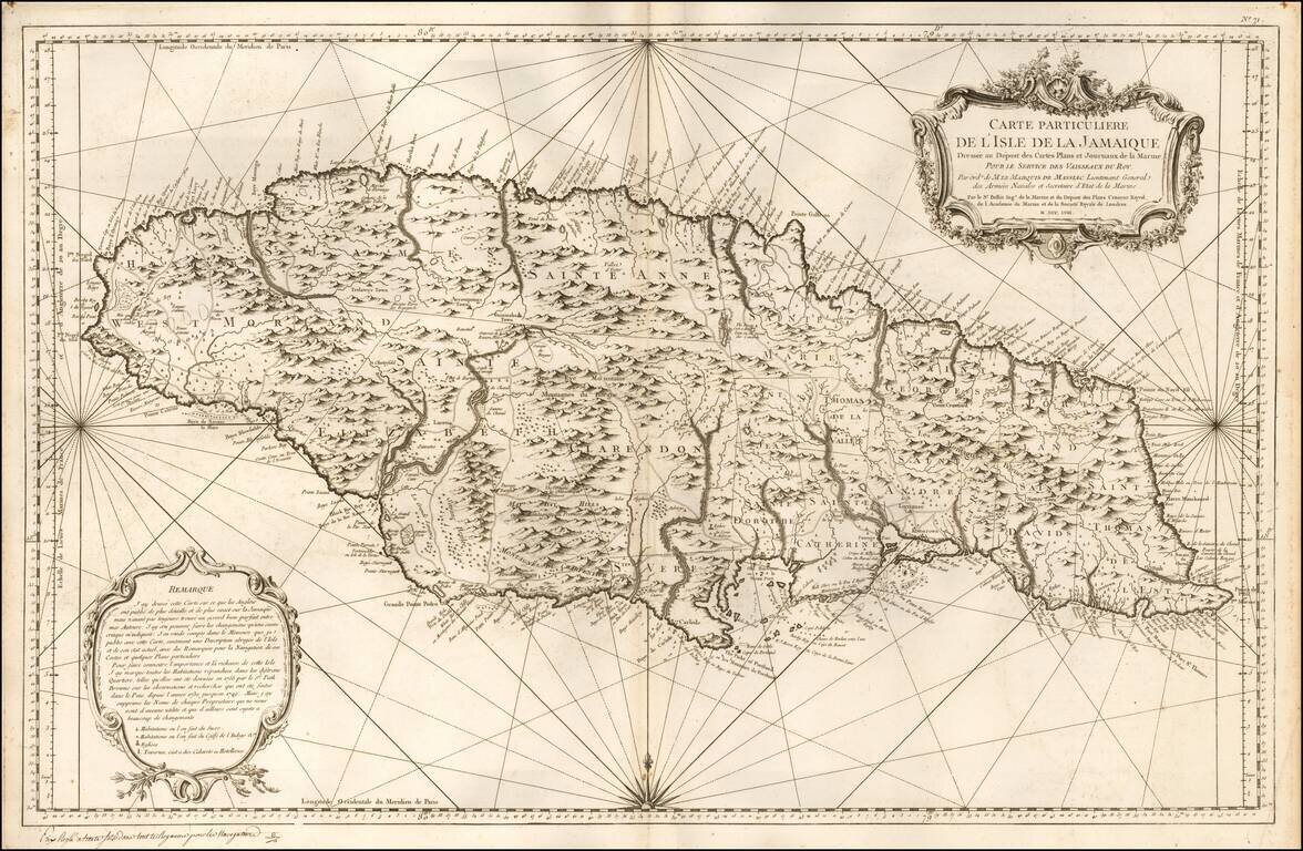
Locates Caberets and Taverns! Detailed Depot De La Marine's sea chart of Jamaica, first published in 1758. This detailed sea chart of Jamaica, shown divided into parishes, includes strong topographical details with many coastal toponyms. Sugar...
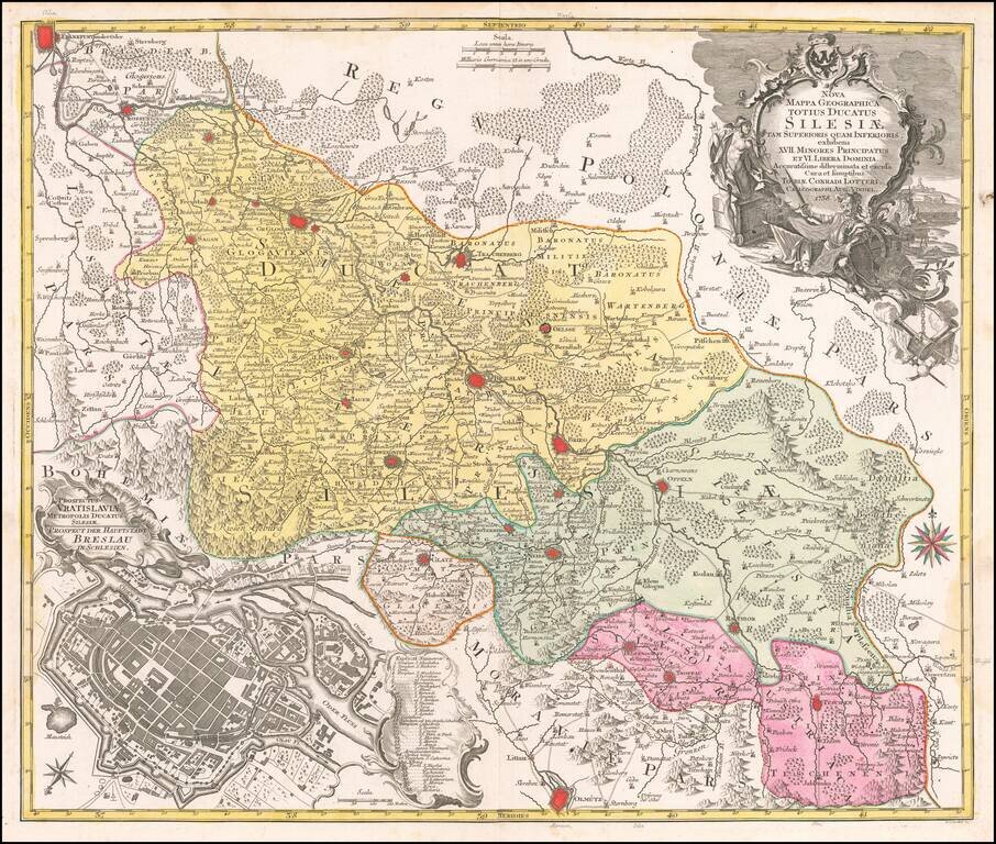
Detailed map of the region of Silesia, centered on Breslau (Wroclaw). Includes a large view of the town of Breslau (Wroclaw) in the lower left corner.
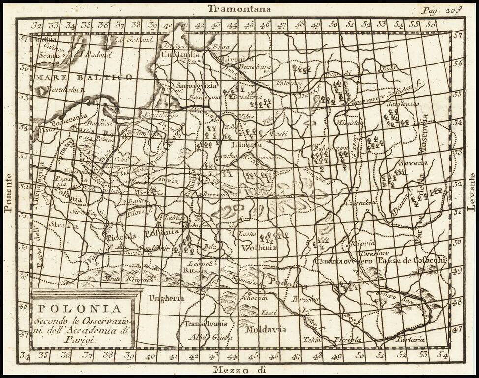
A map of Poland and the Baltic States, extending from Pomerania into Russia as far as Moscovia. Forests, rivers, mountains, settlements, and more are all shown. The four principal winds of the Mediterranean are shown at the edges of the map as a...

Detailed map of Nova Zembla and part of the Northeast passage. Includes a decorative title cartouche. One of the maps produced by Nicholas Bellin for L'Histoire Generale des Voyages.
![[Austrian Army Positions in Moravia, May 1758] . Plan du Campe de L'Armee Imperiale dans les Environs de Chotze le 4me May 1758.](/map/small/59816.jpg)
Chocen, Hemze and Bestovice, Czechia -- May 1758 -- Positions of the Austrian Army Under The Command of Count von Daun Finely executed map illustrating the Austrian military positions, likely under the Command of Field Marshall Count Leopole Josef von...
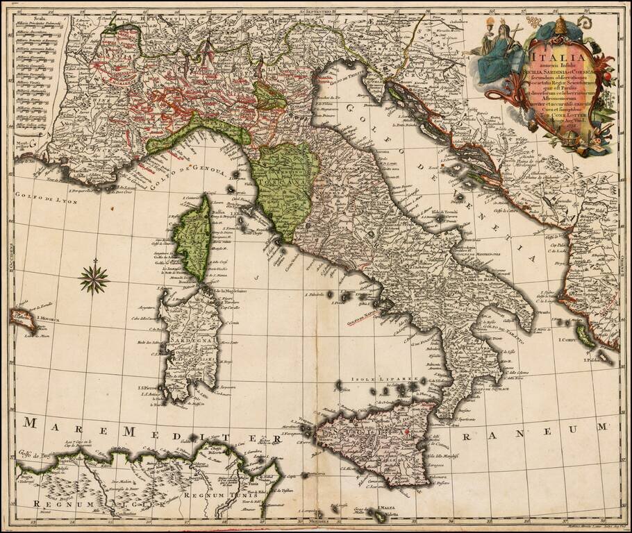
Scarce map of Italy, published by TC Lotter. Includes Sicily (Mt. Aetna erupting), Corsica and Sardinia. Fine dark impression.