![[The First Maps in a la poupée Printed Color] Cartes en Couleur des Lieux Sujets aux tremblements de Terre Dans toutes les parties du Monde Selon le Sisteme de l’impulsion Solaire](/map/small/52293op.jpg)
The First a la poupée Color Printed Maps in A Rare Pamphlet On The Relationship Between The Sun and Earthquakes Extremely rare separately published pamphlet by Jean Fabien Gautier D'Agoty, containing a complete set of his maps from his Observations...
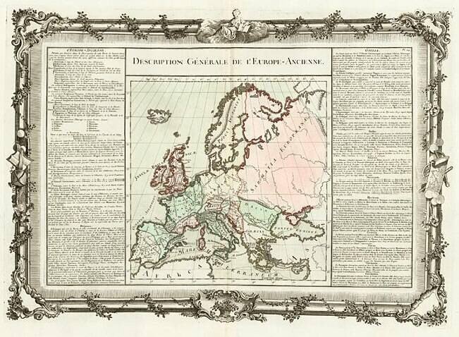
Decorative map of the continent. Includes remarkable decorative borders found only in the deluxe edition of Buy De Mornas' Atlas Methodique et Elementaire de Goegraphie et l'Histoire.
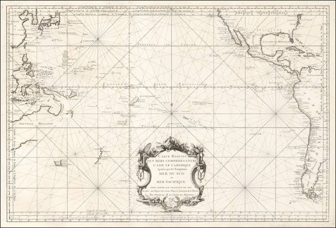
French Chart of the Pacific Ocean on the Eve of the Great Voyages of Discoveries Fascinating sea chart, depicting the Pacific Ocean immediately before the wave of exploration that occurred from the 1760s to the 1790s. This fine chart, issued by the...
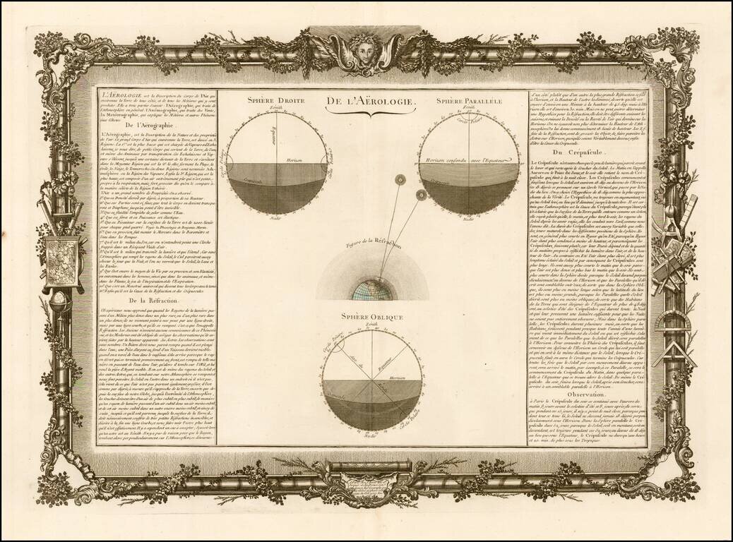
Decorative chart showing various celestial models. Includes remarkable decorative borders found only in the deluxe edition of Buy De Mornas' Atlas Methodique et Elementaire de Goegraphie et l'Histoire.
![Pour Les Vents [world map centered on Asia]](/map/small/59768.jpg)
Decorative world map, with rhumb lines and a 16 point compass rose and 2 8 point compass roses. Incomplete image of Australia, showing the discoveries prior to Captain Jams Cook.
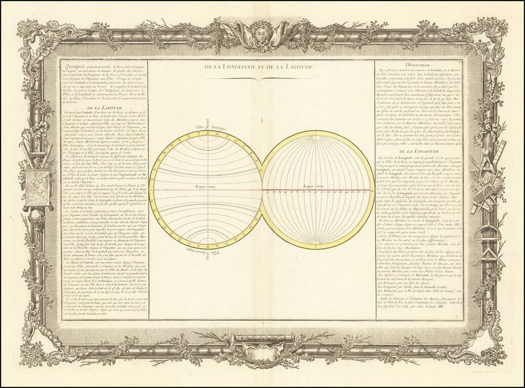
Decorative chart illustrating longitude and latitude. Includes remarkable decorative borders found only in the deluxe edition of Buy De Mornas' Atlas Methodique et Elementaire de Goegraphie et l'Histoire.
![Planisphere Physique ou l'on voit du Pole Septentrional ce que l'on connoit de Terres et de Mers Avec les Grandges Chaines de Montagnes . . . [Bay or Sea of the West]](/map/small/70578.jpg)
Scarce Buache Map of the World's Watersheds, One of the First Thematic Maps Fine example of Buache's watershed map of the world, on a North Polar projection. The map shows how mountain chains affect the flow of water into the various oceans. The map...
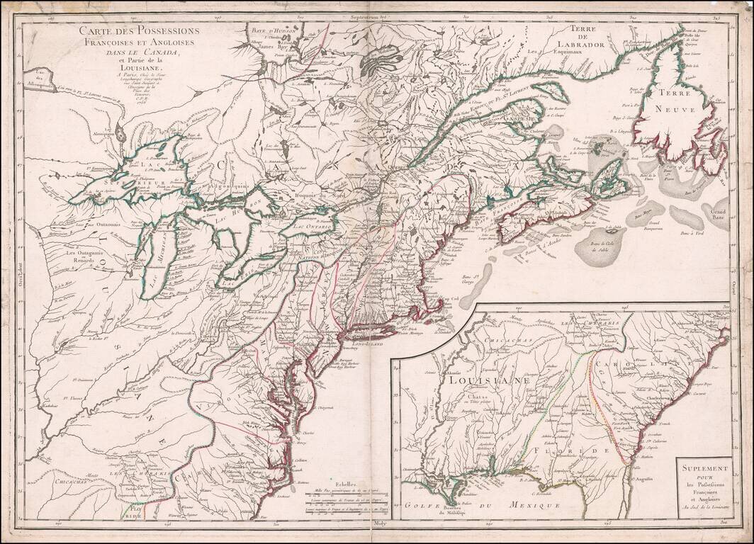
Scarce first edition of this fine early map of the British Colonies in North America at the outset of the French & Indian War. The map names and depicts many of the early boundary lines delineating the colonial charters, some with dates. Some of...
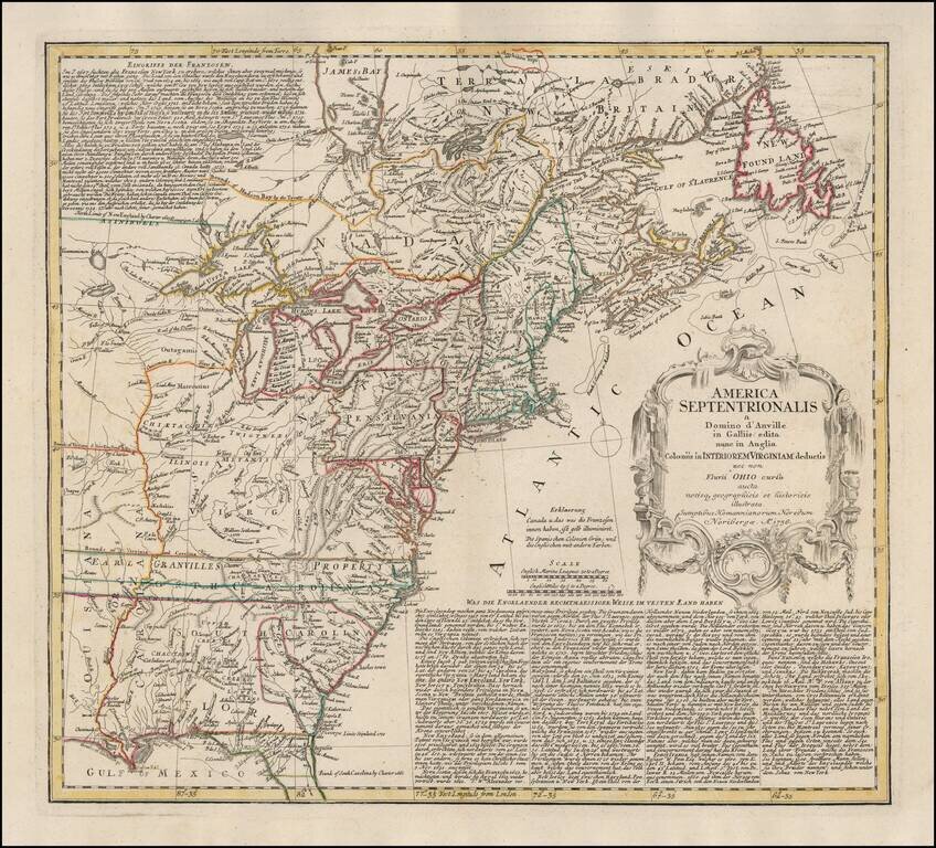
Rare, Detailed First Edition of Longchamps’ Map of the North American Colonies—Proof State! Fine example of the first edition of Longchamps’ map of the colonies—Spanish, French, and British—in North America east of the Mississippi River,...
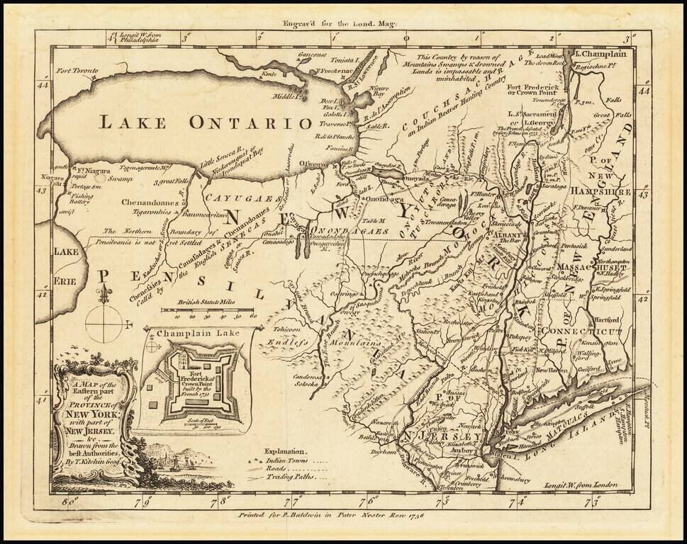
French & Indian War Map of New York and New Jersey Detailed map of the Theater of the French and Indian War in 1755. The region depicted includes the Hudson River valley, north to Lake Champlain, including Forts Ticonderoga and Frederick. Also...
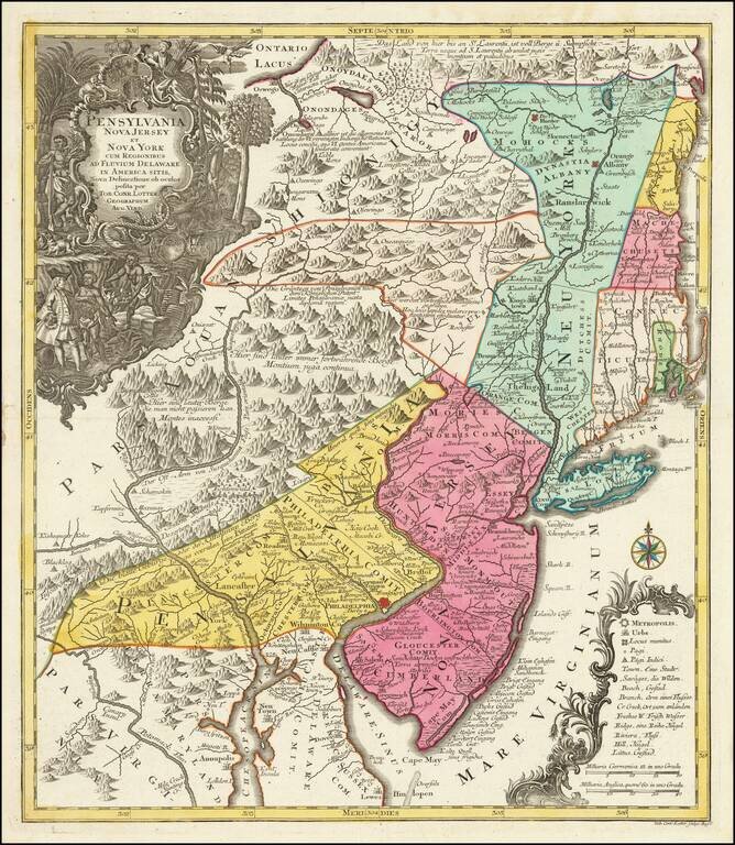
Fascinating Colonial Map of New Jersey, New York and Eastern Pennsylvania Nice example of T.C. Lotter edition of Seutter's map of the Middle British Colonies, based upon Lewis Evans' extremely rare map of 1749. Seutter's map is a notable...
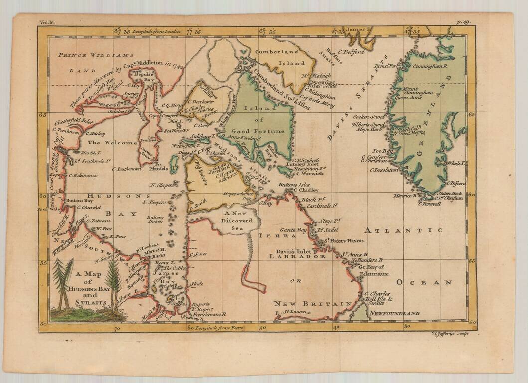
Interesting early map of Hudson Bay and vicinity, engraved by Jefferys. The map illustrates the English expeditions in search of the fabled Northwest Passage. Notes the discoveries in the vicinity of Repulse Bay and Wager River by Capt. Middleton in...
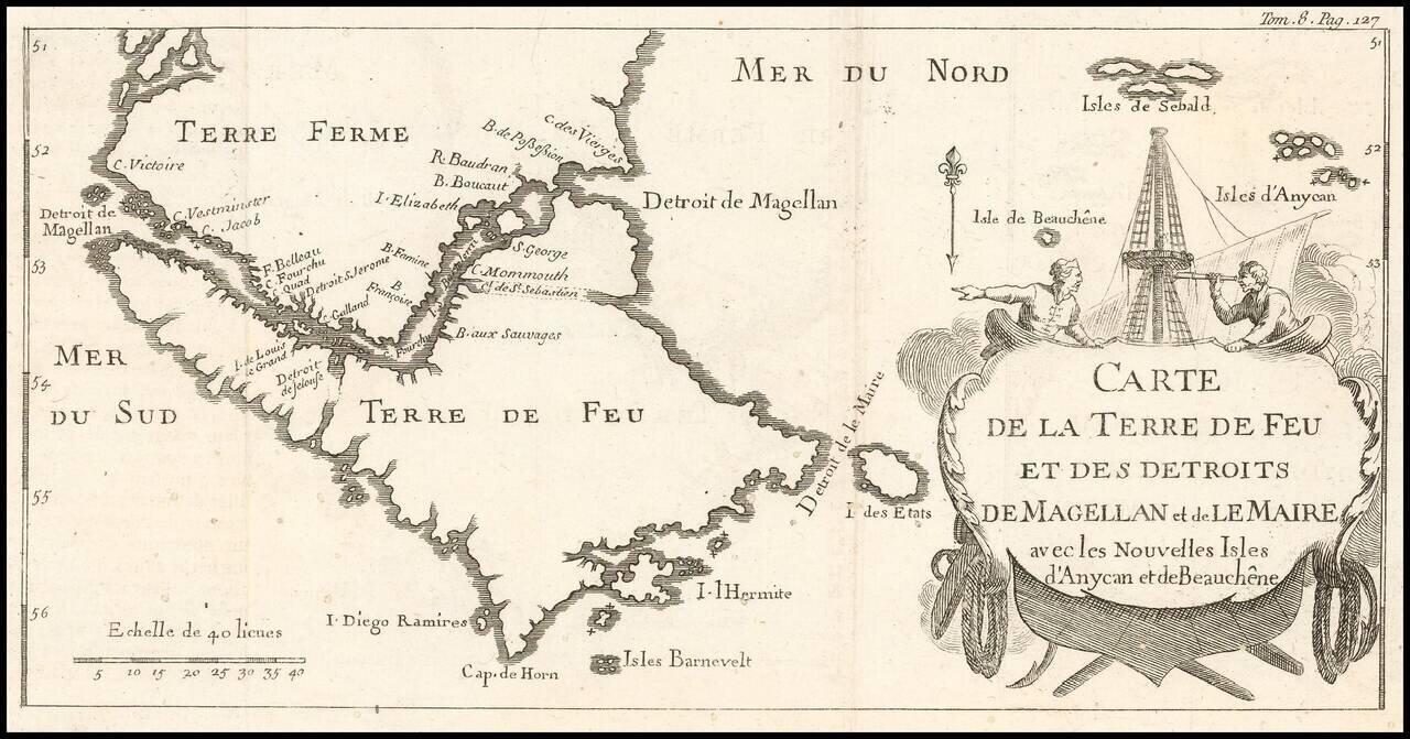
Rare Map of the Straits of Magellan Showing French, English, Spanish, and Dutch Discoveries Rare map showing European discoveries up to the early eighteenth century. The map depicts a large scale outline of southern Patagonia, or Terre Ferme,...
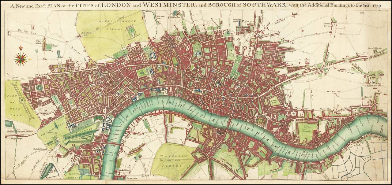
Scarce map of the London, published by Seale. Extends west to Hyde Park, South to Lambeth, north to Hackney Road and Islington and Hoxton, and east to Rotherhithe and Stepney. Only London Bridge and Westminster Bridge are shown crossing the Thames...
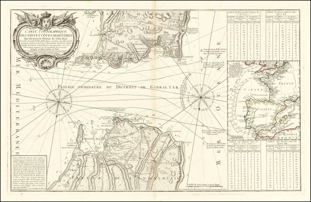
Rare scientific sea chart, oriented with south at the top, showing the entrance to the Mediterranean through the Straits of Gibraltar. The chart illustrates in great detail the fortifications on both the Iberian and African coastlines, as well as the...
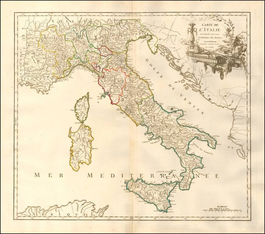
Interesting postal route map of Italy, Sicily, Sardinia & Corsica, from an early edition of DeVaugondy's Atlas Universel. Shows the various postal routes in Italy and Sicily, with the various stops also noted. Includes towns, mountains, rivers,...