Map size in jpg-format: 43.1839MiB
Click to open in high resolution (open in new tab).
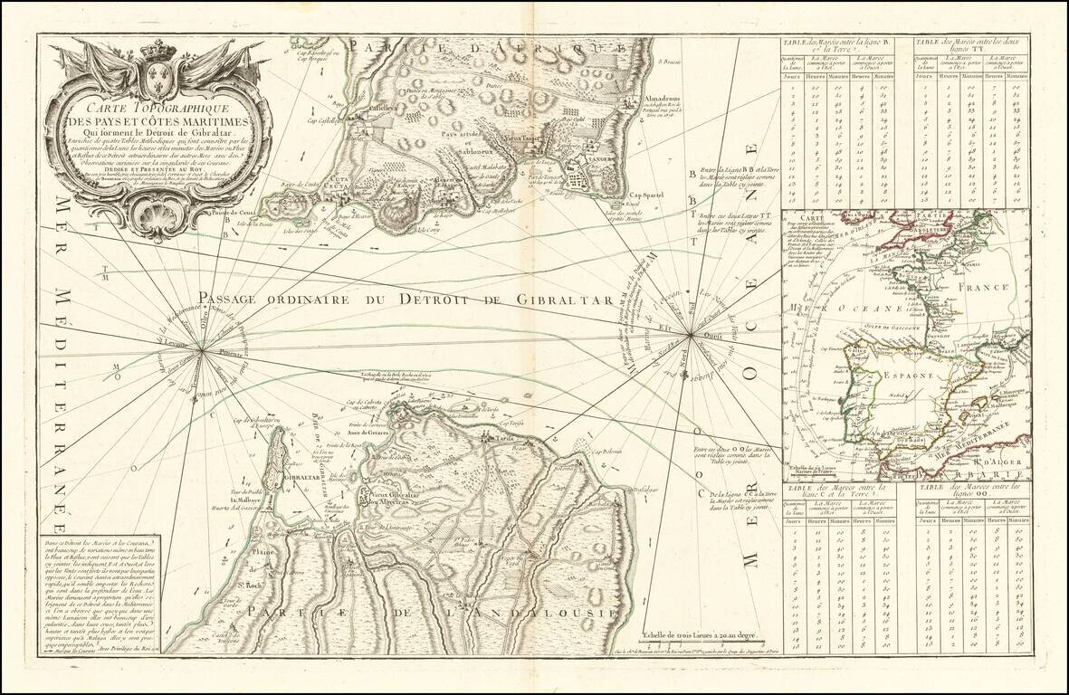
Rare scientific sea chart, oriented with south at the top, showing the entrance to the Mediterranean through the Straits of Gibraltar.
The chart illustrates in great detail the fortifications on both the Iberian and African coastlines, as well as the prevailing currents,
Four tidal tables compare tide levels and times with notes on the currents, best channels for navigation, anchorages, soundings and other important navigational details.
A large inset map illustrates the major shipping routes between the British Isles and Marseilles, France.
The map would be re-issued in German by the Homan Heirs in about 1756.
The French original by Beaurain is quite scarce on the market.
If you are a student, write to us in telegram: @antiquemaps and indicate what material you need and for what work you need a map in high detail. We are ready to provide material on special terms. For students only!


