![A New & Accurate Map of Asia . . . [Shows Mythical De Gama's Land!]](/map/small/70385.jpg)
Decorative map of the continent of Asia, hand colored by countries. In the 1730s and 1740s, De Gama Land was a source of intellectual debate, not as to its existence, but its exact location, with such important explorers as De L'Isle, de la Croyere...
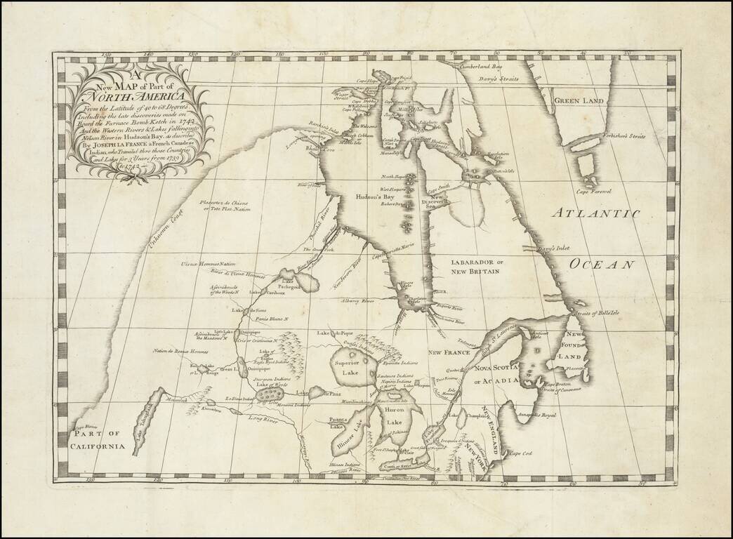
Important early map illustrating the controversy over the Northwest Passage. The map was part of the great Dobbs-Middleton debate concerning British exploration in search of a northwest passage. The present map extends from the Great Lakes, Upper...
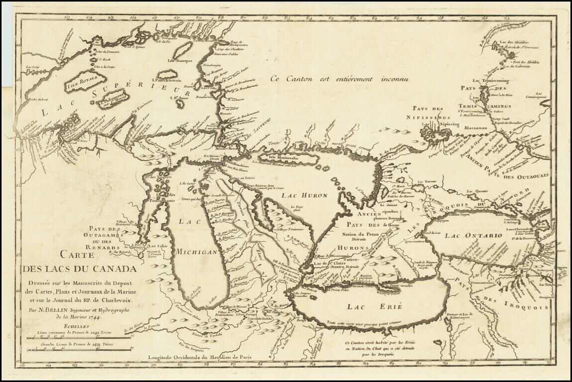
Fine example of Bellin's Landmark map of the Great Lakes region, published in 1744 Bellin's seminal early map of the Great Lakes represented a milestone in the progress of the mapping of the region. It is also one of the earliest appearances of...
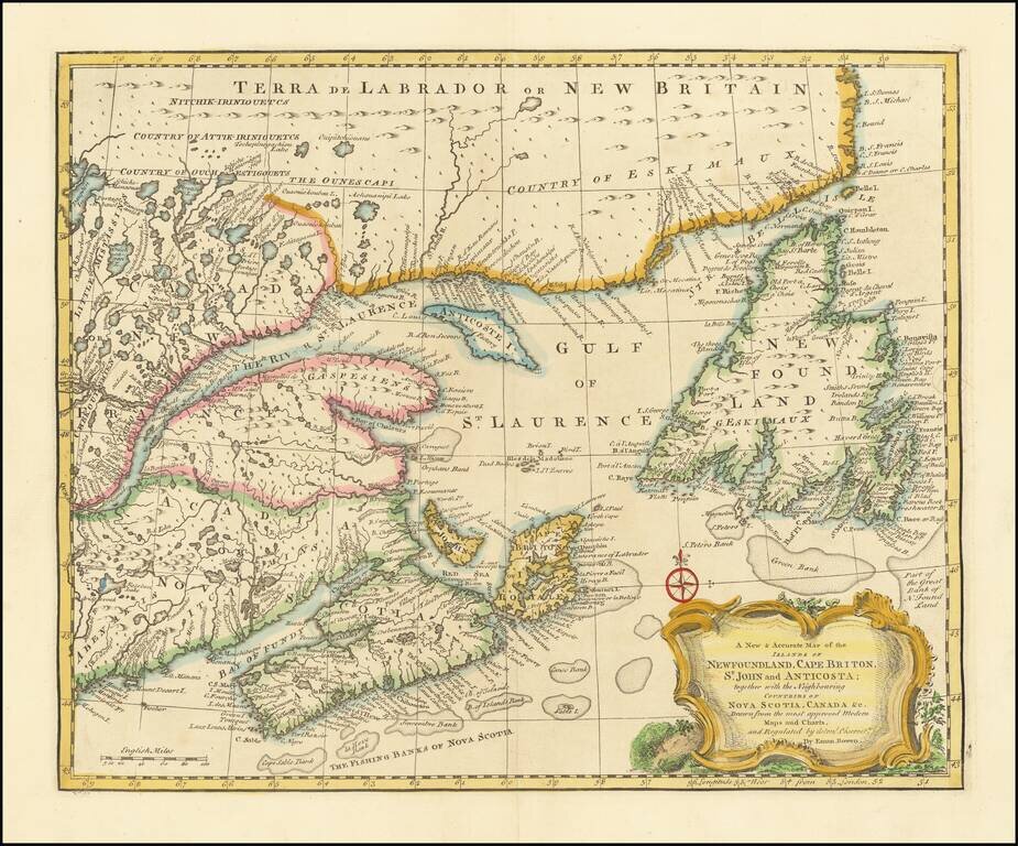
Striking and highly detailed map of Northeastern Canada, etc. published by Emanuel Bowen in London. The map covers the region bounded by Newfoundland, Nova Scotia, Acadia and Labrador. Decorative cartouche, compass rose and excellent detail...
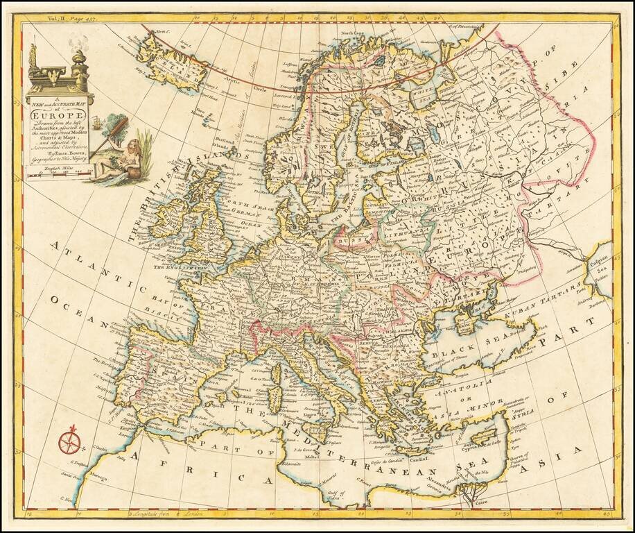
Decorative English map of Europe and Iceland. Decorative cartouche, compass rose and overall nice detail.
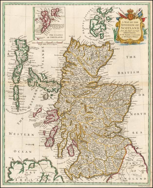
A handsome mid eighteenth century map of Scotland, on a scale of some nineteen miles to the inch, with a cartouche. Interspersed among the place names are some interesting notes and comments - "Aggat & Chrystal Marble found here", "Abundance of...
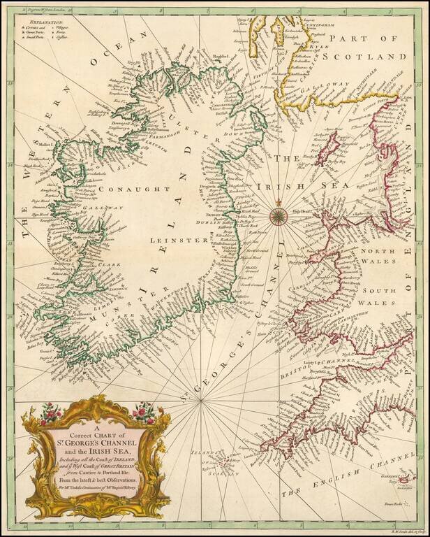
A handsome mid-18th century map of Ireland and the St. George Channel or Irish Sea.
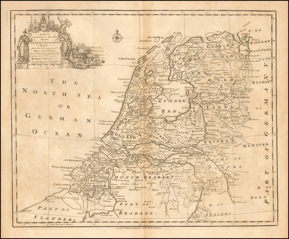
Emanuel Bowen's map of the Seven United Provinces, published in London circa 1744.
![[Nice, Beaulieu-sur-Mer, Monaco] Carte Particuliere des Environs de Nice, et de Ville-Franche, depuis Ville-neuve en Provence, jusqu'a Monaco. Ou l'on voit la Marche des Armees de France et d'Espagne, leurs passage du Var, et les differentes attaques de](/map/small/62767op.jpg)
Rare map depicting the French Mediterranean coast from Monaco to Ville-neuve and centered on Nice and Beaulieu-sur-Mer, engraved by Guerard. The map illustrates the movements of the Spanish and French Armies during the War of Spanish Succession The...
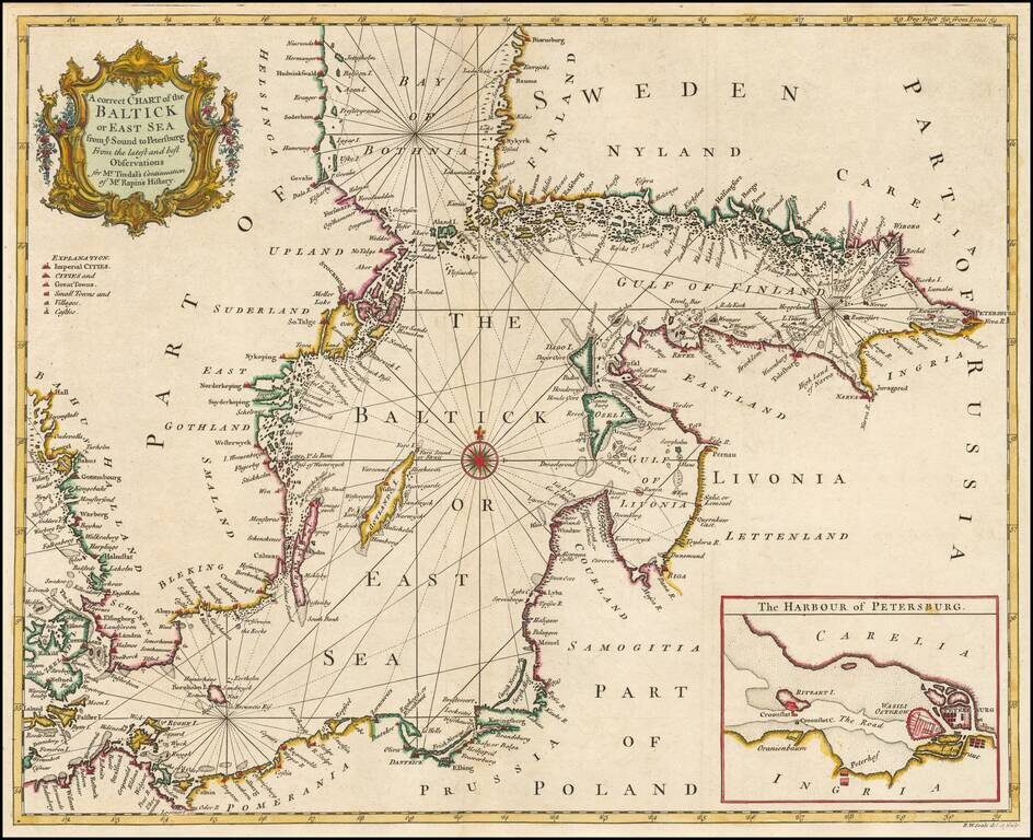
Detailed coastal chart of the Baltic Sea, Bay of Bothnia, Gulf of Finland and contiguous coastlines, with a large inst map o the Harbour at St. Petersburg. Includes a compass rose and rhumblines, with a decorative title cartouche.
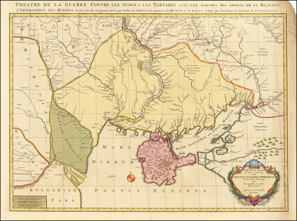
Fine old color example of this rare map depicting the theater of the Russo-Turkish War in the Ukraine in 1737. The map provides excellent detail of the fortifications including the Ukrainian line - a system of defenses from the Dnipro to the Donetz...
![[Prague] Wahrhaffter und Accurater entworffener Plan und Grund-Riss der Hauptstadt Prag in dem Königreiche Böhmen; wie Solche von dem Kayserlichen Königlichen Preussischen Auxiliar Trouppen im Monath September A. 1744 belagert und erobert worden.](/map/small/37226.jpg)
A finely drafted manuscript plan of Prague, depicting Frederick the Great's 1744 siege of the city, executed by the Danish engineer Gregers Daa Trellund. This magnificent plan shows Prague and its environs as they appeared in 1744, after the Prussian...
![A New & Accurate Map of the Western parts of Barbary Containing Fez, Morocco, Algiers . . . [and] A New & Accurate Map of the Eastern parts of Barbary . . .[Shows Cyprus]](/map/small/67838.jpg)
Two engraved maps on one sheet showing the Mediterranean, with a focus on North Africa. The upper map extends from the Atlantic to "Tripoly," while the lower map extends from Tunisia to the Holy Land. In addition to the many states of North Africa,...
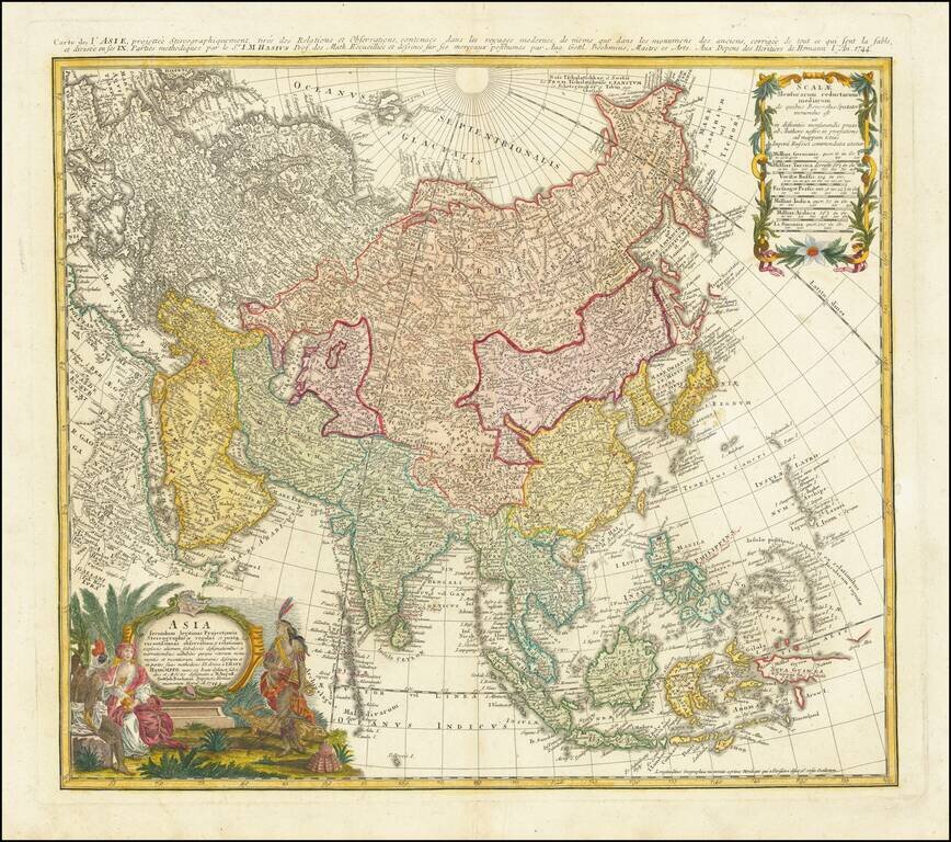
Antique Map of Asia Published in Nuremberg Detailed map of Asia, based upon Johann Mattheus Haas' stereographical projection of the world. As noted in the key at the bottom center, the map is colored based upon the Religious Groups within Asia,...
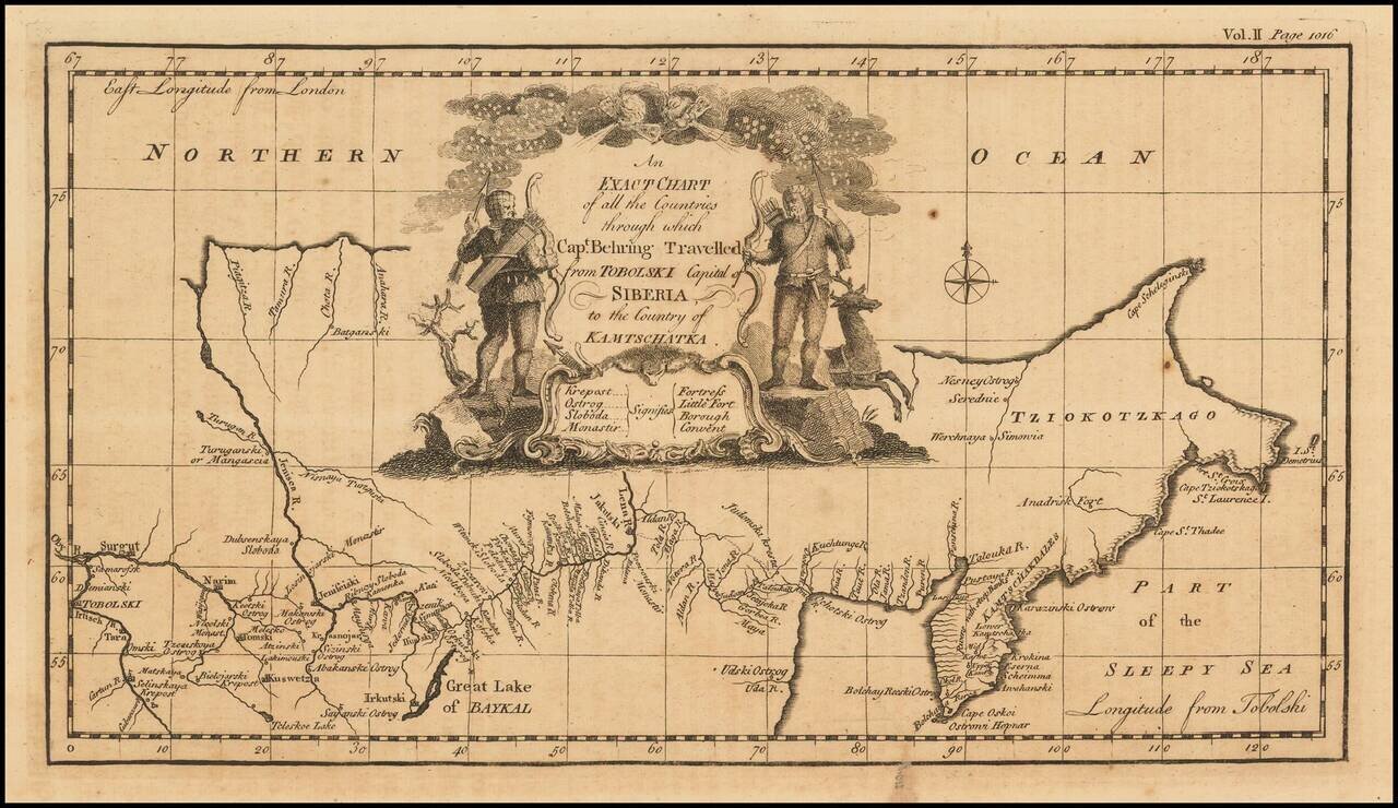
Nice example of the first English language map to show Vitus Behring's Route. In December 1724, Czar Peter the Great ordered the Danish-born Captain-Commander Vitus Bering (1681-1741) to lead the First Kamchatka Expedition (1725-30), in an effort to...
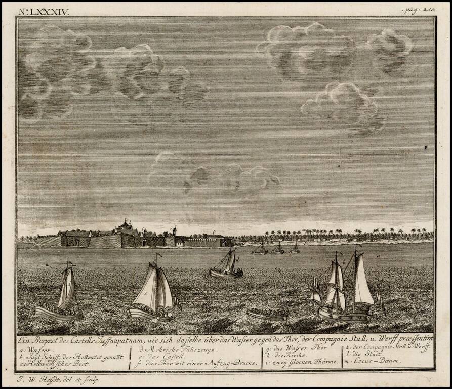
Birdseye view of the Dutch Fort at Jaffnapatnam, from Johann Wolfgang Heydt's Allerneuster Geographisch- und topographischer Schau-Platz von Africa und Ost-Indien. The view depicts Jaffnapatnam the fort on the coast of Sri Lanka. This Portuguese built...