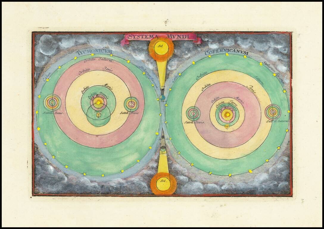
Finely colored example of Zurner's models of the Solar System. A fascinating pair of maps of the solar system, based upon the models of Copernicus and Tycho Brahe.
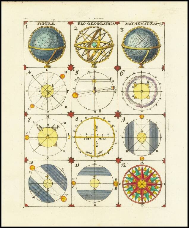
Interesting set of 12 models, ilustrating the construction of celestial and terrestrial models of the globe and solar system, from an anonymous source. An interesting set of images.

Detailed map of Peru, pubished in Paris by a young Philippe Buache, who would go on to become the pre-eminent French mapmaker of the middle of the 18th Century, along with J.B.B. D'Anville.
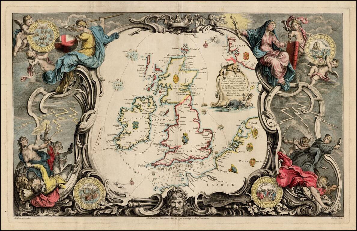
Striking map of the British Isles, from John Pine's The Tapestry Hangings of the House of Lord's representing the several Engagements between the English and Spanish Fleets in the ever memorable year 1588. The maps in Pine's work illustrate a series...
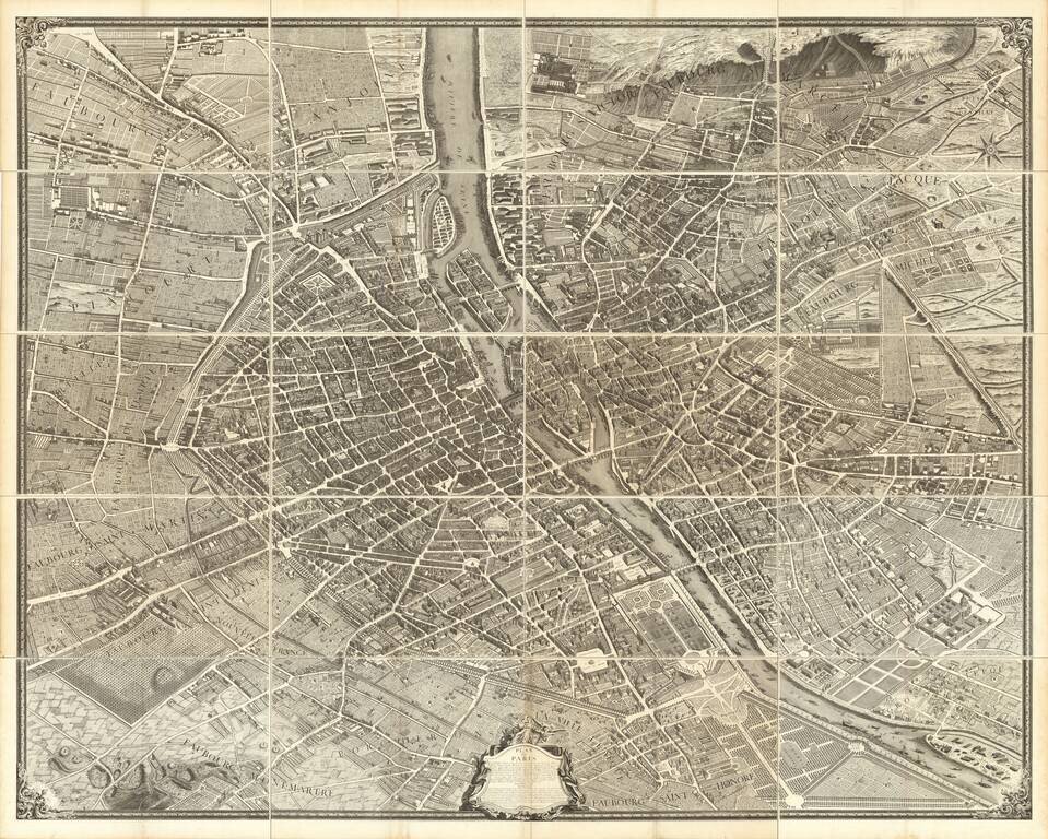
Turgot's Monumental View of Paris, Stretching to Over 10 Feet When Joined. This expansive engraved view of Paris covers the first eleven arrondissements of modern Paris. With a combined width of over ten feet, the joined plan makes for an arresting...
![[Plan of the Emperor's Capital of Moscow] Plan Imperatorskago Stolichnago Goroda Moskvy. Sochinennoi pod smotreniem arkhitektora Ivana Michurina v 1739 godu.](/map/small/38306.jpg)
Fine example of the first plan of Moscow made to scientific specifications, by the architect Ivan Fyodorovich Michurin, published in St. Petersburg in 1739. Michurin's plan of Moscow is a scientific milestone in the modern history of Moscow,...
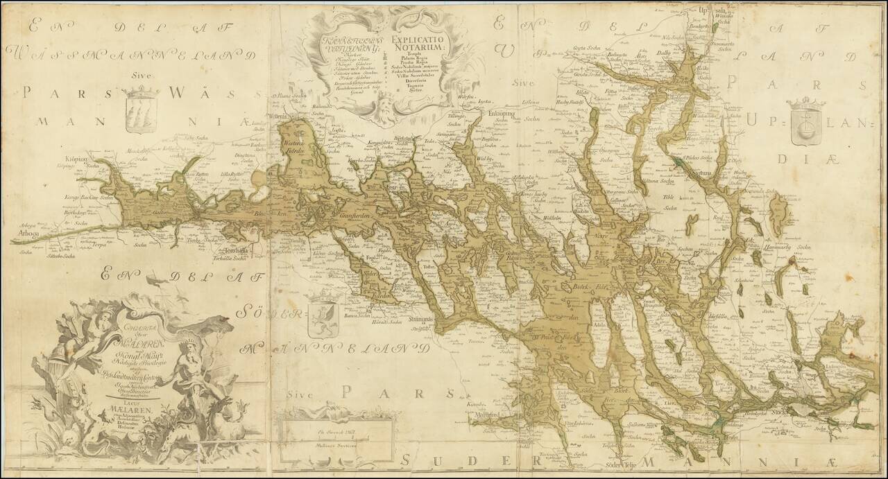
Detailed and scarce antique Swedish map of the region around Stockholm and to its north and west. The map extends from Arboga in the west to Björknäs in the east; in the southwest, the map extends to Mariefred, in the northeast, it extends to...
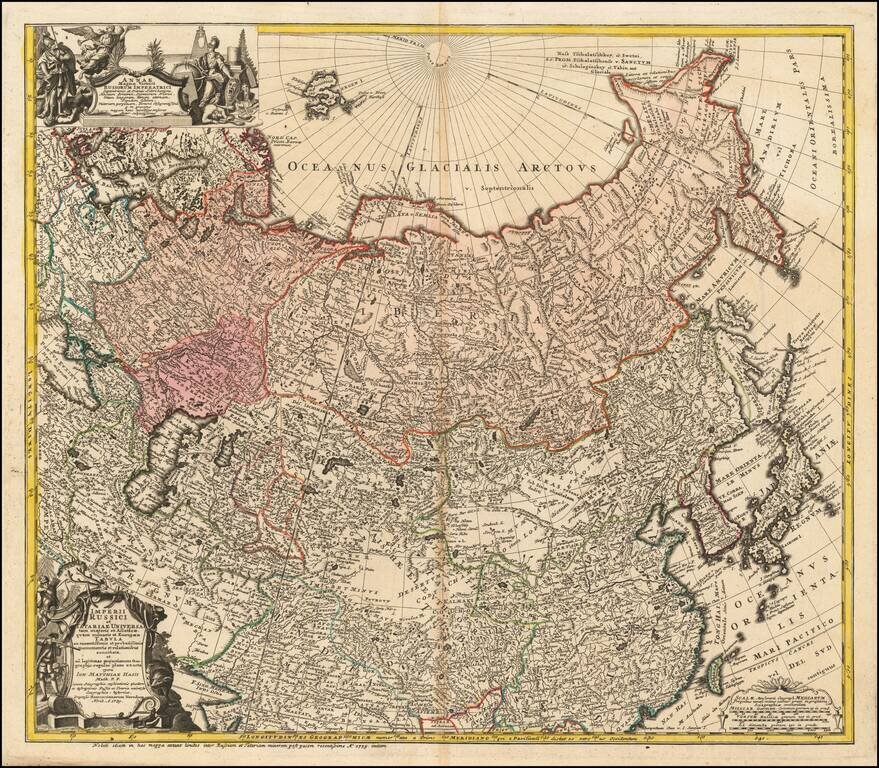
Detailed map of the Asian part of the Russian Empire, from the Caspian Sea and Bergen Island to Japan and the Pacific. The present example includes the portrait of Anna Ioannovna, who was regent of the duchy of Courland from 1711 until 1730 and then...
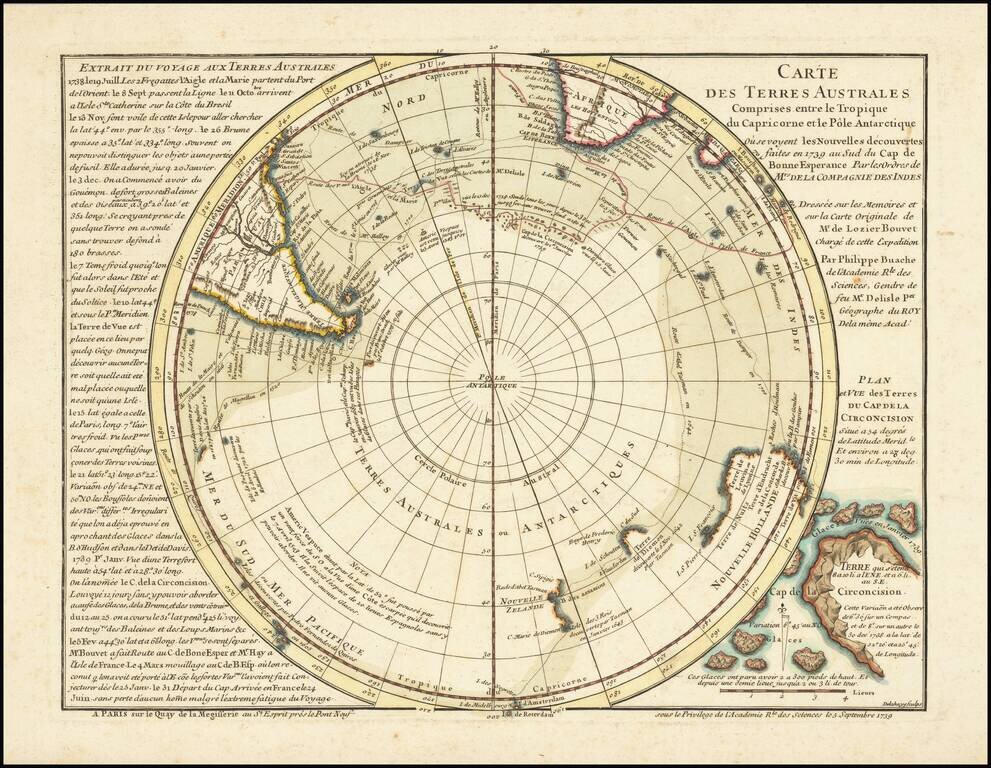
Rare First State / Overview of South Polar Exploration and Conjecture in the First Half of the 18th Century! Remarkable map of the Southern Hemisphere, the foundational map the work of noted French mapmaker Philippe Buache. This map is Buache's...