Map size in jpg-format: 951654B
Click to open in high resolution (open in new tab).
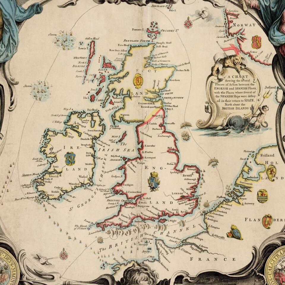
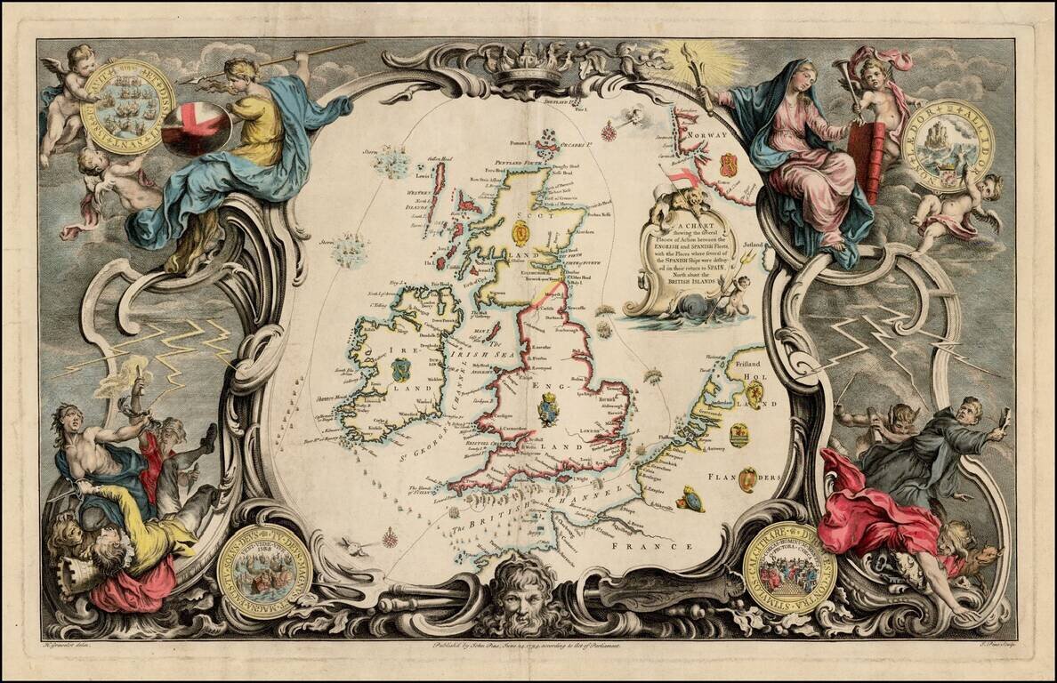
Striking map of the British Isles, from John Pine's The Tapestry Hangings of the House of Lord's representing the several Engagements between the English and Spanish Fleets in the ever memorable year 1588.
The maps in Pine's work illustrate a series of charts first published by Robert Adams in 1588, which show the engagements on a nearly day by day basis of the English and Spanish Fleets and the subsequent destruction of the Armada.
Pine's work is regarded as one of the finest sets of 18th Century books of English engravings.
If you are a student, write to us in telegram: @antiquemaps and indicate what material you need and for what work you need a map in high detail. We are ready to provide material on special terms. For students only!


