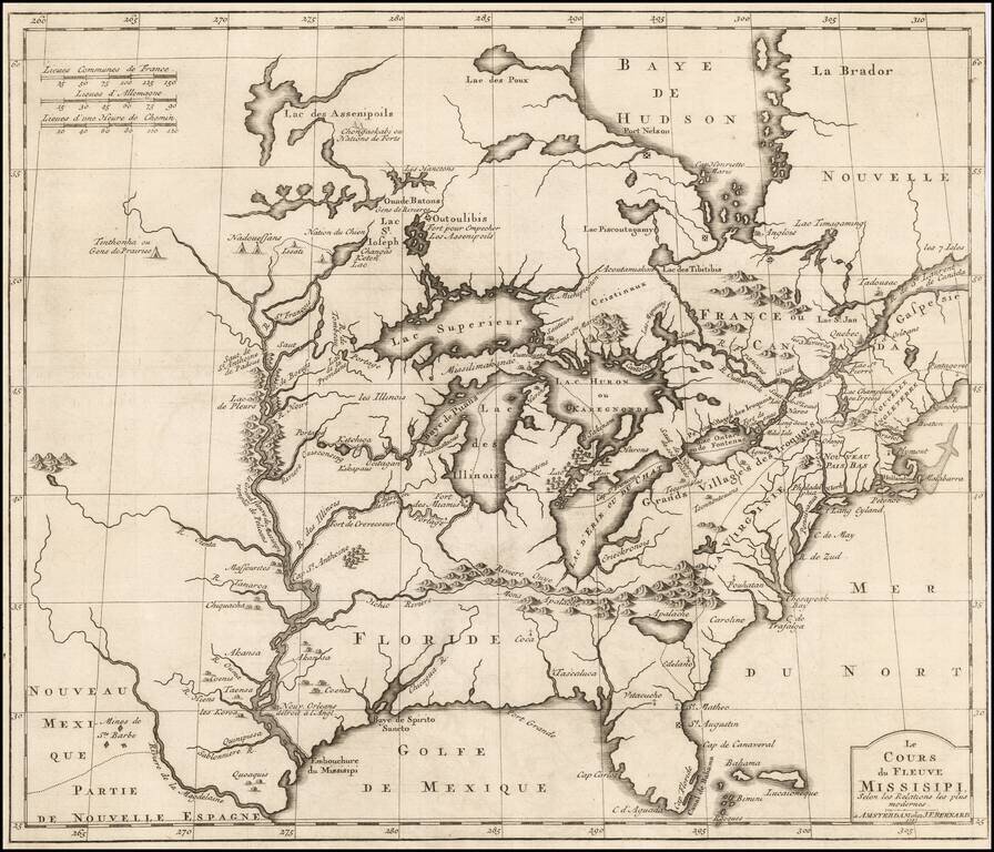
Important early derivative of Louis Hennepin's seminal map of North America. Benard's map provides an excellent treatment of the region from the Mississippi River and the Great Lakes eastward to the eastern seaboard. Along the Mississippi, Benard...
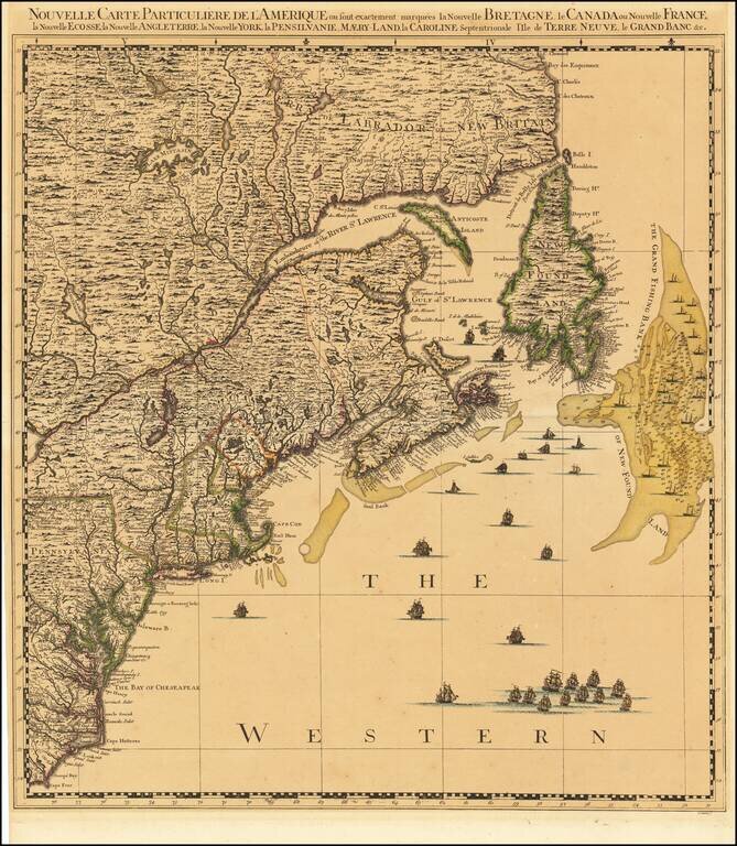
The Northeastern quadrant of Covens & Mortier's four-sheet edition of Popple's seminal map of North America, widely regarded as one of the two most important maps of North America produced in the 18th century (along with the Mitchell Map). Unlike...
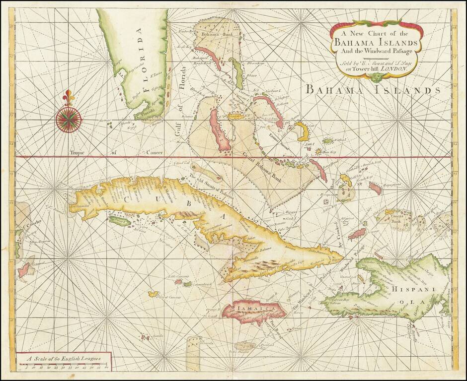
Scarce Early English Chart of the Bahamas from the Influential English Pilot, Fourth Book This chart by Mount and Page includes the tip of Florida, the Cayman Islands, Cuba, Jamaica, the western part of Hispaniola and Cozumel to the far west. The...
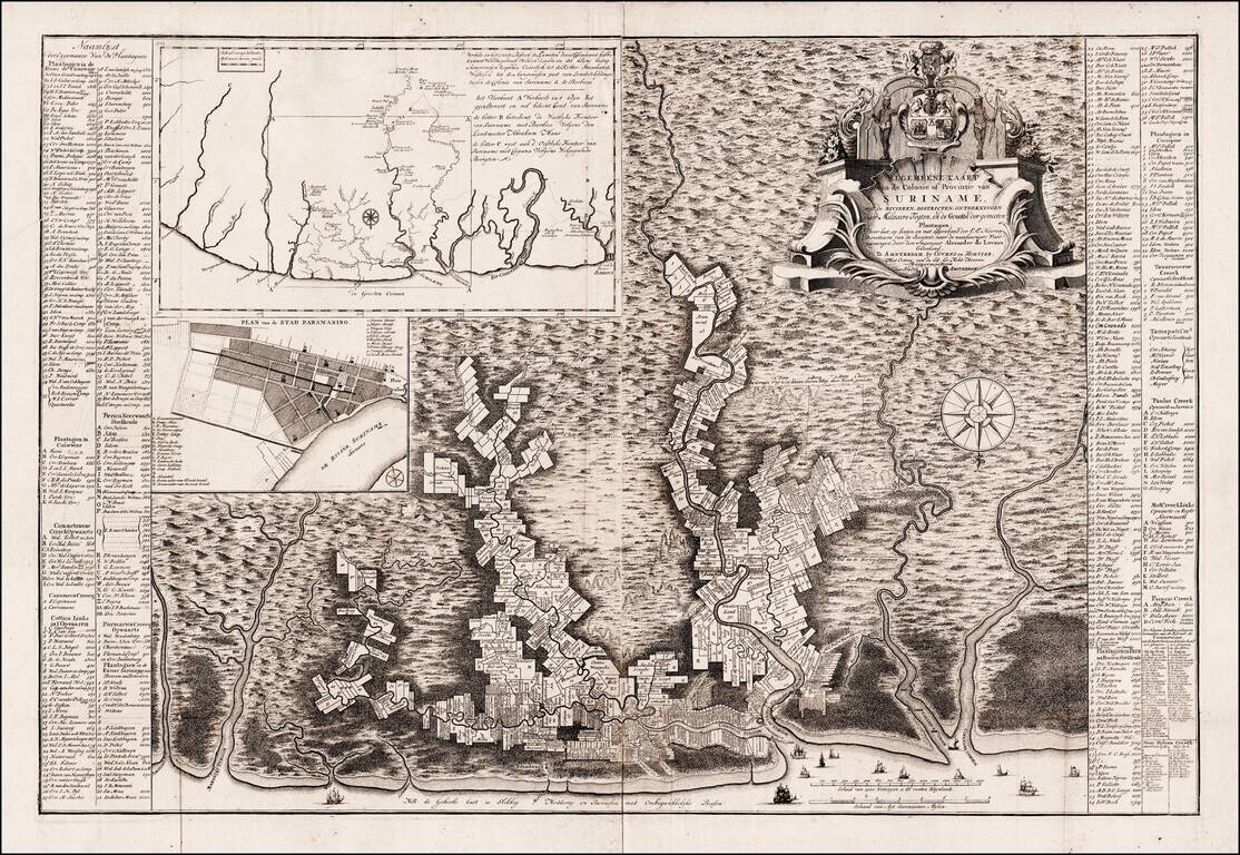
Rare Edition of Alexander de Lavaux's Map of Surinam An attractive and remarkably-informative map of the Dutch colony of Surinam, which in the 17th and 18th centuries was home to the earliest, largest and most significant Jewish population in the...
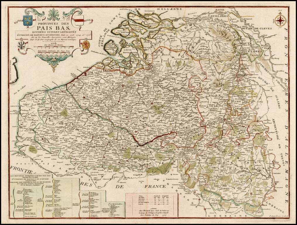
Scarce Benard edition of this detailed map of the Low Countries, from Zeland and Brabant to Luxembourg and Artois. The map includes the coats of arms of France, Austria, Brandenburg and the States General.
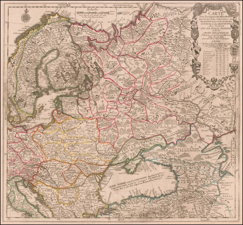
Scarce map of the region centered on the Black Sea and Russia, published by Nicolas De Fer in Paris. The map extends from Scandinavia and the Baltic in the west to the mouth of the Volga in the Caspian Sea. Elaborate cartouche includes 9 coats of...
![[Ochakov] Plan veritable de la fameuse Forteresse d'Oczakow Prise d'assaut sur les Turcs par l'Armee Russie Sous le Commandement de S. Exc. Mr. le Marechal Comte de Munich le 2 Juillet 1737 et deffendue vaillammant par Mr. le Major General de Stoffel, con](/map/small/62883op.jpg)
Exceptional Original Color Finely colored example of Antoine du Chaffat's exceedingly rare map of the Siege of Ochakov, published in Augsburg. The plan includes a detailed treatment of the fortifications and 7 item key in French and German locating...
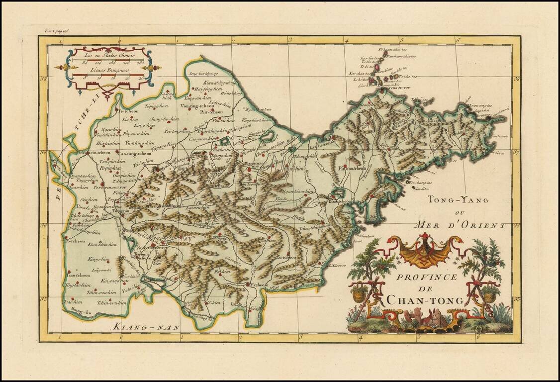
Striking full color example of D'Anville's map of the Shandong Province, from Du Halde's Nouvel atlas de la Chine, de la Tartarie chinoise et du Thibet. D'Anville used maps prepared by Jesuit missionaries and commissioned by Emporer-Kanyx, who in...
![[Guandong and Hainan, China] Province De Quang-Tong](/map/small/57106.jpg)
First Accurate Western Map of Guangdong and Hainan, China Finely-wrought map of the southern Chinese provinces of Guangdong and Hainan, by French geographer and cartographer Jean Baptiste Bourguignon d’Anville. Considered the first accurate map of...
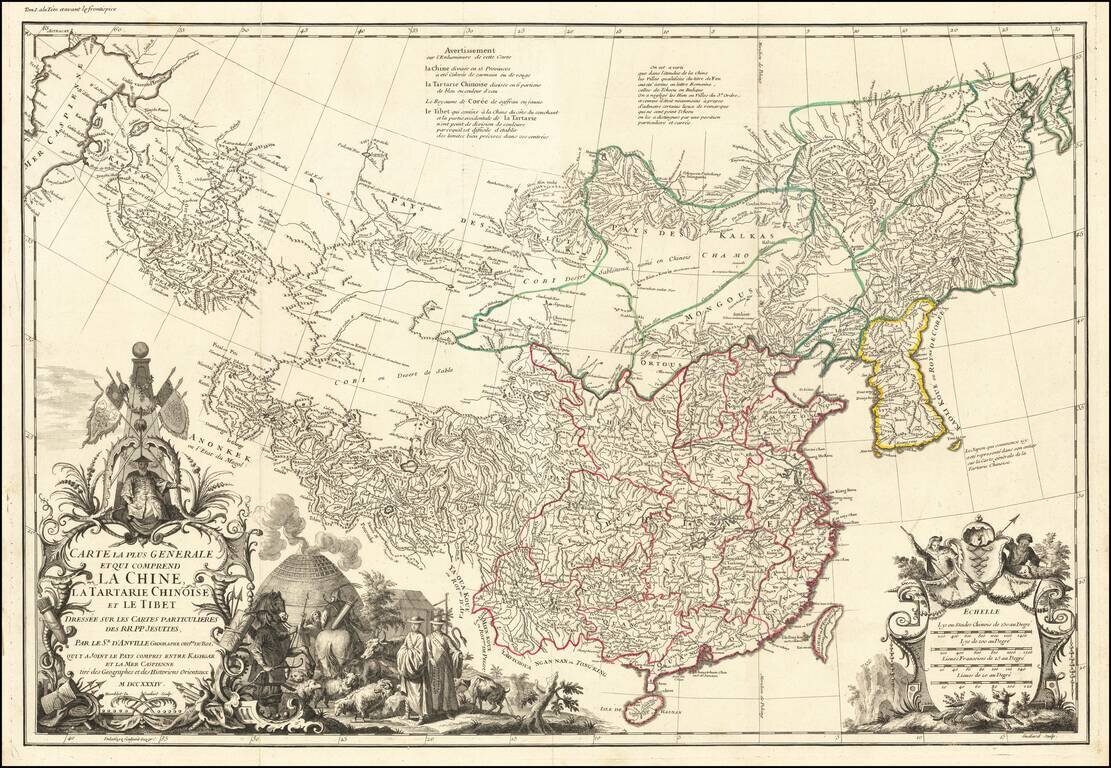
First edition of D'Anville's map of China, the finest printed map of the Middle Kingdom published in Europe during the 18th Century. J.B.B. D'Anville's groundbreaking map of the Middle Kingdom, an important and geographically progressive depiction of...
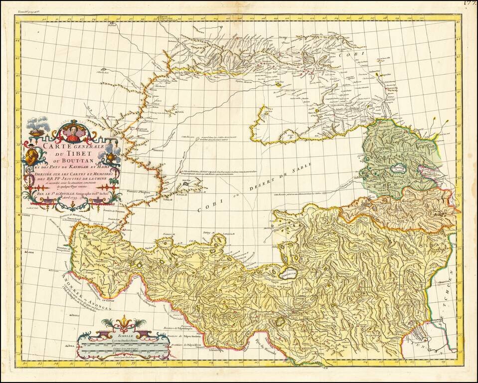
First Euopean Map of Tibet Fine old color example of the first European map of Tibet, first issued in 1737 by D'Anville. Much of the interior is captioned "Gobi ou Desert De Sable" (Gobi, or Sandy Desert) and several rivers are shown "lost" in the...
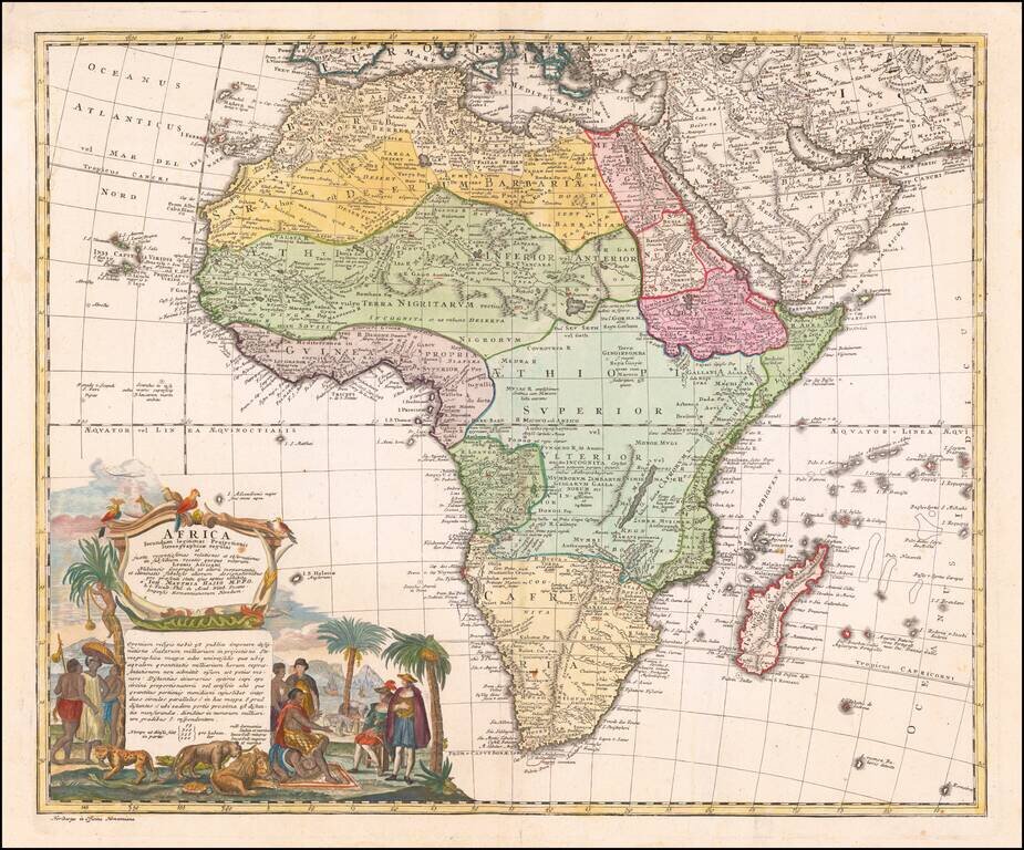
Nice example of the Homann family's second map of Africa, based upon the work of De L'Isle. The map is dominated by a beautiful cartouche showing Europeans, Africans, and various African animals with views of Cape Town, South Africa.

Nice example of Doppelmayr's map illustrating various lunar and celestial theories. The images shown include: Tycho Brahe's model for lunar orbit Illustrations of the surface of the moon from October 1664 Flamsteed's model Hevelius's model...
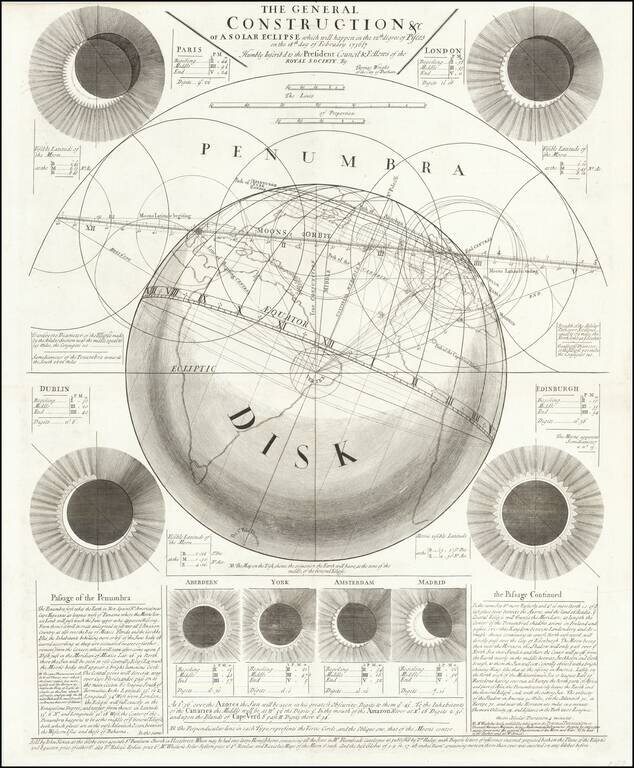
Rare Eclipse Broadside by Thomas Wright and Published by John Senex, the Foremost Producer of Astronomical Broadsides in the Eighteenth Century Fine, large broadside illustrating a prediction of the path of the solar eclipse of February 18, 1737. It...