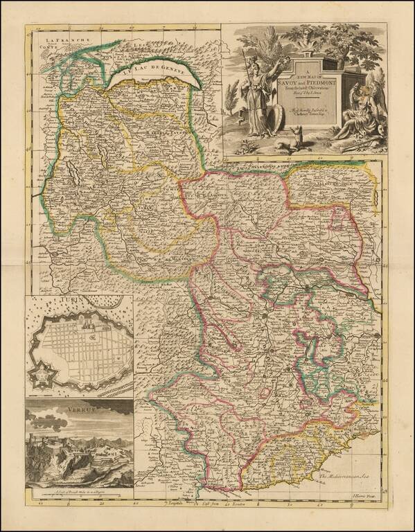
Nice example of John Senex's map of Piedmont & Savoy, from his New General Atlas. The map includes an inset plan of Turin and a view of Verrua. Fine dark impression of this scarce map, with an ornate title cartouche. John Senex John Senex...
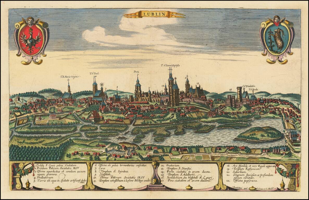
Rare engraved view of the city of Lubin in southwest Poland, published in Amsterdam, about 1721, by Covens & Mortier. The view was originally engraved for Braun & Hogenberg's Civitates Orbis Terrarum in 1617. The plate was eventually acquired...
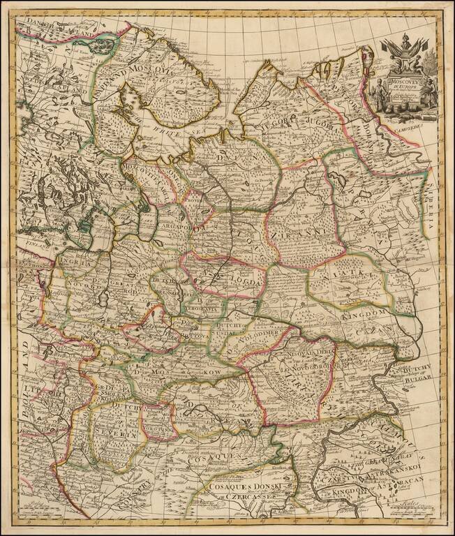
Fine example of Senex's scarce map of European Russia. The map extends to the "Cosaque" regions in the south, including the "Country of the Cosaques " and "Cosaques Donski or Czercasses". Highly detailed and colored by regions, with a small...
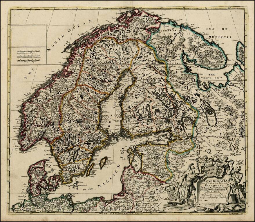
Nice example of John Senex's map of Scandinavia and the Baltic Sea, from his New General Atlas. Fine dark impression of this scarce map, including a decorative cartouche, 3 coats of arms and a dedication to the Duke of Shando.
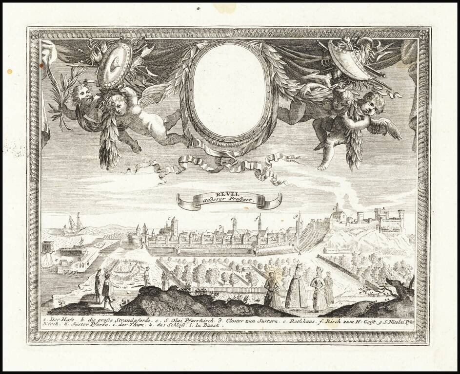
Fine decorative view of Talinn, published by Gabriel Bodenehr in Augsburg.
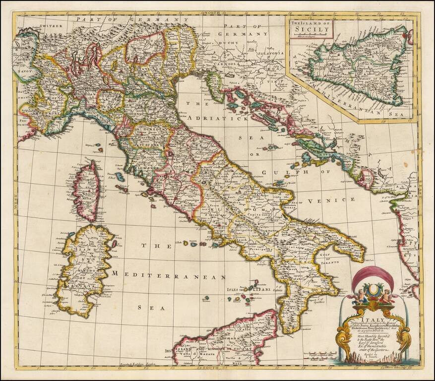
Striking and highly detailed map of Italy, divided into its various regions, from Senex's General Atlas. Includes decorative cartouche and a large inset of Sicily, with dedication to the Earl of Stafford, Knight of the Order of the Garter.
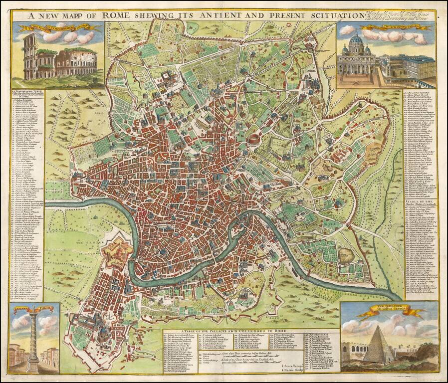
Finely colored and highly detailed map of Rome. Includes 4 vignettes showing the Coliseum, St. Peters, The Sepulcher of Caijus Cestus, and Trajan's Pillar. The keys to the map identify 155 Churches, Parishes, Monasteries, etc., 56 Palaces and Colleges...
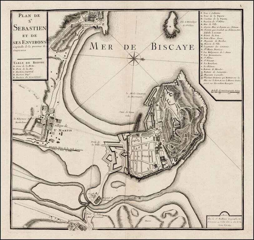
Rare plan of San Sebastien, published by Gaspar Bailleul in Paris. The map shows the bay and fortifications of San Sebastien, St. Martin and environs. The roads and gates between the settlement area also shown. A key locates approximately 30 points of...

Decorative map of Greece and part of Turkey, including a decorative view of Constantinople, from John Senex's General Atlas. Includes decorative cartouches, compass rose and other embellishments.

Striking map of the region centered on Saudi Arabia, Cyprus and the Mediterranean Sea. Includes a large decorative cartouche and annotations throughout the map. Excellent detail and nice color.
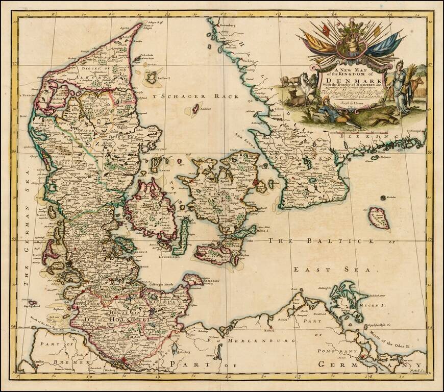
Nice example of John Senex's map of Denmark from his New General Atlas. Fine dark impression of this scarce map, including a decorative cartouche, dedication to Lord Balhaven.
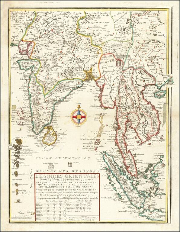
Second edition of De Fer's rare map of the region extending from Hong Kong and Macao in the east to the Indus River and Maldives in the west, bearing the imprint of his son-in-law and successor, Guillaume Danet. This fascinating map includes...
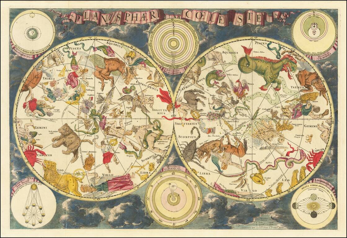
Rare separately published double hemisphere celestial map, first published in Amsterdam by Frederick De Wit in 1680, and here reissued by Covens & Mortier in 1721. An exceptionally decorative, oversized, very rare celestial chart, produced by...