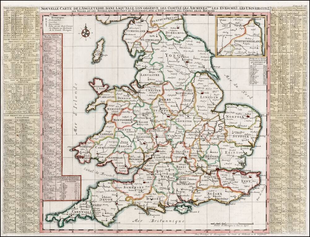
Striking large format map of England, colored by Counties. Shows the major Cities, Churches, Universities and other points of significance within England. From Chatelain's 7 volume Atlas Historique, one of the great compilations of the early 18th...
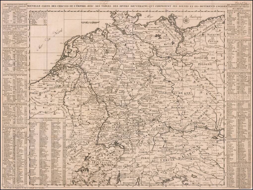
A very detailed map of the German Empire with a list of it's important cities and nobility in tables at the sides. This handsome copper engraved map includes today's Poland, Germany, Switzerland, Austria, Holland, Belgium and Luxembourg.
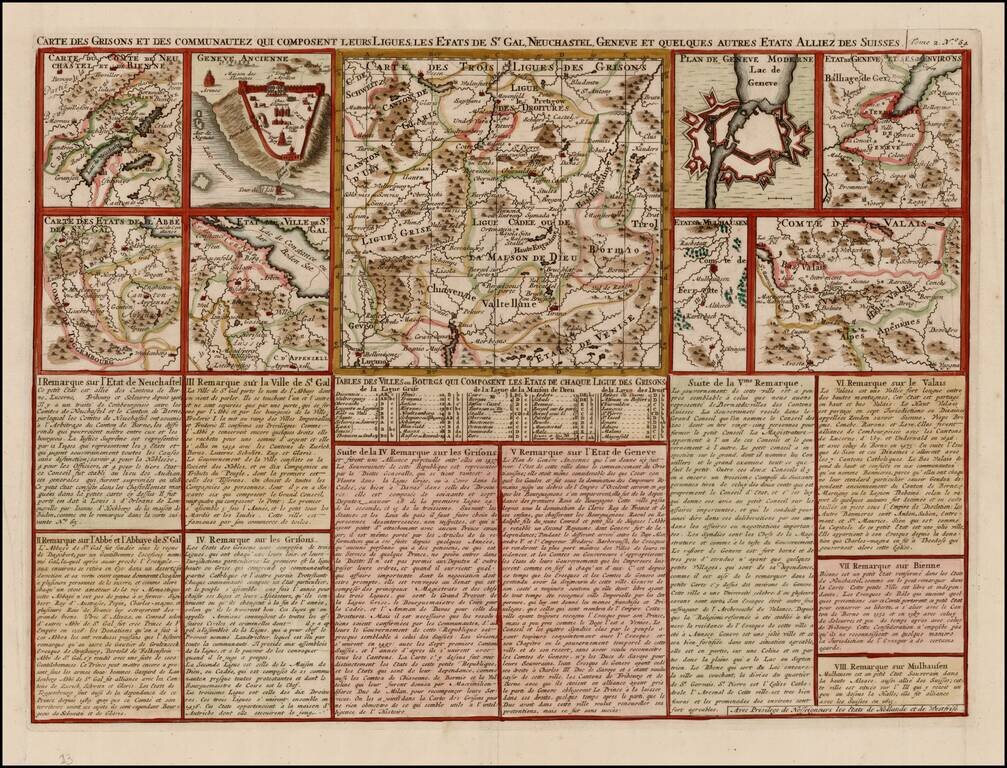
Detailed group of regional maps and town plans of Geneva (ancient and modern), showing battle fortifications. From Chatelain's monumental Atlas Historique, published in 7 volumes.
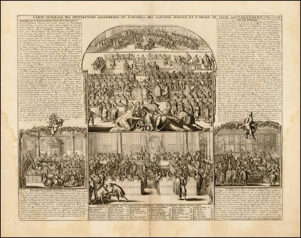
Fascinating series of scenes, illustrating the activities and principal members of the ruling houses of the Swiss Cantons. Remarkable detail. Very decorative. From Chatelain's monumental Atlas Historique.
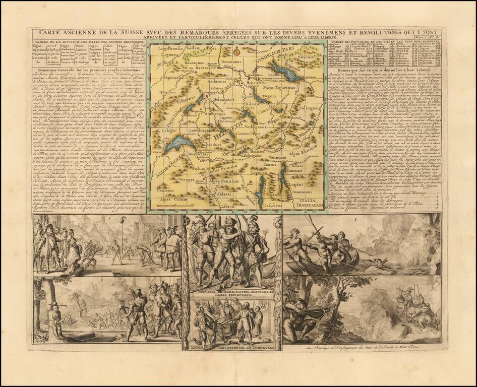
Attractive double-page engraved map of Switzerland by Henri Chatelain, in his typical style, with the map image in the center and descriptive historical text and imagery surrounding it. Shows the Old Swiss Confederacy, which lasted roughly from the...
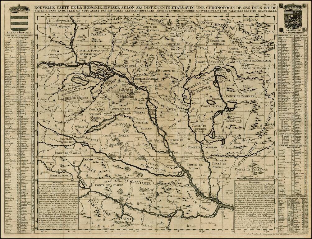
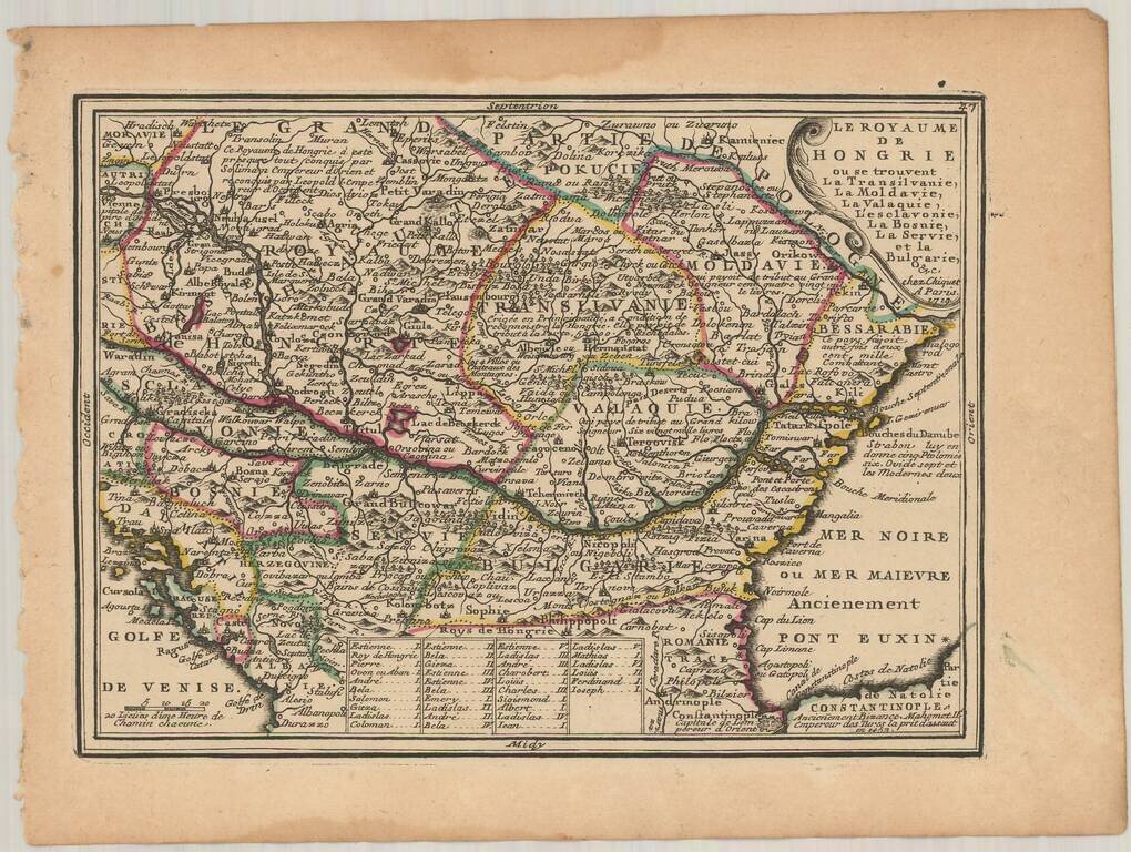
Detailed large format map of the Hungarian Empire, extending to Bosnia, Slovenia, Temeswar, and the Saw River in the south to Moravia, and the Frontiers of Poland in the north, centered on the course of the Danube from Vienna to Belgrade. Includes...
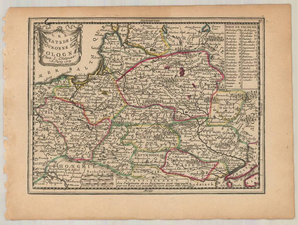
Fine example of Chiquet's map of Poland, from his Le Nouveau et Curieux… Includes a finely engraved cartouche.
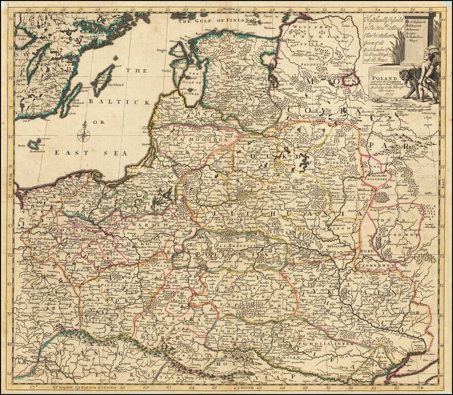
Detailed map of the Polish Empire, published by John Senex. This is the second edition of the map, which was first published by Morden & Browne in 1710. The remnants of the earlier printing , which have been burnished out of the cartouche, are...
Nice example of Chiquet's map of Hungary and the Balkans, from his Le Nouveau et Curieux…
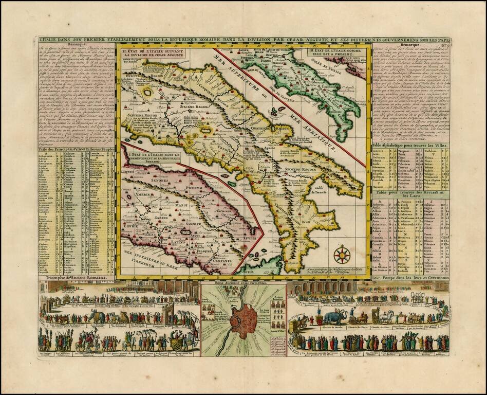
Wonderful map of Italy, comprising maps of Italy during modern (1720) times, at the time of Cesear and at the time of the commencement of the Roman Republic. Large inset of the environs of Rome with two large vignettes showing a Parade of the Ancient...
![[Venice] Carte Du Gouvernement Militarire De La Republique Du Venise . . .](/map/small/30732.jpg)
Decorative set of views of Venice. The inner views are of the Piazza San Marco, a scene of the Gondoliers and a second scene on the Lagoon and a view of the Ponte de la Rialto on the Grand Canal. A striking and decorative map from Chatelain's Atlas...
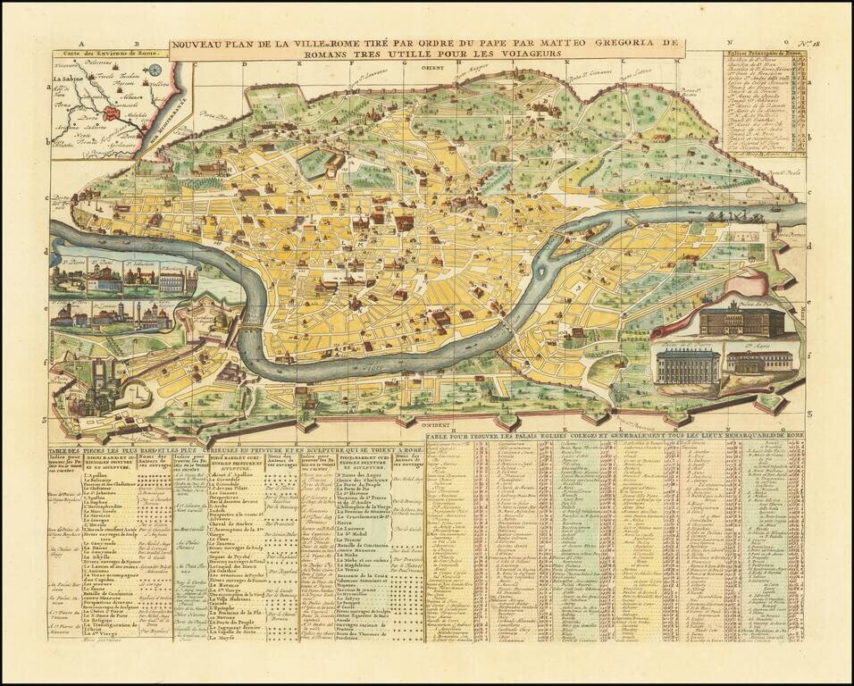
A decorative map of Rome, with inset views of ten major churches and structures, including St. Peter's and the Vatican. A key identifies a number of buildings, which are shown on the map. Other insets as well as text add further information to the...
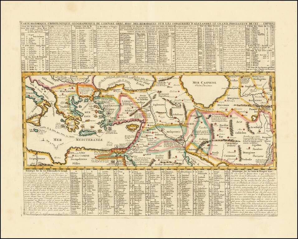
Mapping the Conquests of Alexander the Great. Interesting historical map of the Mediterranean, Black and Caspian Sea regions under Greek Rule. The map has excellent toponymic detail throughout, including extensive notes, trade routes, etc. The...
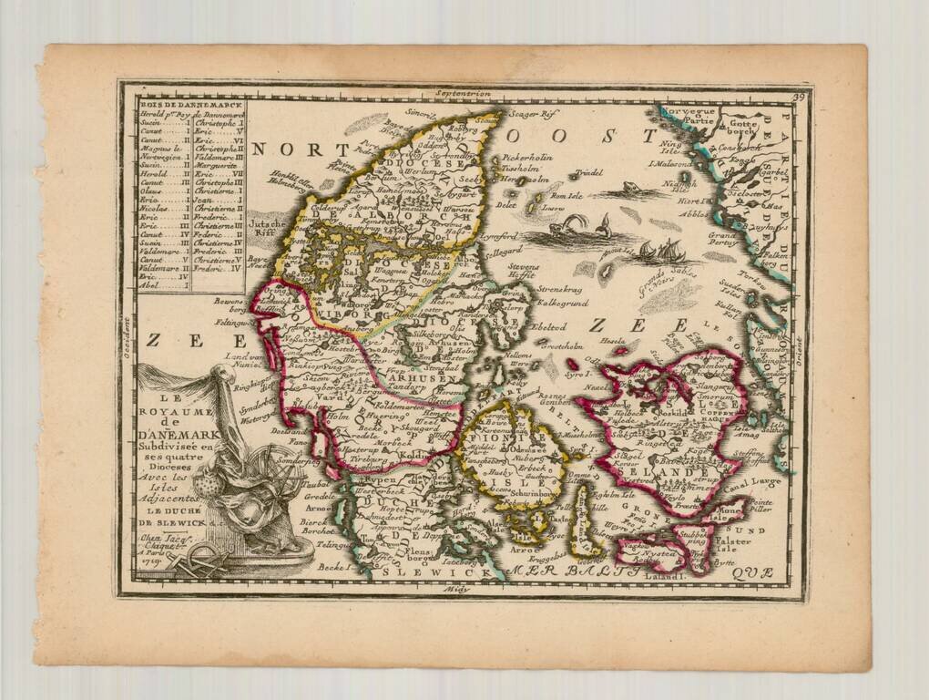
Fine example of Chiquet's map of Denmark, from his Le Nouveau et Curieux… Includes a finely engraved cartouche.
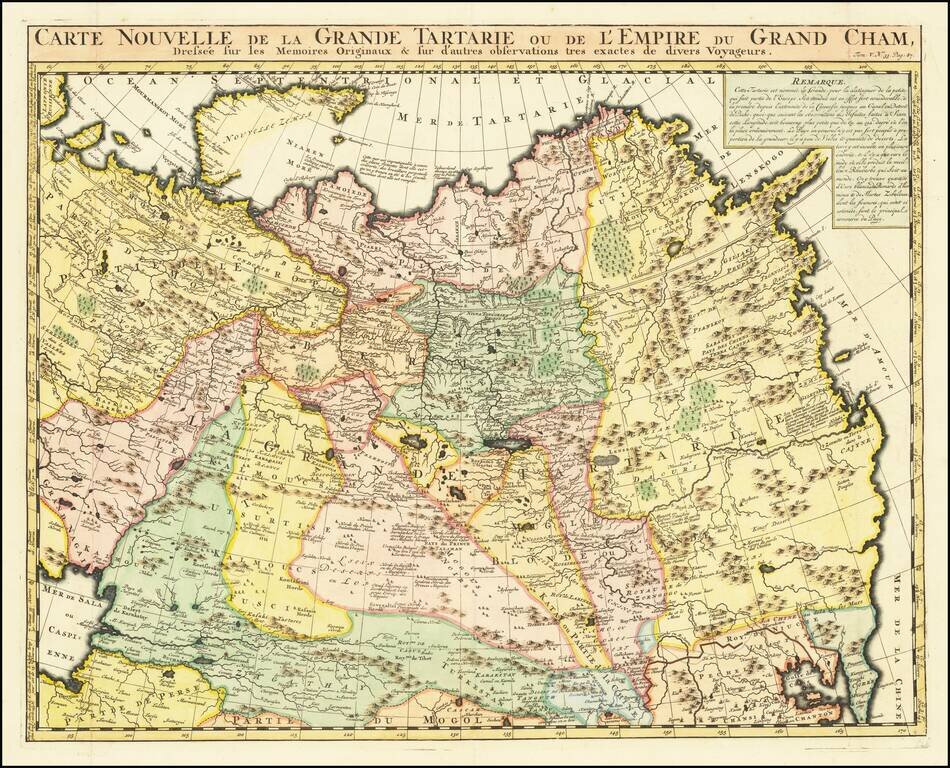
Decorative and detailed map showing Central Asia and the Tartary, from Chatelain's monumental 7 volume Atlas Historique. The map extends from Nova Semla in the northwest towards northern China and the peninsula of Korea in the southwest of the map....
![[Dutch Forts -- Jakarta, Amboine, Ternate, Solor, Banda] Vue et Description de Quelques-Uns des Principaux Forts des Hollandois dans les Indes](/map/small/43122.jpg)
Interesting sheet with seven detailed views illustrating the most important Dutch trading outposts and fortified colonial possessions in the East Indies The sheet includes 4 harbor views Batavia (Jakarta), Amboina, Ternate, and Solor, and 3 fort...