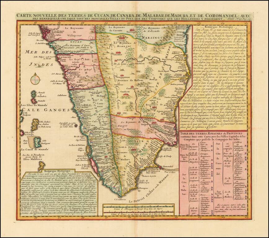
India south of Goa, from Chatelain's monumental Atlas Historique, published in Amsterdam. The map includes three text boxes giving particulars of the region and its divisions. Interior details include the Western Ghats and wild animals among the...
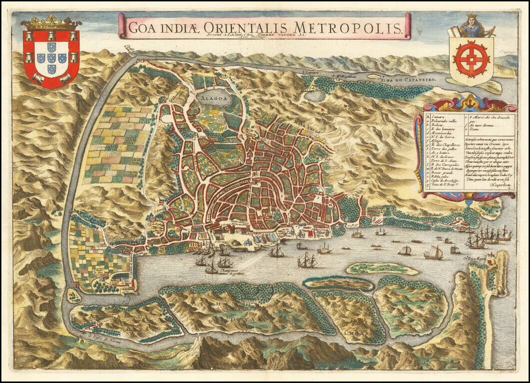
An Early View of Goa Decorative and detailed birds-eye view of the city and harbor of Goa. The map is based upon an earlier map by Jan Huygen van Linschoten. Linschoten served 6 years as the bookkeeper for the Archbishop of Goa (1583-89). While in...
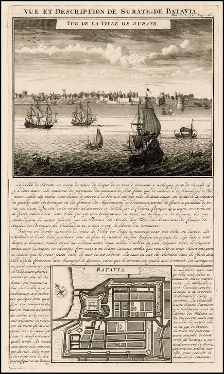
Attractive view of the town and harbor of Surate on the northwest coast of India, and a bird's-eye city plan of Batavia (Jakarta) present-day capital of Indonesia, from Chatelain's monumental 7 volume Atlas Historique, published in Amsterdam. Surate...
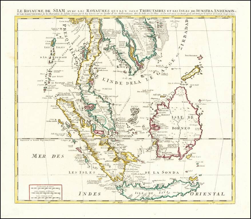
Finely colored example of Chatelain's map of Southeast Asia. The map extends from Thailand, Cambodia, Vietnam, the Malay Peninsula and Gulf of Bengal in the north to Java and Sumatra in the south, and is centered on Malacca and Borneo. Gorgeous wash...
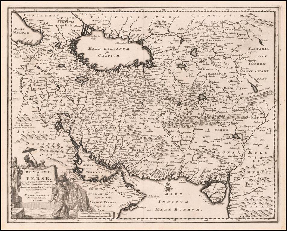
Scarce map of the Persian Empire showing the area that is now Iran, Afghanistan and Iraq with a portion of Oman near the Persian Gulf. The Sinus Persicus is remarkable distorted. The cities and mountains are graphically depicted and a beautiful...
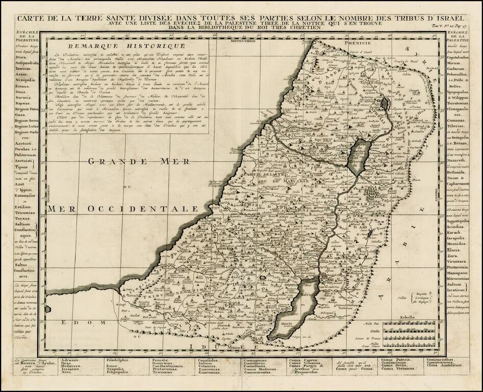
Detailed map of the Holy Land, from Chatelain's Monumental Atlas Historique et Methodique. The map extends from Gaza to Sidon and identifies the 12 Tribes and many other historical features.
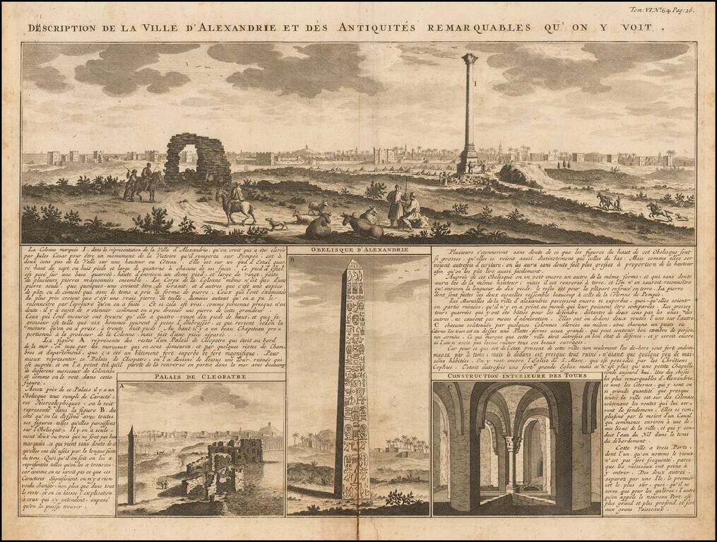
A magnificent panoramic view of the great Egyptian port city of Alexandria accompanied by detailed views of the ruins of Cleopatra's palace, the Obelisk of Alexandria, and "the interior construction of towers." The images are keyed to the surrounding...
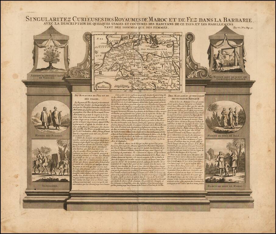
Decorative map and series of inset views of Morocco, with small vignettes of local life.
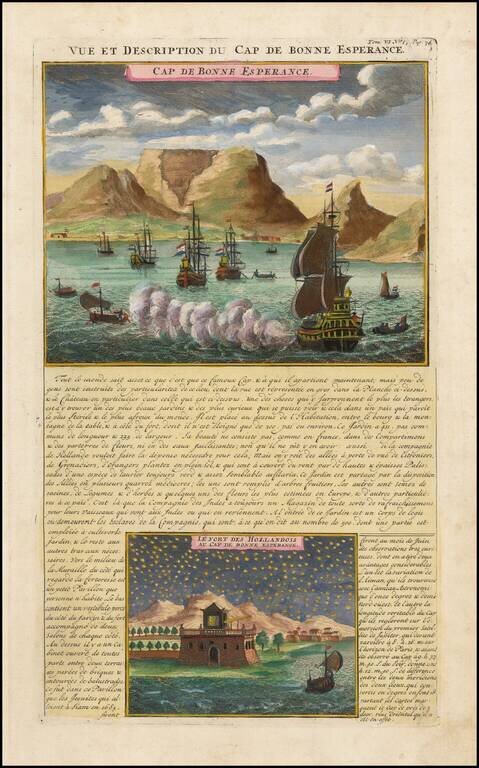
Striking view of the Cape of Good Hope, with Dutch ships in the harbor and Table Mountain in the background. A night view of the Dutch Fort at the Cape is shown below. Chatelain's Atlas Historique, published in 7 volumes at the beginning of the 18th...
![[Title Page] Atlas Historique](/map/small/37714.jpg)
Decorative Title page from Chatelain's Atlas Historique, a 7 volume work which was one of the most popular works on the world at the time and one of the most decorative. Nice example. This seems to be a scarce title page, as we have not previously...
![[Title Page] Title & Dedication Pages](/map/small/43632.jpg)
Title page and decorative dedication page of Volume 5 of Chatelain's Atlas Historique, a 7 volume work which was one of the most popular works on the world at the time, and one of the most decorative.
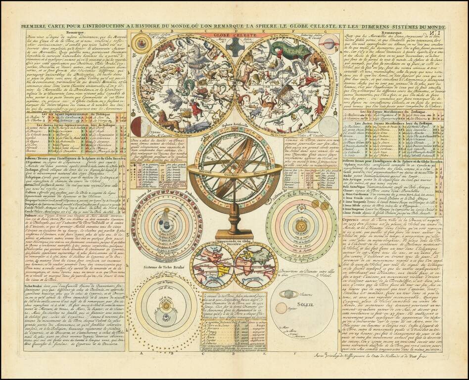
Decorative work showing a double hemisphere Celestial model, Double Hemisphere map of the world w/California as an Island, Armillary Sphere, Copernican Ptolomaic and Tycho Brahe models of the Solar System and a number of other Celestial and Solar...
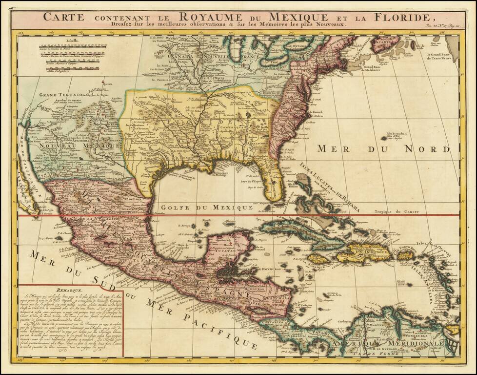
An Early Re-Issue of a Cartographic Landmark Map This is a finely executed map of the southern part of North America by the French mapmaker Henri Chatelain. The map draws its inspiration from the royal mapmaker Guillaume de L'Isle's landmark map of...
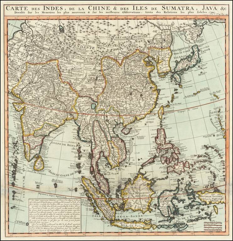
Names the Sea of Korea A large and very detailed map of East Asia, from India and the Indian Ocean in the west to Japan, Korea, and the Philippines. Place names are extensive on this map, both on land and at sea. French text at the bottom describes...