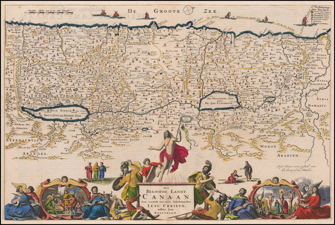
Detailed map of the Holy Land, showing the travels of Christ and the Apostles, including Paul's travel's at sea and numerous sailing vessels. An excellent example of a Dutch Bible map of the Holy Land.
Rare Theodore Danckerts Map of the Holy Land Striking old color example of this rare map of the Holy Land. Decorative full color title cartouche and second cartouche scale of miles. Rarity Theodorum Danckerts maps are rare on the market.
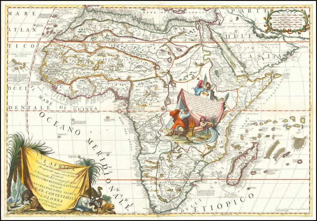
Decorative example of Coronelli's 2-sheet map of Africa, featuring up to date information from modern reports and recent discoveries regarding the sources of the Nile River. Coronelli's map is full of topographical features and place names, and more...
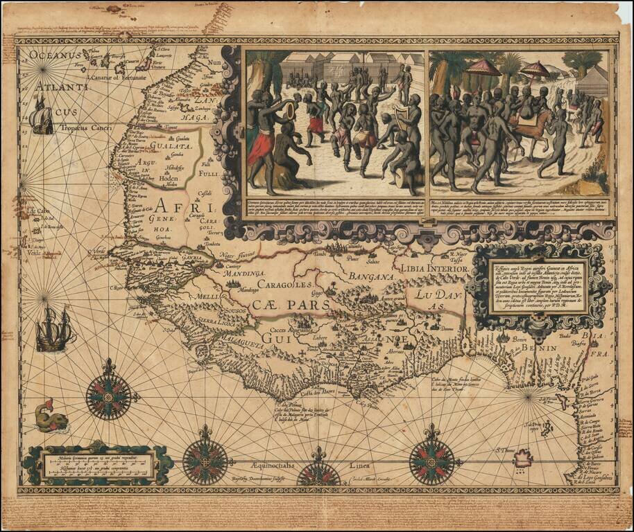
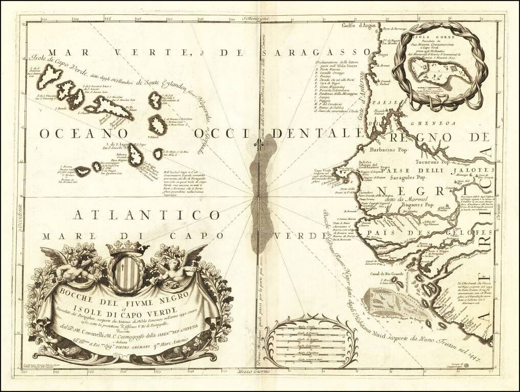
One of the Great Early Maps of West Africa With Significant Manuscript Annotations Important early map of West Africa showing the coastal region from the Canary Islands to the Bight of Benin and São Tomé and Principe. This a striking, dark...
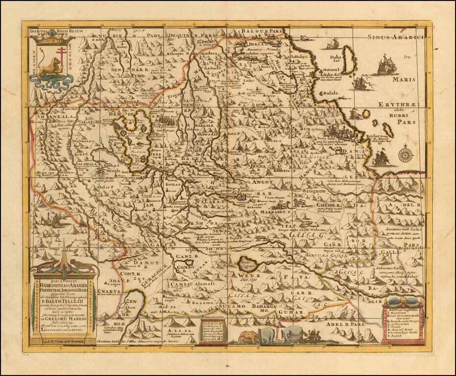
Scarce late 17th Century map of the Upper Nile and Kingdom of Prester John, based upon Jobi Ludolfi map of 1683. The map provides a detailed treatment of Ethiopia and the Eritrean coast, originating from an Ethiopian manuscript. Embellished with...
![[Black Kingdom] Nigritarum Regnum](/map/small/56999.jpg)
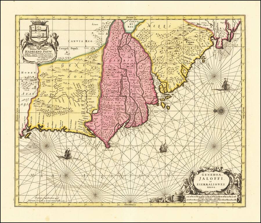
The Black Kingdom Nice example of this decorative late 17th Century map of a part of West Africa, from the region surrounding the Senegal River to Angola. Nigritarum is the feminine plural work in Latin for the word negritis, meaning black. Richly...
Detailed engraved antique map of the West African coast showing present-day Senegal, Gambia, and Cape Verde. An inset map shows Île de Gorée (here called "Isola Goree"), which is a large island in the harbor of Dakar, Senegal. The island played an...
Nice old color example of this detailed sea chart of the West African Coast, from Senegal to Sierra Leone. Decorative cartouches, rhumblines, sailing ships and other decorative features embellish the map.
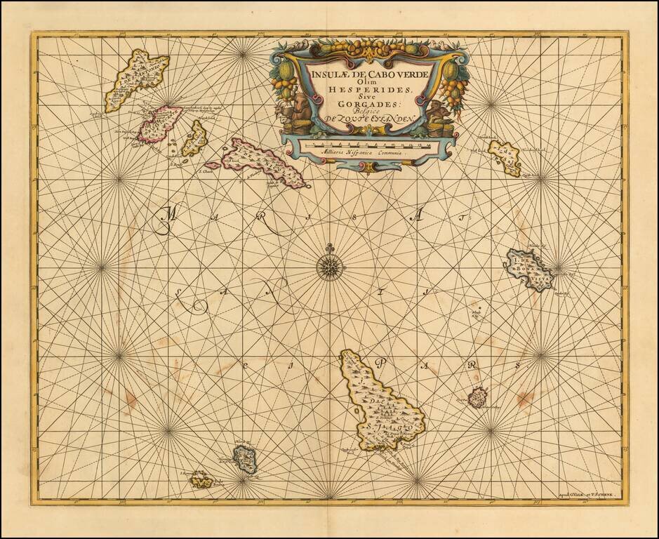
Detailed sea chart of the Cape Verde Islands, published in Amsterdam. Shows a volcano erupting on the Isla de Fuogo.
![[South Polar Globe Gore] Fernando Magaglianes Poco Contento del Re di Portogallo suo Signore . . .](/map/small/70828.jpg)
A Celebration of Magellan's Circumnavigation for the King of Portugal Finely engraved polar gore, or calotte, created for one of Coronelli's largest globes. Coronelli is well known for making a concerted effort to delineate only verified discoveries...
![[Celestial Map of the Southern Hemisphere]](/map/small/33613.jpg)
Fine fully colored example of this rare 17th Century map of the Southern Celestial Hemisphere, originally issued in 1674, by Ignace Gastone Pardies, in Paris and revised in 1690, based in part on the work of the French Jesuit mathematician and...
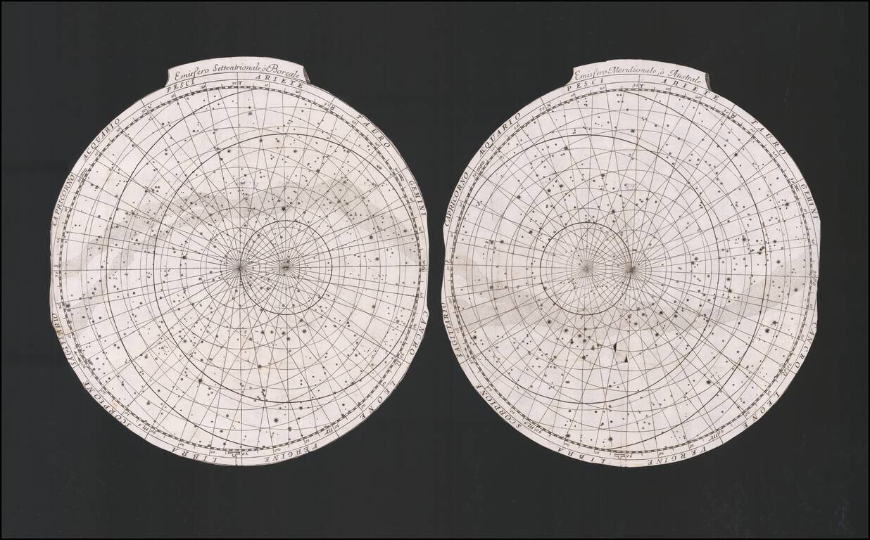
A pair of Celetsial Hemispheres issued by Coronelli in Venice. The images are trimmed as issued.