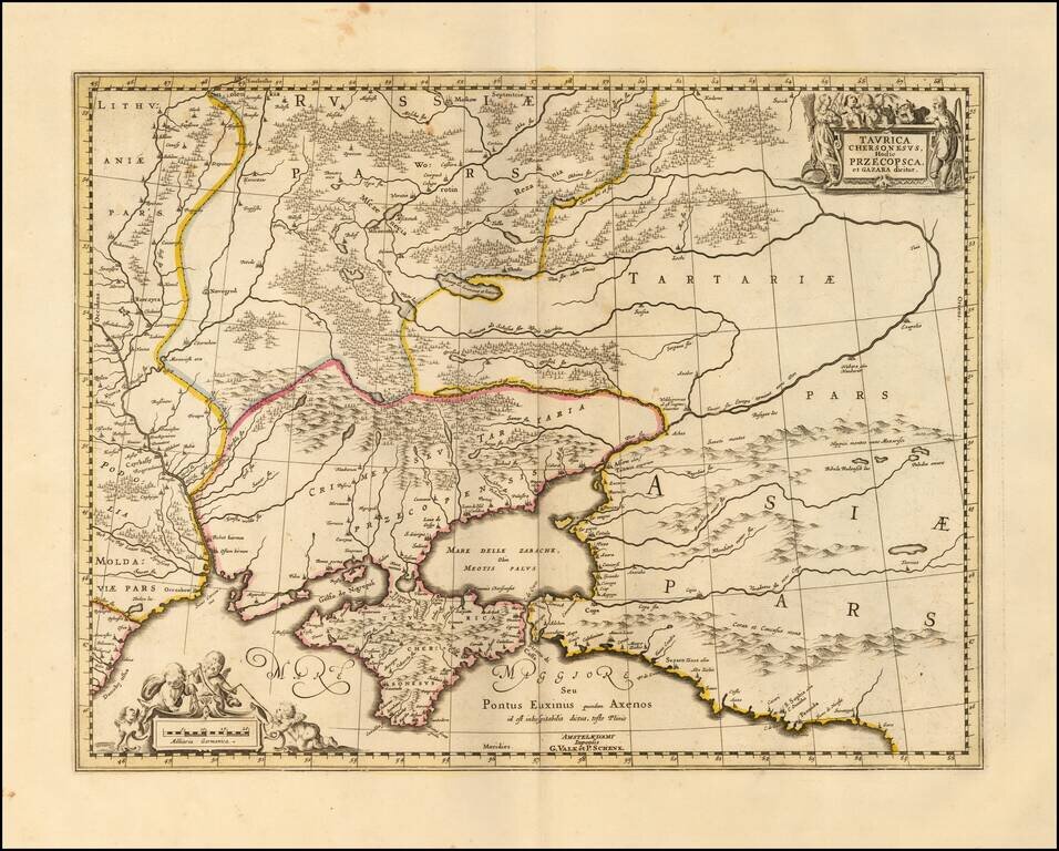
Detailed map of the Ukraine and surrounding regions between the northern coast of the Black Sea and Moscow. Shows ports, fortified cities and the mouths of the Danube. Two decorative cartouches.
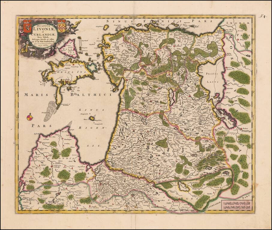
Fine old color map of the Baltic region, covering Estonia and the northern part of Latvia, published in Amsterdam. Includes 2 coats of arms in the cartouche.
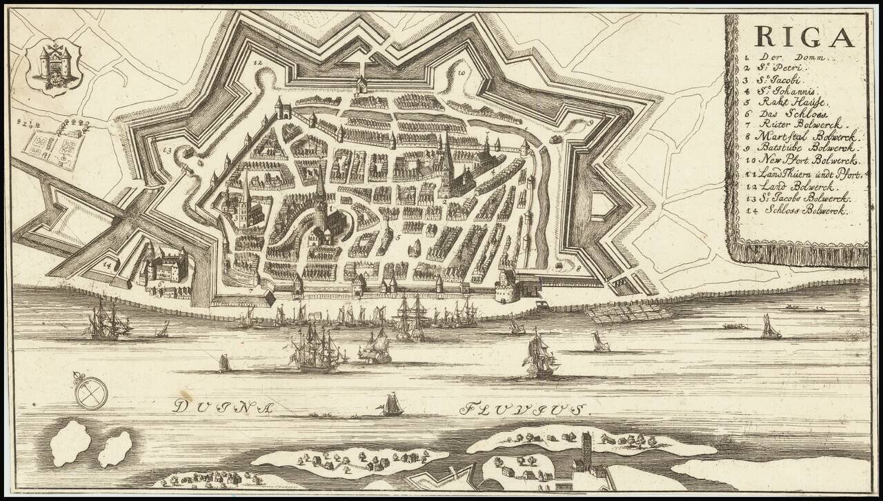
Detailed plan of Riga, with a key locating 14 points of interest. The map is in the style of several other 17th Century maps of Riga, but we were not able to determine a maker.
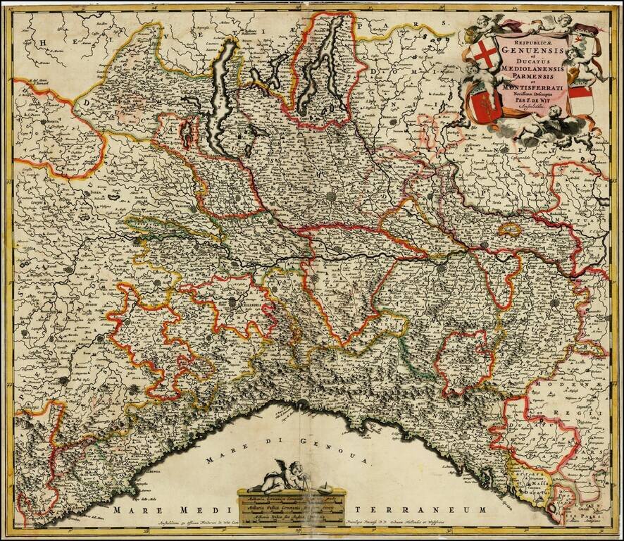
Decorative map of the Republic of Genoa, and Dutchies of Milan, Parma and Montisferrati and contiguous regions. Includes an elaborate cartouche, incliuding 4 coat of arms.
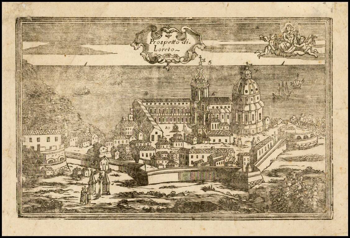
Very rare view of Loreto (Ancona) and the Basilica della Santa Casa, apparently a wood cut, prepared to illustrate a pilgrimage between Nazareth, Tersatto (Trast, Croatia) and the Basilica della Santa Casa, in Loreto (Ancona) on the Adriatic...
![Status Ecclesiasticus Magnus Ducatus Thoscanae [Tuscany, Rome, Siena, Pisa, Florence, etc] (Heightened with Gold Leaf!)](/map/small/50344.jpg)
With Gold Leaf added to the Cartouche and Coat of Arms Old Color, gold heighted example of De Wit's detailed map of the State of the Church and Tuscany, with a portion of Corsica to the west. Cartouche depicts cherubs, a merman and coat of arms.
![Regnum Siciliae Cum circumjacentibus Regnis et Insulis… [shows Malta] (Heighten with Gold Leaf)](/map/small/50376.jpg)
Fine old color, gold leaf example of Visscher's map of Sicily, Malta and a bit of Naples and Sardinia. Large decorative cartouche with 2 coats of arms and a large decorative military scale.
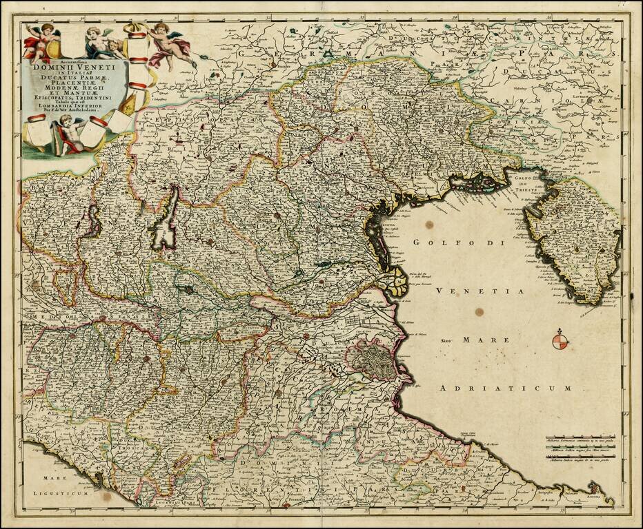
Rare early proof state of De Wit's map of the Dominion of Venice, extending from Stato di Milano and Genoa to Istria. This is apparently a very rare early proof state. We note at least 4 states of the map, this early state, with the coats of arms...
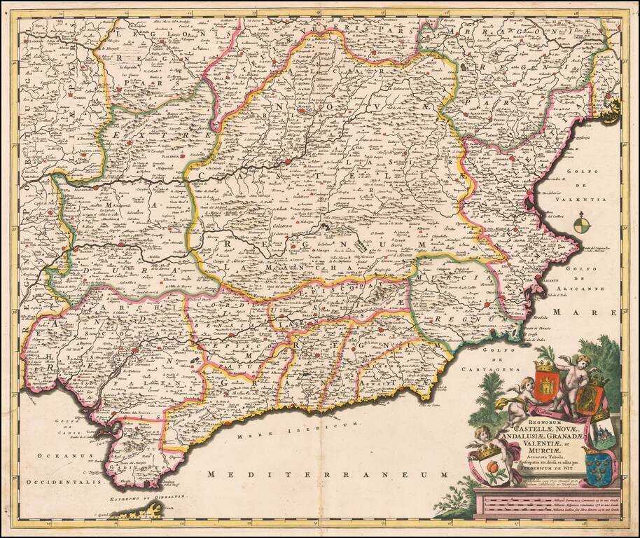
Decorative and highly detailed map of Southern Spain, extending from Salamanca and Segovia in the North, to the Gulfs of Valentia, Alicante and Cartgena in the east, the Straits of Gibralter in the South, and Portalegre, Alcantara and Merida in the...
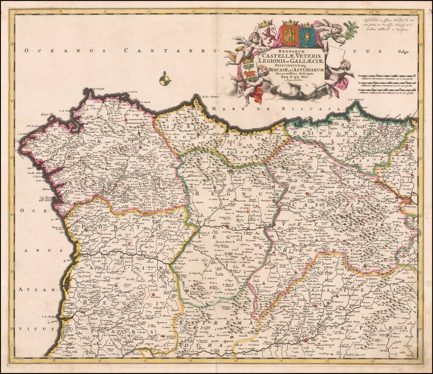
Decorative and highly detailed map of Northern Spain, extending from Galicia in the west to the Basque Country in the east. Major cities include Bilbao, San Sebastian, Santiago di Compstella, Pontevedra, Finisterre, Coruña, Ferrol, Aviles, Oviedo,...
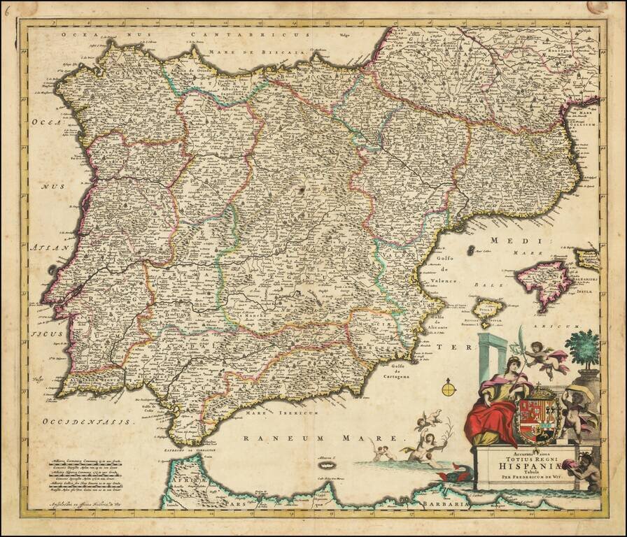
Striking full color example of this rare map of Spain, Portugal and the Balearic Islands, published by Frederick De Wit in Amsterdam. The map is colored by the various kingdoms. Includes an ornate title cartouche, with large coat of arms, sea...
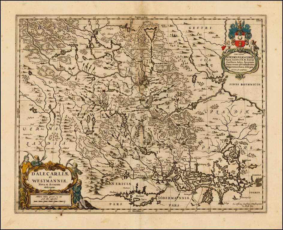
Decorative regional map of central Sweden, published by Moses Pitt. The map is richly decorated with a large figurative cartouche.
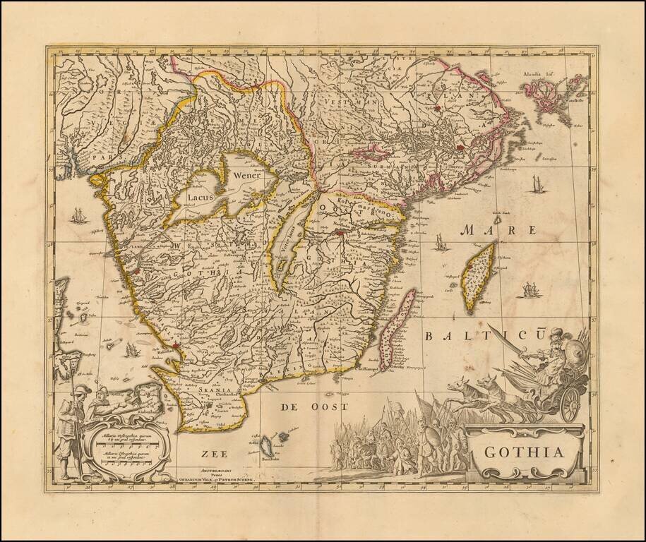
Decorative map of Gothia, published by Valk & Schenk. The map is richly decorated with a large figurative cartouche, scale of miles and sailing ships. Shows the area including Gothenburg, Malmo, Copenhagen, Lund, Helsingborg, Kristianstad,...
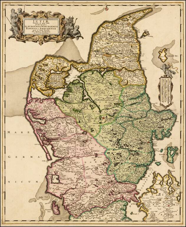
Fine map of Jutland, engraved by De Wit, with deluxe old color and gold leaf highlights. This beautifully engraved map covers the northern and western portions Denmark. The map is filled with minute detail of fortresses, cities, towns and tiny...
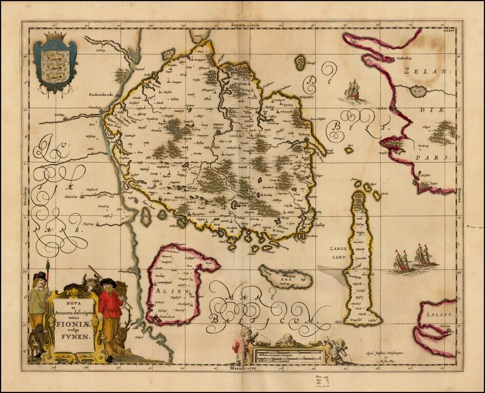
Detailed map of the Island of Funen and surrounding islands, from the scarce Mose Pitt Atlas.
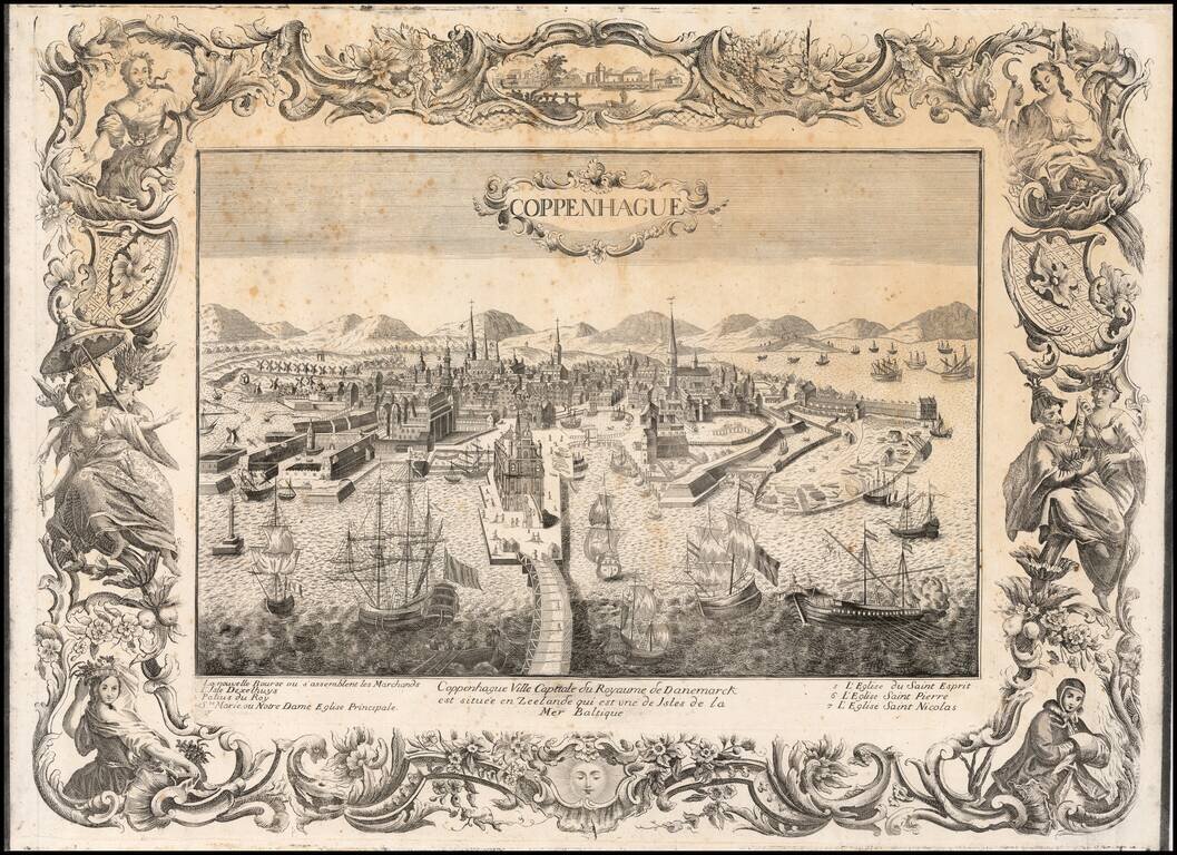
Rare large decorative view of Copenhagen, with an elaborate engraved border. The view shows an elaborate waterfront image, with wharves, windmills, shipbuilding, etc. 7 major sites are identified in the key below the view. The view is rare, with...