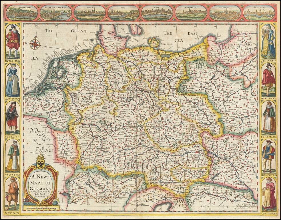
Nice example of Speed's map of the German Empire, extending from Poland in the Northeast to the Danube. Includes birdseye views of Heidelberg, Frankfurt, Vienna, Prague, Cologne, Nuremberg, Strassborg and Augsburg across the top and indigenous...
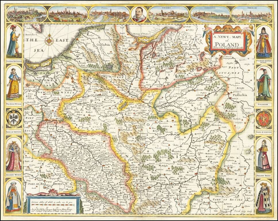
The First Map of Poland Published in England Decorative example of John Speed's highly sought after map of Poland, the first map of Poland to appear in an English Atlas. The map includes birdseye views of Cracow, Dantzick, Posna, Crossen, Sandomiria...
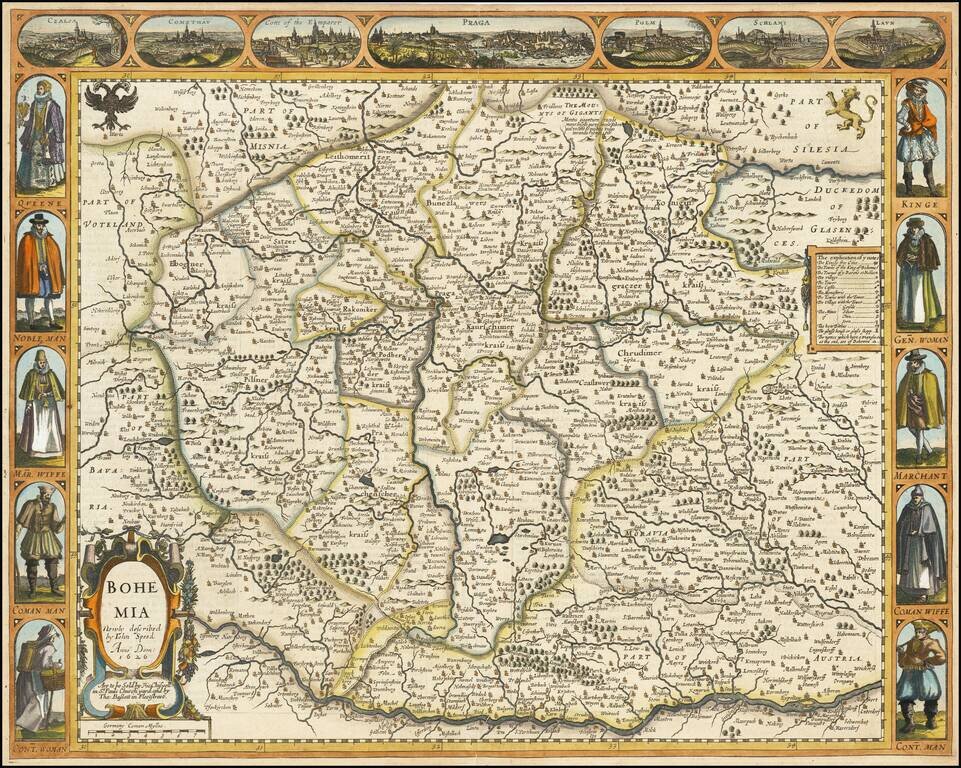
Decorative map of Bohemia, from Speed's Prospect of the World. Includes 7 cities across the top and costumed figures on either side of the map.
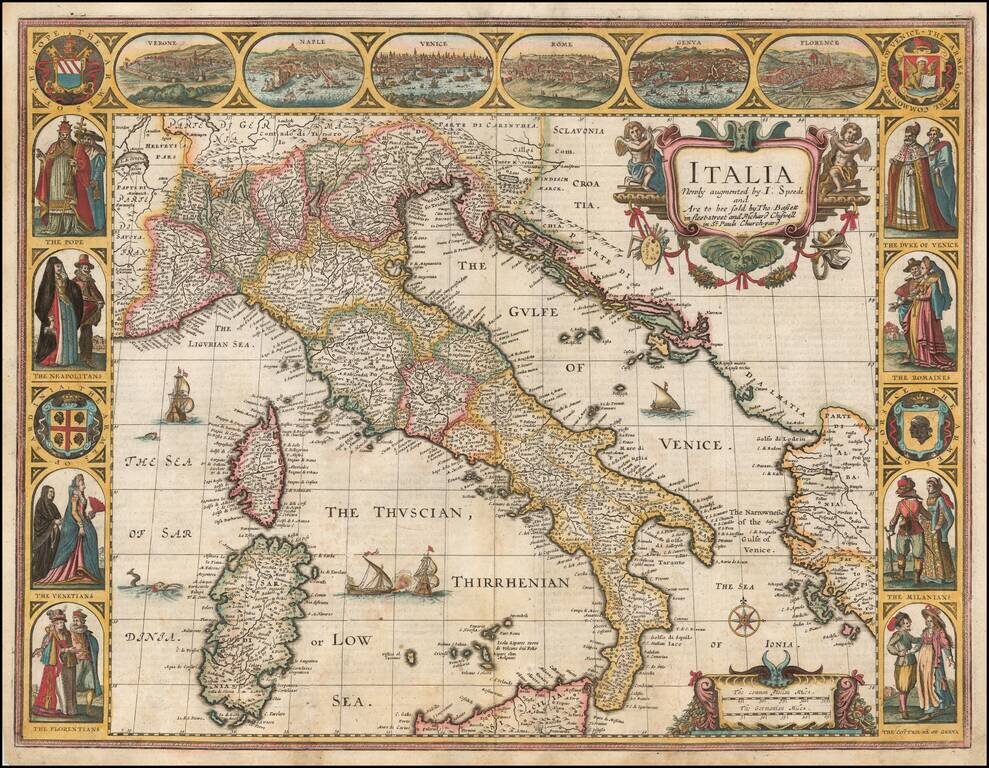
Nice example of John Speed's map of Italy, from the 1676 edition of his Prospect of the Most Famous Parts of the World. Widely regarded as the most beautiful and decorative map of Italy to appear in an English language atlas in the 17th century....
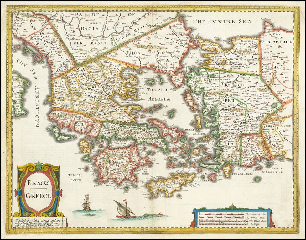
Nice example of John Speed's map of Greece. Extends north to include part of the Black Sea. A highly detailed early depiction of Greece, with fascinating English text description on the verso. The first folio sized map of Greece published in England.
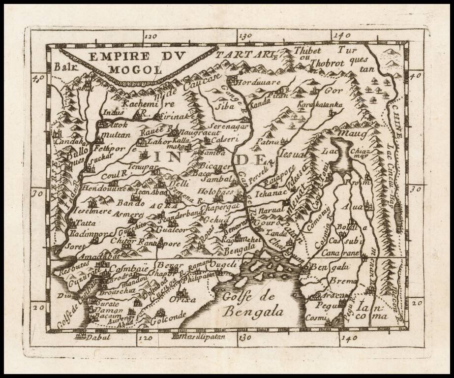
Detailed map of the Mogol Empire, centered on the Ganges River, published in Paris by Du Val. The map extends north to Tibet, west to the Indus River, south to the Bay of Bengal and east to the Mekong River.

Detailed map of the southern part of India and Sri Lanka, published in Paris by Du Val.
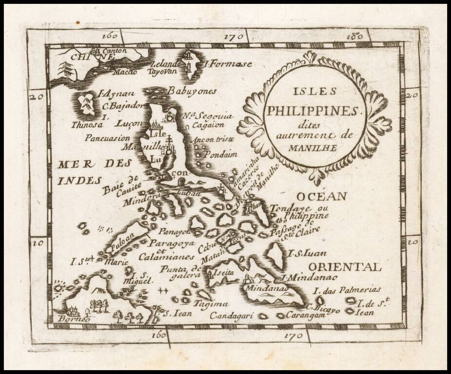
A Philippine Islands Rarity Detailed map of the Philippines, published in Paris by Du Val. An uncommon map of the Philippines, including parts of China and Borneo, depicting major towns and topographical features. The fictitious island of San Juan...
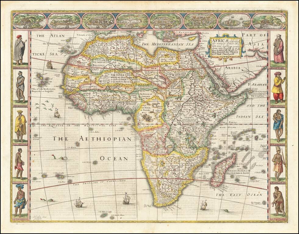
Striking example of John Speed's decorative map of Africa. The side borders contain two sets of five decorative costumes of various African peoples; the top border shows views of eight African cities. The source of the Nile is based upon Ptolemy (two...

Scarce map of the South Polar regions, published in a late edition of the Jansson-Cloppenberg Atlas Minor. Includes an early depiction of Australia and New Zealand, with a note on islands seen by Magellan. Remnants of the mythical Terra Australis...
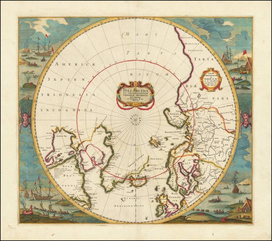
Old color example of Jansson's map of the North Polar regions, newly revised by Frederick De Wit. The map shows Baffin's Bay, Button's Bay and James Bay, Greenland, Iceland, Spitsberge (with incomplete coastline), Lappland, Russian and European Asia,...