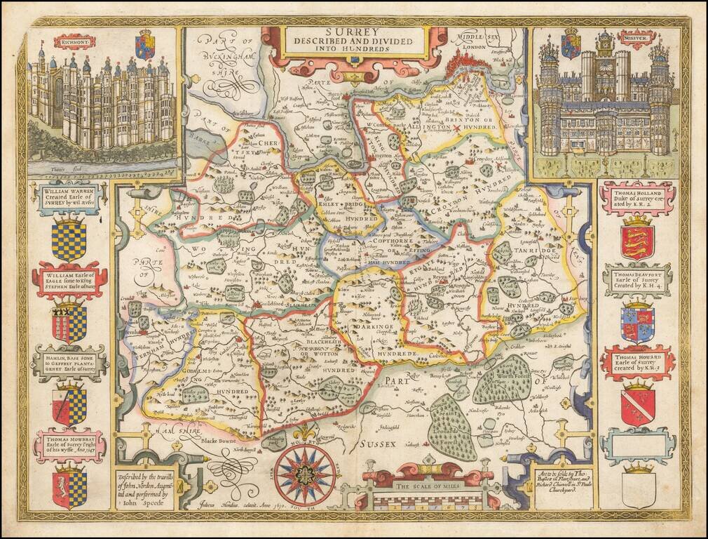
1676 edition of Speed's map of Surrey, from Speed's Theatre of Great Britain, published in 1611 (with credit to John Sudbury and George Humble). Includes elaborate views of Richmont and Nonsuch and 7 coats of arms. London appears on the Thames, just...
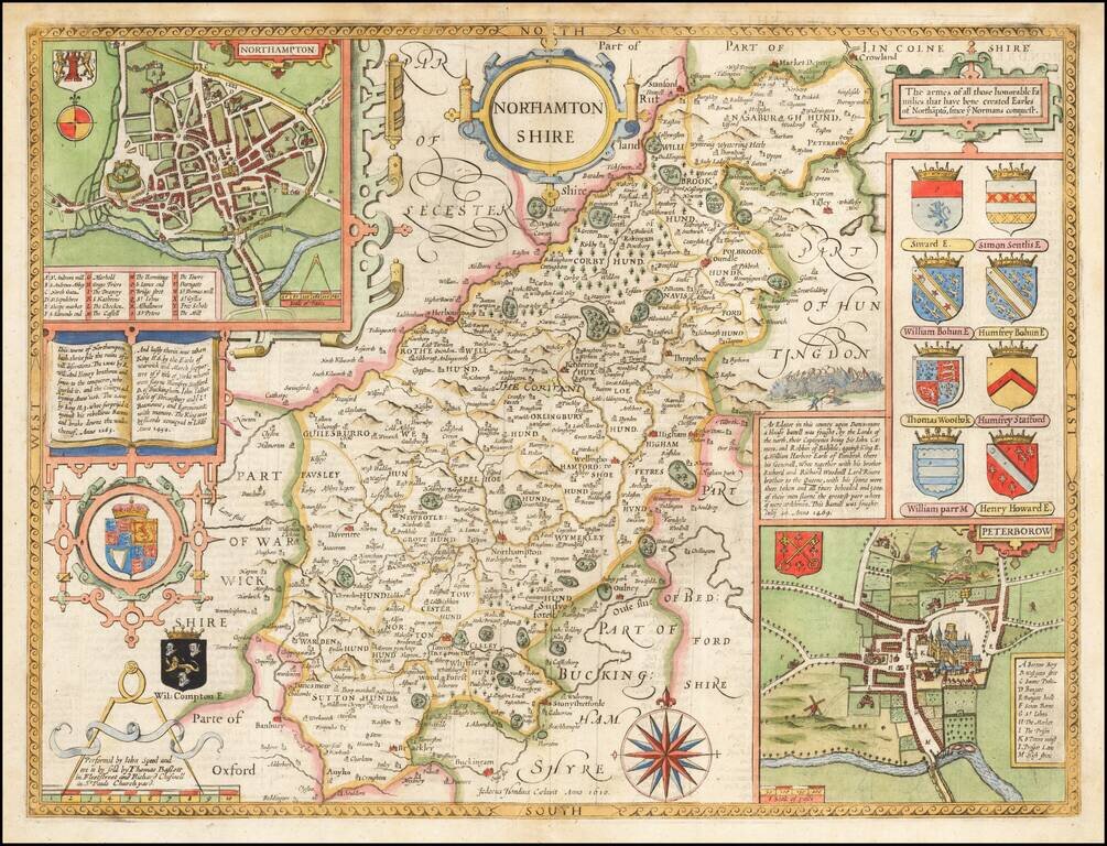
Attractive full color example of Speed's map of Northamptonshire, from an early edition of Speed's Theatre of Great Britain, first published in 1611. Includes large inset plan of Peterborow and Northampton, along with multiple coats of arms.
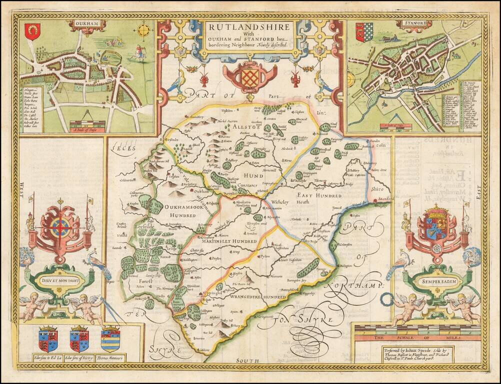
Attractive full color example of Speed's map of the county of Rutland, from the 1676 edition of Speed's Theatre of Great Britain. Includes multiple coats of arms and a large inset plan of the town of Stanford (Stamford) and Oukham (Oakham). British...
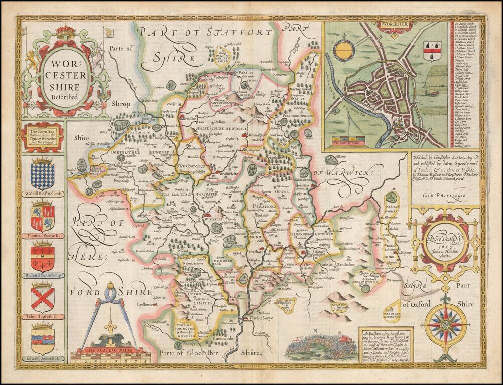
Attractive full color example of Speed's map of the county of Worcester, from the 1676 edition of Speed's Theatre of Great Britain. Includes multiple coats of arms and a large inset plan of the town of Worcester. British historian John Speed is...
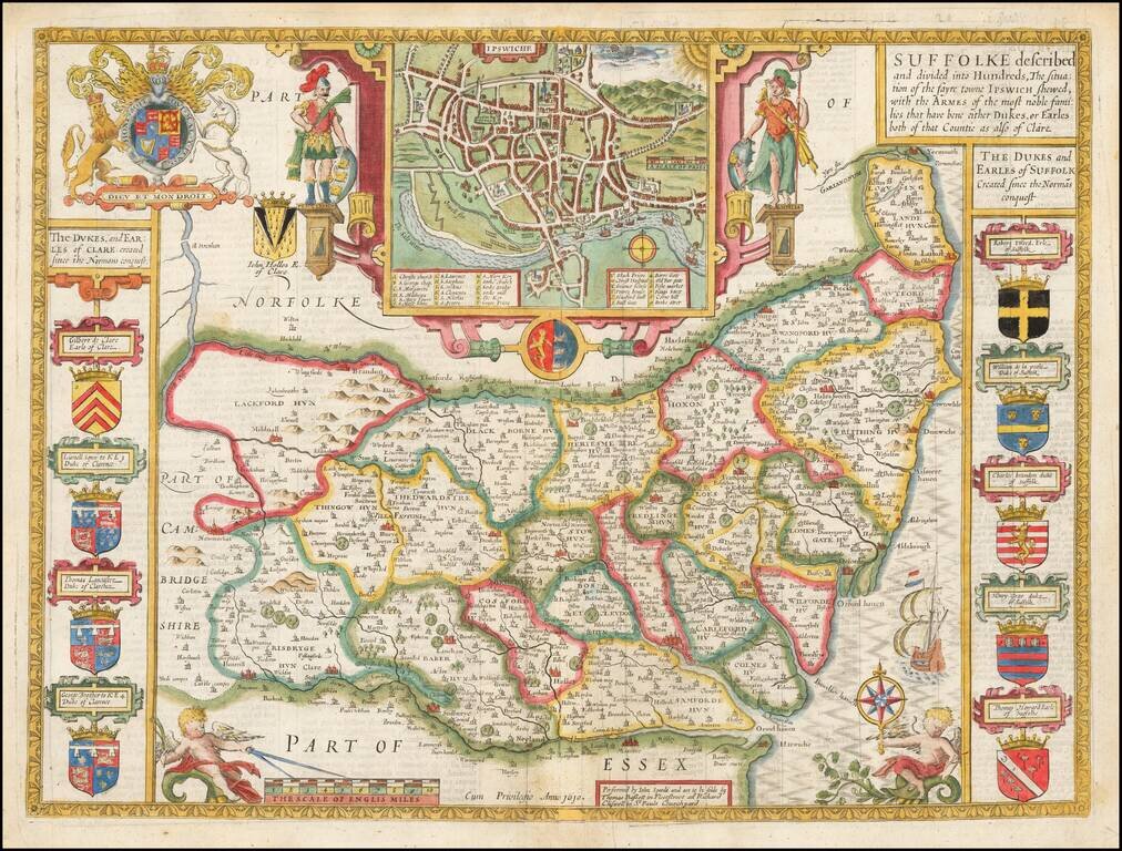
Attractive full color example of Speed's map of the county of Suffolk, from the 1676 edition of Speed's Theatre of Great Britain. Includes multiple coats of arms and a large inset plan of the town of Ipswich. British historian John Speed is perhaps...
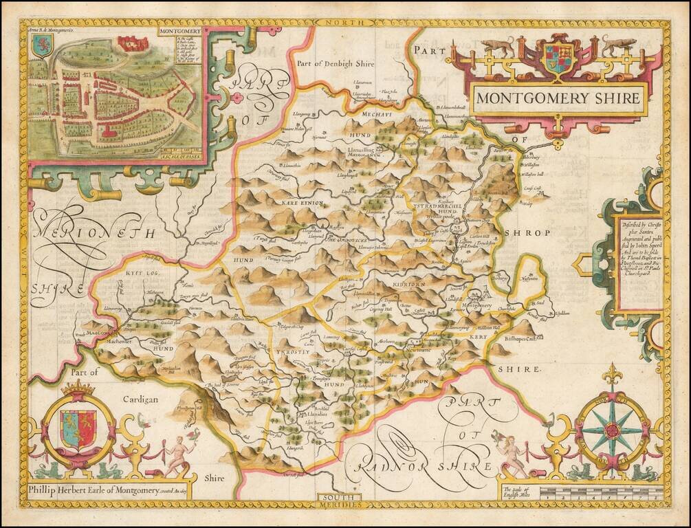
A nice full color example of Speed's map of the County of Montgomery, including coats of arms and detailed town plans of Bangor and Montgomery. Speed's Theatre of the Empire of Great Britain… was first published in 1612, employing maps which Speed...
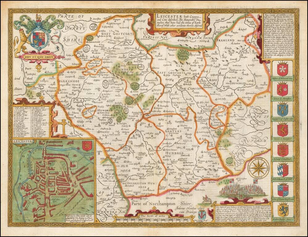
A nice example of this decorative double-page engraved county map of Leicester by John Speed. Includes insets of Leicester, eight coats of arms, plus a large English coat of arms, battle scenes, etc.
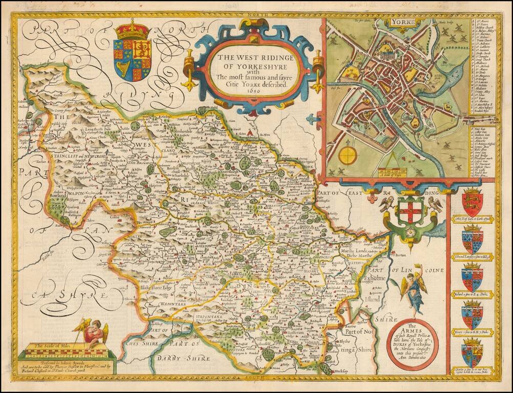
A nice example of this decorative county map by John Speed, covering the West Riding of Yorkshire. Includes inset of Yorke, along with seven coats of arms.
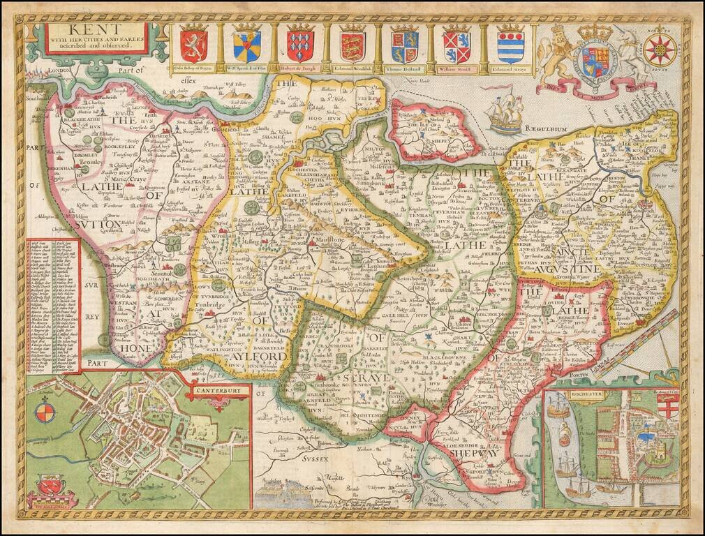
Decorative map of Kent based on the work of Philip Symonson, from Speed's Atlas. Insets of the cathedral cities of Canterbury and Rochester, and seven coats of arms. Due to Kent's extensive coastline, and proximity to France and the Netherlands, it...

John Speed's highly decorative double-page engraved map of Lancaster. The map features the portraits of Henry IIII, Henry V, Henry VI, and Henry VII under the heading "Blessed are, the Peace-Makers." It also shows Edward IIII, Edward V, Richard III,...
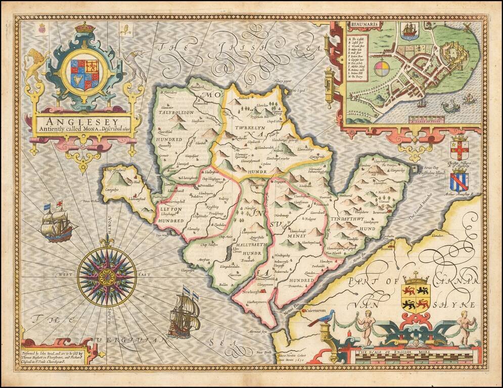
Attractive full color example of Speed's map of the island of Anglesey, off the coast of Wales, published by John Speed. Includes a plan of Beaumaris, the Royal Arms supported by lion and unicorn, the coats of arms of 2 Earls, ships full sail, and an...
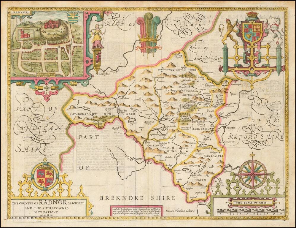
A nice full color example of Speed's map of the County of Radnor, including coats of arms and a detailed town plan of Radnor. Speed's Theatre of the Empire of Great Britain… was first published in 1612, employing maps which Speed began publishing...
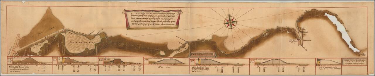
An Amsterdam Canal Map Drawn by Nicolaas van der Heyden. Finely executed gold heightened manuscript map of the Nieuwvaart Canal in Amsterdam, drawn by Amsterdam's Inspector General of Dikes and Canals, Nicolaas van der Heyden in 1676. The map extends...
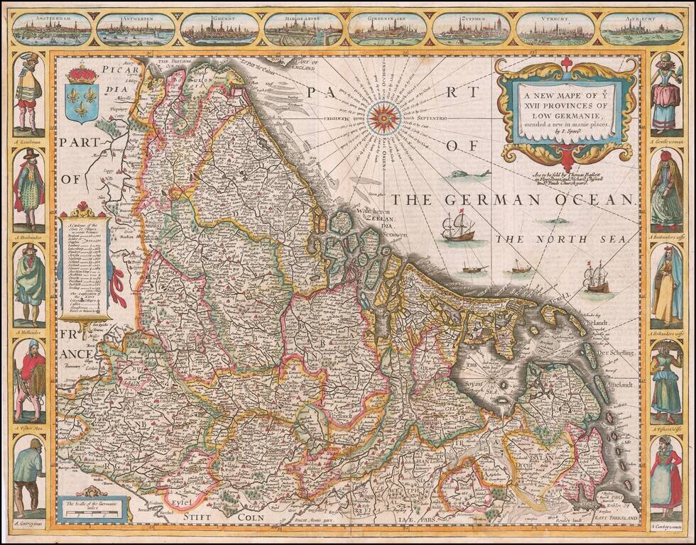
A fine example of John Speed's highly decorative map of the Low Countries. This attractive map embraces all of the 17 traditional provinces of the Netherlands, including the modern nations of the Netherlands, Belgium and Luxembourg. At the time, the...
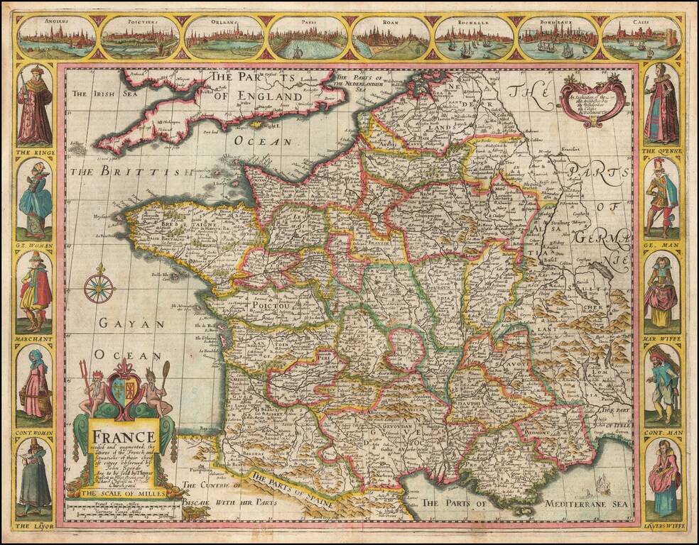
Decorative map of France, published in London by John Speed. Side panels depict costumed figures, while above are vignettes of notable places including Orleans, Paris, Calais, Bordeaux, and Poitiers. The map was engraved by Dirck Gryp in 1626, but...
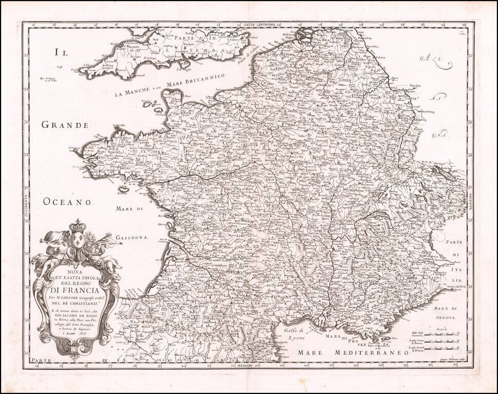
Decorative map of France, published in Rome by Rossi for the Mercurio Geografico overo Guida Geografica in tutte le parti del Mondo.