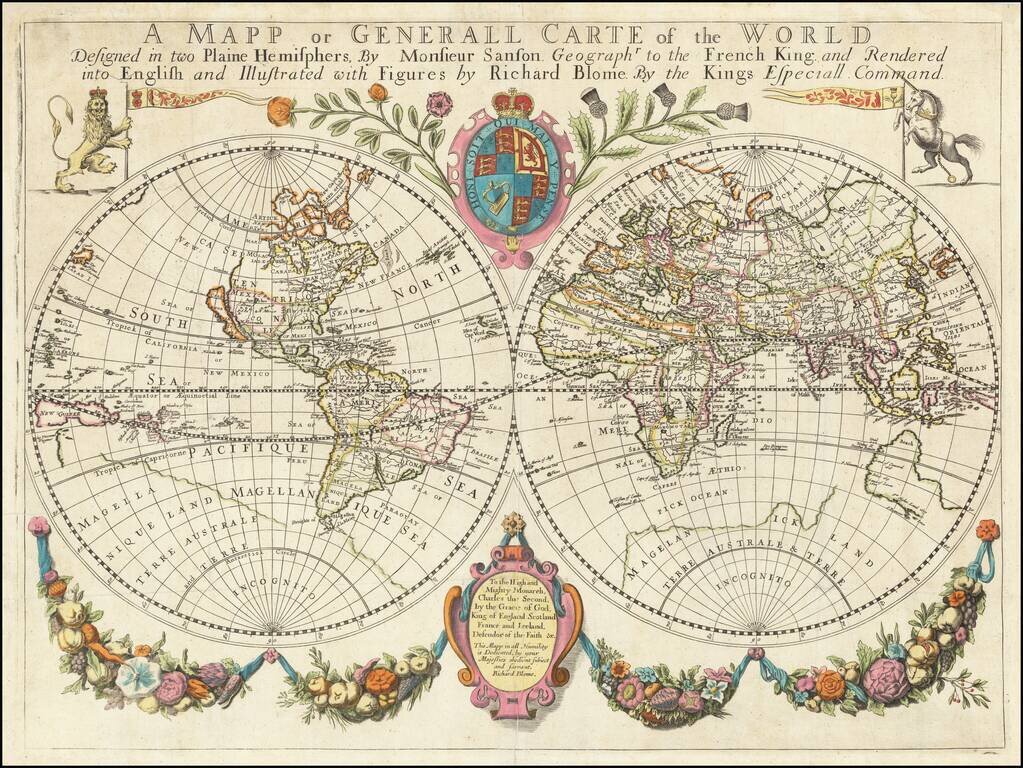
One of the Earliest Obtainable Large Format English World Maps. Old color example of Richard Blome's world map, embellished with decorative features and a dedication to Charles II. Beach is prominently mentioned in Australia, a marvelous reference...
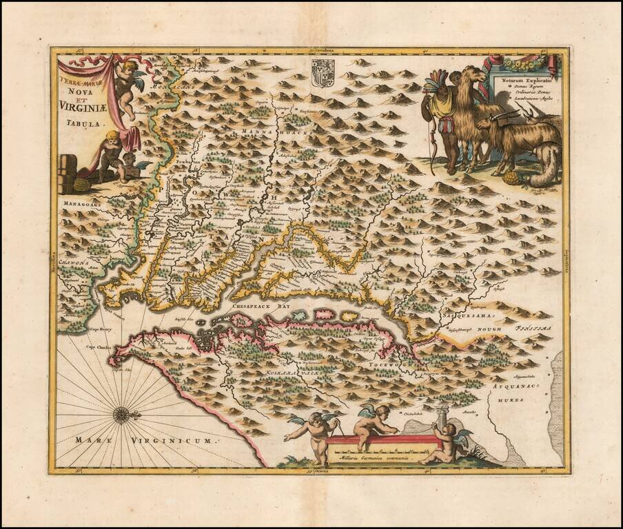
Nice example of Ogilby's edition of Smith's map of the Virginia & Chesapeake region. The map is based upon the earlier maps by Hondius and Blaeu, a bit smaller, but with 3 large cartouches, one of which includes fascinating indigenous animals,...
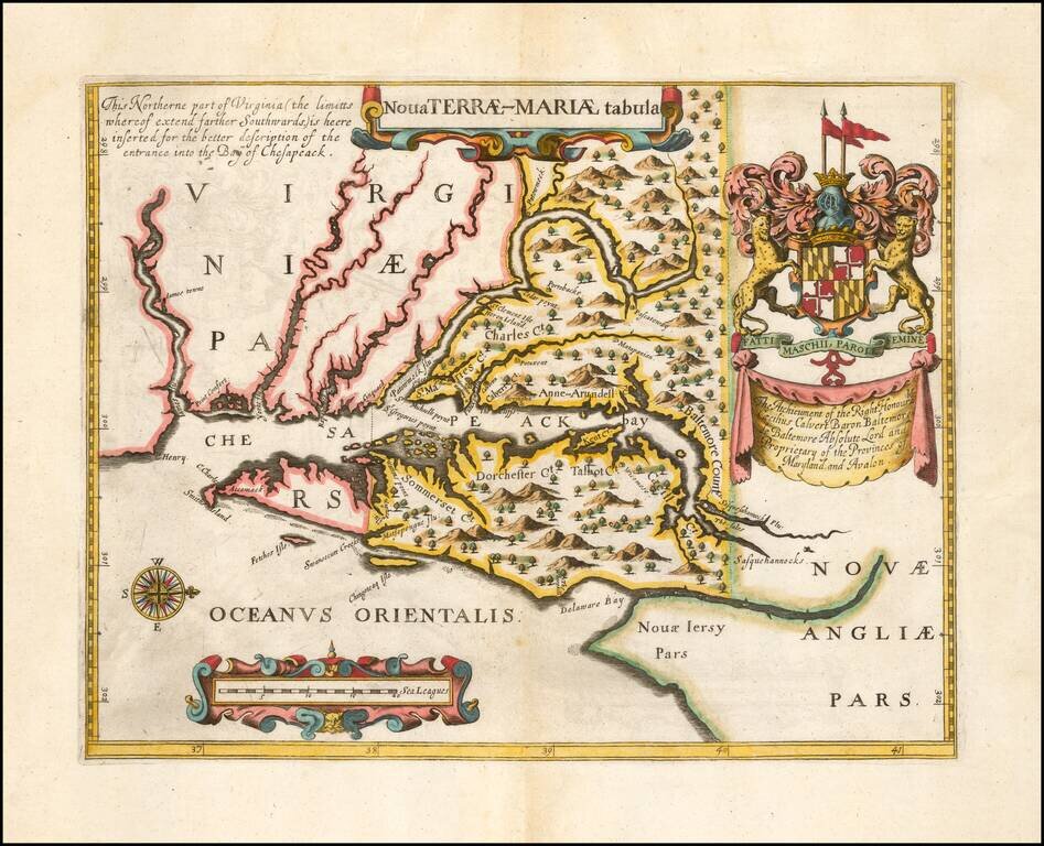
Second Edition of the First Map of the Province of Maryland -- Prepared To Promote The Newly Created Province Fine example of John Ogilby's rare Lord Baltimore Map, the second edition of the first printed map of Maryland and the first to show the...
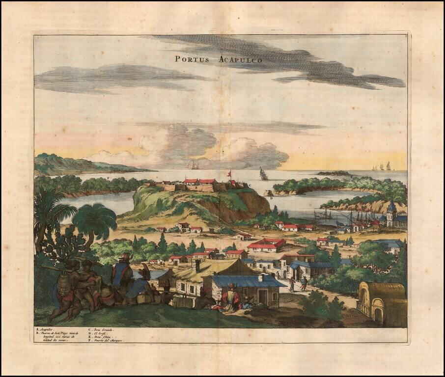
Attractive view of the Spanish stonghold of Acapulco, showing fortifications, outlying buildings, ships in the harbor, costumed locals, etc. Acapulco was one of the most important ports on the Pacific Coast of Mexico and major port in the Manilla...
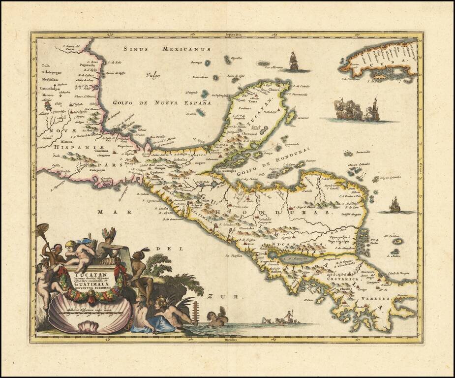
An Early Decorative Map of the Yucatan and Central America Striking full color example of Ogilby's regional map, centered on the Yucatan, Guatimala and Honduras, and extending south to Costa Rica and Panama City and North to Mexico City (and showing...
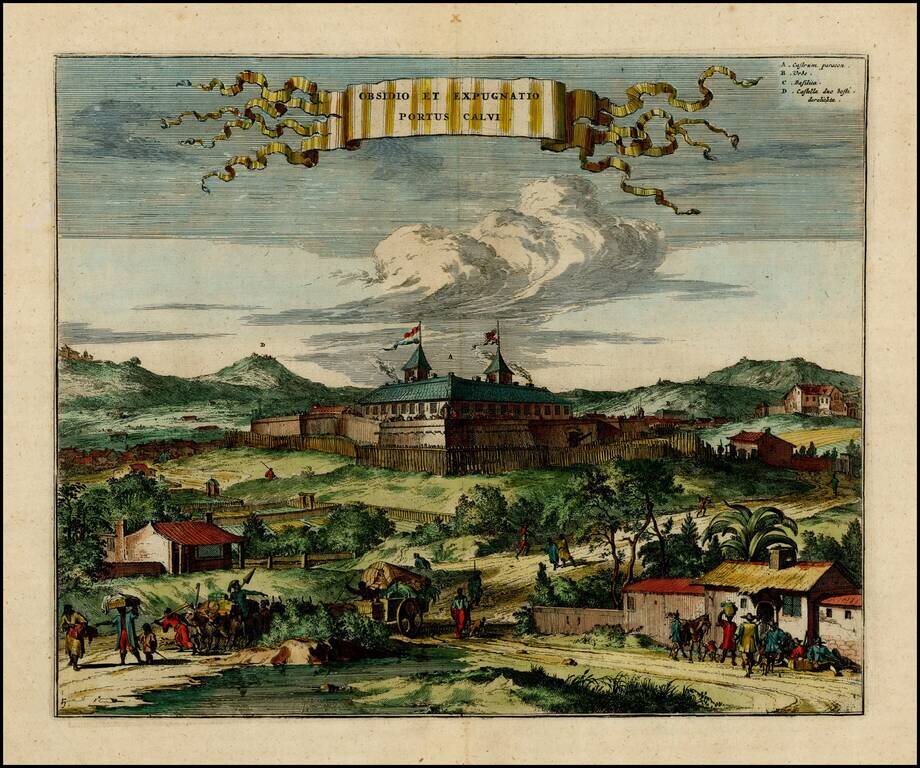
Early view of the Portuguese fort of Porto Calvo in Brazil. Porto Calvo in the Alagoas region, controlled the passage of the Manguaba River, and was at the frontline of Portuguese-Dutch hostilities in the early 1630's. Shown here as a simple wooden...
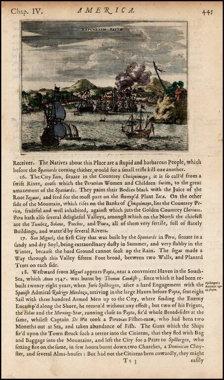
Detailed view of the harbor and town of Payta, burned by Thomas Cavendish in 1547 and visited by Joris Spilbergen in 1575.
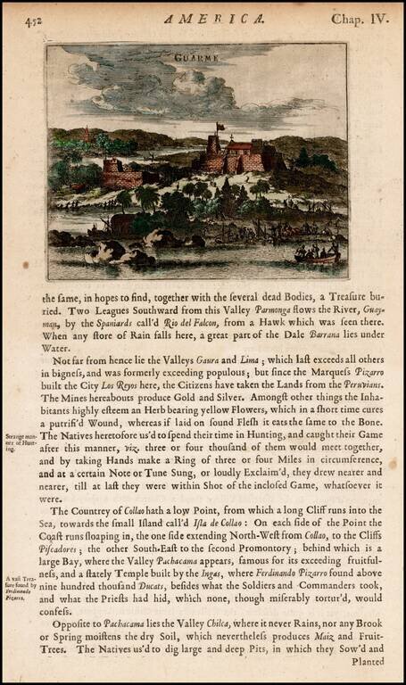
View of the fortifications at Guarme, or present-day Huarmey, Peru, from Ogilby's Complete History of America. Includes men landing goods and barrels from boats and a settlement with a church in a distance.
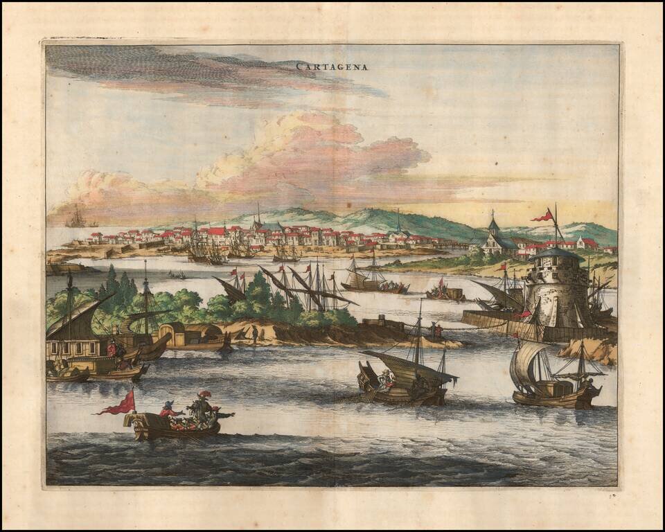
Striking view of the fortified town of Cartagena, Colombia showing sailing vessels, fortifications etc. The map illustrates an idealized harbor, walled city and European style buildings. Very active commercial scene shown in the foreground. This view...
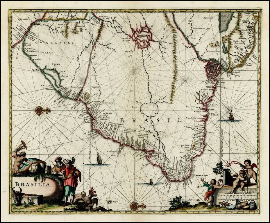
Striking full color example of the map of Brazil from Ogilby's English translation of De Nieuwe en Onbekende Wereld published by Arnold Montanus, which was used by John Ogilby as the basis of his Complete History of America. The cartography of the...
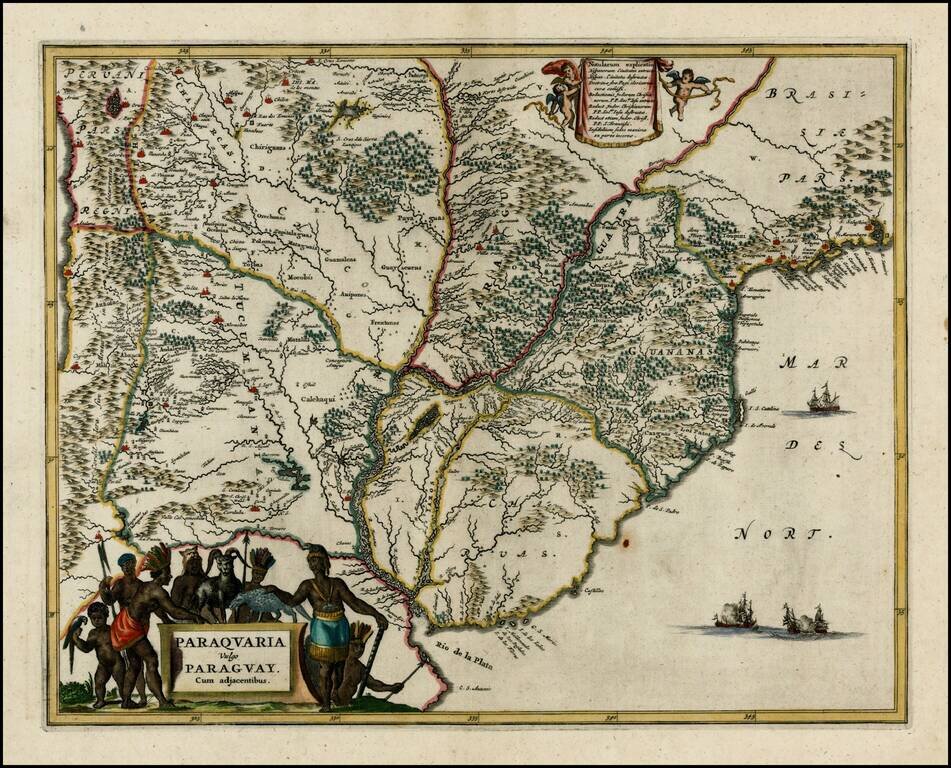
Nice full color example of this regional map, extending from the mouth of the Rio De La Plata to San Sebastian and Marambaya in Brazil, and centered on the course of the Rio De La Plata. Embellished with 2 decorative cartouches and sailing ships.
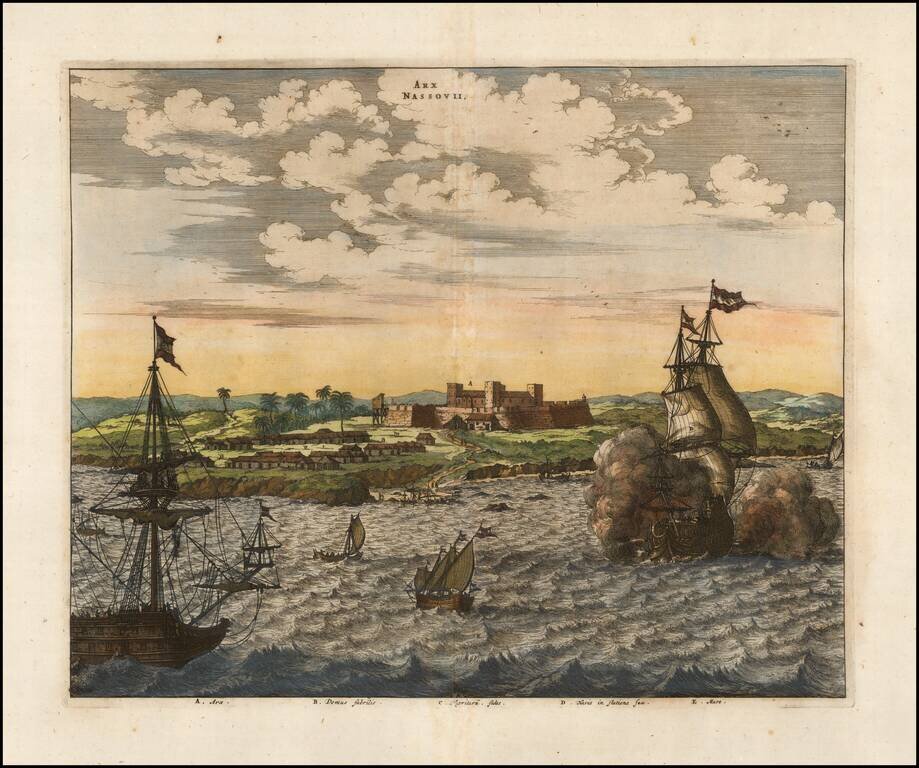
An attractive early view of Fort Nassau. This fine early view depicts the scene of a battle off the coast of Pernambuco on the east coast of Brazil, during the Dutch & Portuguese struggle to retain ownership of the area. Fort Nassau (Arx Nassovii)...
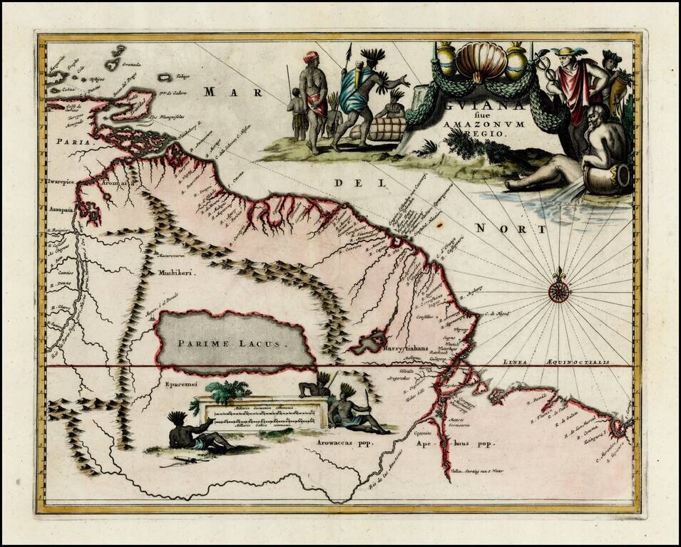
Striking full color example of the map of the coast between the Orinoco River and the Amazon, centered on Parime Lacus, from Ogilby's Complete History of America. Very large decorative cartouche, compass rose and large second cartouche showing...
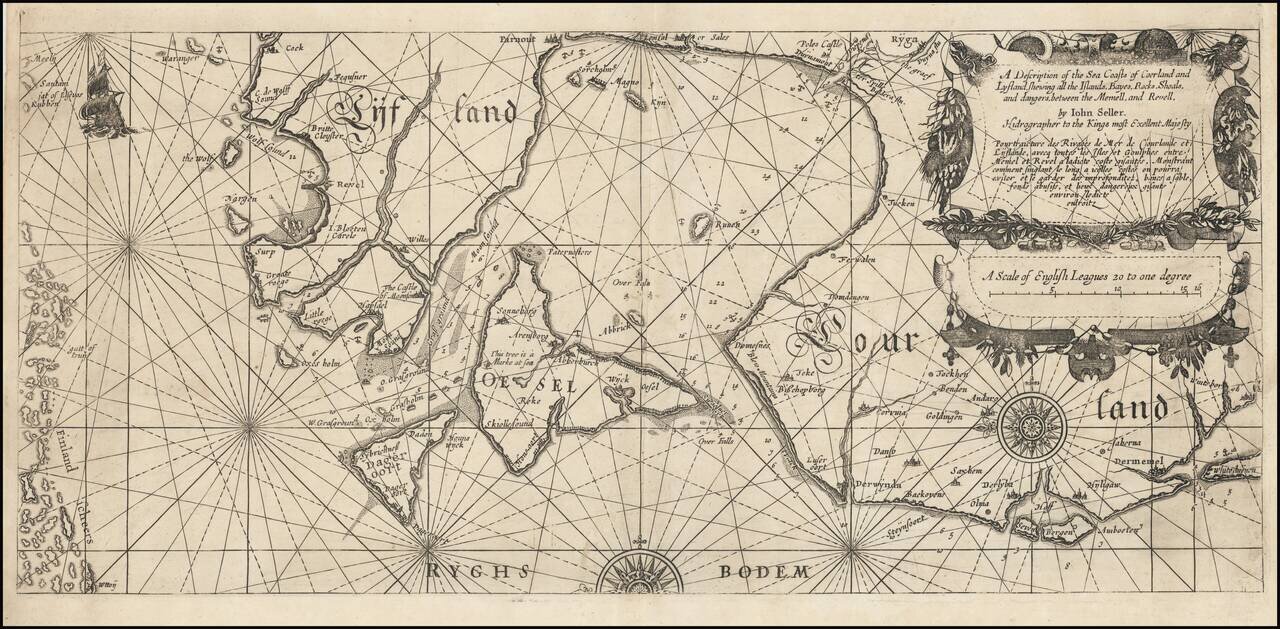
An Extremely Rare English Chart of the Baltic Coasts of Estonia, Latvia, and Lithuania. A wonderful rarity from the early days of English sea chart publication, being one of the maps that John Seller produced using copper plates bought from the Dutch...