
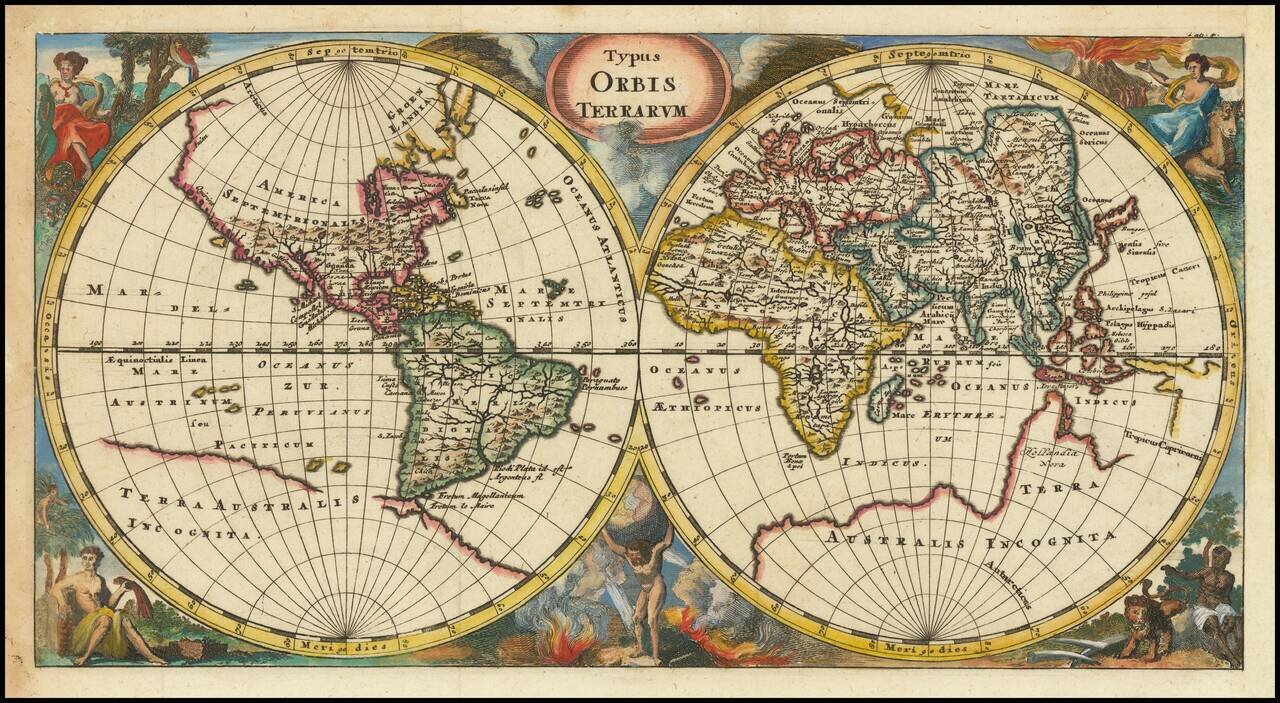
Old color example of Frederick De Wit's striking double hemisphere map of the World, with significantly new cartographic detail in Southeast Asia and to the north of New Zealand. The map shows the Briggs model of California as an island and the...
Interesting double hemisphere map of the world, from Cluver's Introductionis en Universum Geographicus…., one of the most prolific 17th and 18th Century Geography books. The map presents a classic depiction of the world as known in the mid-17th...
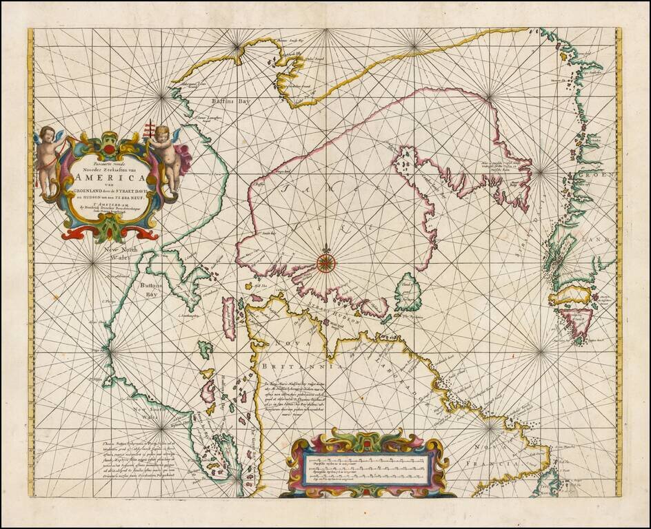
Fine example of Doncker's rare early map of the Northern part of America, including Hudson Bay, Davis Straits, Button Bay and the west coast of Greenland. Doncker's chart is one of the earliest obtainable charts to show this configuration and much of...
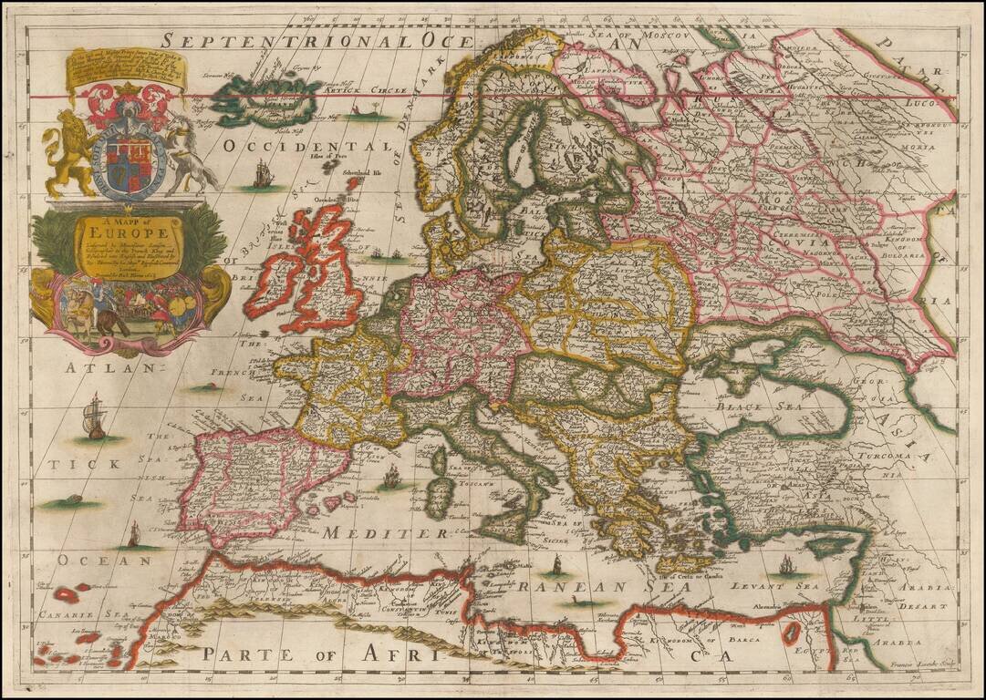
Fine Old Color Example of Richard Blome's Map of Europe Old color example of Blome's scarce map of Europe, the earliest folio size map of Europe to be engraved and printed in England. The map demonstrates the naïve engraving style characteristic of...
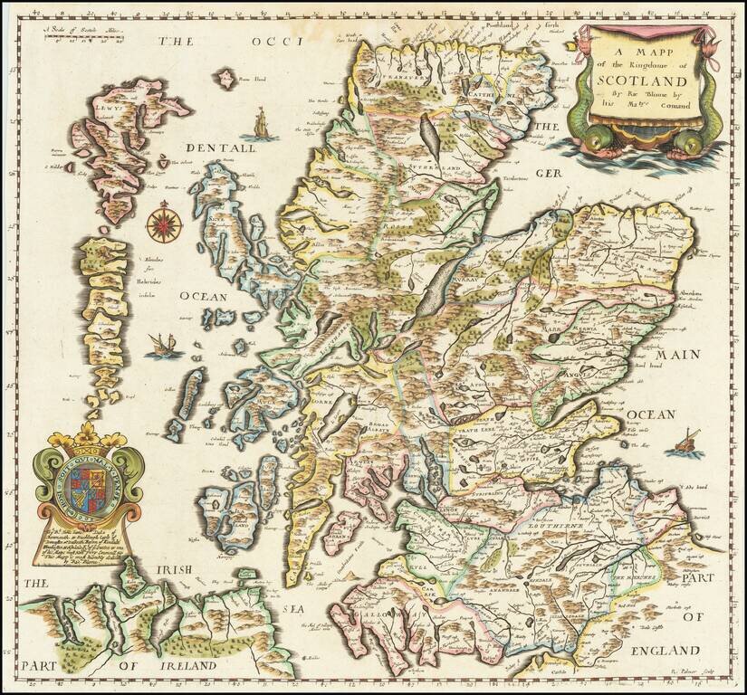
Finely executed map of Scotland, published by Richard Blome. This important early map of Scotland appeared in the first edition Blome's of 'Britannia', his series of county maps. The map includes an elaborate cartouche, coat of arms, and a dedication...
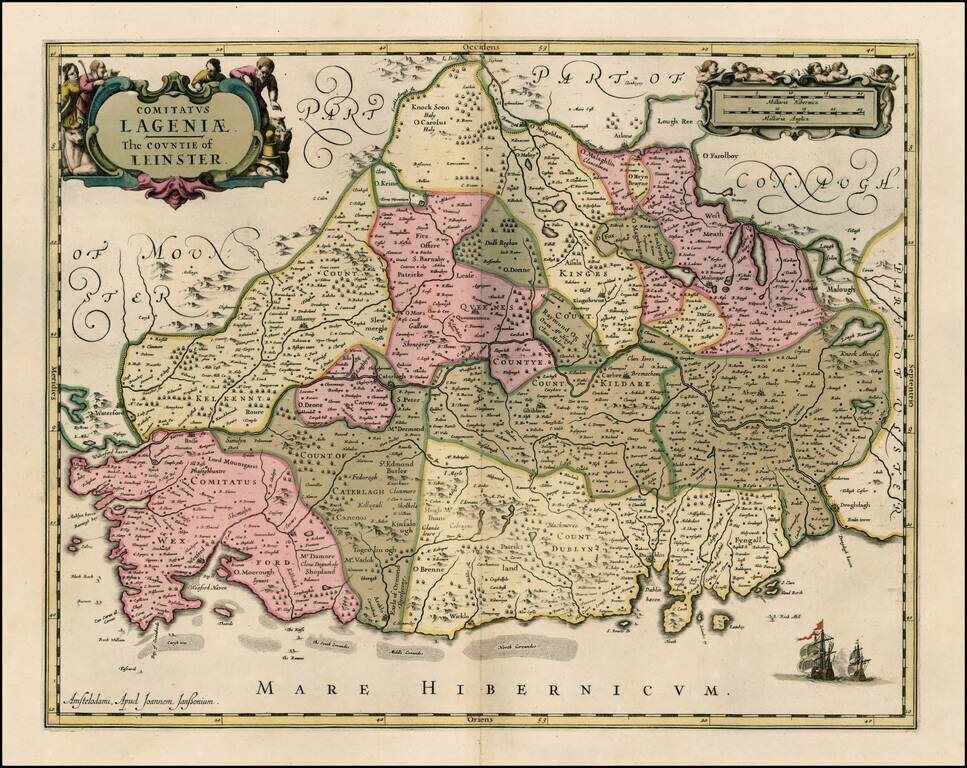
Striking old color example of Jansson's map of the County of Leinster. This example appeared in a composite atlas, issued in the late 17th Century and has no text on the verso.
![Salces en Roussillon. [Salses-le-Château, France].](/map/small/37766.jpg)
A rare view by Sébastien Pontault de Beaulieu, depicting the action around the fortress of Salses-le-Château in Roussillon during the Franco-Spanish War. Salses-le-Château (called Salces in both Spanish and Catalan) was, until the mid-17th Century,...
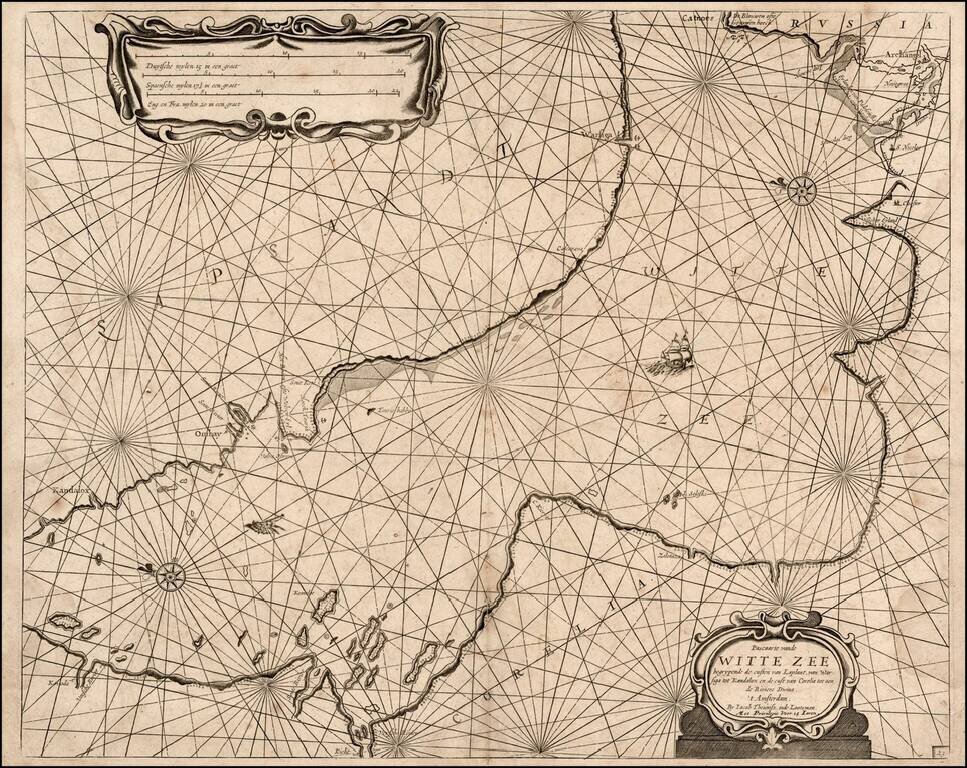
Rare sea chart of a part of the White Sea, published by Jacob Theunisz (Lootsman). At first Jacob adopted his father Anthonie's name, being known as Jacob Theunisz. Later with his brother, Caspar, in association, they added the name Lootsman to their...
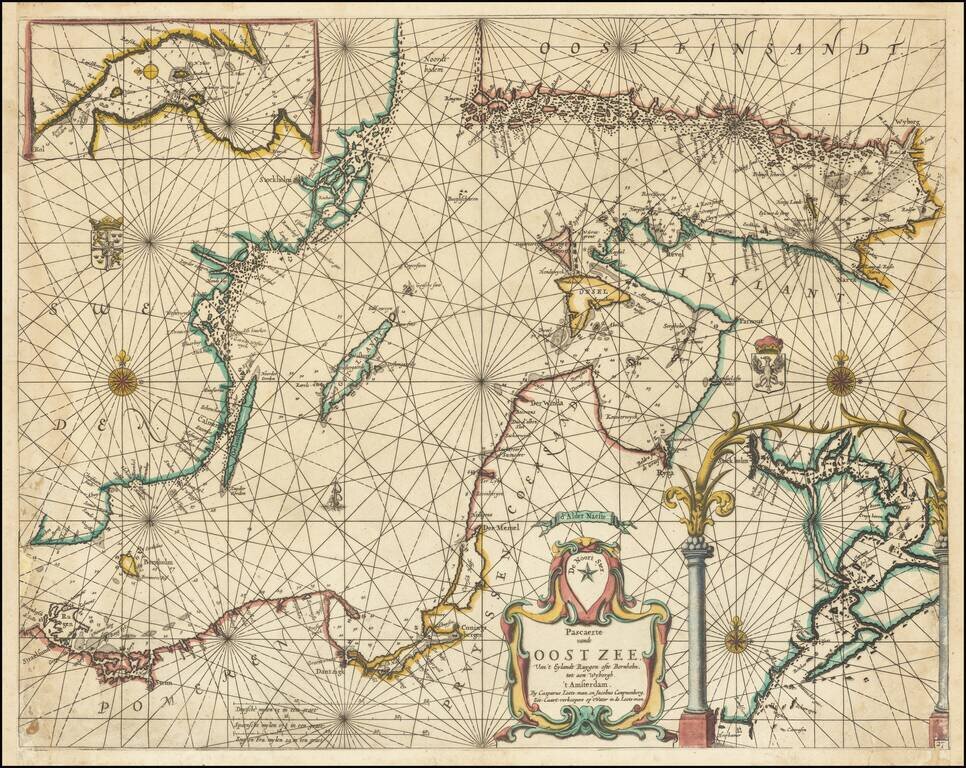
Exceptionally rare chart of the Baltic Sea and adjoining coastlines published by Caspar Lootsman (here "Casparus Loots-man") in Amsterdam. The chart shows the Baltic Sea from Trelleborg to Rugen at the west and the easternmost section of the Gulf of...
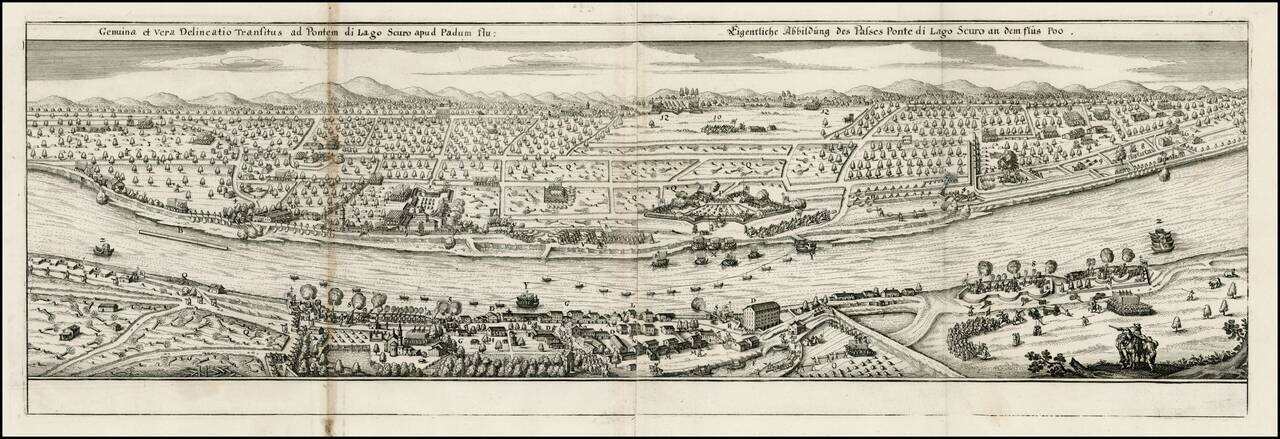
Decorative view of the Po River, near the Lake Scuro, from Merian's Theatrum Euopaeum.
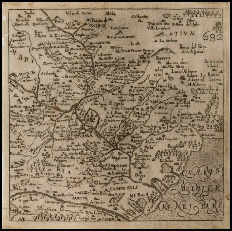
Scarce map of the area around Rome, from Francesco Scoto's Itinerario, published in 1670.
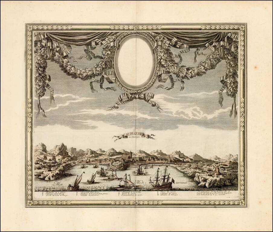
A rare view of Cadaqués by Sébastien Pontault de Beaulieu, depicting the action around the fortress of Cap de Quiers in Catalonia during the Franco-Spanish War. Cadaqués is today one of the northernmost natural habors on the Catalan Coastline, just...
![[Toledo] Tollede](/map/small/62195.jpg)
Toledo Rarity Rare early view of Toledo, Spain, published in Paris by Jollain. Includes an explanation of Toledo in Latin, French and Spanish.
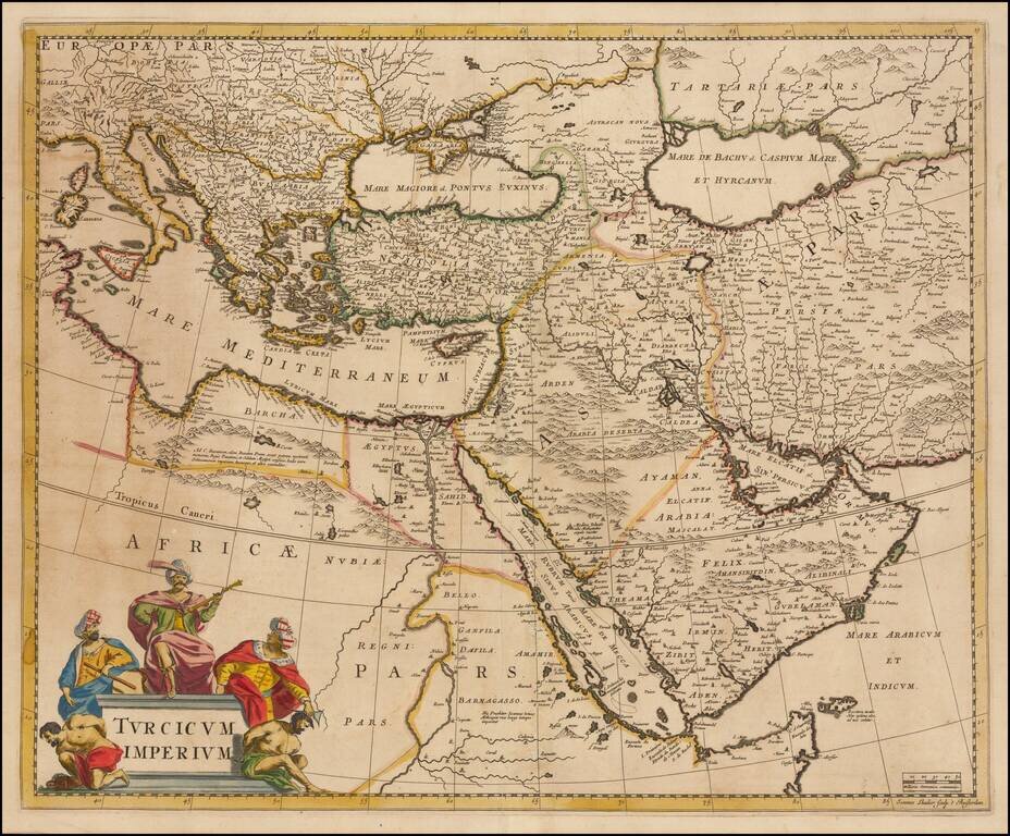
Striking map of the Turkish Empire bounded by the Eastern Mediterranean, Greece, and Italy in the West and Saudi Arabia, the Persian Gulf and Caspian Sea in the east and centered on Turkey and Cyprus. This fine map depicts the Ottoman Empire on the...
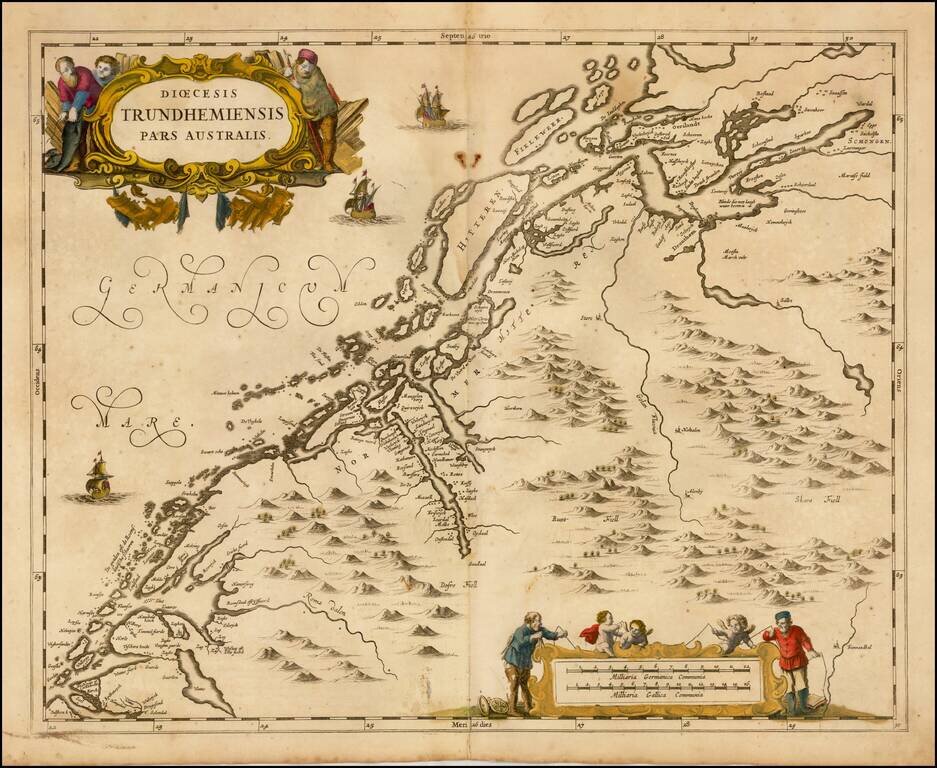
Scarce map of the Southern part of the Diocese of Trondheim in Norway, first published by Jan Jansson in Amsterdam for his Atlas Major.
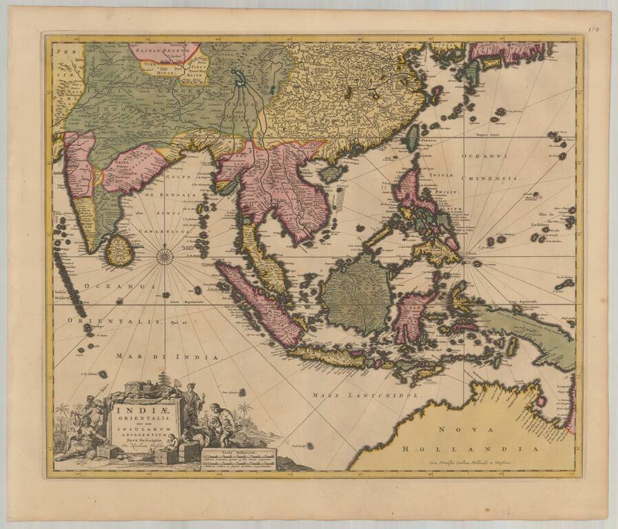
Detailed map of Southeast Asia and the North Coast of Australia, published in Amsterdam by Nicolas Visscher. The map extends from India and the Maldives in the west to New Guinea and the southern coast of Japan in the east, centered on the Stratis of...