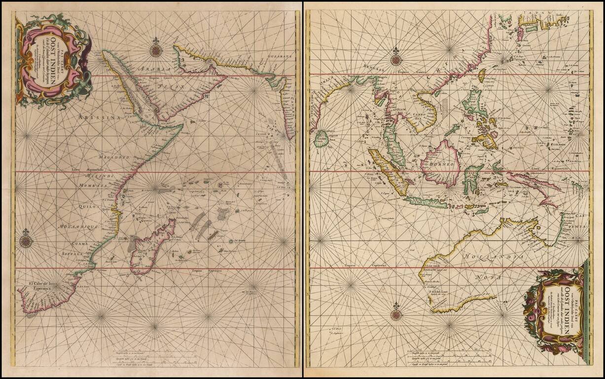
Rare Sea Chart of Australia, Southeast Asia, and the Indian Ocean from the Dutch Golden Age of Cartography Early pair of sea charts of the Indian Ocean and contiguous regions. Australia is remarkably delineated for this early date and reflects recent...

First edition of the Sanson-Marriette map of North America, first issued in 1669. Produced by Guillaume Sanson and Pierre Mariette, after the death of Guillaume's father Nicolas in 1667, this map is a reduced-size copy of Nicolas Sanson's 4-sheet wall...
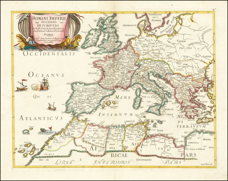
Rare map of the Roman Empire and contiguous regions. This map was originally designed by Michel Antoine Baudrand (1633-1700), a French Historian and Geographer, who served as secretary to Cardinal Francesco Barberini (then Dean of the College of...
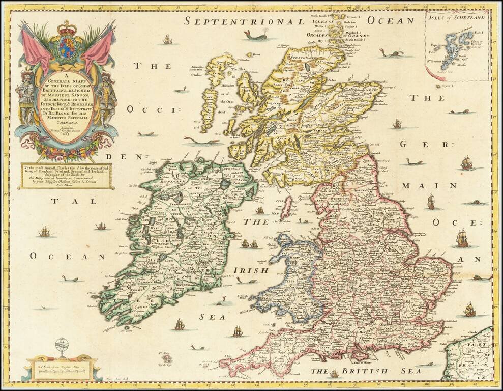
Gorgeous old color example of Richard Blome's map of the British Isles, which appeared in the first world atlas to be printed and engraved in England. The map demonstrates the naïve engraving style characteristic of 17th Century English engravers,...
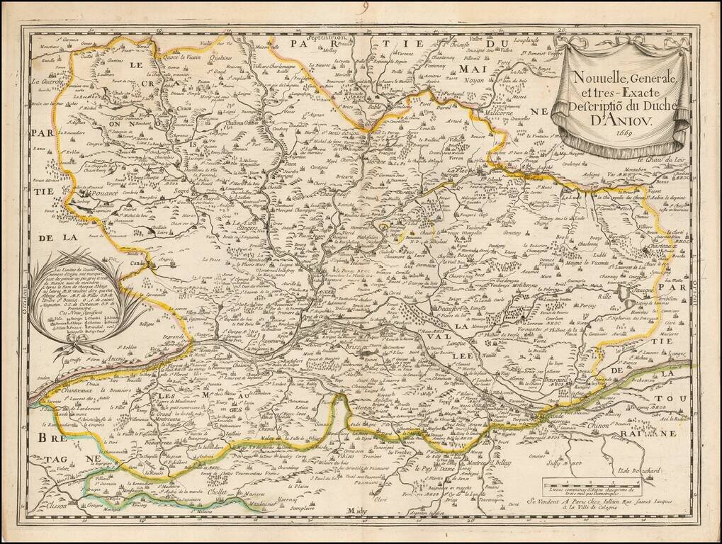
Scarce early map of the Anjou region of France, published by Gerard Jollain. The map is centered on the Loire River, extending from Champtoceaux in the west to Langeais in the east, and from Sablé-sur-Sarthe in the north to Cholet and Clisson in the...
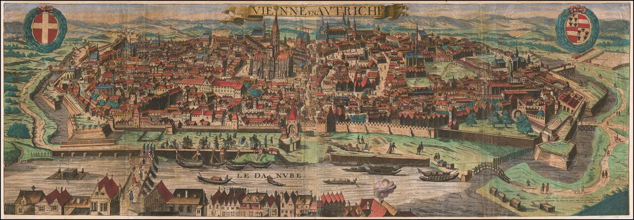
Rare separately publshed view of Vienna by Hubert Jaillot, published in Paris in 1669. This is a very early work for Jaillot. Rarity We located no other examples of the view in OCLC or any auction records or dealer catalogs.
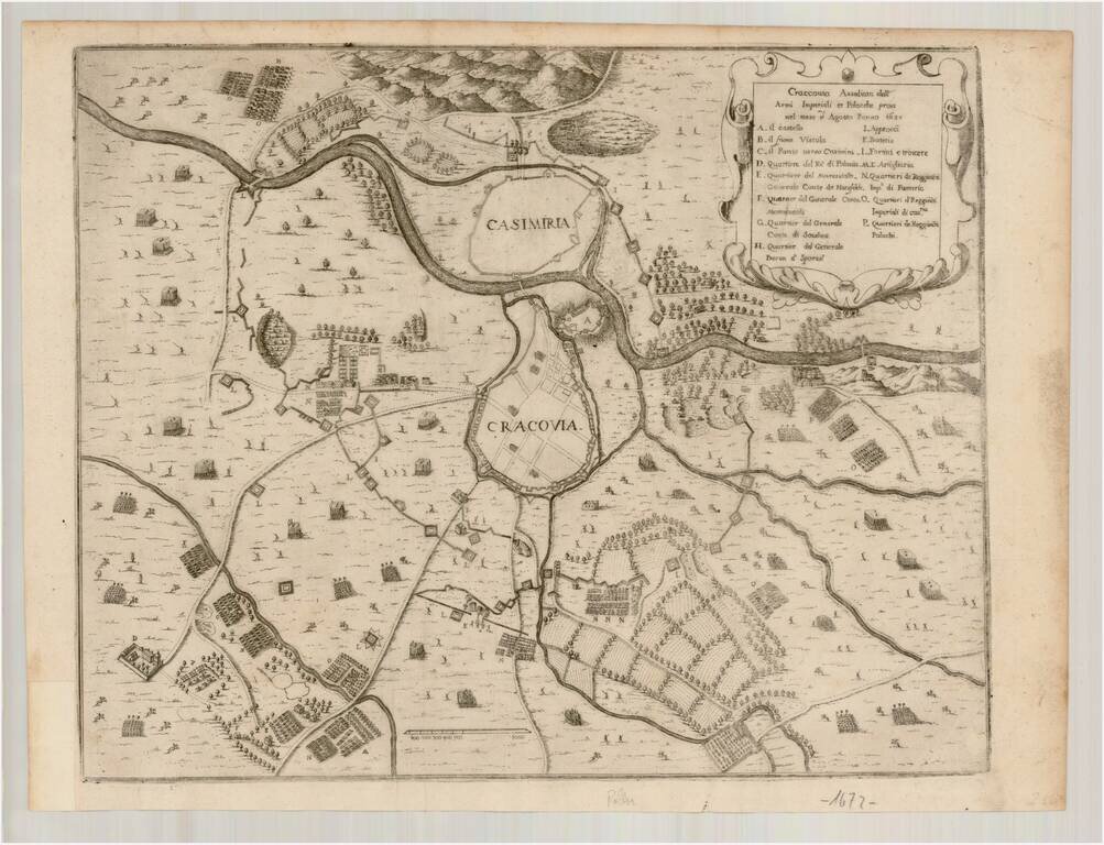
Rare map of the area around Krakow, showing the siege of August 1657. The map shows the positions of the combatants in and around the walled city of Krakow and neighboring Casimiria on the opposite side of the river. After 2 years of Swedish and...
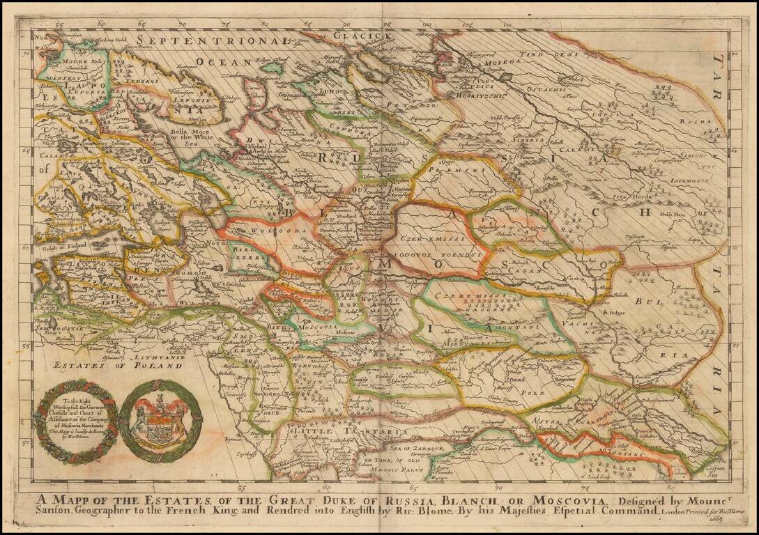
One of the Earliest Maps of Russia published in England. Old color example of Richard Blome's scarce map of Russia, the earliest folio sized map of the region to be engraved in England. The map reaches to the Caspian Sea and Ukraine in the South....
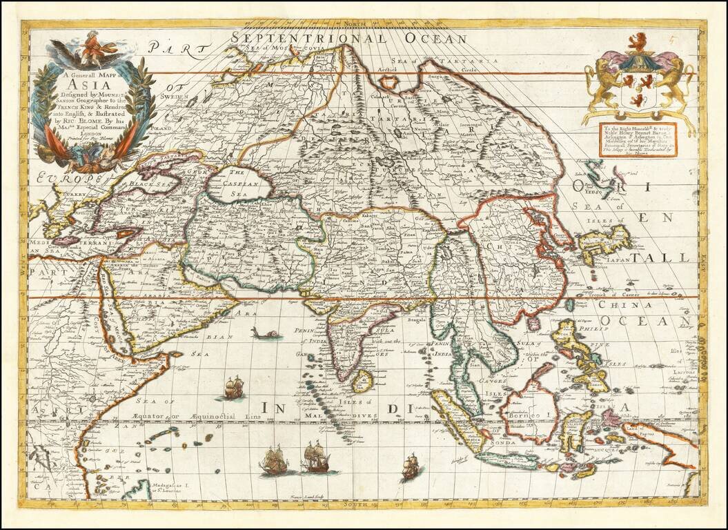
A striking dark impression of this scarce map of Asia, the earliest folio-size map of Asia to be engraved and printed in England. The map demonstrates the naïve engraving style characteristic of 17th Century English engravers and features an...
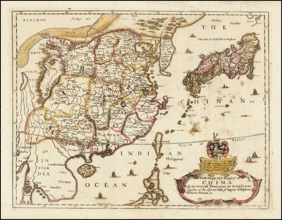
Rare Second State of Richard Blome's Map of China. Finely colored example of Richard Blome's scarce early map of China, with coat of arms and dedication to the London Lawyer Thomas Robinson. Unlike most of Blome's maps, the present map is based upon...
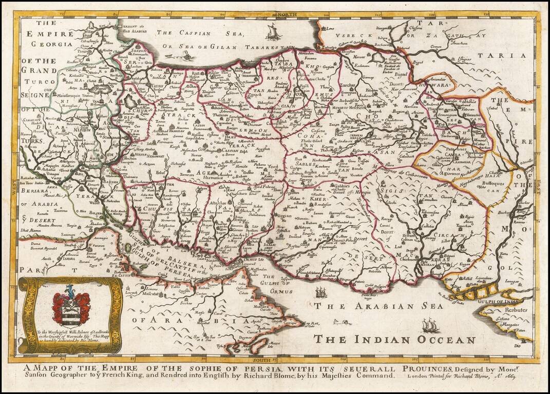
A striking dark impression of Richard Blome's scarce map of Persia, the earliest folio sized map of the region to be engraved in England. The map demonstrates the naïve engraving style characteristic of 17th century English engravers, and features an...