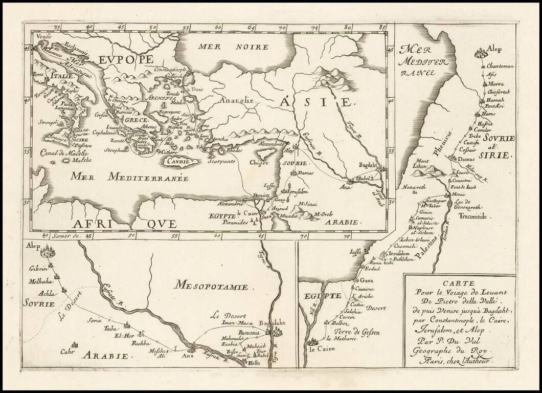
Interesting antique engraved three-part map of the Middle East following the travels of Renaissance writer Pietro Della Valle (1586-1652). The maps show voyages from Venice to Baghdad, from Cairo to Aleppo, and from Aleppo to Baghdad.
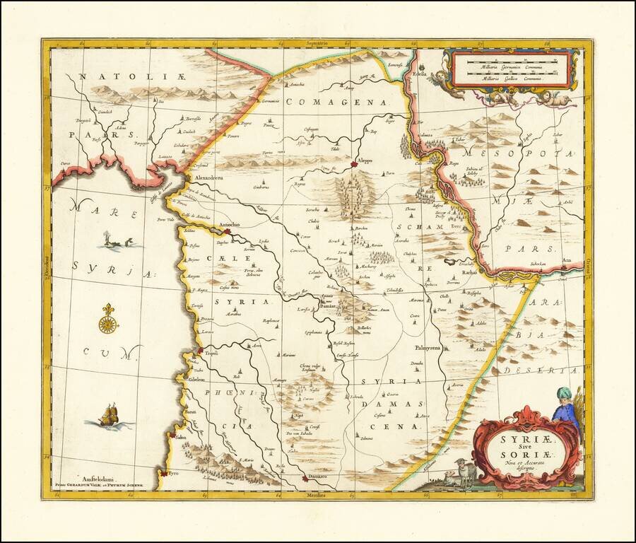
Detailed map of Syria published in Amsterdam by Jansson. The map extends from Damascus and Sidon in the south, to Edessa, Alexandretta, and Antioch in the north as well as to Aleppo, Palmyrena, Damant, etc. The map also extends from the Mediterranean...
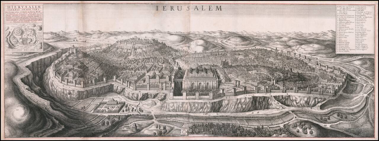
Fine large birdseye view of Jerusalem, published in London by Wenceslaus Hollar. One of the most impressive engraved views of Jerusalem. The representation of the Jewish Temple at Jerusalem is based on the engravings in H. Prado and J.B....
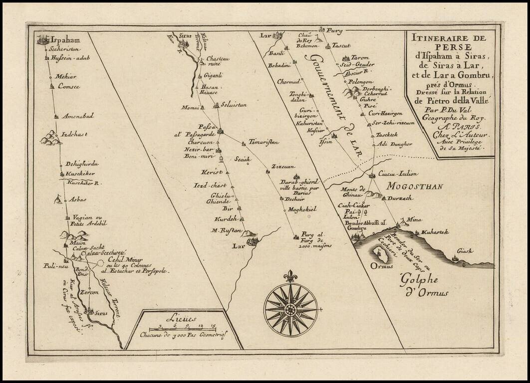
Interesting three-part map showing the journey of Renaissance writer Pietro Della Valle through Persia. The route extends from Isfahan to the Gulf of Hormuz.
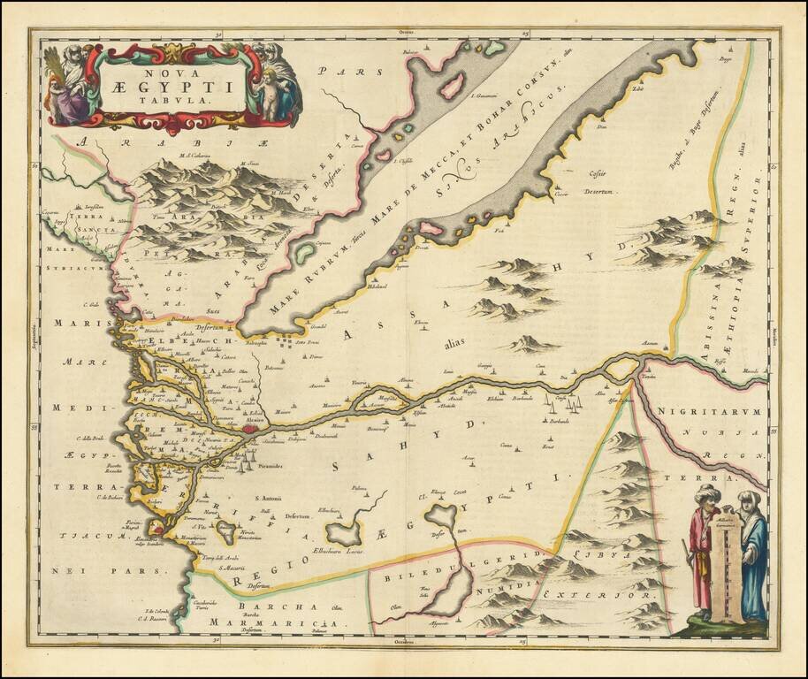
A nice example of Blaeu's modern map of Egypt, in fine old color. The map shows Egypt oriented with east at the top, centered on the Nile River. Pyramids are illustrated in two locations along the Nile. The copper plate for this map eventually went...
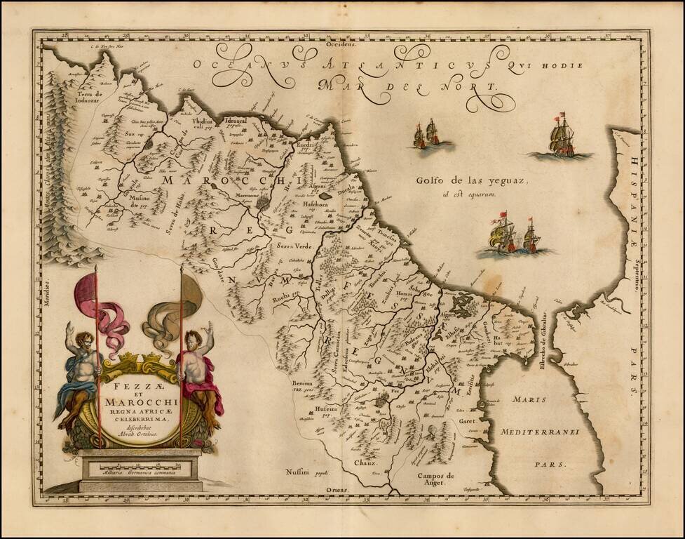
Nice old color map of Morocco, showing large fortified towns of Marakesh, Taradante and Fez, towns, mountains, rivers, lakes, etc. Tanger, Cueta and Rio Rabata also appear. Large decorative cartouche and sailing ships. Ortelius is credited in the...
![Africa ex Bello Africano [with] Egiptus ex Bello Alexandrino](/map/small/49002.jpg)
Small engraved map of two of the African theaters in Julius Ceasar's Civil War, produced by Pierre Du Val in Paris, circa 1660. The map shows the two African components of Ceasar's war of power consolidation, including Tunisia (showing the B.C. 49...
![[Cape Verde] Pascaerte vande Soute Eylanden oftge Ilhas de Cabo Verde](/map/small/67911.jpg)
A Rare Early Sea Chart of Cape Verde Rare early sea chart of the the Cape Verde Islands by Johannes Van Loon. The islands shown with its towns and anchoring places. Island of Del Fuogo is shown with an erupting volcano. Very decorative map with a...
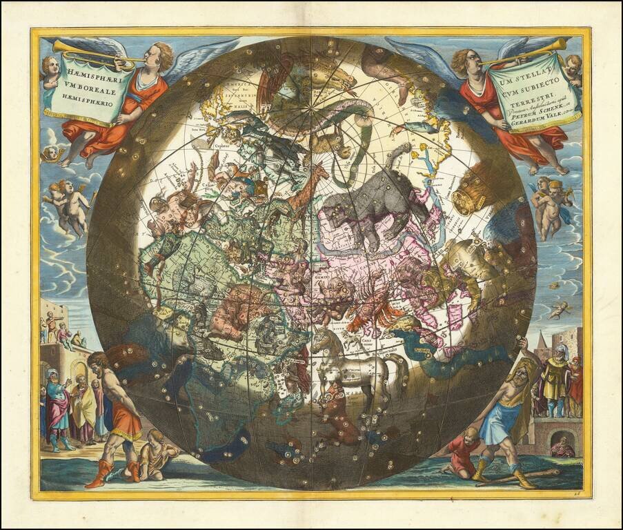
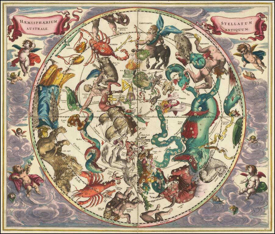
Fine old color example of this striking chart of the Northern Sky, illustrating the constellations of the Southern Hemisphere superimposed over the earth's Southern Hemisphere, from the 1708 Valk & Schenk edition of Andreas Cellarius's Harmonia...
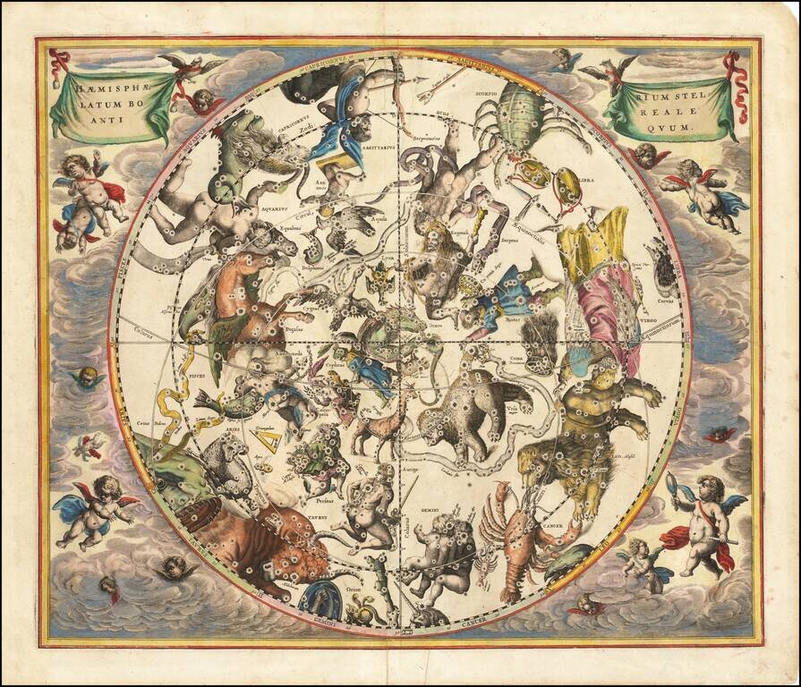
Very nice example of this striking chart of the Northern Sky, illustrating the constellations of the Northern Hemisphere superimposed over the earth's Southern Hemisphere, from Andreas Cellarius's Harmonia Macrocosmica, first published in 1660. The...
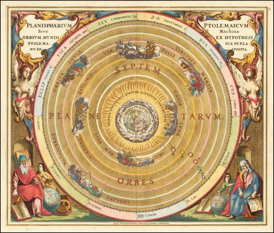
Striking example of this celestial chart illustration of Claudius Ptolemy's model of the Universe, a model of the solar system with the earth at the center, from the 1708 Valk & Schenk edition of Andreas Cellarius's Harmonia Macrocosmica seu Atlas...
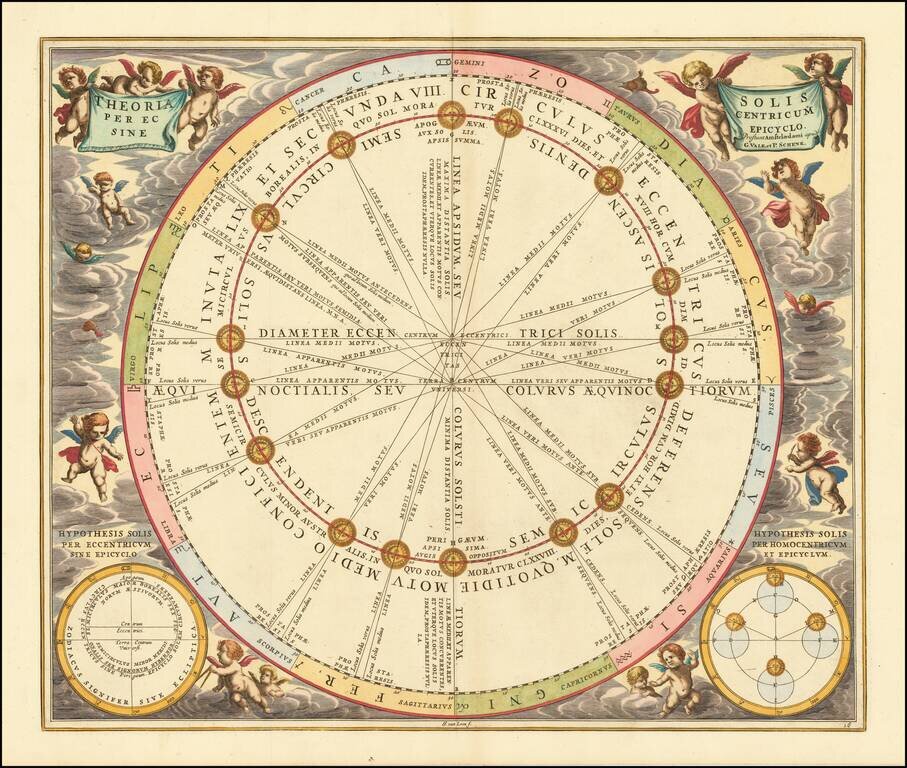
Fine example of this celestial chart illustrating the Sun's orbit around the Earth, from the 1708 Valk & Schenk edition of Andreas Cellarius' Harmonia Macrocosmica. Cellariu's chart illustrates the Ptolemaic theory of the Sun's orbit around the...

Finely engraved celestial map showing Claudius Ptolemy's model of the Lunar Cycles, from the 1708 Valk & Schenk edition of Andreas Cellarius' Harmonia Macrocosmica. Striking celestial chart illustrating the Ptolemaic model of lunar motion. The...
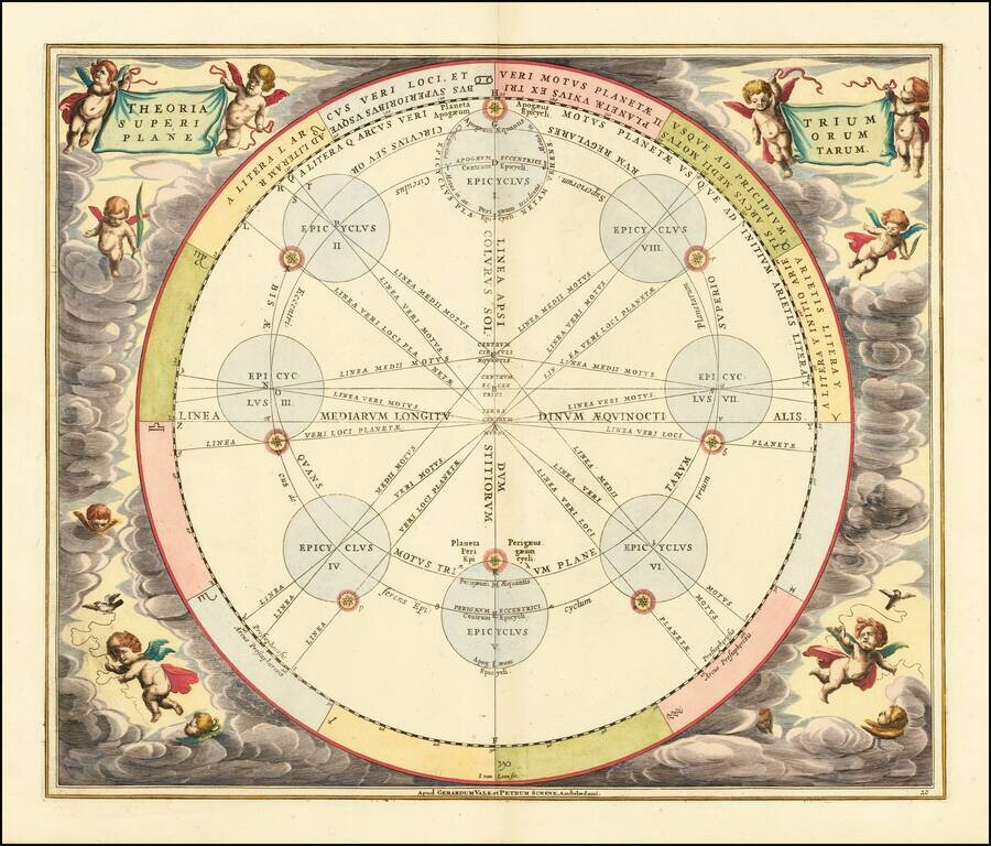
Fine example of Cellarius's chart illustrating the Theory of Epicycles, which supported Claudius Ptolemy's earth-centered model of the universe, from the Valk & Schenk edition of Andreas Cellarius' Harmonia Macrocosmica. In this chart, Cellarius...
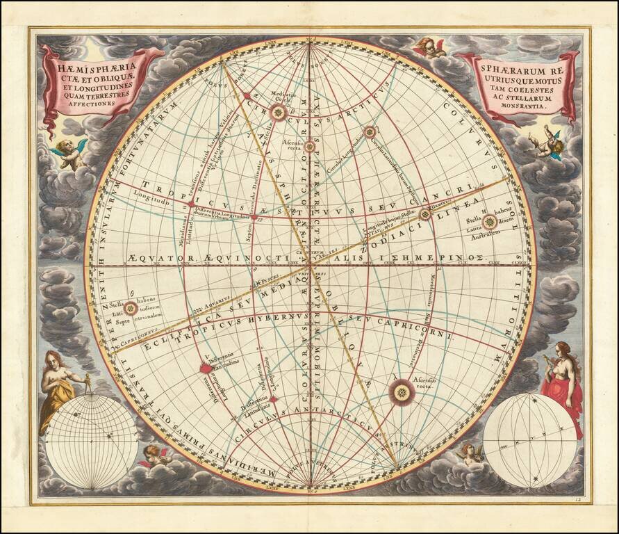
Finely executed celestial chart illustrating the motions of both the upright sphere (the equatorial co-ordinate system) and the oblique sphere (the ecliptic co-ordinate system); the celestial and terrestrial longitudes; and the influences of the stars,...
Exceptional Original Color A fine old color example of this striking map of the Southern Sky, illustrating the constellations of the Southern Hemisphere superimposed over the earth's Southern Hemisphere, first published by Andreas Cellarius in 1660....