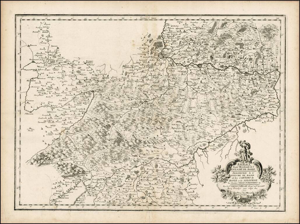
Scarce regional map of the region around Basle, including a striking cartouche.
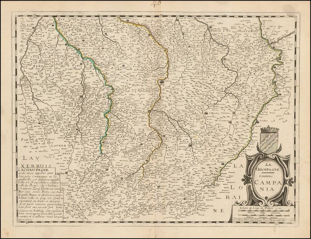
Detailed map of the Champagne region, published by Jollain.
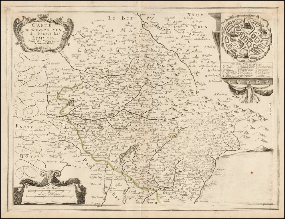
Rare Nicolas Langlois map of the Lymosin region of France, with a large plan of Limoges. The map is centered on Lymoges.
![Itineraire de France, pour la Route de Paris a Lion [with] Route de Lion a Marseille et a Nice.](/map/small/47011.jpg)
Antique engraved map of the routes from Paris to Lyon and Lyon to Marseille and Nice in the middle of the 17th century. The map was published by Pierre Du Val probably around 1660.
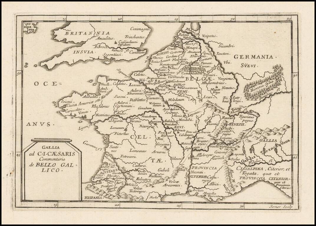
Antique engraved map of ancient France intended to illustrate Julius Caesar's commentary on the Gallic Wars. The map was issued by Pierre Du Val, probably in the 1660s. The map is scarce, this being the first time we have had it.
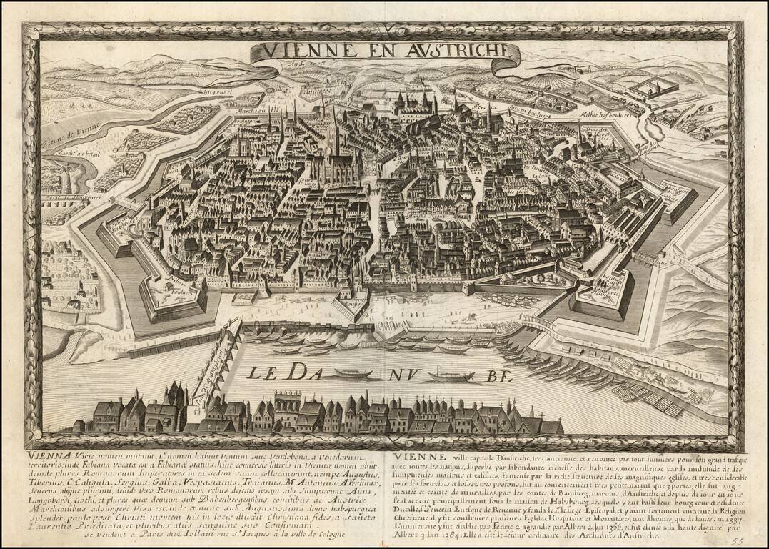
Fine early view of Vienna, published by Jollain in Paris. The view shows Vienna from across the Danube, looking westward. All Jollain views are rare on the market.
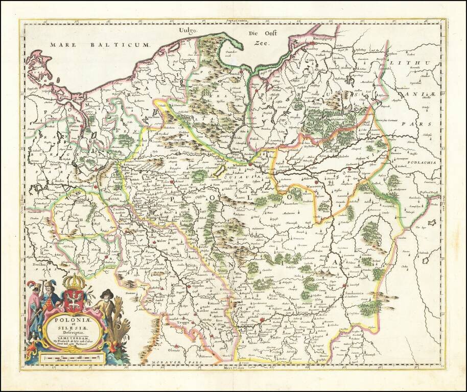
Fine example of De Wit's rare map of Poland and Silesia, extending north to the Baltic Sea. This is the second state, with "fo. 16" at the top right corner. This the second example of the map we have offered in more than 20 years.
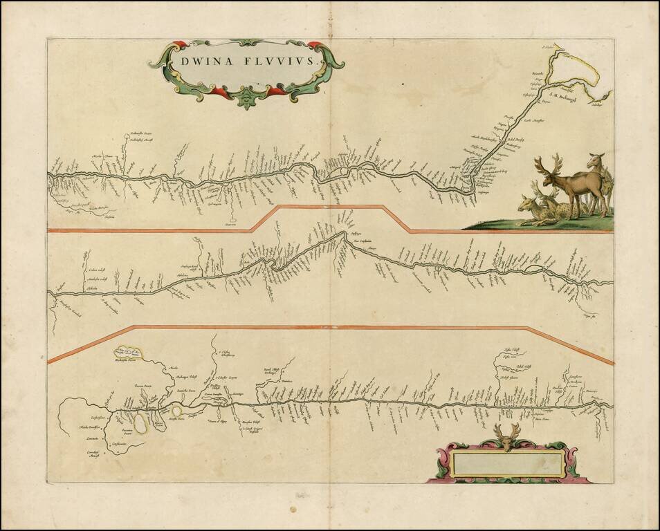
Rare late edition of Blaeu's map showing the course of the Dvina River in three separatre panels. The headwaters are at bottom left, with the mouth at Archangelsk at upper right. The map is decorated with a superb title cartouche surrounded by putti...
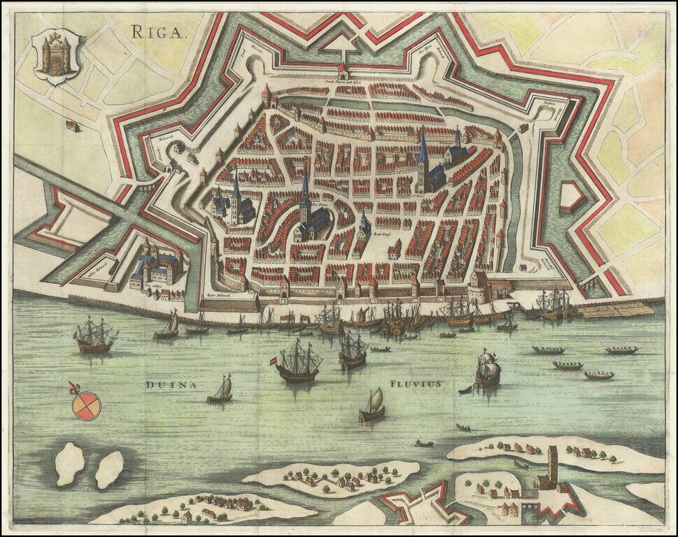
Gorgeous early plan of Riga, including coat of arms and sailing ships in the harbor. The map shows the town plan and the Duina River, with several places identified by name. Jansson's plan appeared in two different publications, Jansson's rare 6...
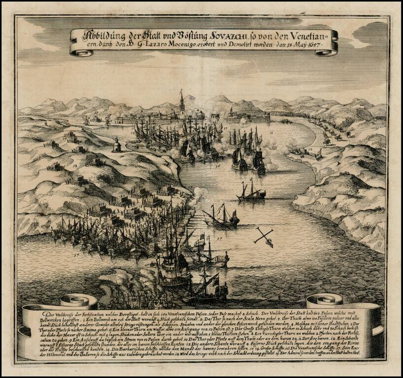
Early battle scene of the attack on Split on the Adriatic coast, on May 18, 1657. The bay is filled with ships shrouded in clouds of smoke and armies are shown throughout the countryside. German text explanation in banner at bottom.

Antique engraved map of the parts of Bosnia, Herzegovina, and Serbia that fall along the route from Paris to Constantinople. The map explains the four ways to reach Constantinople from Paris. The roads from Ragusa (Dubrovnik) to Nisse and Belgrade to...
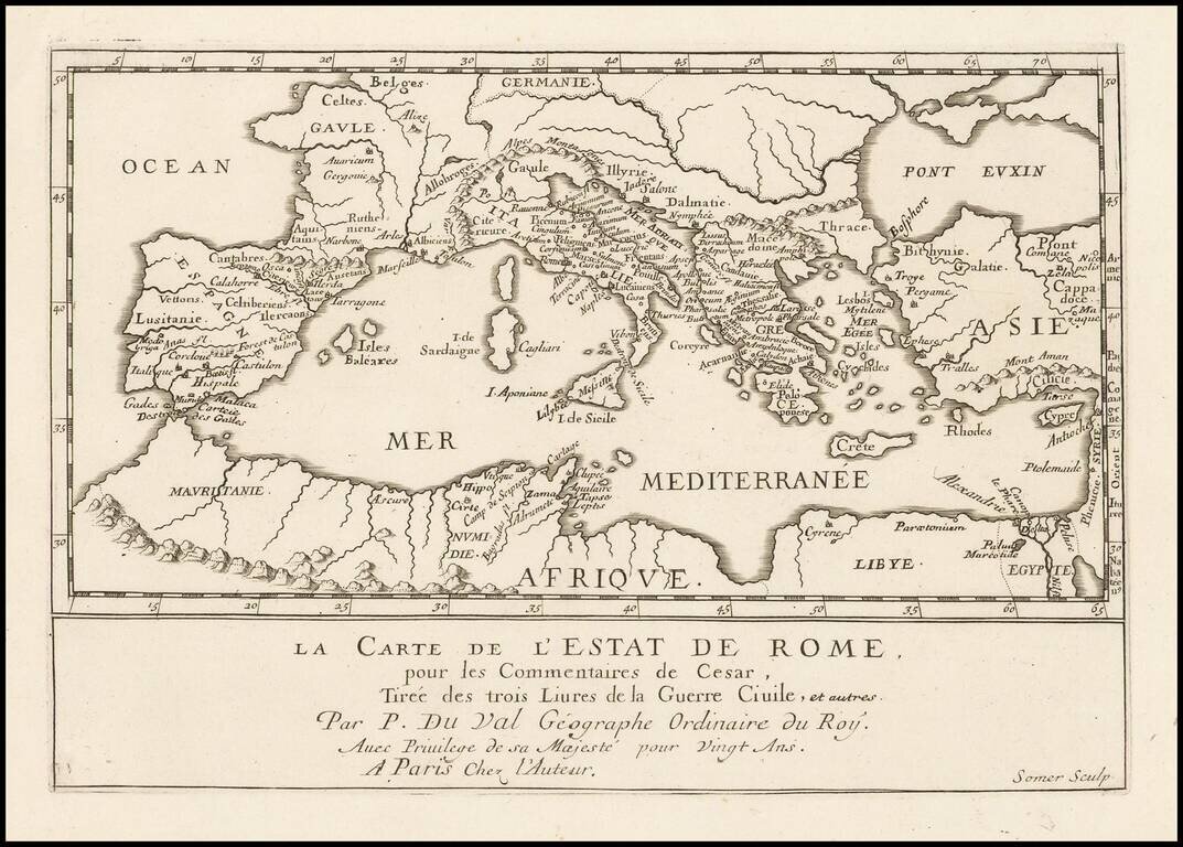
Antique engraved map of the Roman Empire, published by Pierre Duval in Paris in the 1660s. The map shows the important early Roman cities around the Mediterranean. According to the title, the map shows the State of Rome, from the Commentaries of...
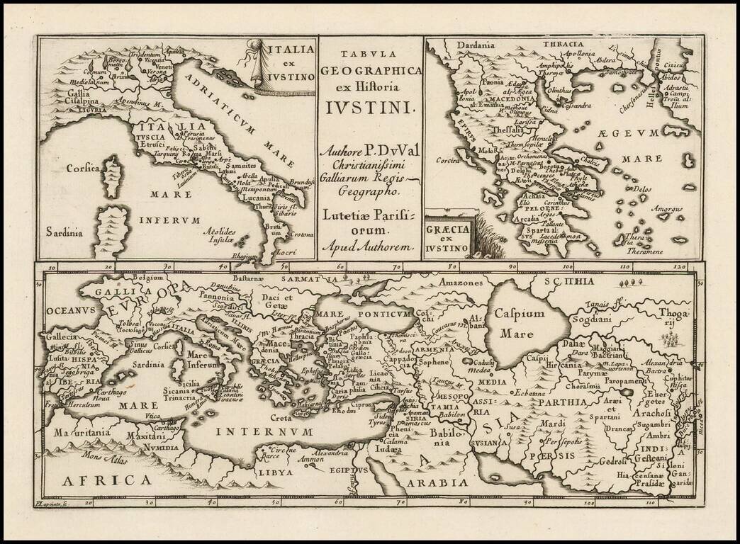
Antique engraved map of ancient Italy, Greece, Europe and the Middle East, after the writings of the Roman historian Justin.
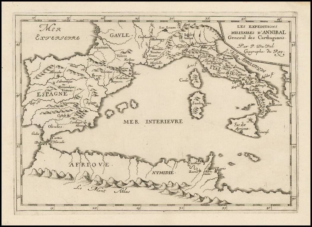
Antique engraved map of the military expedition of Hannibal, the Carthaginian general, published in Paris circa 1660 by Pierre Du Val. The map covers all of the western Mediterranean, with the most detail in Italy and Spain and a few locations in...

Finely engraved view of Pisa, originally published by Johannes Blaeu for Blaeu's town books of Italy. Includes a key at the bottom locating 97 places, including of course, the famous leaning tower of Pisa at the top center. The present example was...