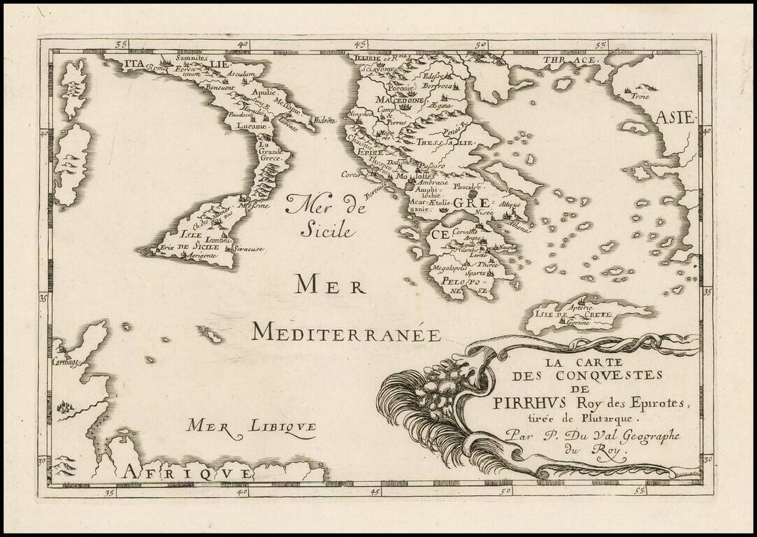
Antique engraved map of the conquests of Pyrrhus of Epirus, covering Greece, Southern Italy, and Sicily. The map was published in Paris in 1660 by Pierre Du Val.
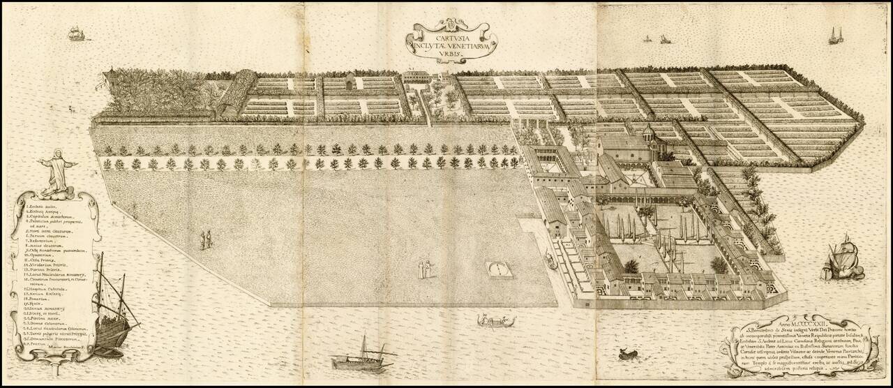
Fine example of this striking view of the island of Vignole and its Monastery, built in 1422. Fine bird's-eye view of the formerly famous monastery with all the gardens and greens, mostly demolished within the last 200 years. The view was engraved by...
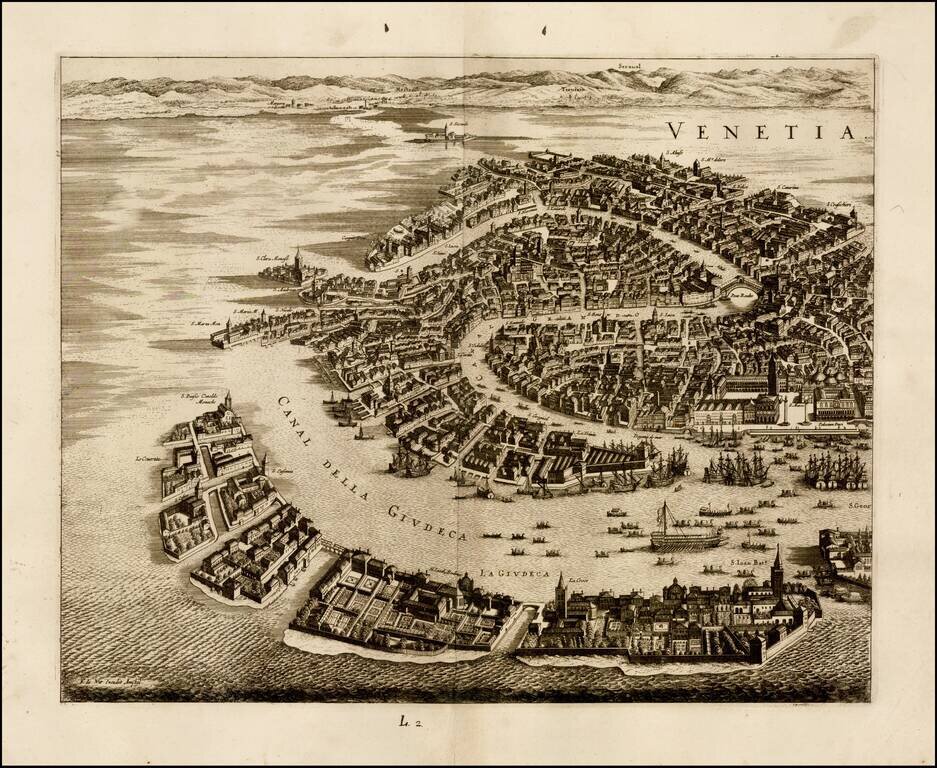
Fine dark example of the left half of this stunning view of Venice and environs, published in Amsterdam by Frederick De Wit. Shows the Grand Canal, Piazza San Marco, Ponte Rialto and other major landmarks.
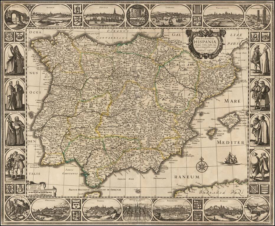
Rare separately issued map of the Iberian Peninsula, published in Amsterdam by Nicholas Visscher in 1660. The map is embellished with city views across the top: Madrid Sevilla Lisbon Valladolid Burgos Barcelona Toledo Granada At the...
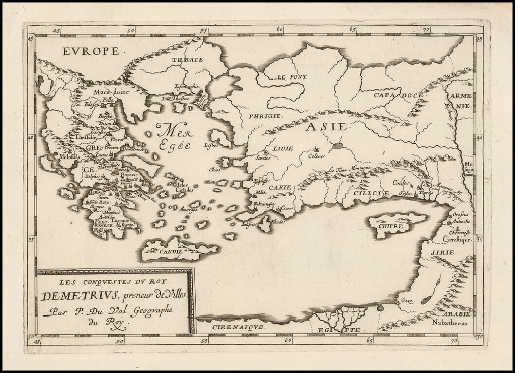
Antique map of the conquests of Demetrius I "Taker of Cities", published by Pierre Du Val in Paris, circa 1660.
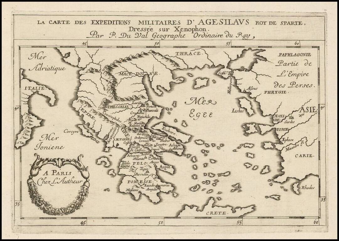
Antique engraved map of the military expeditions of Agesilaus II, as described by his friend the historian Xenophon. Agesilaus II was king of the Greek city-state of Sparta.
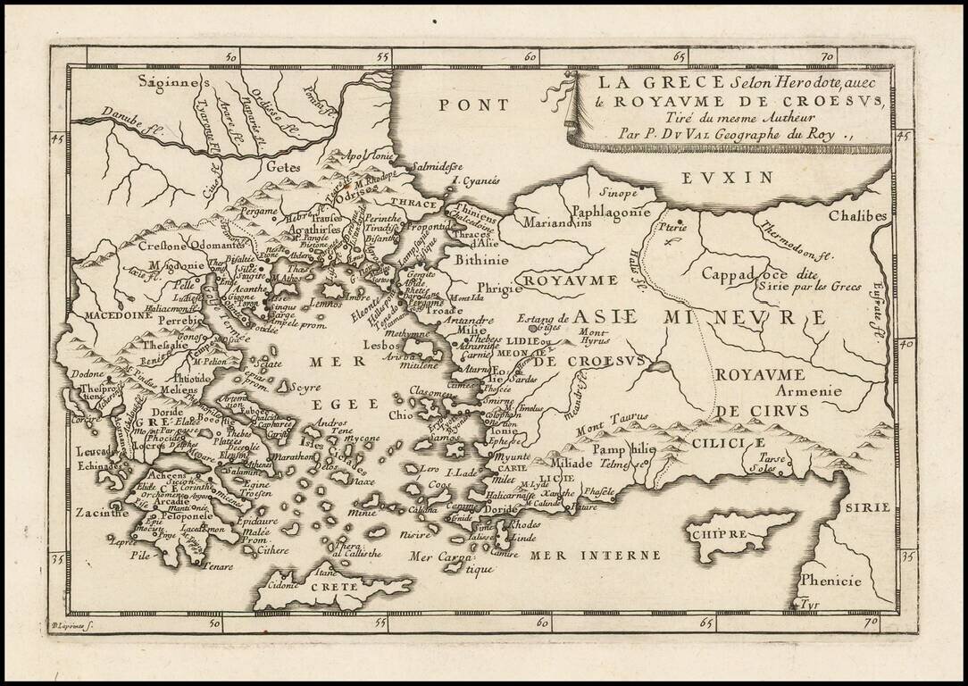
Antique engraved map of Greece and the Kingdom of Croesus (Lydia), after a description by Herodotus. The map was published in Paris by Pierre Du Val, probably around 1660.

Antique engraved map of the retreat of The Ten Thousand, published by Pierre Du Val in Paris around 1660. The Ten Thousand (Ancient Greek: οἱ Μύριοι, oi Myrioi) were a force of mercenary units, mainly Greeks, employed by Cyrus the Younger to...
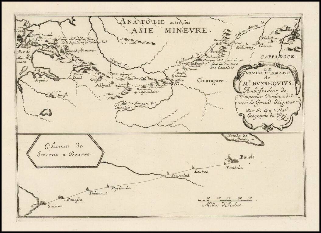
Antique engraved map of the route from Constantinople to Amasya in Turkey, and from Smyrna to Bourse. The route shown is that of Ogier Ghiselin de Busbecq, Ambassador for Ferdinand I of Austria.
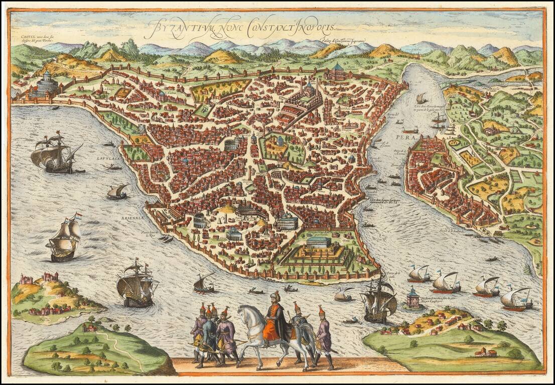
Rare map / birdseye view of Istanbul, from Jansson's monumental town book. Jansson's view is one of the finest and most sought-after views of Istanbul. Viewed from the village of Scutari, the City is shown with all its fortifications, the original...
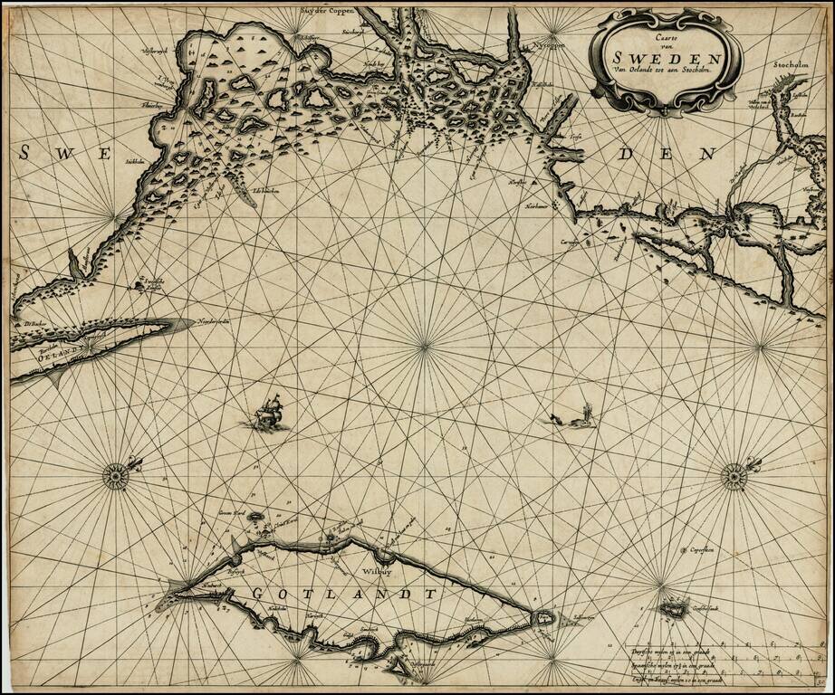
Dark impression of Goos' regional sea chart of Sweden, based upon an earlier chart by Jacobsz. The chart covers the coast of Sweden from Schenckenes and Oeland towards Stockholm, along with the island of Gotland. The chart includes the names of towns...
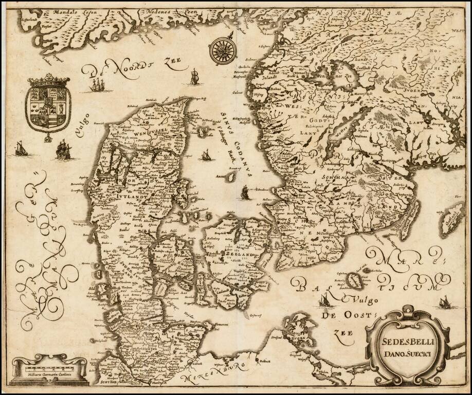
Interesting map of Scandinavia, illustrating the theater of the Second Northern War. In 1657, during the Second Northern War, Denmark launched a war of revenge against Sweden (then distracted in Poland), which turned into a complete disaster....
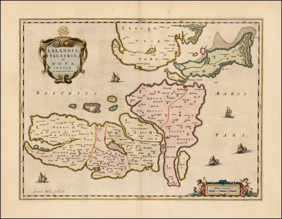
Scarce map of the Danish islands of Lolland, Falste and Mon, which first appeared in Blaeu's Atlas Maior. Also included are the southern portion of Zealand (Sjaelland), as well as the numerous adjacent smaller islands. The cities of Praesto,...
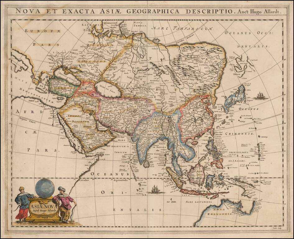
Rare Hugo Allard map of Asia and the north part of Australia. The map includes a nice representation of the Philippines. Korea is shown as a strangely shaped peninsula. China and the Great Wall are located. The depiction of Yedso, Comps. Landt and...
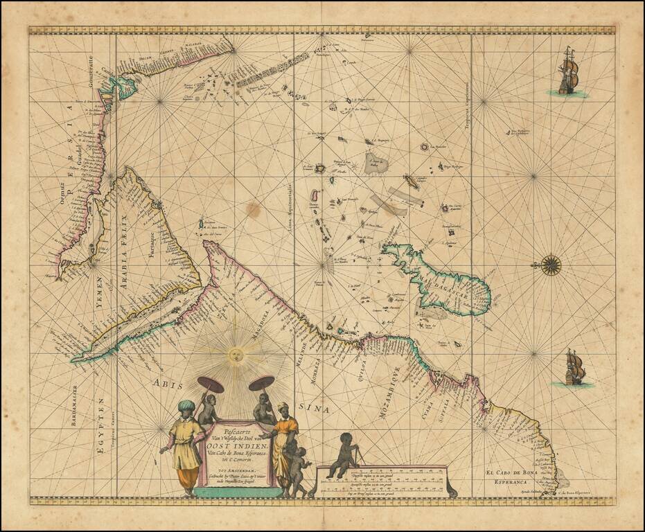
Charting the Western Indian Ocean Decorative sea chart of the Indian Ocean, orientated with the north to the left. The highly decorative chart shows the East African coast, Arabia, Madagascar and the islands of the Indian Ocean with the Seychelles...
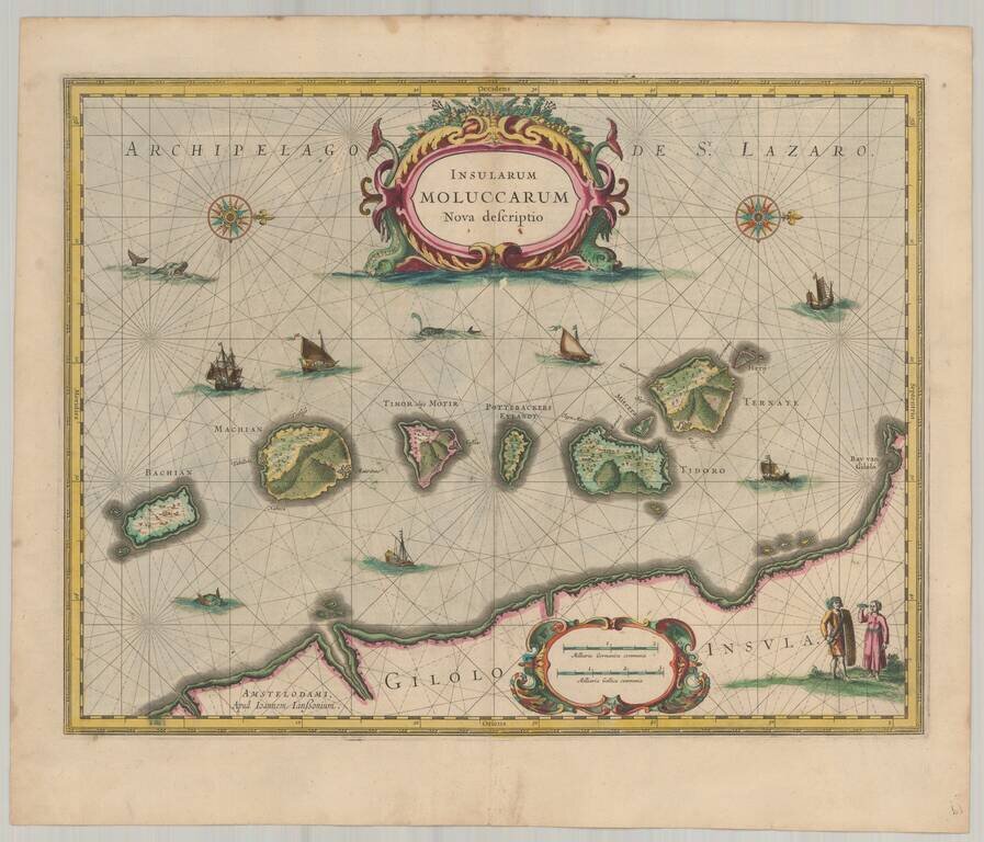
Old color example of Jansson's important and highly decorative map of the Spice Islands. The map features a Moluccan couple in the lower right corner in Europeanized native dress. Indicative of the area's commercial importance, Jansson has filled the...