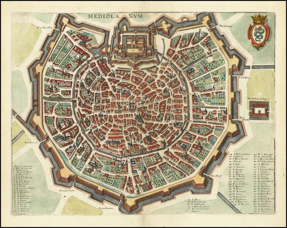
A detailed town plan of Milan, showing the fortified walls, city gates, inner ring and important public buildings, squares, and much more. A key names seventy three places of interest. The coat of arms of the Visconti, once rulers of the city, is shown...
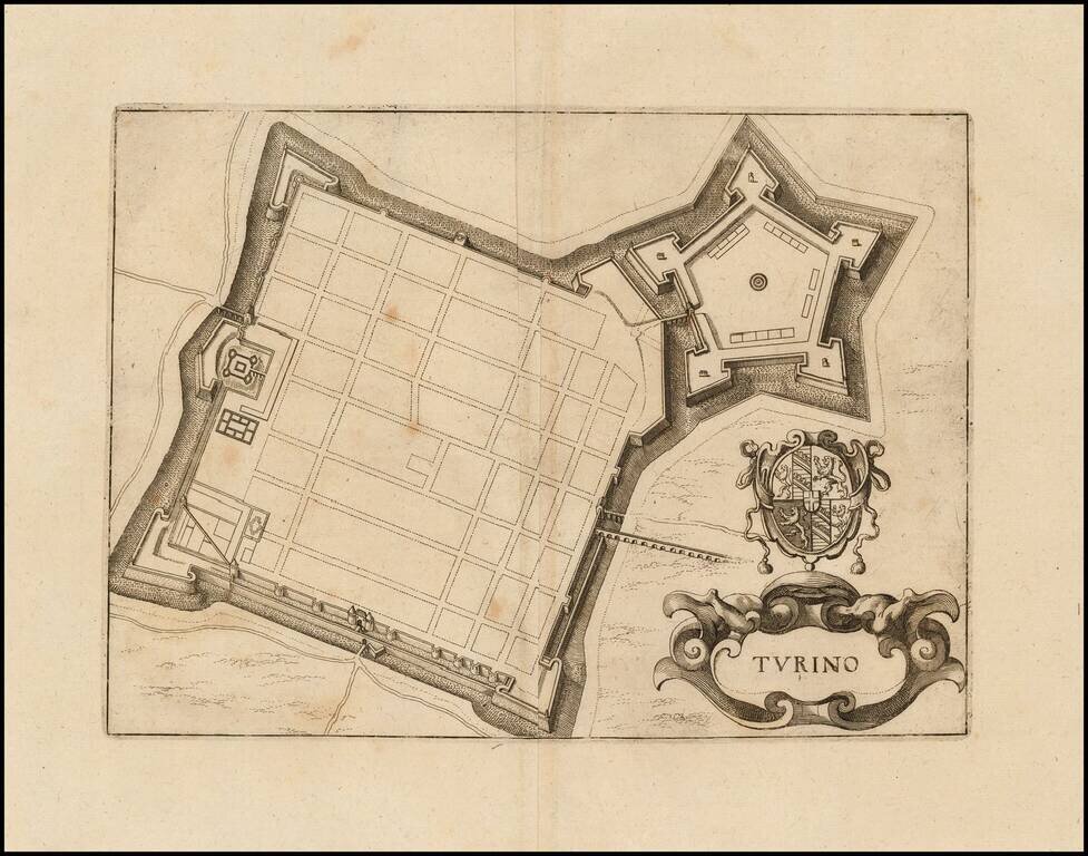
Detailed town plan of Torino, showing the fortified walls. Cartouche and coat of arms. Fine full color example.
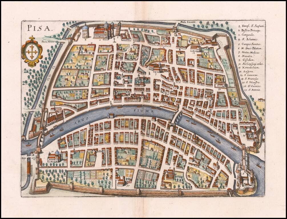
Detailed town plan of Pisa, showing the fortified walls, City Gates, major buildings, squares and streets. The Leaning Tower is #3 in the key of 16 locations. Includes a key naming 73 places. Coat of arms in upper right corner. Fine full color example.
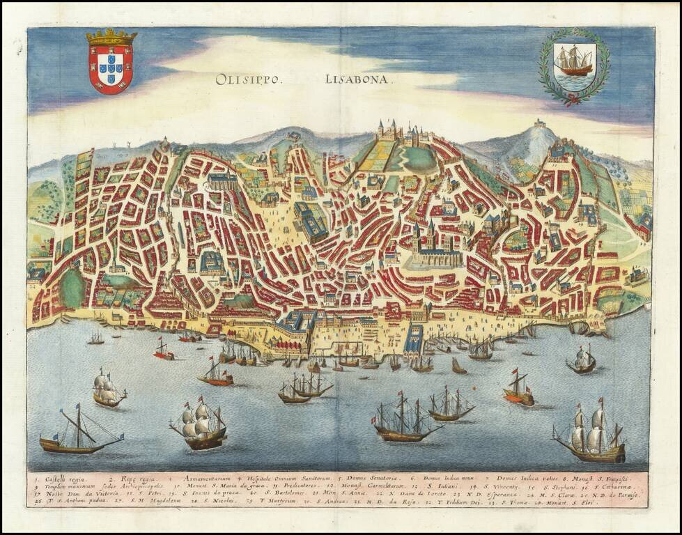
A detailed town plan of Lisbon, showing the town, harbor, fortified walls, canals, waterfront, and important public buildings, squares, and more. The map includes a key naming 34 places, including famous castles, churches, and other notable points in...
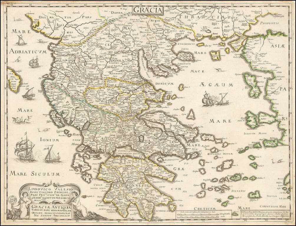
Tavernier and Sanson double-page engraved map of ancient Greece.
![Natolia, quae olim Asia Minor [shows Cyprus]](/map/small/40634.jpg)
Jan Jansson's decorative engraved map of Asia Minor, showing Turkey, Cyprus, and the Islands in the Aegean. This attractive map shows all of Turkey, Cyprus and the Aegean Islands to a relatively high degree of accuracy. At the time the entire region...
![Turcicum Imperium. Turckiche Reich. Concordia res parvae crescunt Discordia maximae dilabuntur [shows Cyprus]](/map/small/68352.jpg)
Striking full color example of Merian's map of the Turkish Empire. Extends from Sicily and Italy in the West to the Black & Caspian Seas in the North and the Gulf of Aden, Red Sea and Saudi Arabia peninsula in the South.
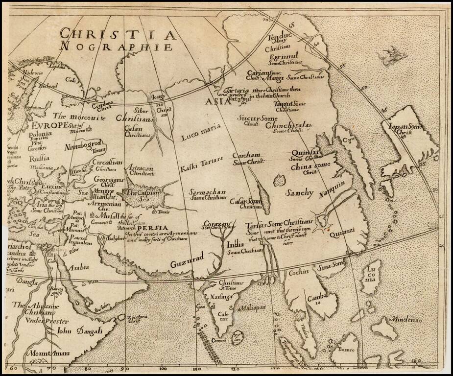
Rare map of Asia, from Ephraim Pagitt's Christianographie, or the Description . . . of the Christian World, not subject to the Pope, first published in London in 1635. The map shows Corea as an Island, and unusual projection for Japan and names Luzon...
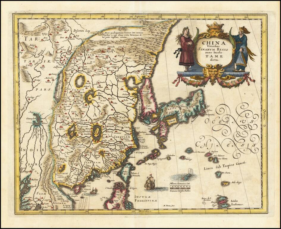
Decorative map of China, Japan and Korea and includes the north portion of the Philippines from Jansson's Novus Atlas. The map depicts the eastern part of China (bounded in the west by the Great Wall), Korea as an island and the three main islands of...
Decorative map of China, Japan, the Island of Korea, and the northern part of Luzon. Notes Pakan al I. Formosa Sailing ships and decorative cartouche. A very detailed and highly decorative map, based upon Blaeu's map of the same title.
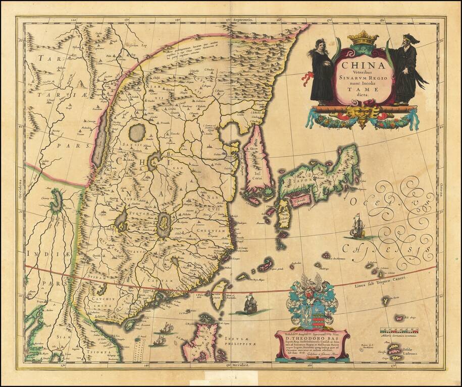
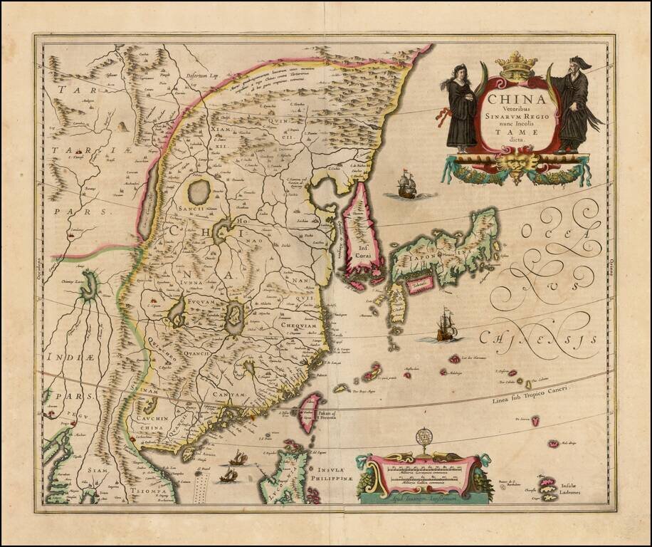
Blaeu's First Map of China Decorative map of China, Japan, Korea and including the north portion of the Philippines. The map depicts the eastern part of China (bounded in the west by the Great Wall), Korea as an island, and the three main islands of...
![Iaponiae Nova Descriptio [Korea as an island]](/map/small/56910.jpg)
Jansson’s Early Map of Japan, Showing Korea as an Island Fine example of one of the earliest European atlas maps of Japan, which also shows Korea as an island. The Jansson Japan is a delicate and skilled reworking of the Mercator-Hondius atlas map...
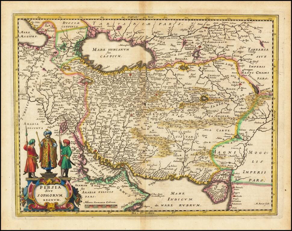
The Persian Empire in the 17th Century Decorative map of Persia extending from Saudi Arabia and Turkey to the Indus River, centered on Persia, with the Red Sea and the Persian Gulf in the South and Caspian and Tartaria in the North. A very detailed...
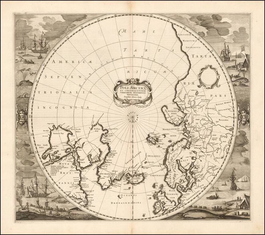
Striking example of Henricus Hondius' map of the North Polar Regions, first issued in 1636. With the advances in the knowledge of the Arctic, Mercator's map of 1595 had become obsolete by the 1630s. Hondius drew on the cartography of Henry Briggs for...
![[Title Page] Des Niewen Atlas Aenhang. . . 1644](/map/small/29096.jpg)
Striking old color example of the title page from Jansson's Atas Novus, first published in 1636. Marvelous ornate coat of arms. Title pages are increasing collected. Noteworthy cartographic historians, including R.V. Tooley, collected 16th-18th...