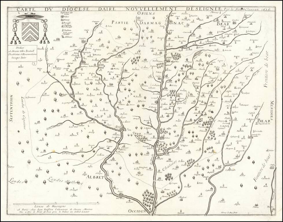
Jean Boisseau's First Map! Rare map of the Diocese of Aire, printed in Paris in 1635. The map is oriented with east at the top, breaking the course of the Leie River and its tributaries. All of Boisseau's maps are rare. As noted in Mapforum.com...
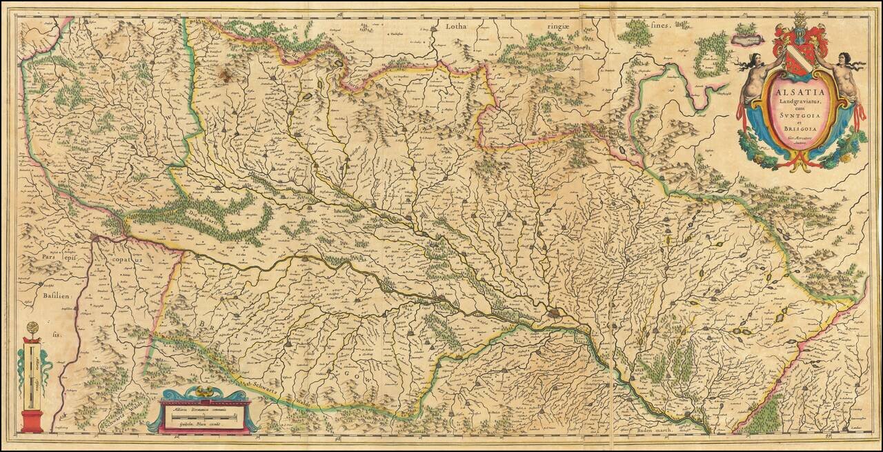
Large antique engraved map of the Alsace Region, focusing on the cities of Basel and Strasbourg. The map was published by Willem Janszoon Blaeu, based on a map by Gerard Mercator. This folding map is larger than the typical double-page folio map that...
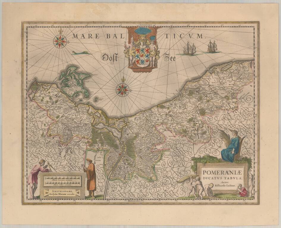
Blaeu's map of Pomerania. Decorative map of the area of Pomerania, in present day eastern Germany and Poland with considerable detail. An elaborate coat of arms of Pomerania is at the top center. A mileage scale, in German and French miles, is at the...
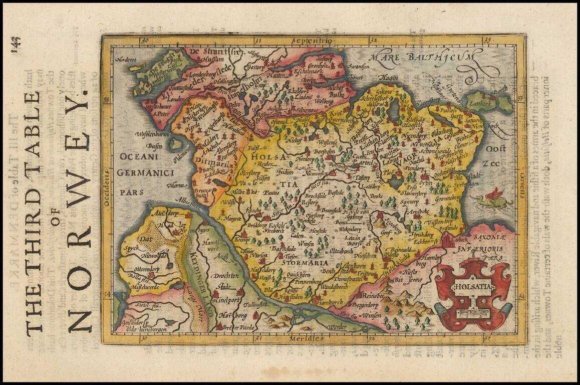
Decorative regional map of Northern Germany and part of Denmark (then Norway), showing Hamburg, Lubeck, etc. Decorative cartouche and a sea monster in the Baltic. From an English Edition of the Mercator-Hondius Atlas.
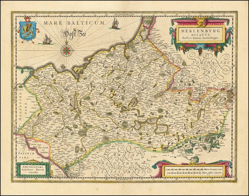
Beautiful example of Willem Janszoon Blaeu's map of the Dukedom of Mecklenburg in northern Germany on the Baltic Sea. Includes the cities of Rostock, Schwerin, Wismar, and Lake Muritz.
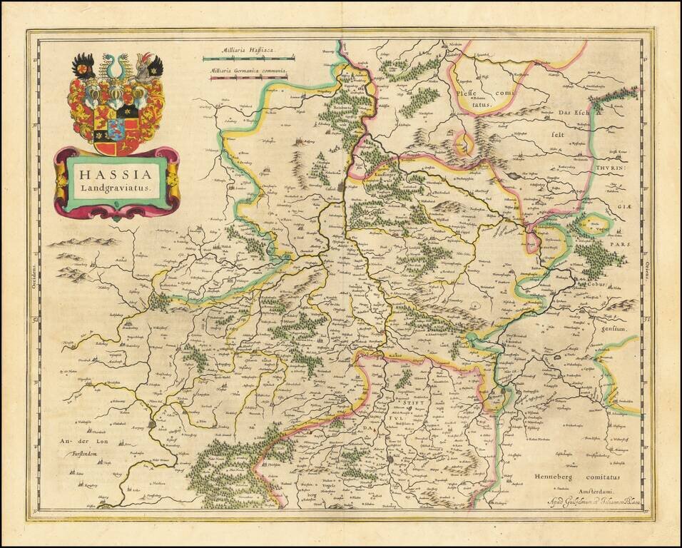
Antique engraved map of the Hesse region in Germany by Willem Janszoon Blaeu.
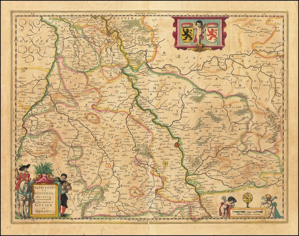
Antique engraved Blaeu map of the Duchies of Julich and Berg on the Rhine River. The city of Cologne is shown. Has the coats of arms of the two cities in the upper right corner.
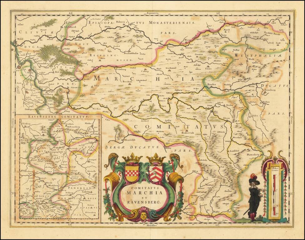
Fine old color example of Blaeu's map of Marchia and Ravensberg.
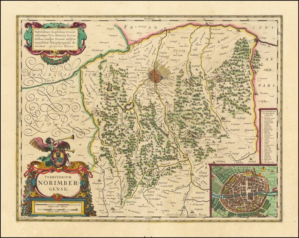
Attractive antique engraved map of the area around Nuremberg, Germany, with a nice inset of the city. Published by Blaeu in Amsterdam.
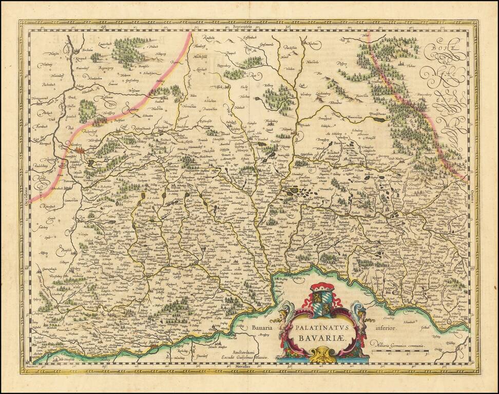
Decorative regional map of the Palatinate of Germany, from the Danube and north, including Nuremberg. Decorative cartouche with coat of arms.
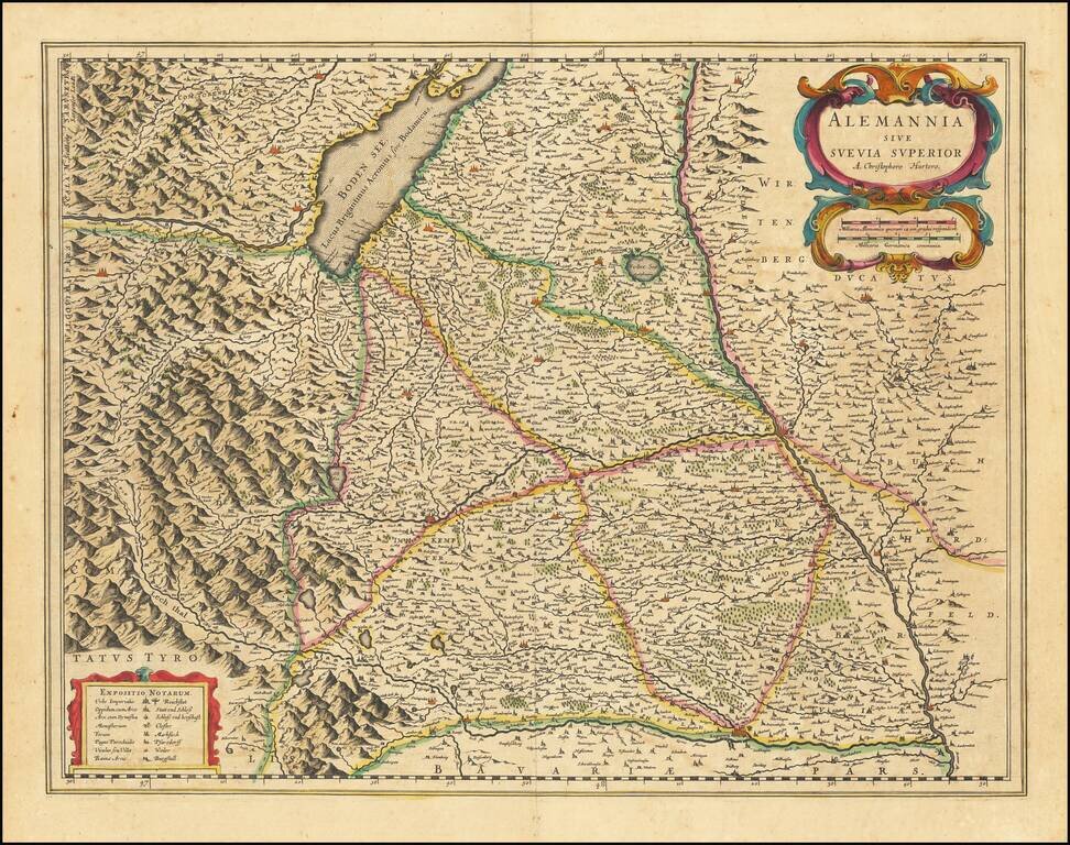
Antique engraved map of southwestern Bavaria, showing Augsburg and Ulm, as well as the Boden See. Shows the mountains of the Alps, local towns and villages, political boundaries, etc.
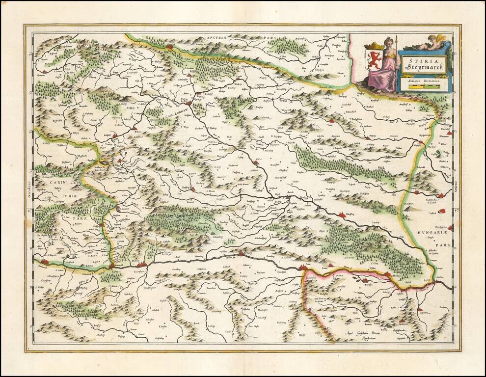
Detailed map of Stiria, published by Willem Blaeu. The map tracks the region north of the Drava River. Major cities include Gratz, Voitsberg, Bruck an der Mur, Kapfenberg, Leoben, Kobenz, Knittelfeld, Obdach, Kreiglach,
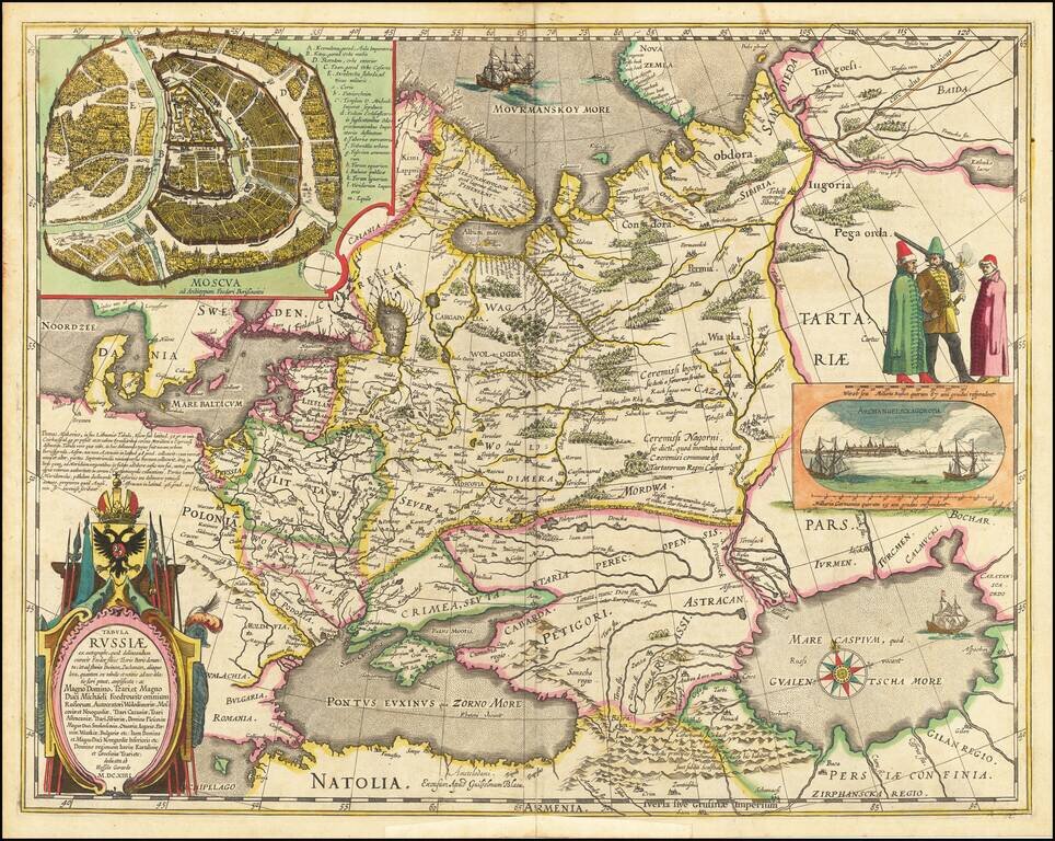
Decorative hand-colored example of Hessel Gerritsz's map of Russia, with the large inset of Moscow and plan of Archangelsckagoroda. Hessel Gerritsz's map of Russia, first issued 1613, was published by Blaeu after he acquired the plate following...
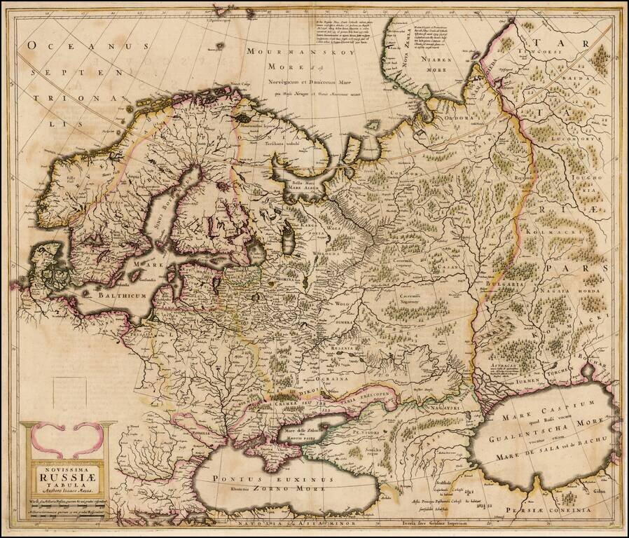
Old color example of the rare English language edition of the Mercator-Hondius map of the Russian Empire and Scandinavia . The present example of the map is a proof state. In the following year, the map would be finished, with 5 costumed figures and a...
![[Ukraine / Dniepr River] Lectori S. Hunc Borysthenis tractum ut ad nostrum Geographiae tabulam . . .](/map/small/63932op.jpg)
Striking 2-sheet map of the Dniepr River, engraved by Hessel Gerritzs. The map was originally issued as the eastern part of Blaeu's 6-sheet wall map of Lithuania. The map shows the course of the Dnieper River from Cherkasy to the estuary on the Black...
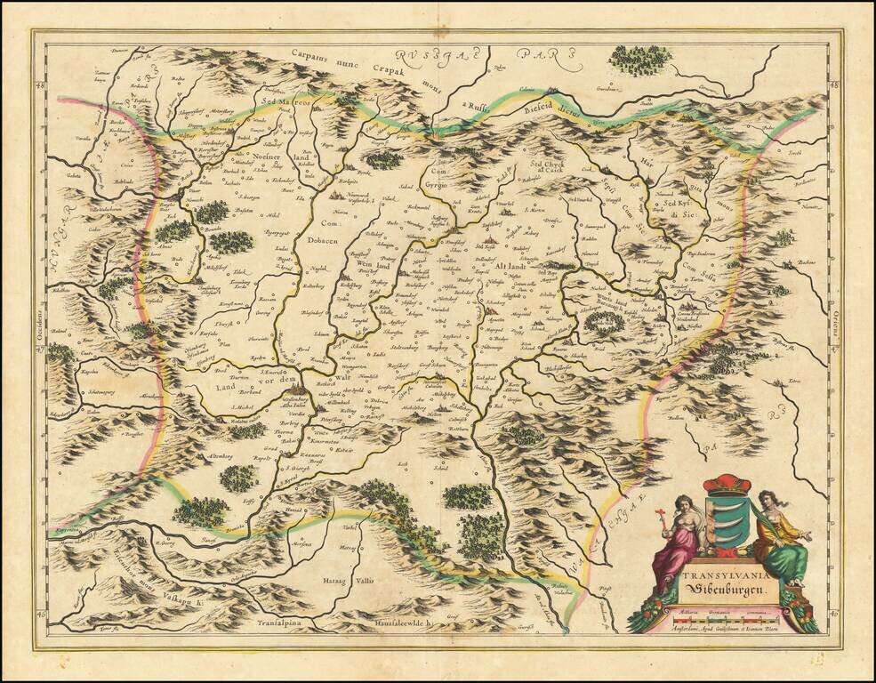
Fine old colored example of Blaeu's map of Transylvania and Sibenberg, first issued by Blaeu in 1634. Includes decorative cartouche and coat of arms.