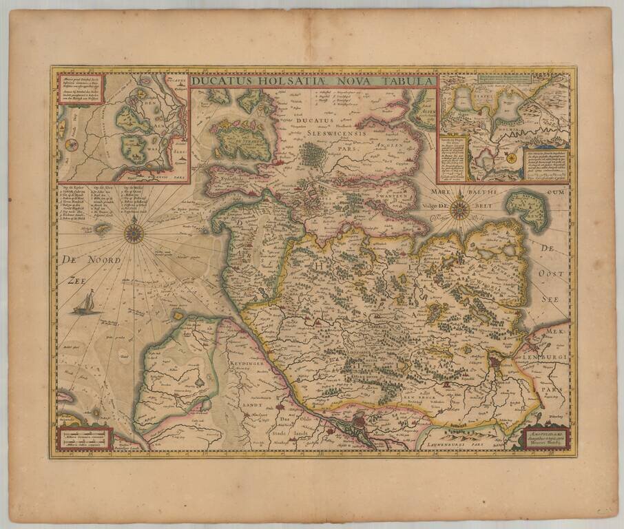
Old color example of Henricus Hondius' map of the Duchy of Holstein. Includes 2 large inset maps. Extends to Hamburg, Lubeck, Kiel, etc.
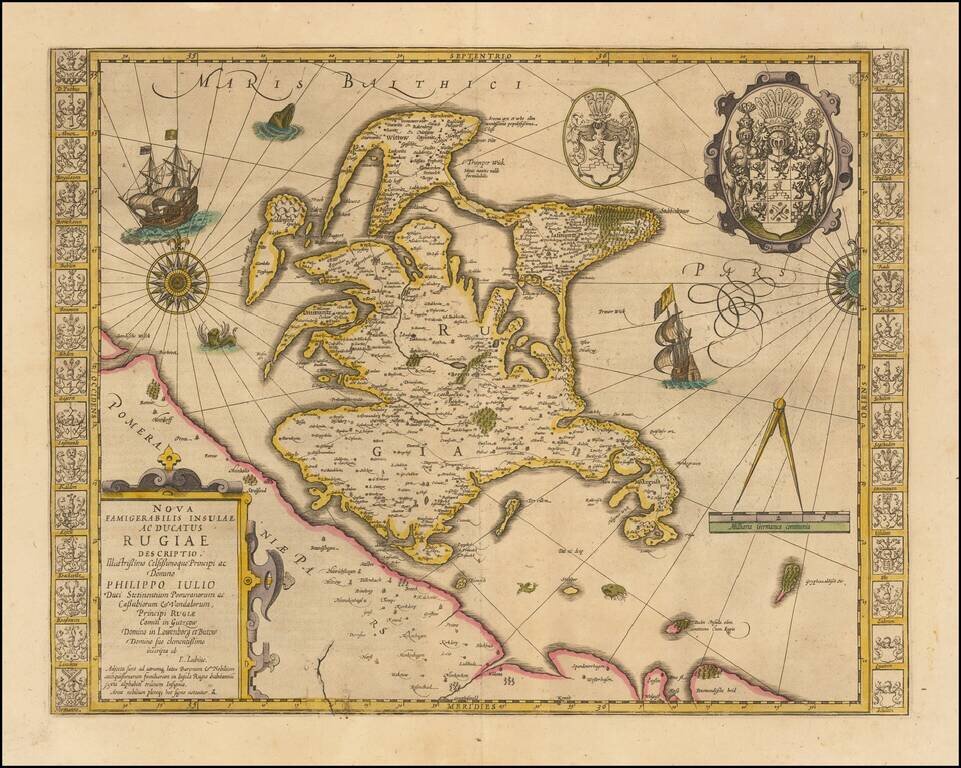
Striking hand-colored example of this decorative map, including two compass roses, sailing ships, sea monsters and massive coat of arms, plus the smaller coat of arms along both side borders, filled with the coats of arms of the island's leading...
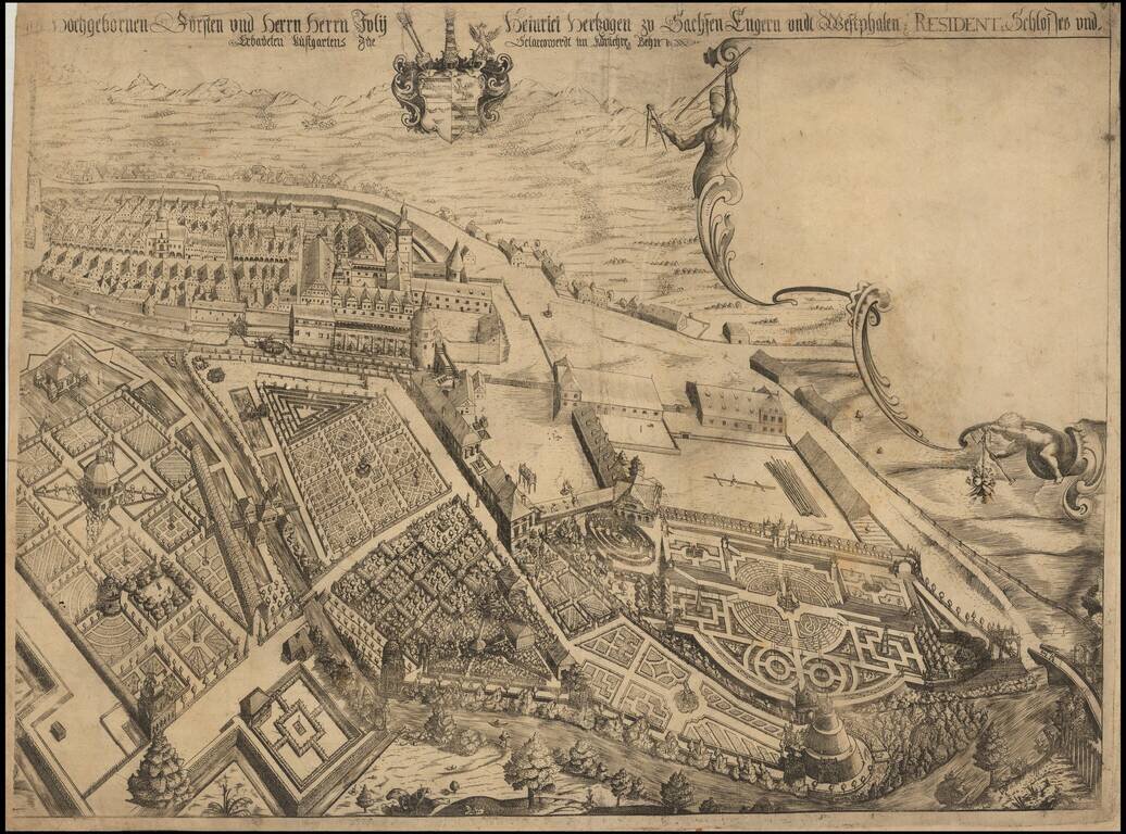
Rare separately published view of Ostrov nad Ohrí (German Schlackenwerth), in northwest Bohemia. We have not been able to locate an example of this view, but we have identified a smaller contemporary view by Merian, which suggests that a portion of...

Nice old color example of Jansson's second map of Istria, with east oriented at the top. Jansson's map is based upon Magini's map of 1620, which appeared in his atlas of Italy, the first modern atlas to focus on Italy. Shows the Istria peninsula,...
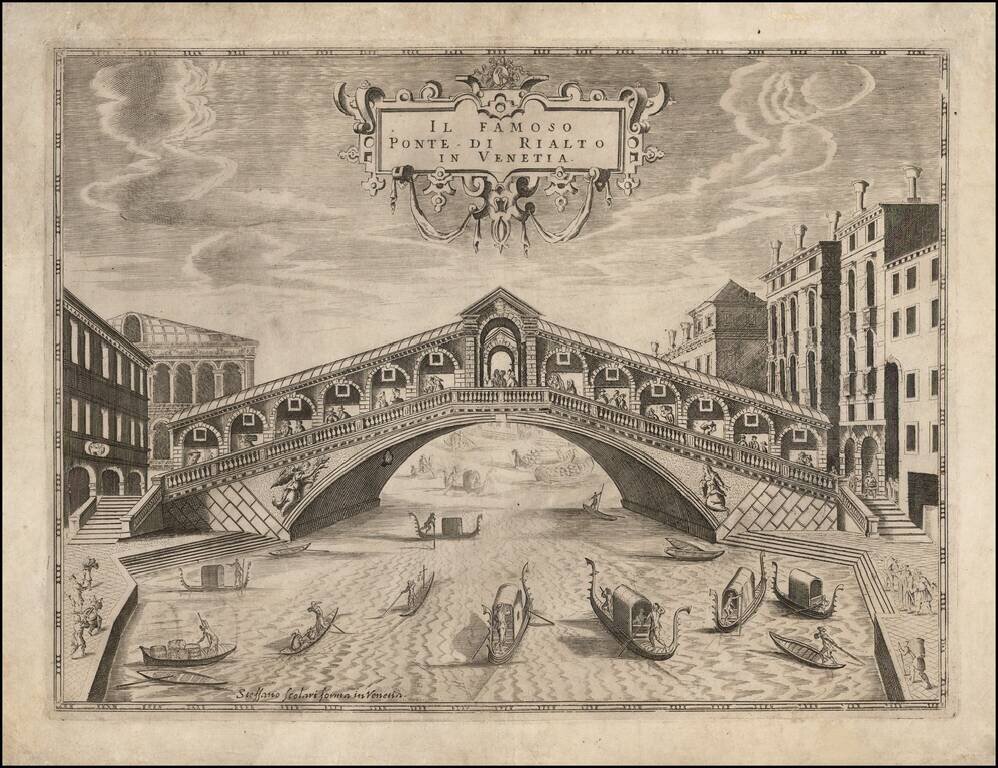
Rare view of the Rialto Bridge, one of the most famous bridges in Venice. The Rialto Bridge is one of the earliest bridges in Venice. The first dry crossing of the Grand Canal was a pontoon bridge built in 1181 by Nicolò Barattieri. It was called the...
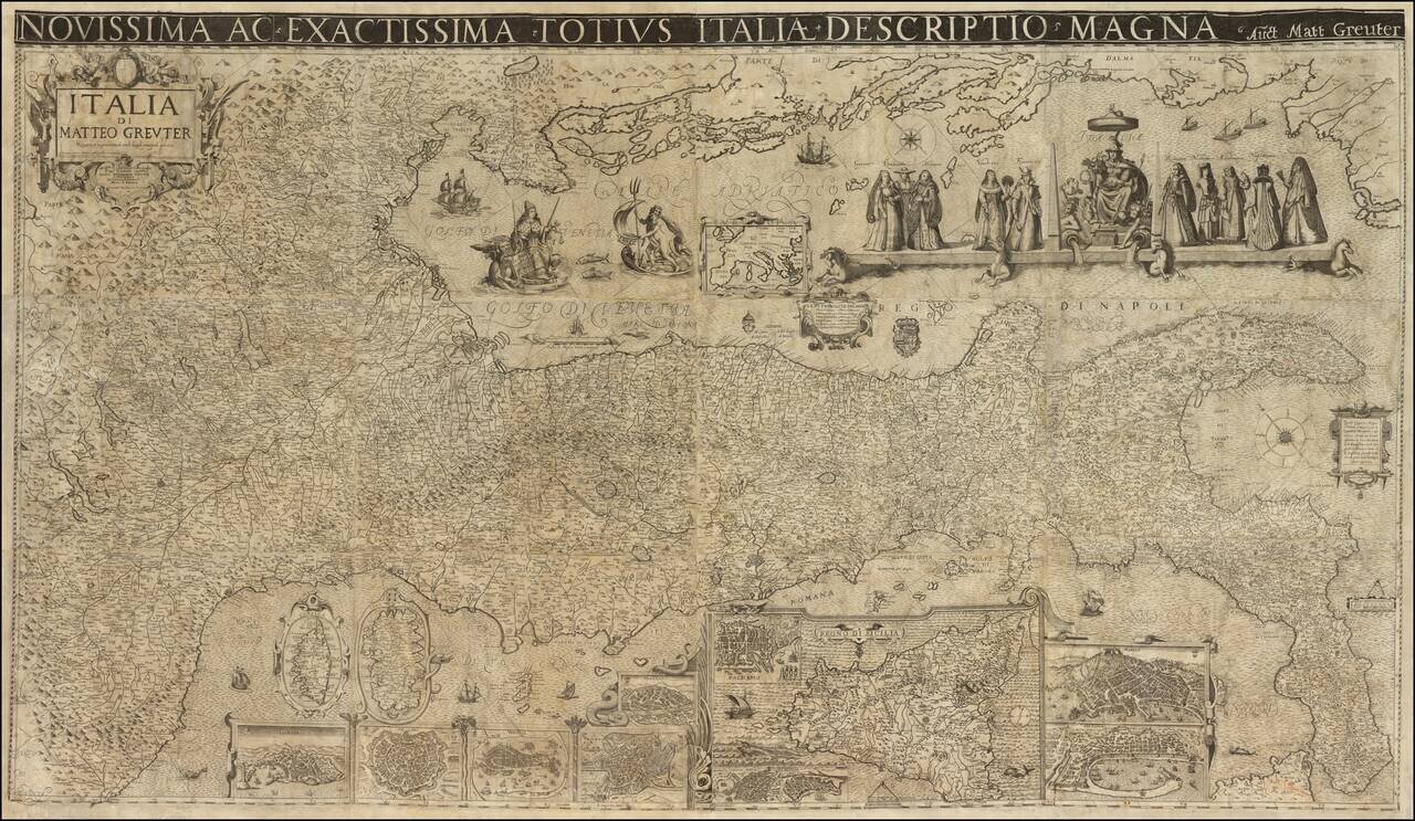
A Landmark Seventeenth-Century Wall Map of Italy Spectacular 12-sheet map of Italy, first published by Matteo Greuter in Rome in 1630 and offered here in its second publication, by Stefano Scolari in Venice in 1657. At the time of its publication,...
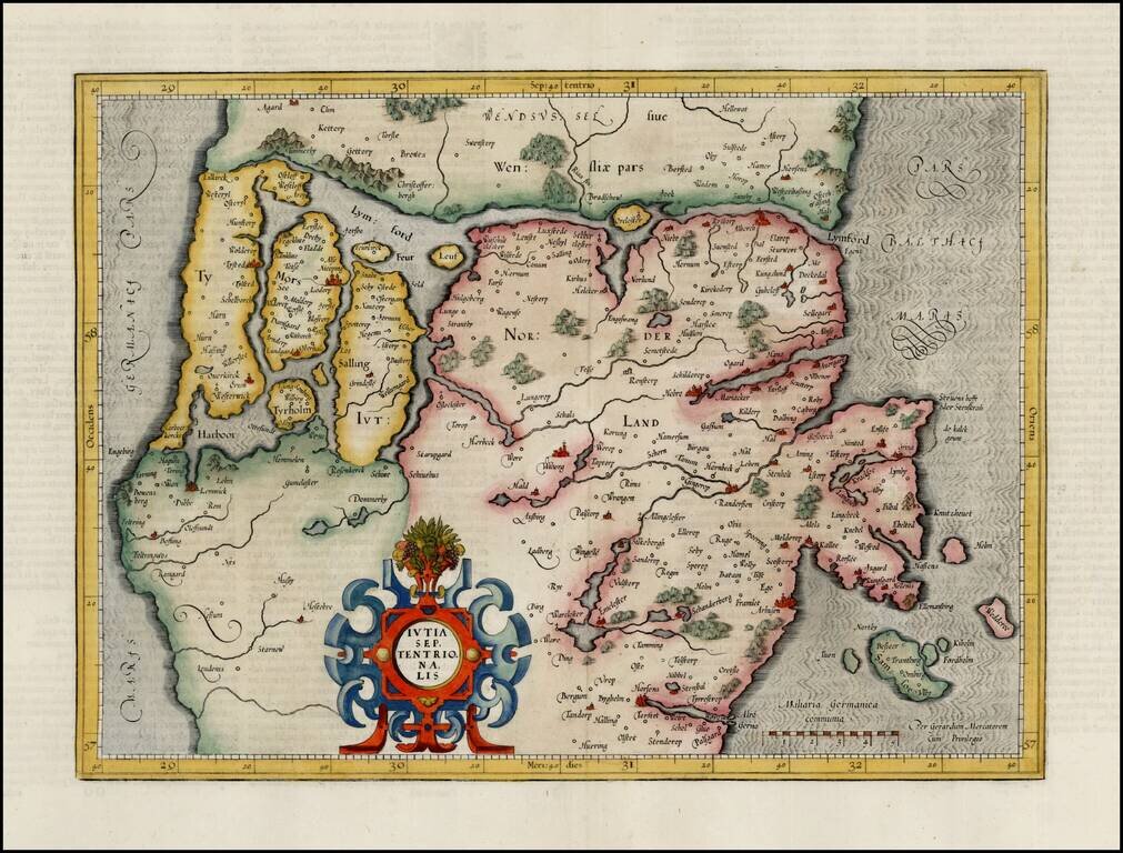
Fine full color example of Mercator's map of the northern part of Jutland, from the first edition of his Atlas Sive Cosmographia.
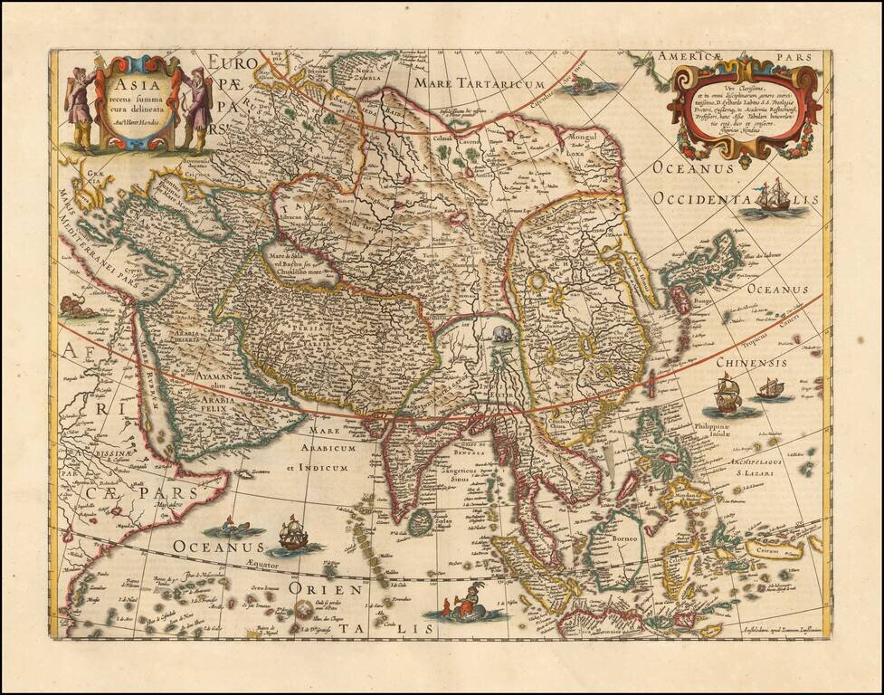
Striking Map of Asia from the Dutch Golden Age of Cartography Fine example of Henricus Hondius’ map of Asia, which appeared in the distinguished Mercator-Hondius atlas. The map encompasses the entirety of the continent, including the Arabian...
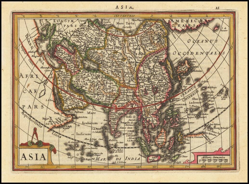
Striking example of this interesting map of Asia, from the Mercator-Hondius Atlas Minor. Includes Corea as an island, early depiction of the Philippines Islands and the land bridge to North America.
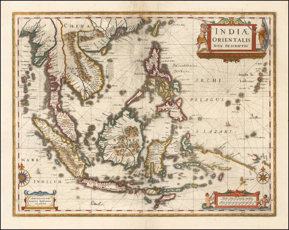
Important early map of Southeast Asia and the Philippines as well as a landmark map in the mapping of Australia, first published by Jan Jansson in 1630. The detail in the Philippines and Southeast Asia is excellent for the period. The map is perhaps...
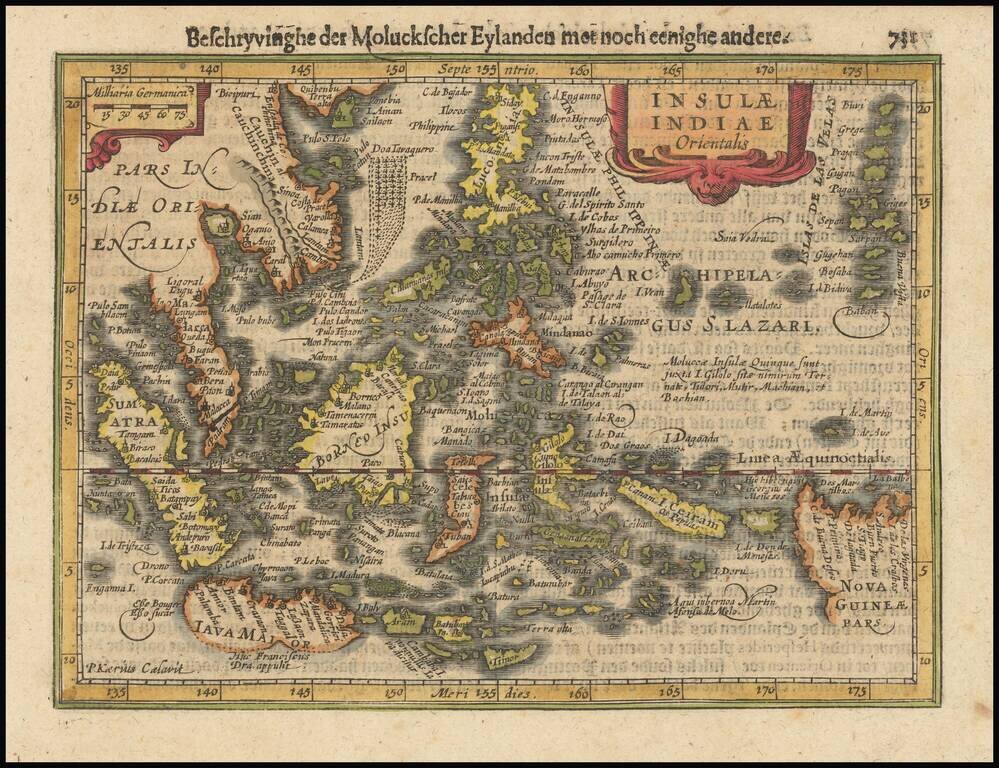
Fine example of Jansson's new map of Southeast Asia and the Philippines, which appeared in his Atlas Minor, first issued in 1628. Jansson has revised and significantly improved this regional map, which had been previously issued by Hondius in 1607,...
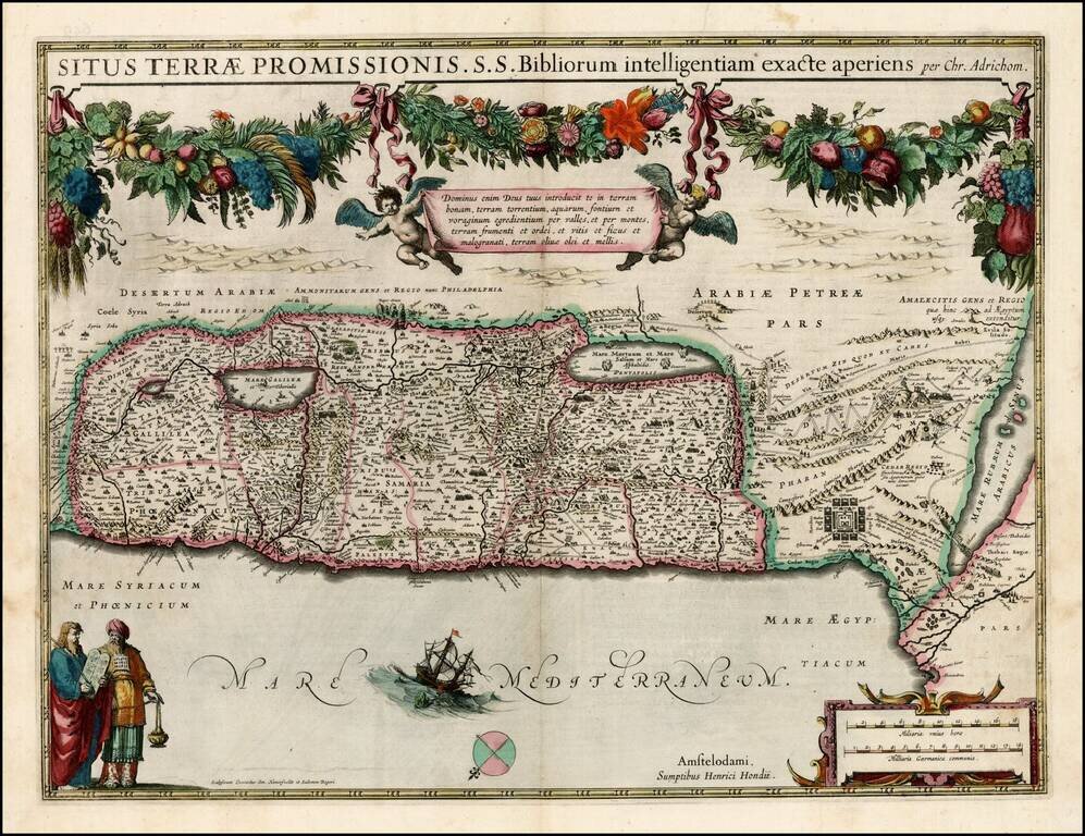
Early edition of Hondius' map of the Holy Land, based upon the report of Christian Van Andrichom, then the most influential holy land cartographer. The map was subsequently copied by Janssonius, who adds his imprint to the map sometime around 1645.
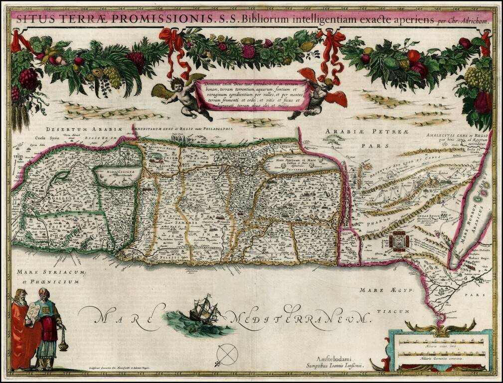
Fine old color example of Jansson's map of the Holy Land, based upon the report of Christian Van Andrichom, then the most influential holy land cartographer.
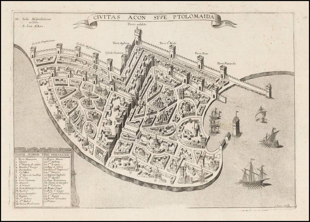
Extremely rare plan of Acre, based upon the Vesconte-Sanuto plan, intended to illustrate a period when the town was under the control of the Knights of St. John. Shows extensive fortifcations, town plan, buildings and a key identifying significant...
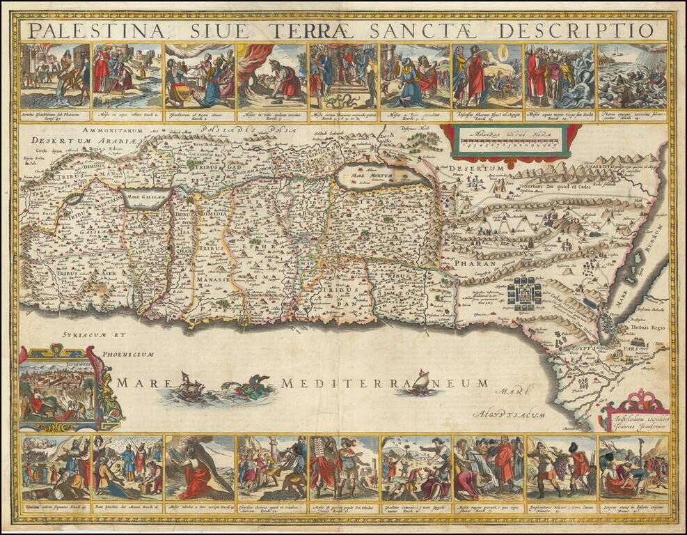
Finely colored and highly decorative map of the Holy Land, embellished with 18 decorative vignettes showing scenes of Moses from Exodus and a view of Jerusalem. Based upon Van Andrichom, the map is oriented to the East, divided into the tribes on both...