![(Siena, Corsica, etc.) Senensis Ditionis Accurata Descrip [and] Corsica [and] Marcha Anconae Olim Picenum. 1572](/map/small/44502.jpg)
Fine old color example of Ortelius' maps of Corsica, part of Tuscany and the Tuscan Sea (Siena, etc.) and the Ancona region, Ortelius' Theatrum Orbis Terrarum, the first modern atlas of the world.
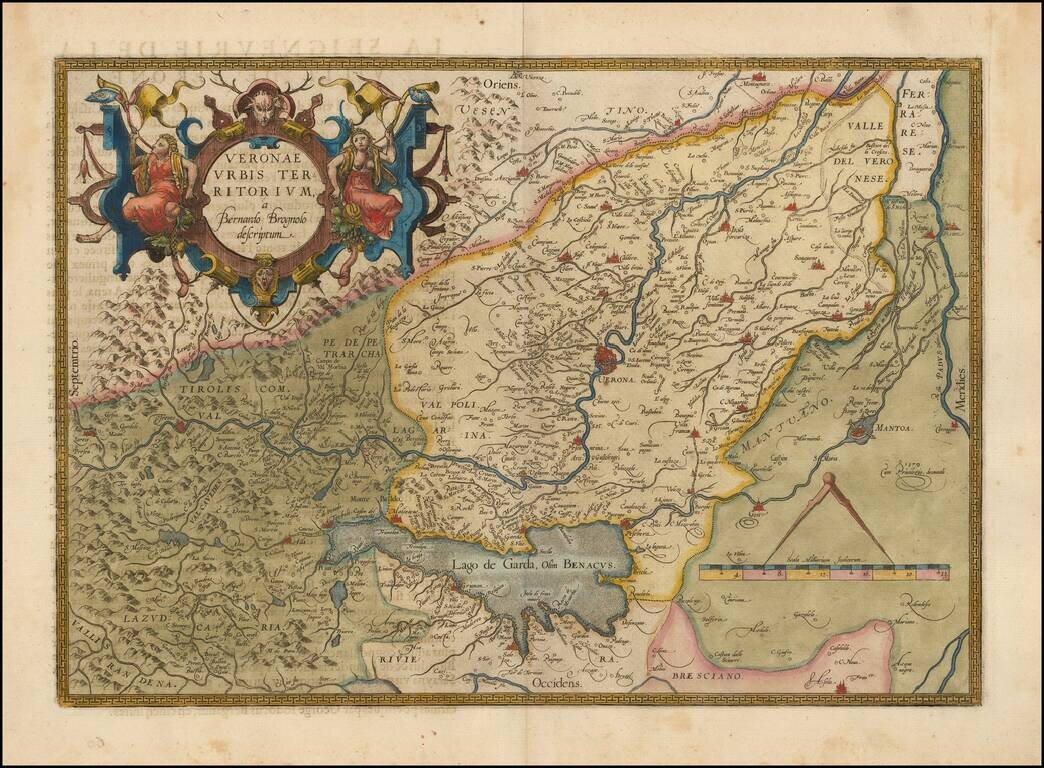
Decorative example of the Ortelius' map of Verona, based upon Brugnoli's map, which was issued by Forlani in Venice in 1574. The map appeared in Ortelius' Theatrum Orbis Terrarum, the first modern atlas of the world. Striking massive cartouche and...
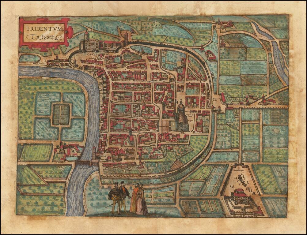
Fine early birdseye view of the Trento in Italy. From Braun & Hogenberg's Civitatus Orbis Terrarum, the most important book of town plans and views published in the 16th Century. The bird's-eye plan shows Trento on the Adige with its surrounding...
![[Bunting's Map of the Mediterranean Region]](/map/small/55211.jpg)
Map of the Mediterranean region, from Heinrich Bunting's Itinerarium Saccrae Scripturae first published in 1581. T he map shows the Eastern Mediterreanean, including Sicily, Malta, Cyprus, Rome, the Holy Land, Alexandria, the southern Black Sea,...
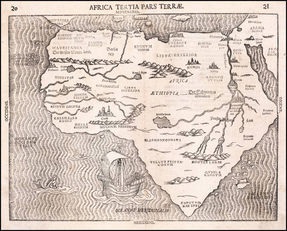
Fine Map of the African Continent, Based on the First Modern Map of Africa Nice example of Heinrich Bunting's scarce map of Africa, from his Itinerarium Sacræ Scripturæ. It is based on the first modern map of Africa, which featured in Sebastian...