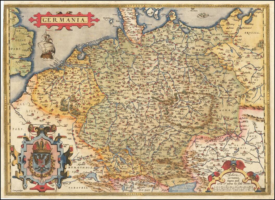
Fine old example of Ortelius' map of the German Empire, from his Theatrum Orbis Terrarum, the first modern atlas of the world. The map extends from The English Channel to the Baltic, the Vistula and Poland in the northeast, Budapest, Venice and the...
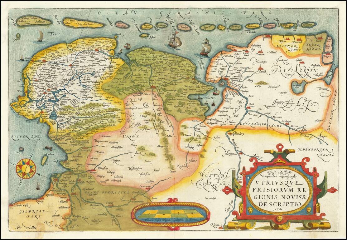
A nice old color example of Ortelius' map of Friesland, including a larger compass rose, sailing ships and an elaborate cartouche. The map appeared in Ortelius' Theatrum Orbis Terrarum, the first modern Atlas, first issued in 1584.
![Cyprus Insula [with] Candia, Olim Creta](/map/small/65746.jpg)
Striking example of Ortelius' first map of Cyprus and Crete, from Ortelius' Theatrum Orbis Terrarum, the first modern atlas of the World. The map is based upon earlier maps by Bordone (1528) and Camocio (1564). During the time of the map's creation,...
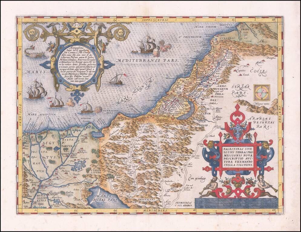
A nice example of Ortelius' map of the Holy Land, from his Theatrum Orbis Terrarum, the first modern atlas. The map shows all of the Holy Lands with Egypt. In the upper left is a text box describing the region. In the bottom right is a fine title...
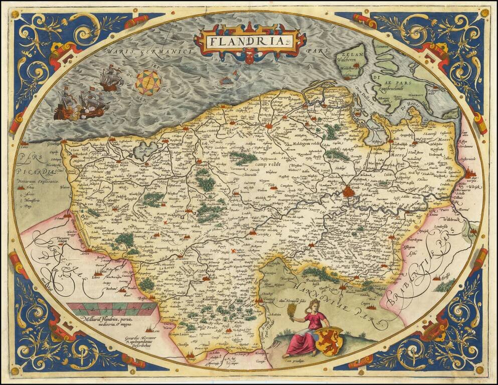
A nice example of Ortelius's second map of Flanders, from the 1584 Latin edition of his Theatrum Orbis Terrarum, the first modern atlas of the world. The map is executed inside of a decorative strapwork egg-shaped border and is one of the most...