The United States Office of the Coast Survey began in 1807, when Thomas Jefferson founded the Survey of the Coast. However, the fledgling office was plagued by the War of 1812 and disagreements over whether it should be civilian or military controlled. The entity was re-founded in 1832 with Ferdinand Rudolph Hassler as its superintendent. Although a civilian agency, many military officers served the office; army officers tended to perform the topographic surveys, while naval officers conducted the hydrographic work.
The Survey’s history was greatly affected by larger events in American history. During the Civil War, while the agency was led by Alexander Dallas Bache (Benjamin Franklin’s grandson), the Survey provided the Union army with charts. Survey personnel accompanied blockading squadrons in the field, making new charts in the process.
After the Civil War, as the country was settled, the Coast Survey sent parties to make new maps, employing scientists and naturalists like John Muir and Louis Agassiz in the process. By 1926, the Survey expanded their purview further to include aeronautical charts. During the Great Depression, the Coast Survey employed over 10,000 people and in the Second World War the office oversaw the production of 100 million maps for the Allies. Since 1970, the Coastal and Geodetic Survey has formed part of the National Oceanic and Atmospheric Administration (NOAA) and it is still producing navigational products and services today.
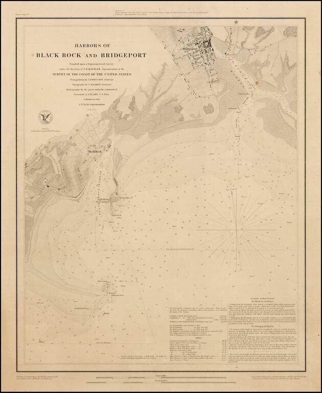
Fine example of this rare edition of the US Coast Survey map of Harbors of Black Rock and Bridgeport, Connecticut, published separately on thick paper as a presentation copy. The chart provides fine detail topographical and geographical details of the...
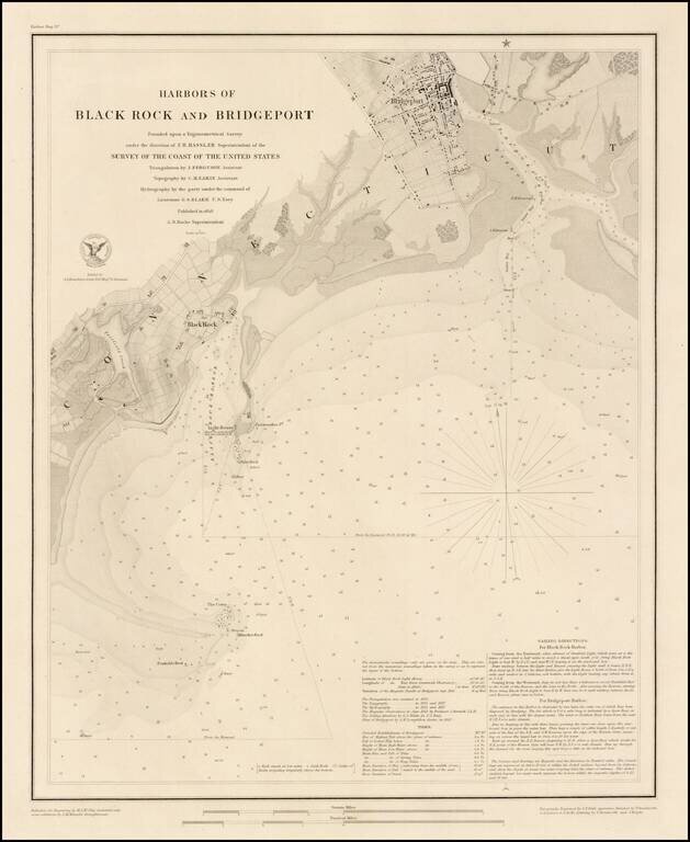
Fine example of this rare edition of the US Coast Survey map of Harbors of Black Rock and Bridgeport, Connecticut, published separately on thick paper. The chart provides fine topographical and geographical details of the two harbors, including...
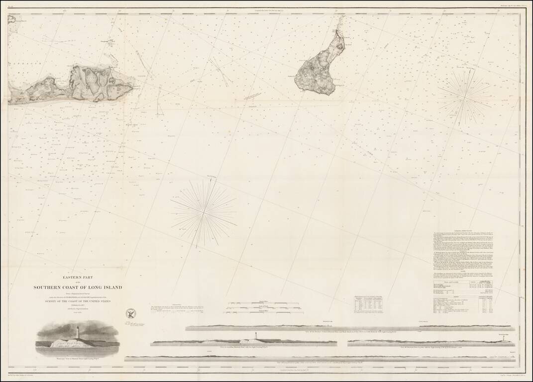
Fine separately issued chart of the coast of Long Island, published by the United States Coast survey in 1857. The chart extends from Montauk Point to Block Island, with full land & marine detail; view of Montauk Light; and 4 coastal recognition...
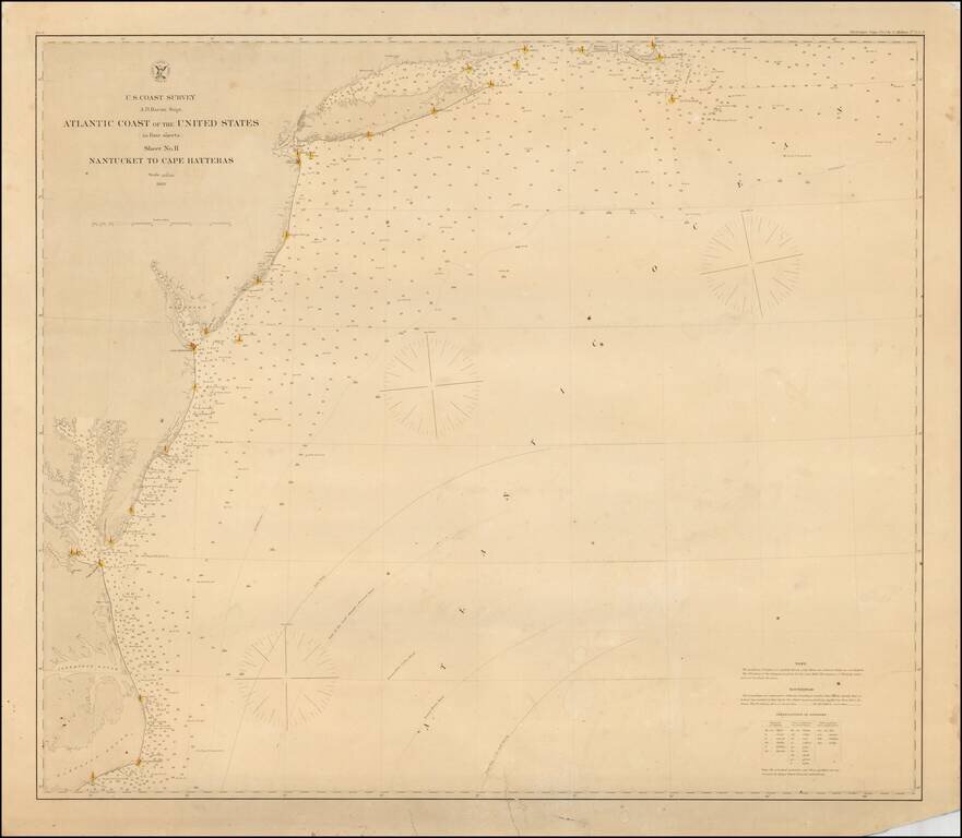
Rare separately issued coastal chart of the Coast of the United States, from Nantucket to Cape Hatteras. Includes lighthouses, soundings, place names, notes and sailing directions. The present example is published on thick paper and was never folded,...
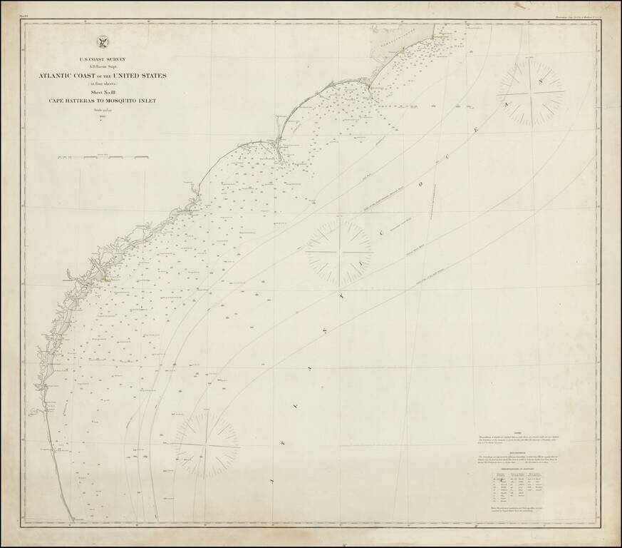
Rare separately issued coastal chart of Southeastern Coast of the United States, from Cape Hatteras to Mosquito Inlet in Florida. Includes lighthouses, soundings, place names, notes and sailing directions. The present example is published on thick...
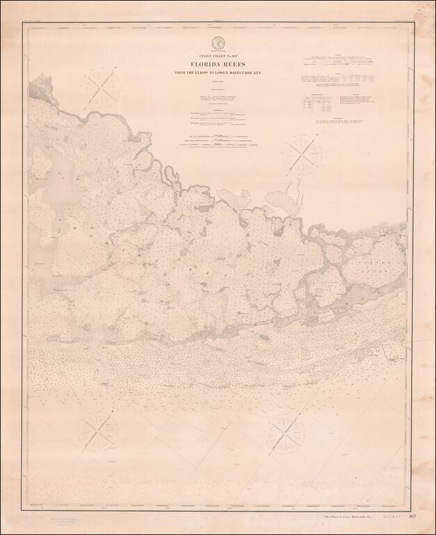
Antique Map / Sea Chart of the Florida Keys -- from Key Largo and Middle Key to Lower Matecumbe and Rabbit Key. Rare separately issued sea chart on heavy paper, showing the area between Lower Matecumbe Key and Key Largo, centered on the Plantation Key...
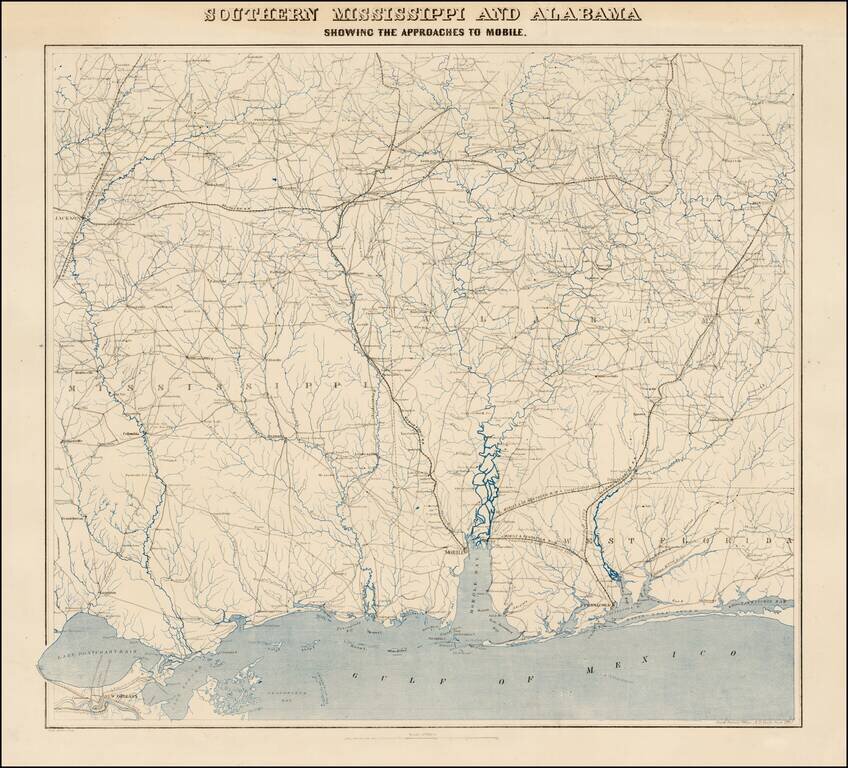
Fine uncut, unfolded example of the second edition of this rare Civil War map was created by the United States Coast Survey in 1863, under the direction of A.D. Bache. This exceptionally detailed map was prepared specifically by the US Coast Survey...
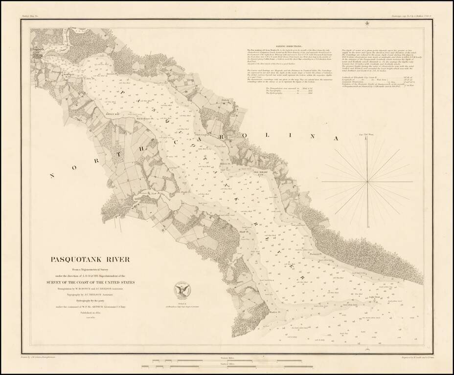
Rare separately issued sea chart of the Pasquotank River, published by the United States Coast Survey. Includes fine details throughout, including soundings and sailing directions. The Pasquotank River is one of the major rivers flowing into...
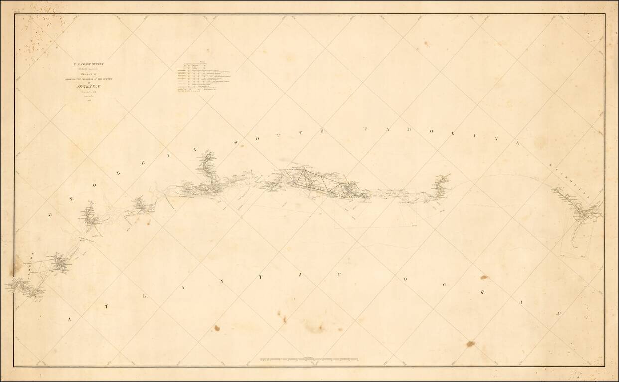
Unusual thick paper copy of the US Coast Survey progress chart from North Carolina to South Carolina, tracking the progress of the survey from 1847 to 1857 on along the Southeast Coastline. The accompanying notes identify the location of Astronomical...
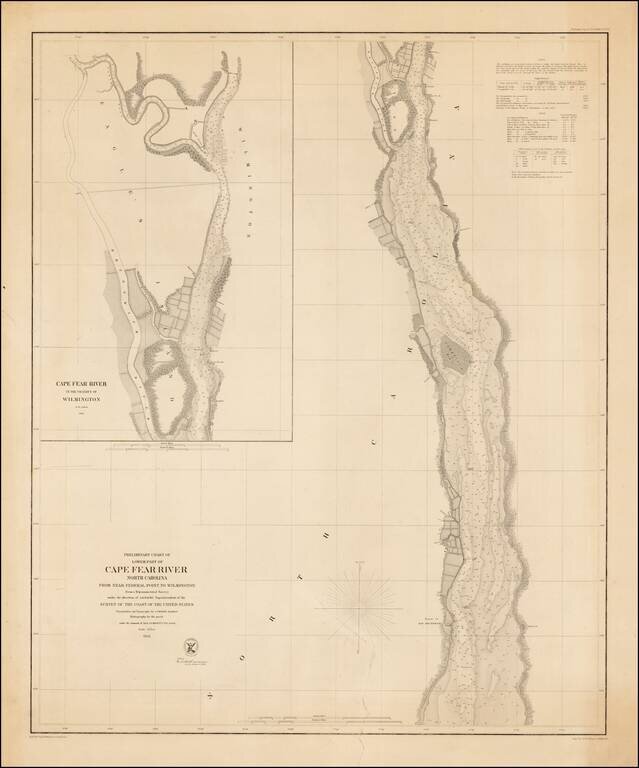
Rare separately issued example of the first edition of this detailed chart of the Lower Part of the Cape Fear River, from the Wilmington area to just south of the Ruins of Old Brunswick, first issued in 1856. Includes a large inset of the area around...
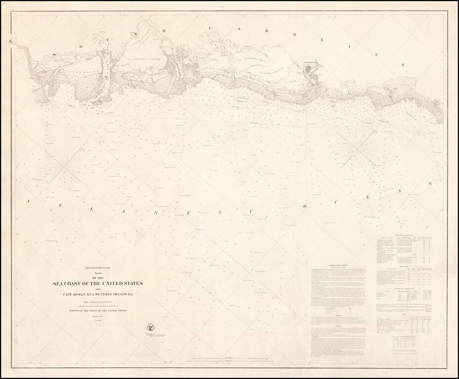
Rare (unrecorded) separately issued sea chart of the region from Savannah to Bull's Bay, published at the outset of the Civil War by the United States Coast Survey. A trove of information, this chart includes immensely detailed soundings; navigational...
![[Charleston] Preliminary Chart of Charleston Harbor And Its Approaches From a Trigonometric Survey . . . Published in 1858 . . . 1864](/map/small/50361.jpg)
Rare separately issued and colored example of this important chart of Charleston Harbor and the most detailed and accurate chart of the harbor to date. The present chart is called by the Library of Congress the "resurvey" chart, reflecting the...
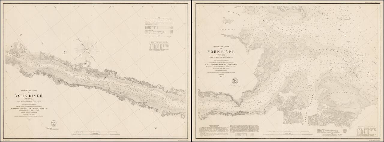
Rare pair of separately issued Coast Survey Charts, showing a section of the James River, from its entrance to West Point. The maps are exceptionally detailed, including sailing directions, soundings and other fine details. The first of the charts...
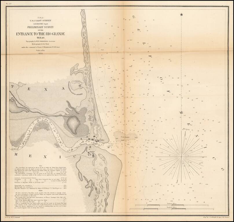
An early Sea Chart of the Mouth of the Rio Grande River One of the earliest obtainable charts of the region around the mouth of the Rio Grande River. Shows Bagdad, the observatory and a number of geographical details, soundings, etc. Includes tidal...
![Reconnaissance of the Western Coast of the United States From San Francisco to San Diego . . . 1852 [Rare Separately Issued & Revised Electrotype Copy]](/map/small/64536.jpg)
Early US Coast Survey Chart of the Coast of California, of one of the earliest coastal charts of the California Coastline produced in America. The chart includes 17 views of various parts of the California Coastline, including San Francisco Bay, Pt....
![Sketch of Anacapa Island In Santa Barbara Channel . . . 1854 [with] Reconnaissance of Smith's or Blunt's Island Washington . . . 1854 [J.A. Whistler engraving]](/map/small/70293.jpg)
Whistler's Seagulls -- Earliest Known Engraving Work By James Abott MacNeil Whistler An extremely important set of maps of from the California Coastline, being the first known example of the engraving work of James Abbott MacNeill Whistler, who would...