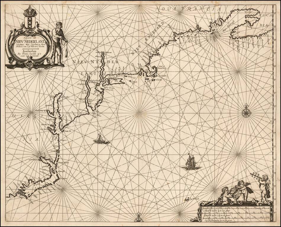
The First Dutch Sea Chart of The East Coast of North America Rare Dutch Sea Chart, extending from the Outer Banks of the Carolinas to Nova Scotia, first published in about 1650. There has been significant controversy over the dating of this map....

A highly decorative and important sea chart showing Florida, the Gulf Coast, Caribbean, Central America and the region from south of the mouth of the Delaware River. This fine separately published map was first engraved around 1650, but is based...
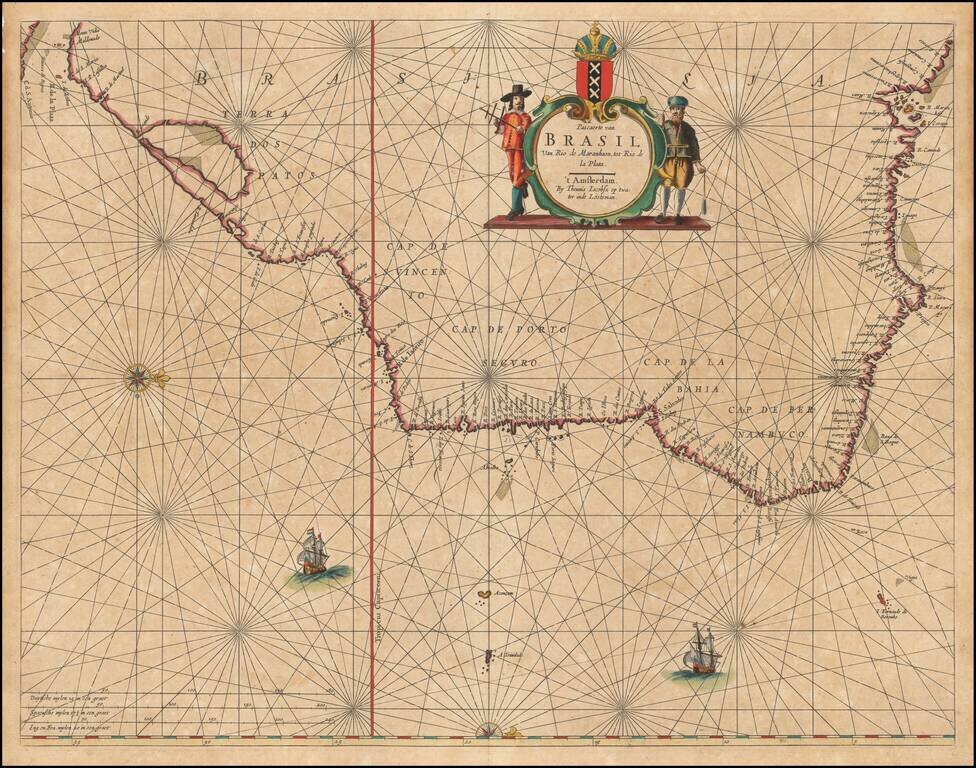
Rare sea chart of Brazil, one of the earliest obtainable Dutch Sea Charts of the region. Extraordinary detail, with rich colors and gold heightened.
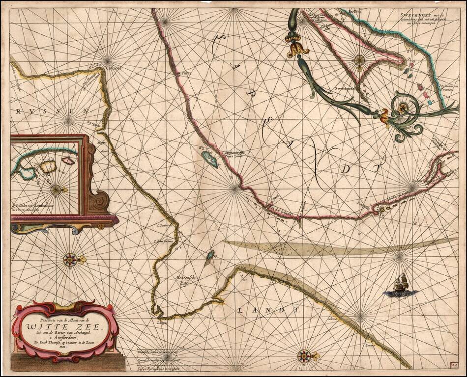
Rare sea chart of a part of the White Sea, published by Jacob Theunisz (Lootsman). At first Jacob adopted his father Anthonie's name, being known as Jacob Theunisz. Later with his brother, Caspar, in association, they added the name Lootsman to their...
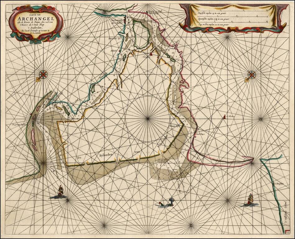
Rare sea chart of the mouth of the Duina River and the port town of Archangel, published by Jacob Theunisz (Lootsman). At first Jacob adopted his father Anthonie's name, being known as Jacob Theunisz. Later with his brother Caspar, in association,...
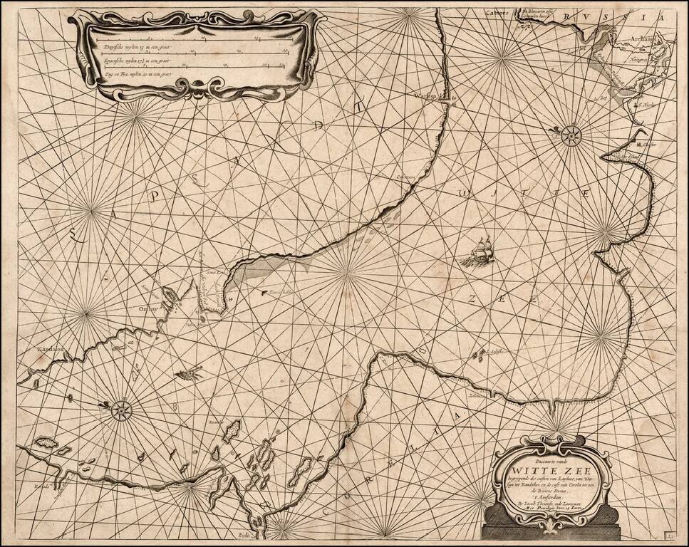
Rare sea chart of a part of the White Sea, published by Jacob Theunisz (Lootsman). At first Jacob adopted his father Anthonie's name, being known as Jacob Theunisz. Later with his brother, Caspar, in association, they added the name Lootsman to their...