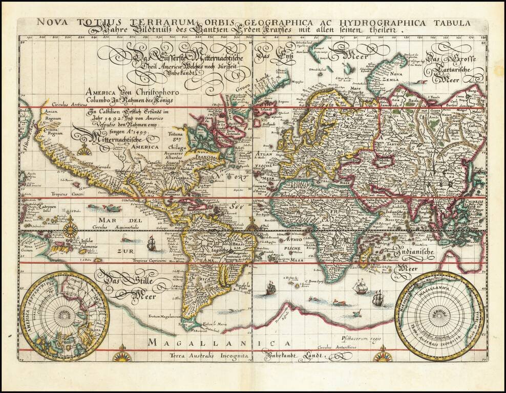
Rare old maps of the whole world. Secret knowledge, ancient worlds, ancient maps - discover the ancient world
![[Indian Ocean Currents] Carte du Sisteme des courants des Mers de L'Inde dans le tems de la mousson du N.E. au N. de la Ligne. Publiee par Vicomte Grenier en 1776](/map/small/58646.jpg)
Finely illustrated sea chart of a portion of the Indian Ocean, highlighting the direction of the ocean currents and prevailing winds in the region. Important chart illustrating the fastest sailing routes through the region. The present chart is one...

An 18th Century English Wall Map of Asia, Australia & The Indian Ocean Nice example of the 6 sheet Laurie and Whittle wall map of Asia, Australia and the Indian Ocean, first published in Asia in 1794. The map in its complete state covers an area...
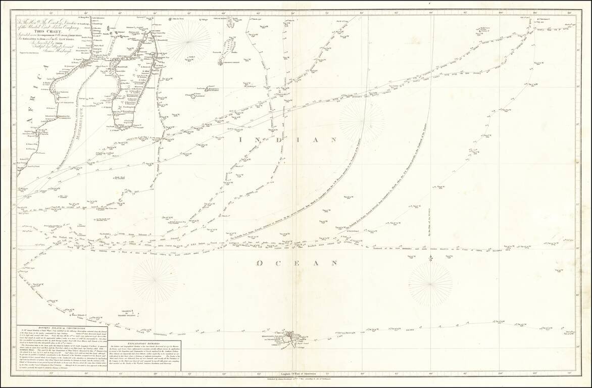
Provides one of the First Accurate Descriptions of Bouvetøya A detailed and fascinating chart of the South Indian Ocean, showing some of the most important journeys of the late 18th and early 19th centuries. This includes Cook's 1776 voyage and du...

Penelope Steel's Map of the Indian Ocean -- Used in an American Circumnavigation in the 1840s. Rare four-sheet blueback sea chart of the Indian and Pacific Oceans, focusing on the trading routes from the east coast of Africa to Canton and New Zealand,...
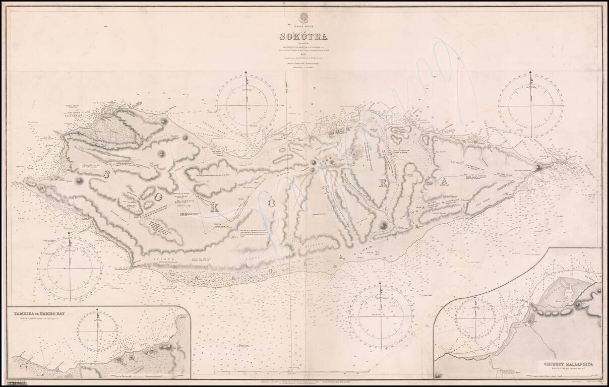
A Rare Early Sea Chart of Socotra Island. Fine large format Socotra Island, published by the British Admiralty, first published in 1857. Includes large insets of Tamrida or Hadibo Bay and Ghubbet Kallansiya Regional History In 1507,Tristão da...