
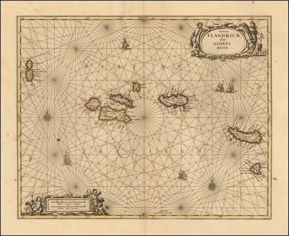
Nice example of Valk & Schenk's scarce sea chart of the Azores, published in Amsterdam in 1690. The map is oriented with north at the top and includes compass roses, sailing ships and 2 decorative cartouches. Each of the islands includes...
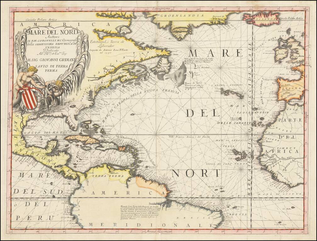
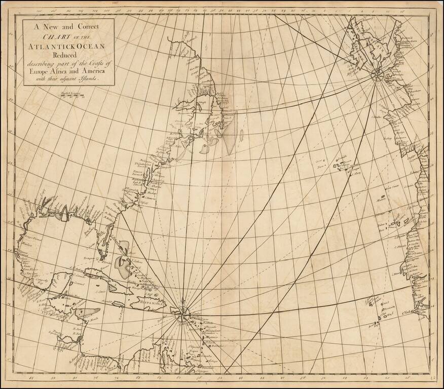
Fascinating chart of the Atlantic Ocean and the contiguous coastlines of America, Europe and Africa, by Vincenzo Maria Coronelli, one of the most important map makers of the late 17th century. The map provides a detailed treatment of the Atlantic...
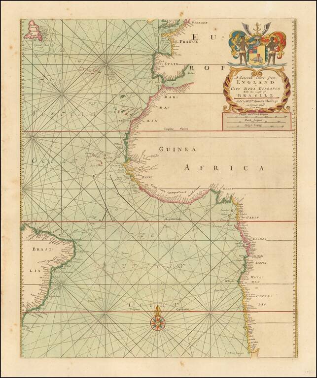
Fine sea chart of the Southern Atlantic Ocean, first published in London by John Thornton. The general map from Thornton's English Pilot The Third Book, concentrating on oriental navigation, showing the first half of the route to the Far East. The...

Scarce map centered on Greeland and focusing on the passage in the North Atlantic from Europe to Hudson's Bay. The map shows the location of where Henry (Jens) Munk wintered in 1619-20. Jens Munk was a Danish explorer. On May 9 1619, he undertook a...
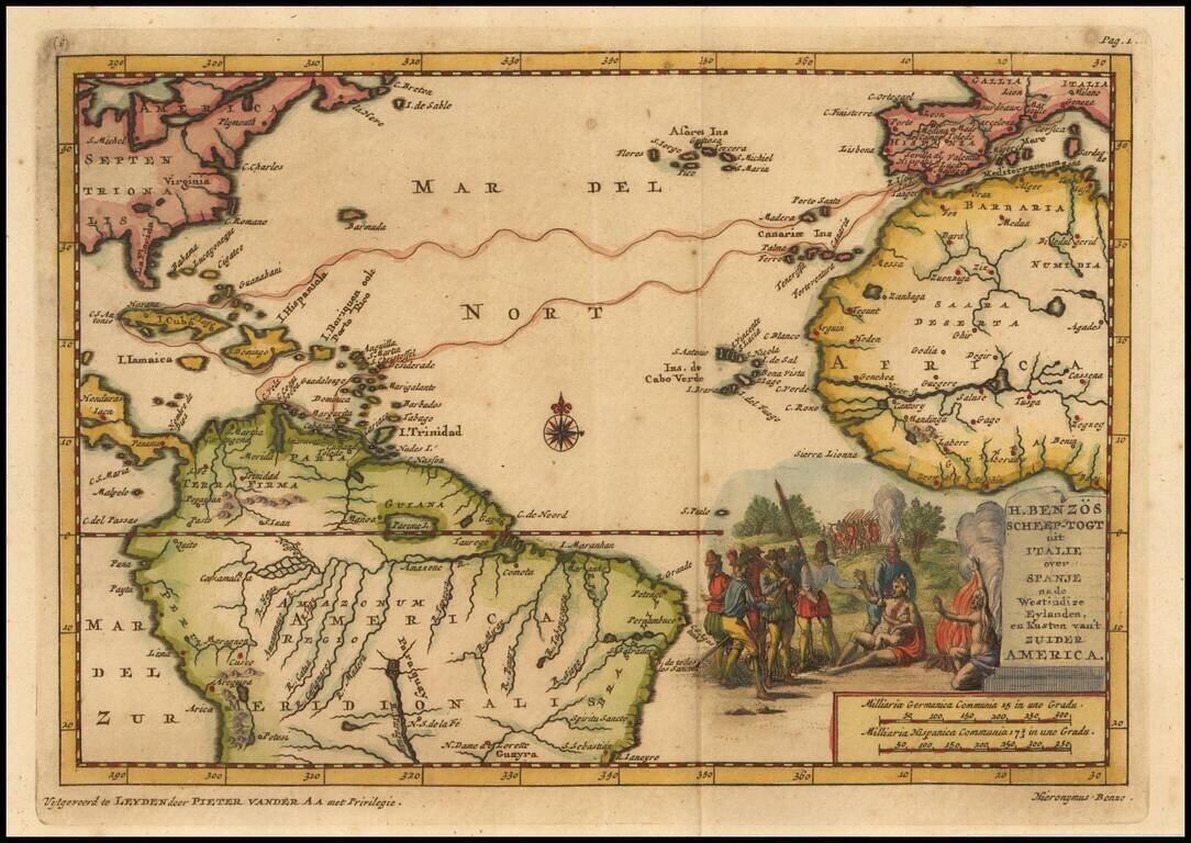
Detailed map of the Atlantic and contiguous coastlines, which was prepared to illustrate the Dutch Account of Girolamo Benzoni's voyage to America in 1541. Benzoni (born Milan ca 1519) travelled to America in 1541, visiting the Caribbean, Isthmus of...
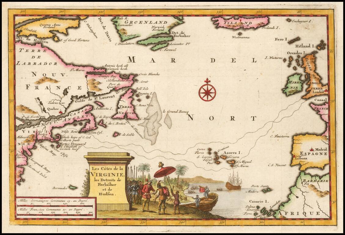
Detailed map of Northeastern America and the Atlantic, illustrating the route from England to Plymouth, Massachusetts, published to illustrate the voyage of Bartholemew Gosnold, who is generally credited with the discovery of Cape Cod and Martha's...
Rare Chart of the Atlantic from an Influential Atlas Scarce early eighteenth-century English sea chart of the East Coast of North America, the Caribbean and the North Atlantic Ocean. The coasts of Europe and North Africa are also shown. The chart is...

Fine Chart of the Atlantic from an Influential Atlas Scarce sea chart of the Atlantic Ocean from the important Atlas Maritimus et Commercialis, published in London in 1727. The map provides a detailed treatment of the East Coast of North America,...

Antique engraved map of the southern Atlantic Ocean, by Jacques Nicolas Bellin, the foremost French chartmaker of the 18th century. The map covers all of the eastern South American coast from Cape Horn to the mouth of the Amazon. In Africa, the map...
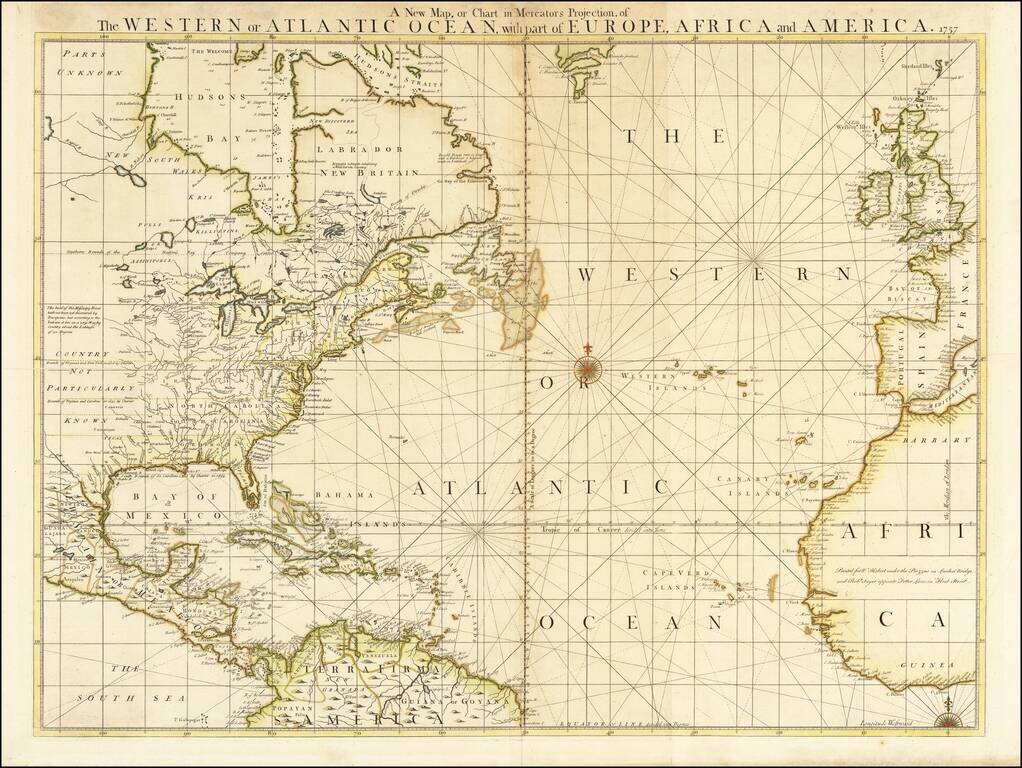
Rare Map of the Atlantic at the Outset of the French & Indian War Extremely rare separately issued map of North America, The Caribbean and the Atlantic Ocean, issued by William Herbert in London. The map is richly annotated with information both...
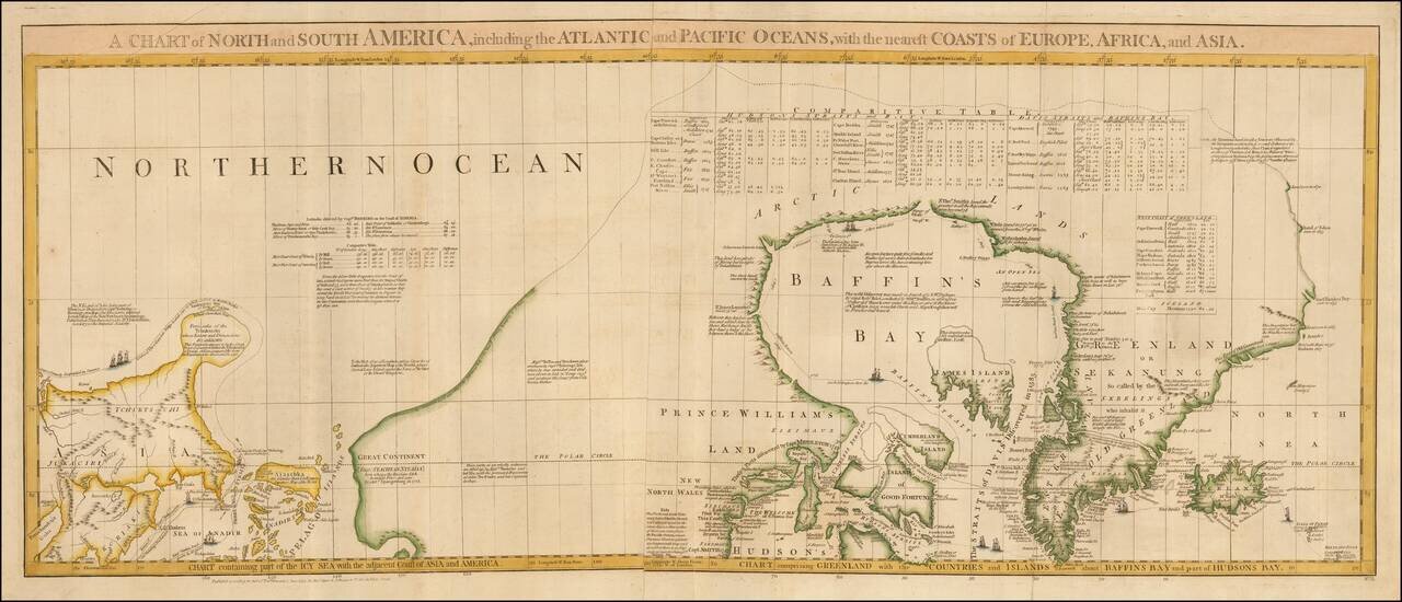
One of the Most Detailed and Important Map of the Americas made by a Scandalous Geographer This is a nice example of the northernmost sheets of 1775 edition of this important six sheet chart of North and South America, originally compiled by John...
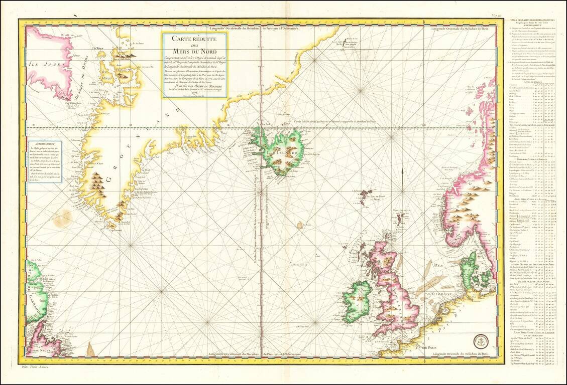
Late 18th Century Scientific Expedition In the North Atlantic Important mid-18th Century sea chart of the North Atlantic, published by the French Depot de la Marine. Centered on Iceland, the map extends from Labrador, Newfoundland, and Baffin Island...
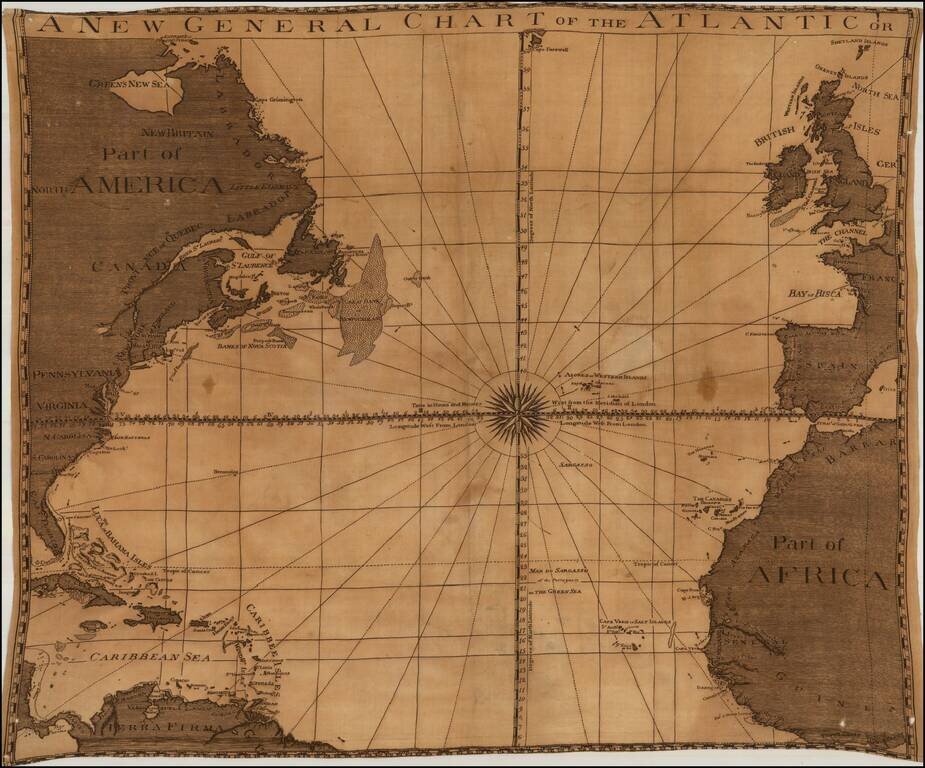
Unrecorded map of the Atlantic Ocean, printed on linen, likely published in London about 1780. The title of the map and its style and nomenclature are very similar to the 1777 edition of Sayer & Bennett's A New General Chart of the Atlantic or...
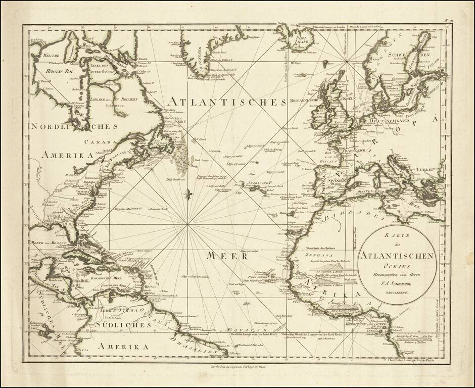
A detailed antique map of the North Atlantic from just south of the equator to southern Greenland. The map shows coastal settlements, geopolitical boundaries, navigational features, and more. Names are given either in German or in their local...
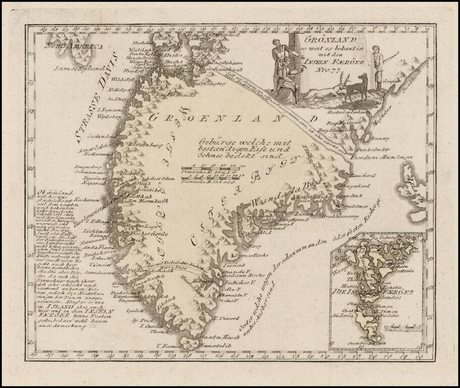
Scarce map of Greenland, with an inset map of the Faroes. The map is quite detailed, and shows several settlements and a number of coastal features.
![[ Atlantic Ocean / Triangular Trade / Negroland ]](/map/small/65187.jpg)
Interesting hand drawn sea chart of the North Atlantic, illustrating the region covered by the Triangular Trade. The chart focuses on the major trading ports in America (Charleston, Boston, New York, Baltimore and Philadelphia), with a very curious...