Map size in jpg-format: 2.18148MiB
Click to open in high resolution (open in new tab).
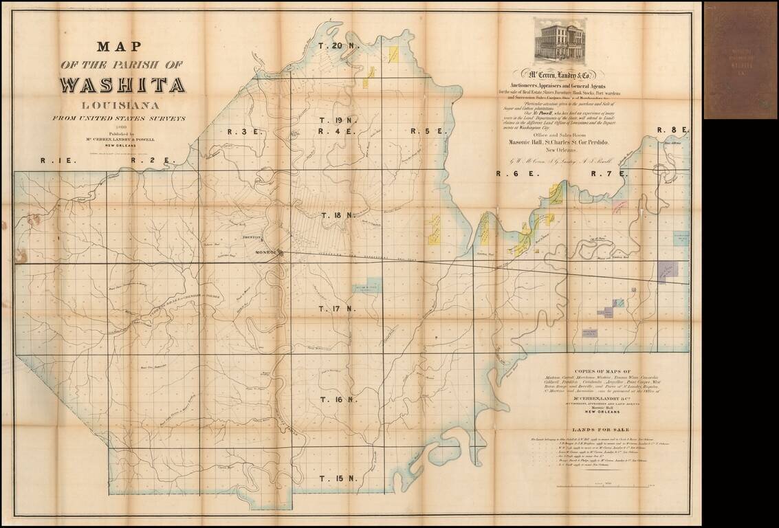
Rare Map of Ouachita Parish, Louisiana
Nice example of this rare large format map of Ouachita Parish, Louisiana, published in New Orleans in 1860 by McCerren, Landry & Co., Auctioneers, Appraisers and General Agents for the sale of Real Estate, Slaves , Furniture, Bank Stocks, Port wardens and Succession Sales . . .
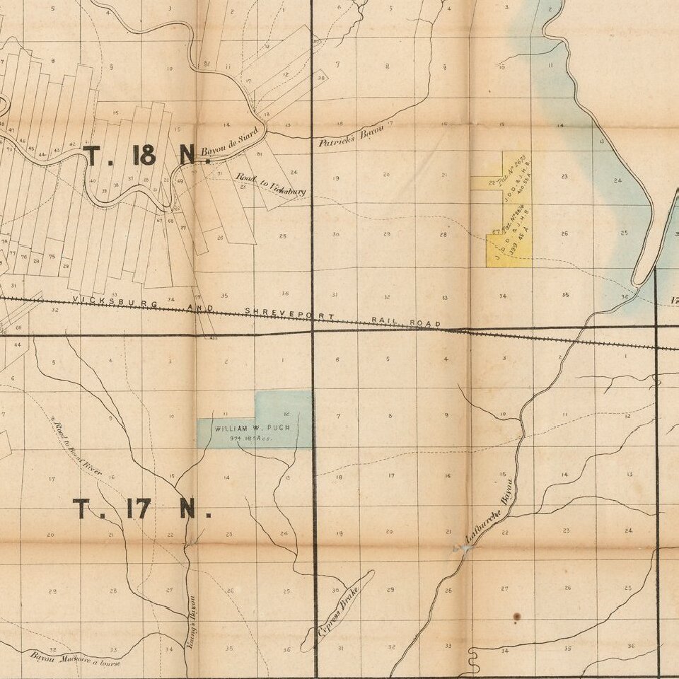
The map provides a nice overview of Ouachita Parish, which was divided into townships.
A list of 7 major land owners offering lands for sale is shown at the bottom right corner, with their lands shown in various colors.
Several early roads appear. This is most likely the earliest printed map of Ouachita Parish.
Rarity
OCLC locates other copies at the Library of Congress and the British Library.
If you are a student, write to us in telegram: @antiquemaps and indicate what material you need and for what work you need a map in high detail. We are ready to provide material on special terms. For students only!
![The Coast of West Florida and Louisiana . . . [with] The Peninsula and Gulf of Florida or Channel of Bahama with the Bahama Islands . . .](/map/small/66344.jpg)