Map size in jpg-format: 35.6614MiB
Click to open in high resolution (open in new tab).
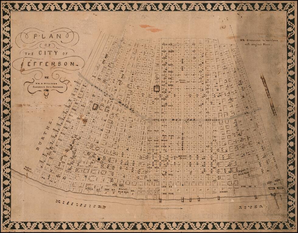
Jefferson City Before Its Annexation by the Big Easy -- Hand Drawn By A Prominent New Orleans Surveyor
Fine hand drawn Antebellum plan of Jefferson City, Louisiana on the east bank of the Mississippi, prior to it annexation by New Orleans in 1870.
Historical Overview
The population of the areas just upriver from New Orleans began growing after the arrival of the St. Charles and Carrollton Railroad in 1833. In 1846, the section between Toledano and Eleonore Streets was incorporated as the Borough of Freeport. The Borough lasted four years, before being combined into the municipality of Jefferson (or Jefferson City), bounded by Toledano and Lowerline Streets.
“The sparsely-settled New Orleans suburb, an amalgam of seven privately-developed individual faubourgs, received a city charter from the state legislature in 1850. For twenty years after that, Jefferson City had an independent existence complete with its own mayor, aldermen, courts, public schools, cemeteries, public market, port, and other facilities.” (Friends of the Cabildo and Associates of the Louisiana State Museum, New Orleans Architecture. Volume VII: Jefferson City, p. 27)
The new city thrived, but in 1870 it was annexed to New Orleans in what was essentially a hostile takeover.
Plan of the City of Jefferson
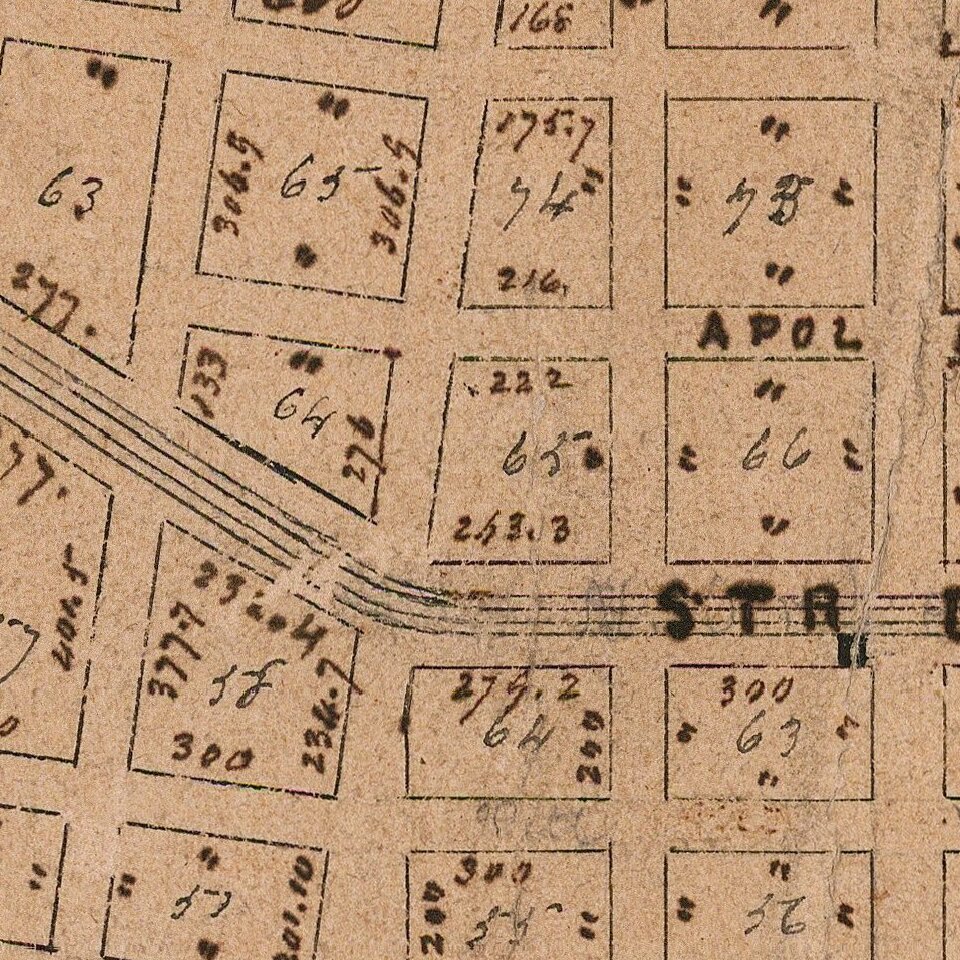
Dated 1860, in the midst of Jefferson's 20 year run as an independent city, the map identifies prominent area surveyor William T. Williams as the maker, noting at the right that its dimensions are "drawn from original plans. In addition, it includes extensive, virtually comprehensive pencil annotations in the hand of a contemporary owner.
Jefferson is shown centered on the intersection of two broad avenues, Napoleon and Nayades, along the latter of which runs the route of the New Orleans & Carrollton Railroad. The irregular orientation is due to its being an “amalgam” of several privately-owned plantations, each laid out in the French manner as a long strip with narrow frontage on the river. In the case of Jefferson, however, an oxbow in the Mississippi River forced each parcel to narrow to a wedge as it ran inland. The plantations were subdivided at different times for development between 1834 and 1855 as faubourgs (suburbs) of New Orleans, each with its own more-or-less rectilinear street plan, resulting in irregular trapezoidal lots along the faubourg boundaries.
In combining the original seven faubourgs, each retained its original lot numbers system, with the dimension of each side of the trapezoid individually numbered. Public spaces are reserved at Laurence and Samuel Squares along Napoleon Avenue and two unnamed squares along Nashville. The plan further locates cemeteries, three named brickyards near the river, a ferry and livestock landing at the base of Louisiana Avenue, several unnamed wharves, and the Poydras Asylum (a home for orphans and widows) occupying two blocks along Peters Avenue in Faubourg Rickerville, surrounded by a printed stencil border.
The plan is drawn in pencil and at least three different types of ink, with numerous calculations and other notations in pencil faintly visible in the blank areas. As such it bears every sign of having been an original working document and probably served as the basis for a plan of the same title issued in 1860 and bearing the imprint of New Orleans lithographer J. Manouvrier. The two are very similar, though the printed plan lacks both the unusual ornamental border and a note reading “N.B. Dimensions in accordance with original Plans.”
Rarity
The map is apparently unique. We locate no other examples.
Provenance: Crescent City Auction Gallery, September 2018.
If you are a student, write to us in telegram: @antiquemaps and indicate what material you need and for what work you need a map in high detail. We are ready to provide material on special terms. For students only!
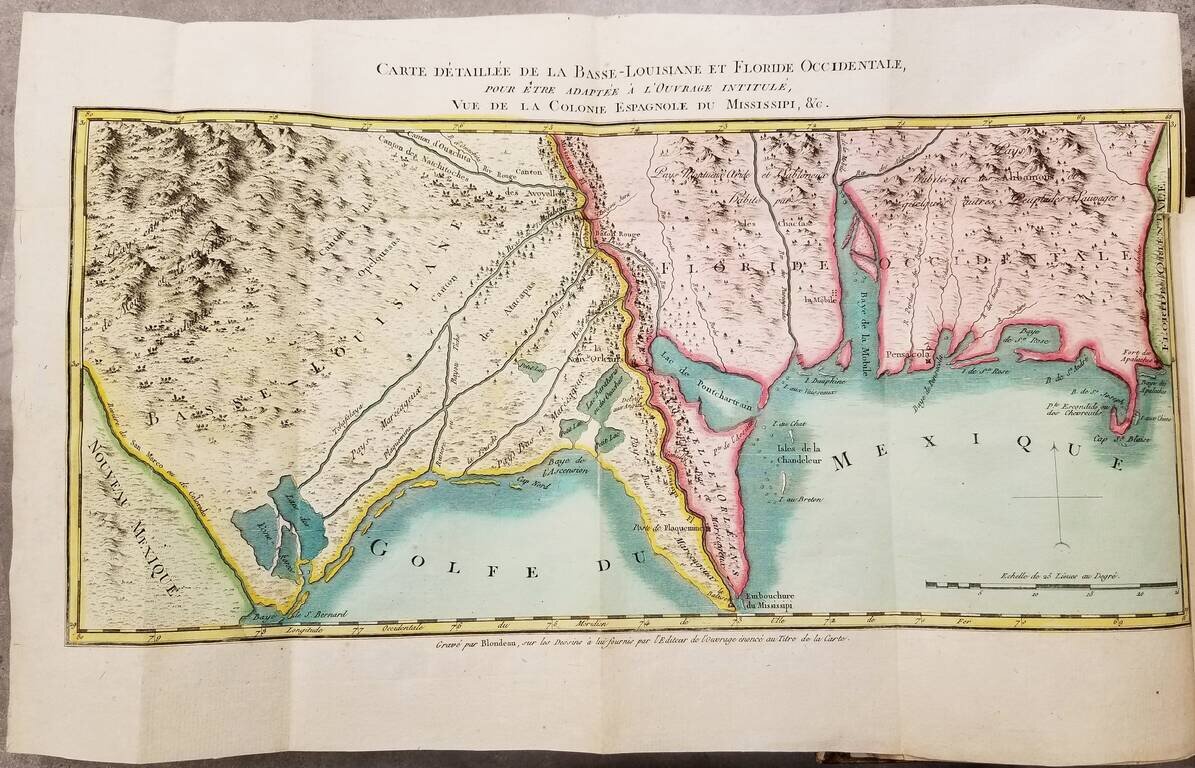
![The Coast of West Florida and Louisiana . . . [with] The Peninsula and Gulf of Florida or Channel of Bahama with the Bahama Islands . . .](/map/small/66344.jpg)