
![[Southwest Colorado] Tourist & Sportsman Guide and Map to Southwestern Colorado](/map/small/66559.jpg)
The Vacation Land That's Really Different . . . Whimsical pictorial map of Southwestern Colorado, illustrating the regions the roads, passes, towns and major peaks. The map is surrounded with ads for local businesses, focused on the sportsman's...
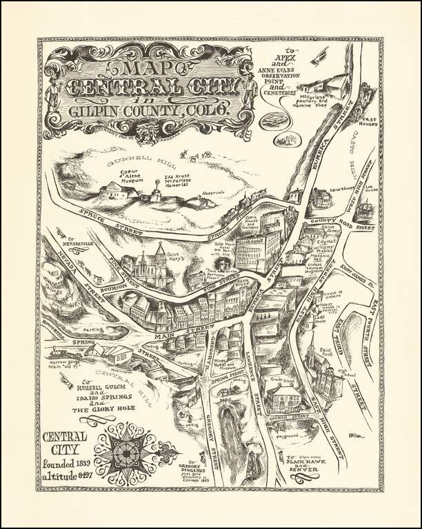
An Early Barbara Remington Illustration Attractive pictorial map of Central City, Colorado, drawn by Barbara Remington. The map is oriented with west at the top, showing the town spreading out along Eureka and Main Streets. Includes a decorative...
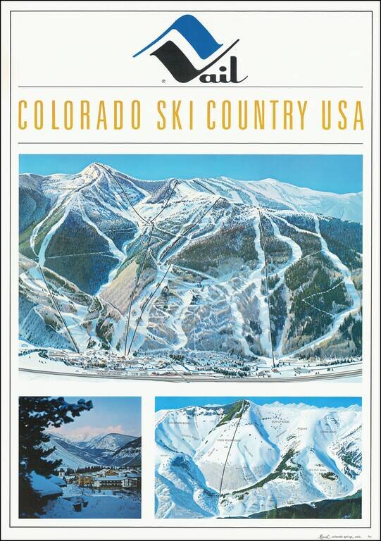
Fine early Hal Shelton Poster, promoting Vail, Colorado. Iconic promotional poster of Vail, published shortly after the addition of Gondola #2. The top image is a large traditional trail map, identifying ski lifts, trails, bowls, etc. with the...
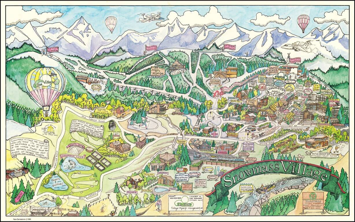
Decorative pictorial map of Snowmass Village, Colorado, drawn by artist James Giattino. The map promotes the recreational industries of Snowmass, both summer and winter. The ski mountain can be seen across the top, highlighting the four peaks...
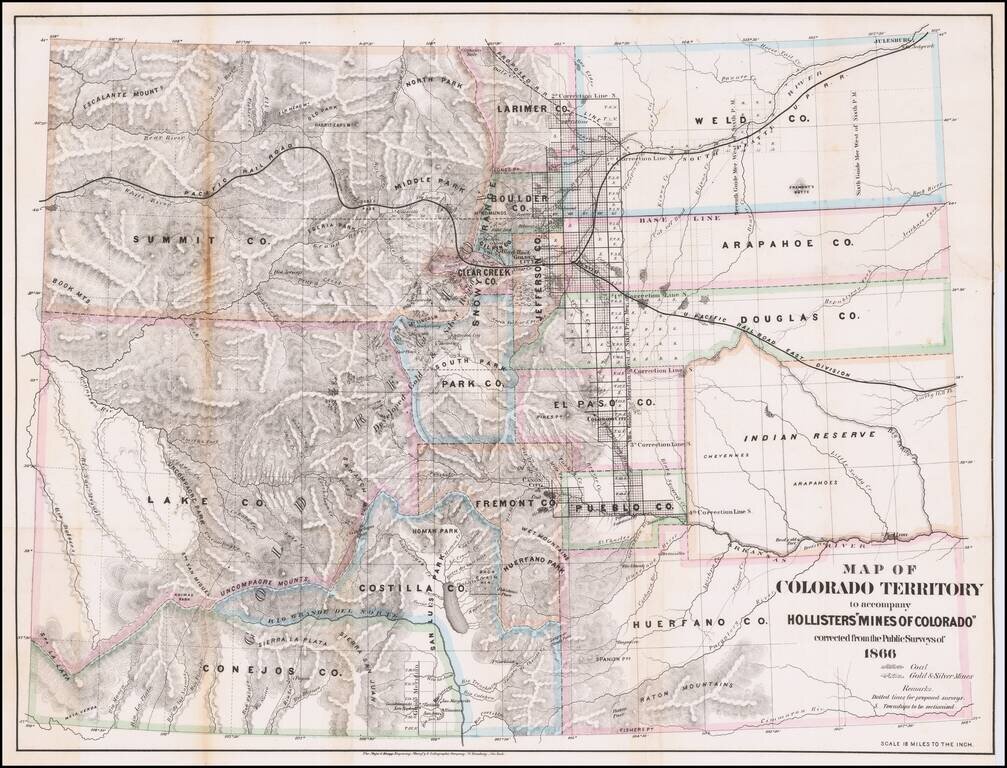
Detailed Map of Colorado Territory in 1866, with original text. Scarce map of Colorado Territory, showing sixteen counties and a large Indian Reserve. The reserve is divided into Cheyenne and Arapahoe tribes. Extensive watershed information and...
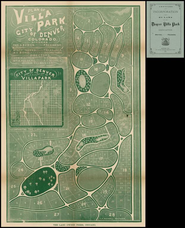
Fine early map of Villa Park, in the Barnum part of Denver, published by the Villa Park Association, showing land owned by PT Barnum and his daughter. Map shows proposed streets, (not named), parks, creeks, small bodies of water, and plan of lots....
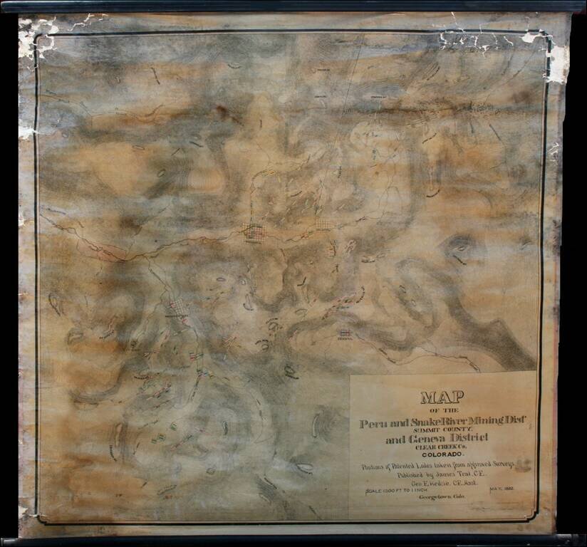
Highly detailed wall map of the area immediately south of Georgetown, Colorado, in the Peru Mining District, Snake River Mining District and Geneva Mining District, Summit County and Clear Creek County Colorado. Teal's map provides in fine detail the...
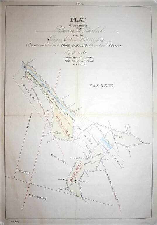
Fascininating Clear Creek County, Colorado Plat Map and GLO Mineral Certificate, confirming the mining claim of Marcus W. Rasbach to mining rights first claimed on June 30, 1881. A fine example of a General Land Office Mineral Certificate, consisting...
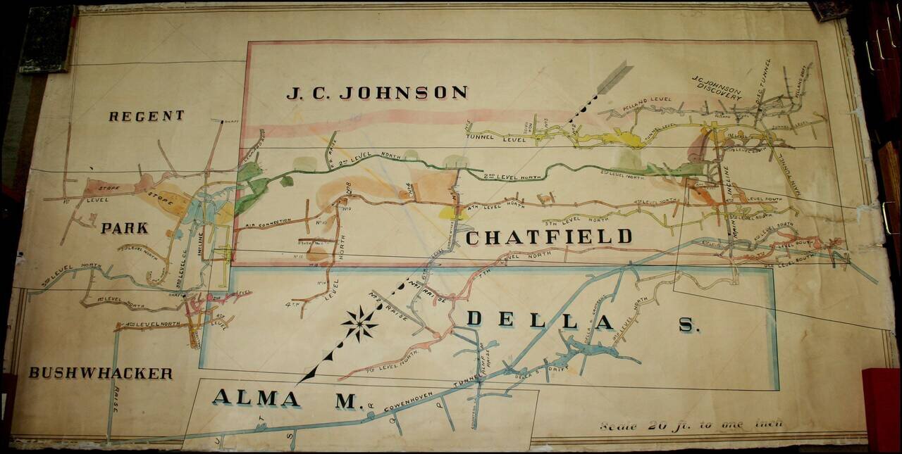
A Remarkable Aspen Mining Map -- Smuggler Mountain Large map illustrating the competing mining claims of several silver mines in Aspen, Colorado, which resulted in litigation between John C. Johnson and the Standard Mining Company of Kansas City,...
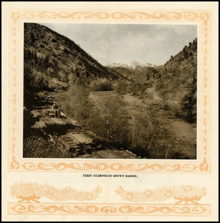
Early photographic view of the Snowy Range in Colorado, from the turn of the Century.
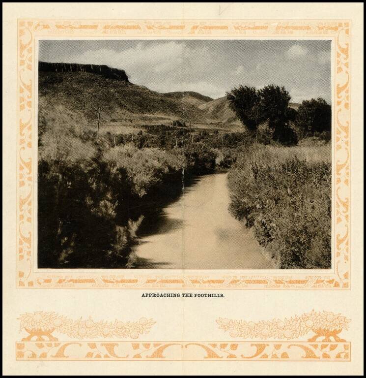
Early photographic view of the foothills on route to Georgetown, Colorado, from the turn of the Century.