
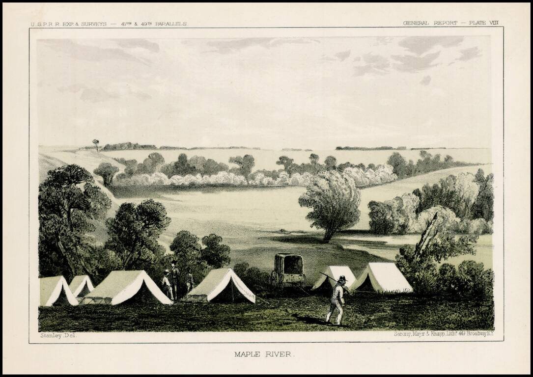
Fascinating view of an encampment on the Maple River in South Dakota, prepared as part of the United States survey for the most practicable route for a railroad line to the West Coast of America, conducted just prior to the Civil War. A scenic view as...
![[Wounded Knee] Scene of the Fight with Big Foots Band, Dec. 29th 1890. showing Positions of Troops when first shot was fired. From Sketches made by Lt. S.A. Cloman Act'g Eng'r Officer Division of the Missouri](/map/small/65742.jpg)
Interesting battle plan depicting the Battle of Wounded Knee / Wounded Knee Massacre Wounded Knee resulted in the killing of several hundred Lakota Indians, almost half of whom were women and children, by soldiers of the United States Army, on...
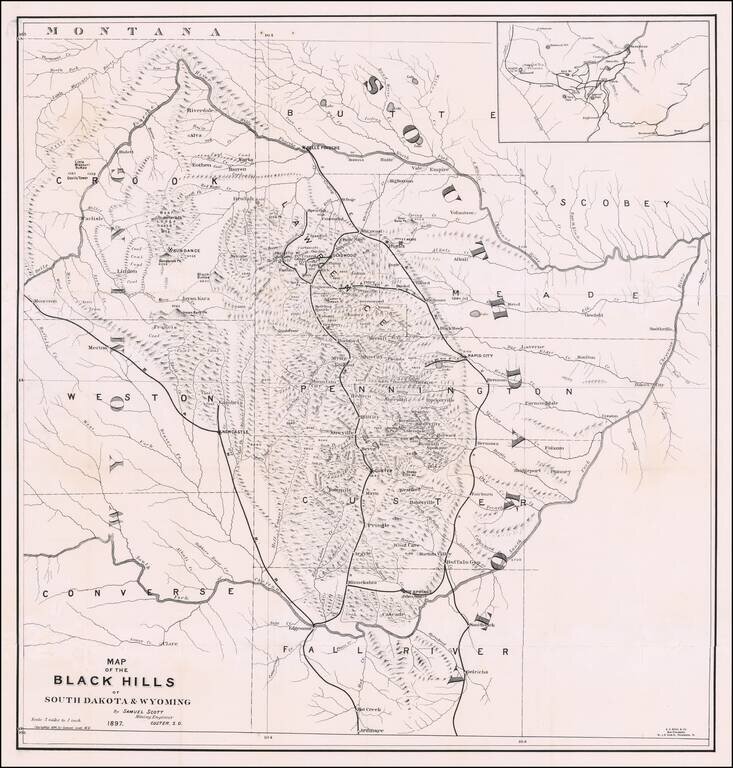
The First Book on Descriptive Mineralogy of the Black Hills with An Important Map Detailed map of the Black Hills region of western South Dakota and eastern Wyoming, between the North Fork and the South Fork of the Cheyenne River, published by Samuel...
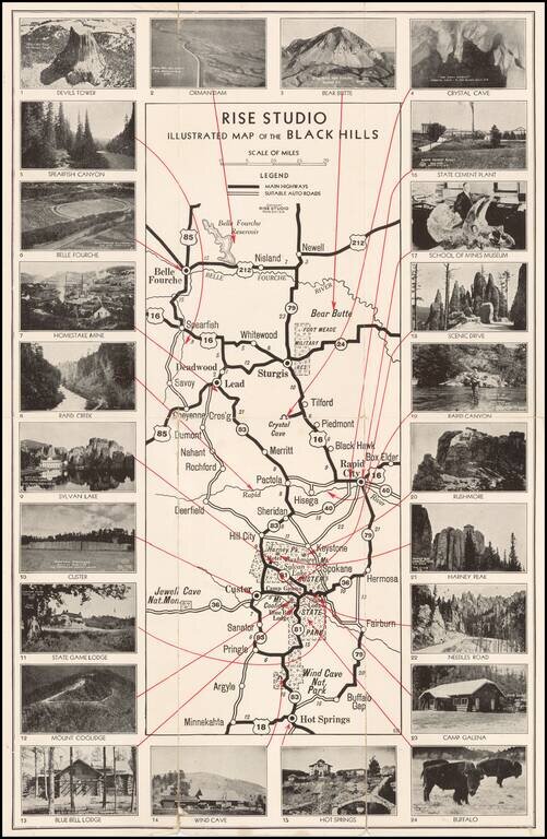
Unusual promotional map of the Black Hills, published to advertise the services of Rise Studio (photographers), of Rapid City, South Dakota. The map shows the roads in and around Custer's State Park, Rapid City and Sturgis, extending north to Belle...
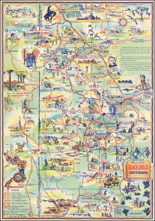
Why Not Have a Real Vacation this Year in The Mountainous Black Hills of South Dakota Decorative vintage pictorial map of the South Dakota Black Hills, published locally in the 1940s. Attractive tourist promotional pictorial map by K. Pyle. We have...
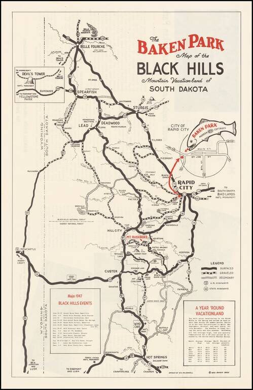
Promotional map for the Baken Park area of South Dakota, published in 1947. The map illustrates the recreational opportunties centered on Baken Park, a suburb of Rapid City, South Dakota. Advertising on the verso and a list of Major 1947 Black Hills...
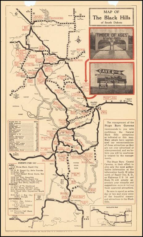
The Black Hills Leading Crystal Cave Tourist promotional map of the Black Hills Region, including advertising on the verso for Cyrstal Caverns, with photographs. Centered on Rapid City, the map highlights other tourist attractions in the region.