
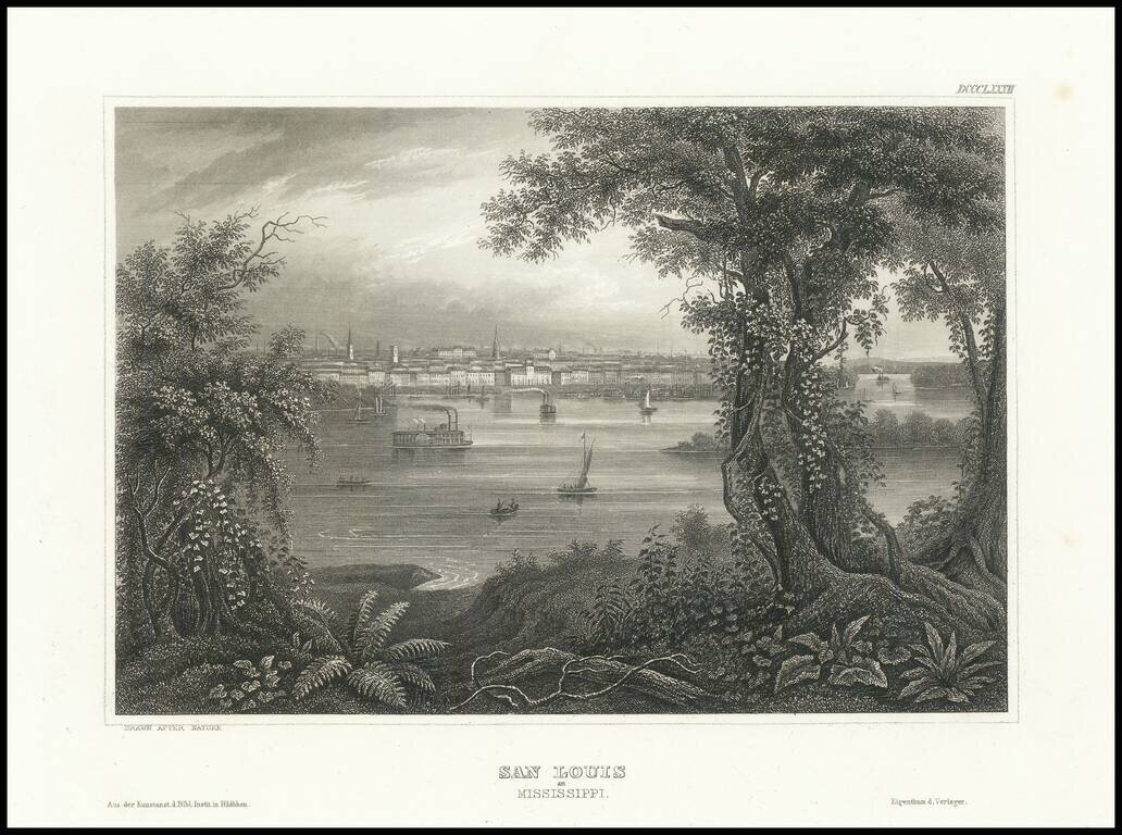
Fine steel engraved view of St. Louis from across the Mississippi River.
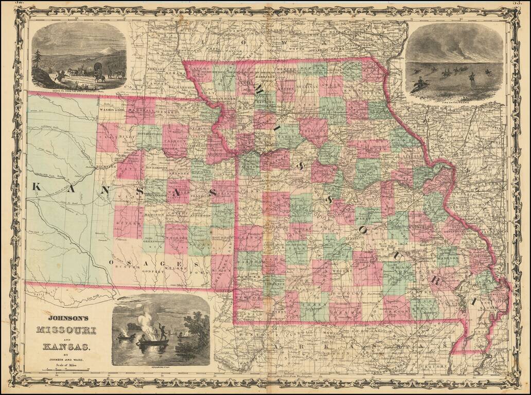
Decorative map of Missouri and Kansas, colored by counties, published by Johnson & Ward. Includes large decorative vignettes of a fire on the prairie with horse mounted Indians, the Santa Fe Trail and spear fishing Indians. Shows towns, counties,...
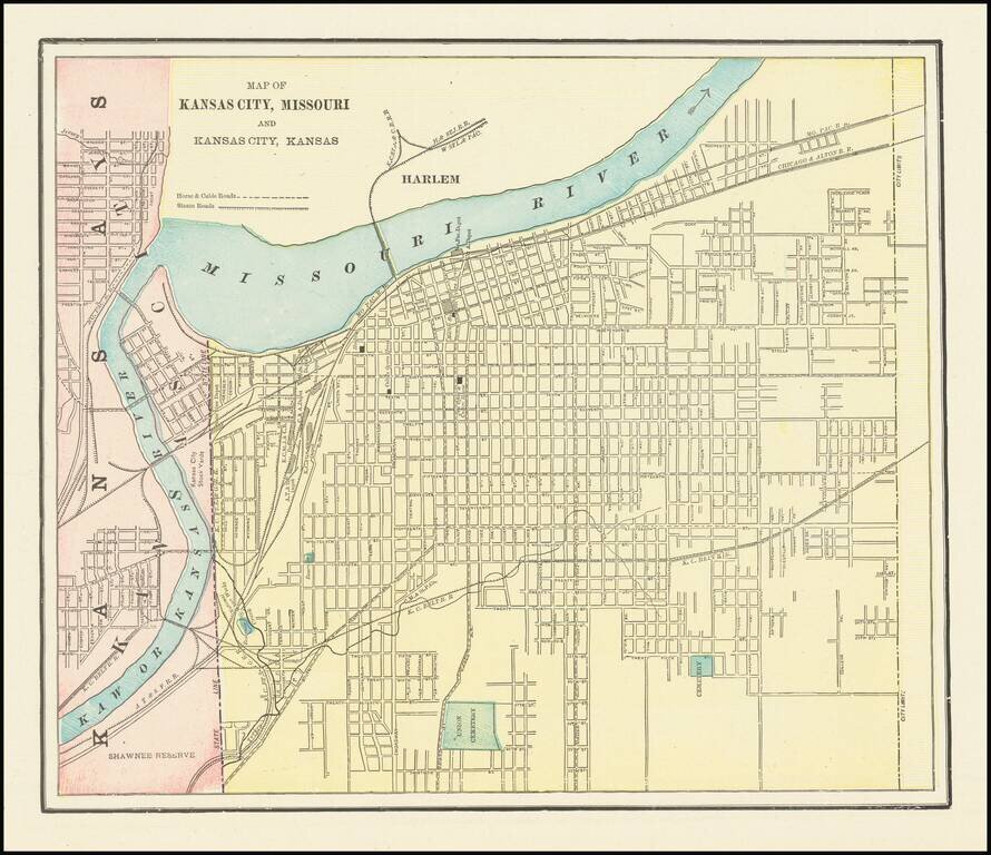
Detailed city plan of Kansas City, showing streets, buildings, train lines, public places, rivers etc. Cram was one of the pre-eminent American Mapmakers of the late 19th Century, relying upon a cerographic printing process first applied to maps by...
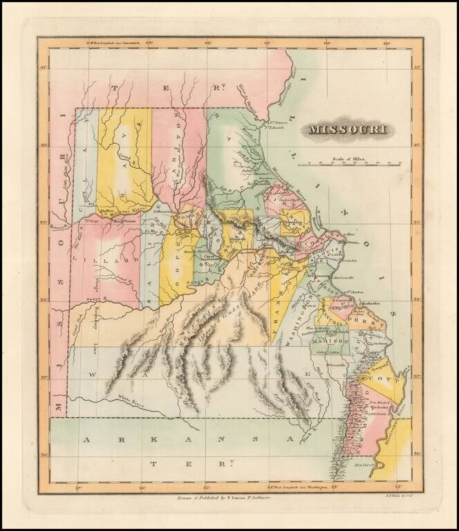
One of the Earliest Printed Maps of the State of Missouri Rare early map of Missouri just two years after statehood. Early state boundaries and most Western area are not yet partitioned into smaller counties. An Osage Boundary Line passes through...
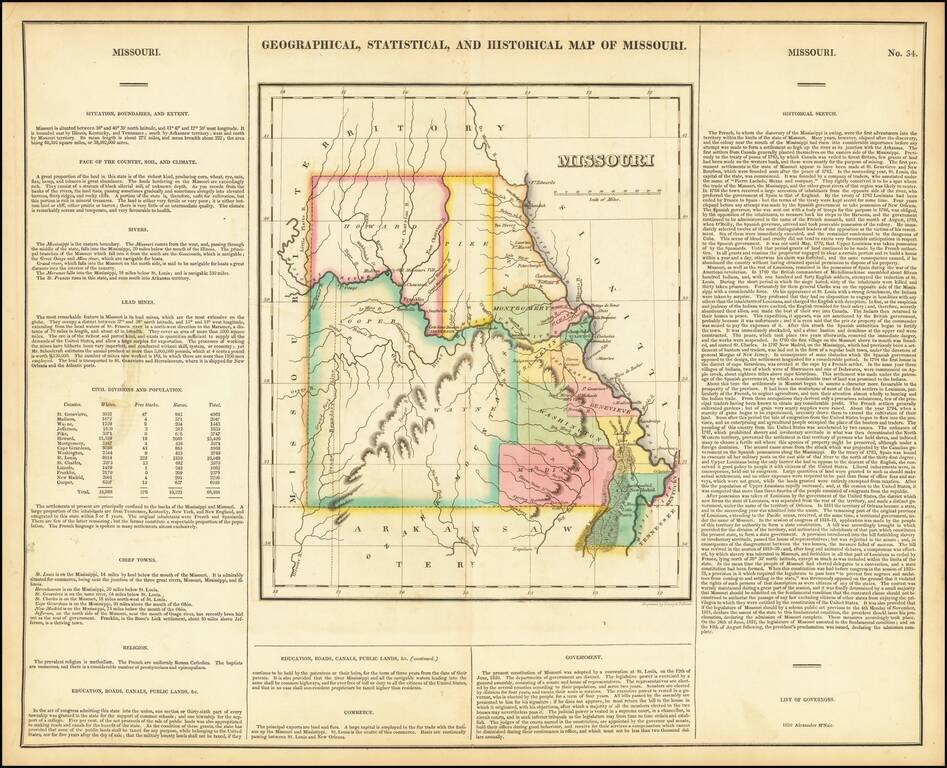
Nice example of the first printed map of Missouri as a state from the first edition of Carey & Lea's Atlas. Size includes text below map, which contains details concerning the topography, indigenous lands, rivers, chief towns, commerce,...
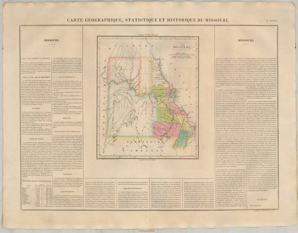
The First European Printed Map of Missouri . Fine example of Buchon's map of Missouri, the first map of Missouri published outside of America. Buchon's map appeared in his Atlas Geographique, Statistique, Historique et Chronologique ...., the first...
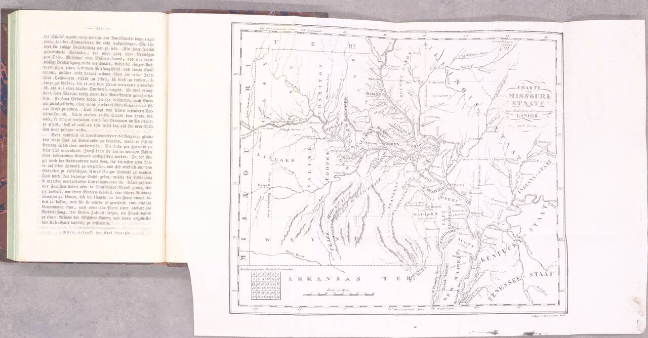
The Beginning of German Immigration to Missouri. Second and best edition. Gottfried Duden was among the first German immigrants to Missouri, having traveled there in 1824. He established a farm in the Missouri River valley between St. Louis and...
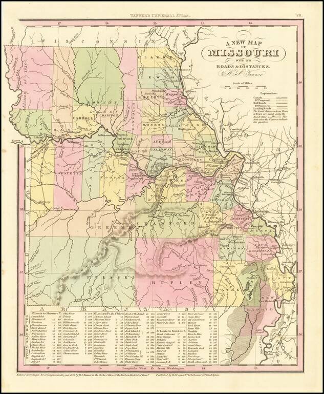
Detailed map of Missouri from Tanner's New Universal Atlas. Hand colored by county and showing towns, rivers, lakes, railroads, roads, etc. Table of Steam Boat routes and distances. Includes a number of ovesized counties, including Barry, Taney,...
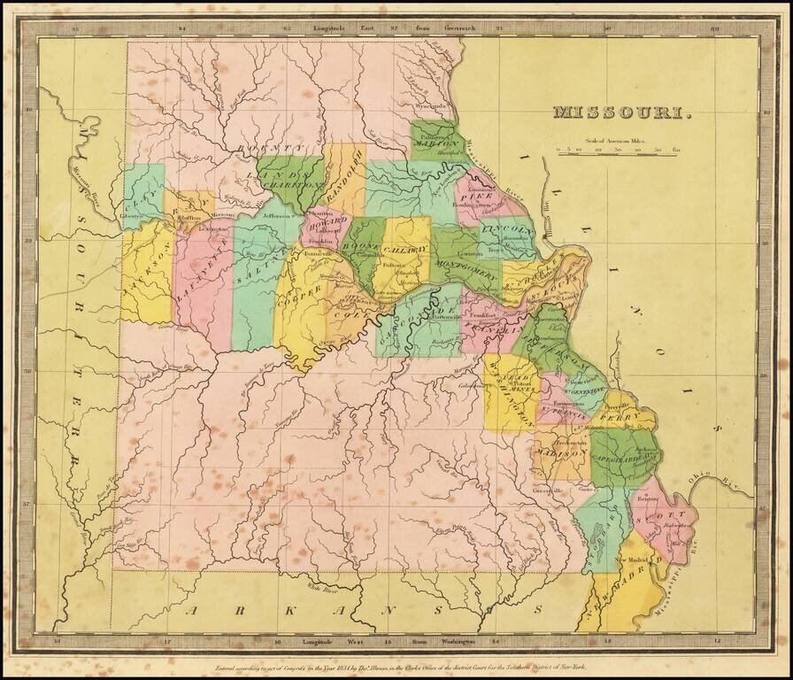
Striking full color example of the first edition of David Burr's map of Missouri, which appeared in his Universal Atlas. Includes fascinating primitive counties, large unnamed counties in the north and south, Bounty Lands above Chariton, etc. The...
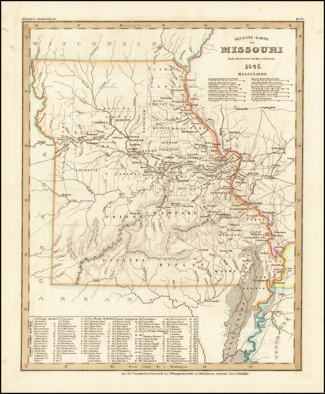
Elegantly engraved & detailed map, taken based upon Tanner's work in the early 1840s. Shows counties, towns, roads, mountain ranges, rivers etc. Includes a table of Distances and times for various steamship routes along several rivers.
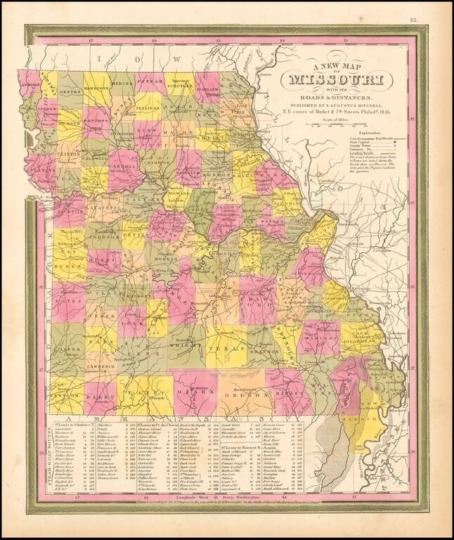
Detailed and interesting map from Mitchell's New Universal Atlas. Hand colored by county and showing towns, rivers, lakes, railroads, roads, etc. Table of Steam Boat routes and distances. Nice wide margins. Mitchell's pre-1850 maps are becoming...
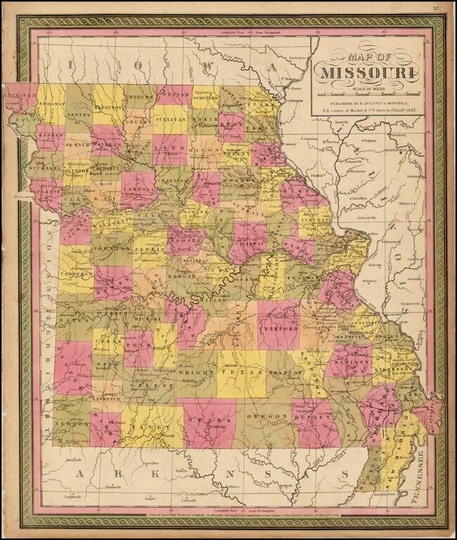
Detailed map of Missouri, hand colored by counties, and showing towns, roads, rivers, mountains, lakes, forts, Post Offices and other details. From one of the leading map makers of the mid-19th Century.
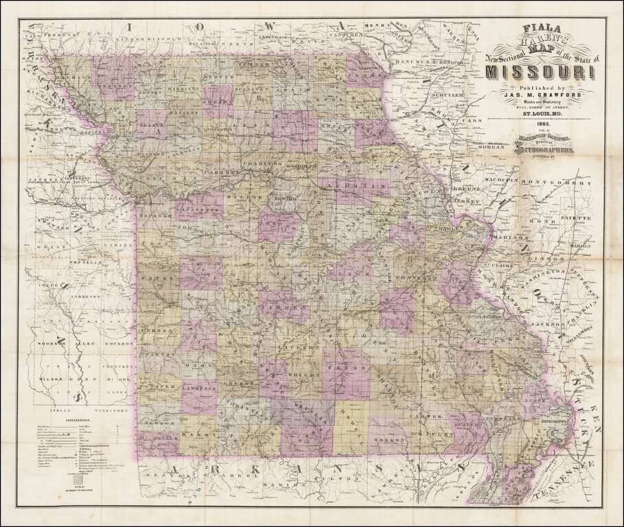
Rare separately published map of Missouri by Fiala and Haren, published in St. Louis by James M. Crawford. The map is hand colored by counties and subdivided by townships, with an extensive explanation of symbols at the bottom left corner. Among the...
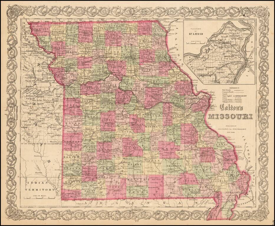
Detailed map of Missouri, colored by counties. Shows roads, railroads, towns, villages, post offices, rivers, lakes, stations and a host of other details. Inset of St. Louis vicinity in upper right corner. Decorative border. A terrific map, from JH...
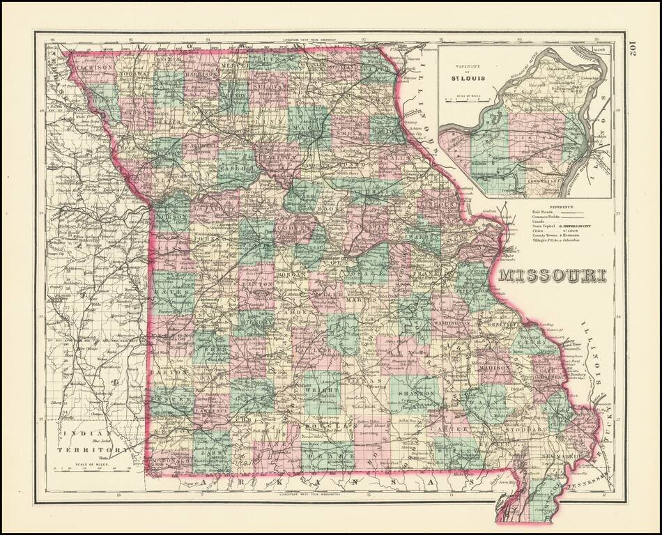
Detailed map of Missouri, hand colored by counties. Includes a large inset map of St. Louis. Excellent detail throughout, including counties, townships, towns, rivers, roads, railroads and a host of other details.
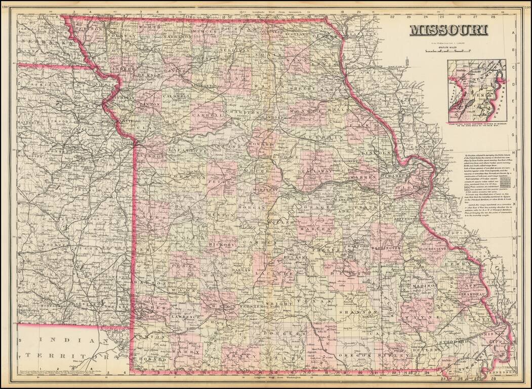
Highly detailed map of Missouri, published by OW Gray. The map is colored by counties and showing towns, roads, railroads, Post Offices, etc. Inset of the plan of the eastern portion of Missouri.