logo

1799. Map of the Northern Provinces of the United States

  • Map of the Northern Provinces of the United States

Map of the Northern Provinces of the United States information:

Year of creation: 
Resolution size (pixels): 
 12144x7888 px
Disk Size: 
 22.3683MiB
Number of pages: 
 1
Place: 
 London

Print information. Print size (Width x height in inches):
Printing at 72 dpi 
  168.67 х 109.56
Printing at 150 dpi 
 80.96 х 52.59
Printing at 300 dpi 
 40.48 х 26.29

An example of detailing the file of this map of in a printable high-resolution:

Click to open in high resolution (open in new tab).
Attention! this is just the central piece (central area 960x960 px) of the map file!
This is an example, so that you can see and study the level of detail of a given map. The entire Map will be fully available after payment!

Map of the Northern Provinces of the United States

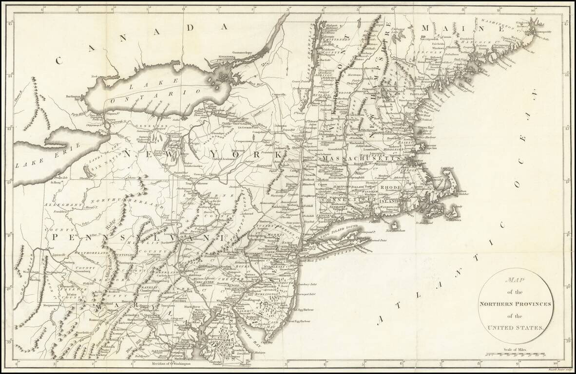
Detailed map of the Northeastern United States, extending south to Maryland and the Upper Chesapeake.

The map includes excellent treatment of the early US roads throughout the region.

The map appeared in La Rochefoucault-Liancourt's Travels Through the United States.


Special conditions for students!

If you are a student, write to us in telegram: @antiquemaps and indicate what material you need and for what work you need a map in high detail. We are ready to provide material on special terms. For students only!

Item information:

Year of creation:
Size:
12144x7888 px
Disk:
22.3683MiB
Number of pages:
1
Place:
London
Author:
Francois A.F. La Rochefoucault-Liancourt.
$14.99

Related item