
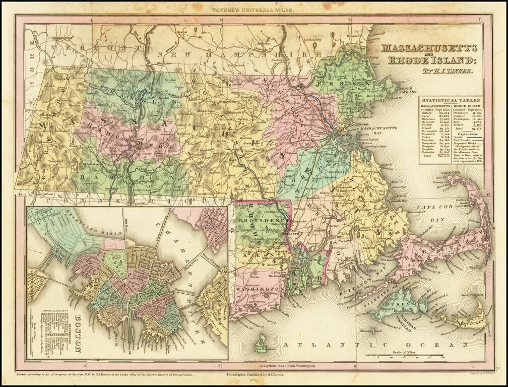
Nice example of Massachusetts and Rhode Island from Tanner's New Universal Atlas. This map is hand colored by county and contains great detail, including, waterways, travel routes, and rail lines. A statistical inset provides population by county....
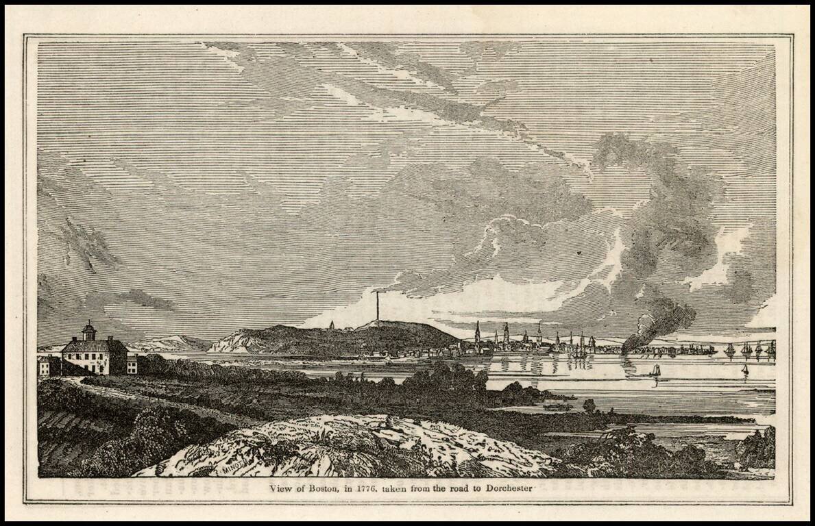
Early view of Boston, from the Historical Collection of the State of Massachusetts. John Warner Barber (1798-1885), was an American engraver whose books of state, national, and local history featured his vivid illustrations, said to have caught the...
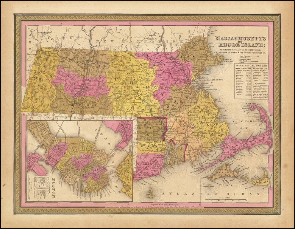
Detailed map of Massachusetts and Rhode Island from Mitchell's New Universal Atlas, showing railroads, townships, canals, etc. Hand colored by county. Statistical table shows population by county. Inset of Boston showing important buildings. An...
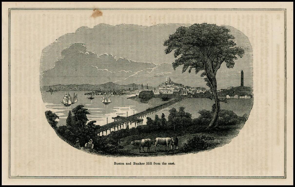
Woodcut view of Boston and Bunker Hill, from a mid 19th Century work.
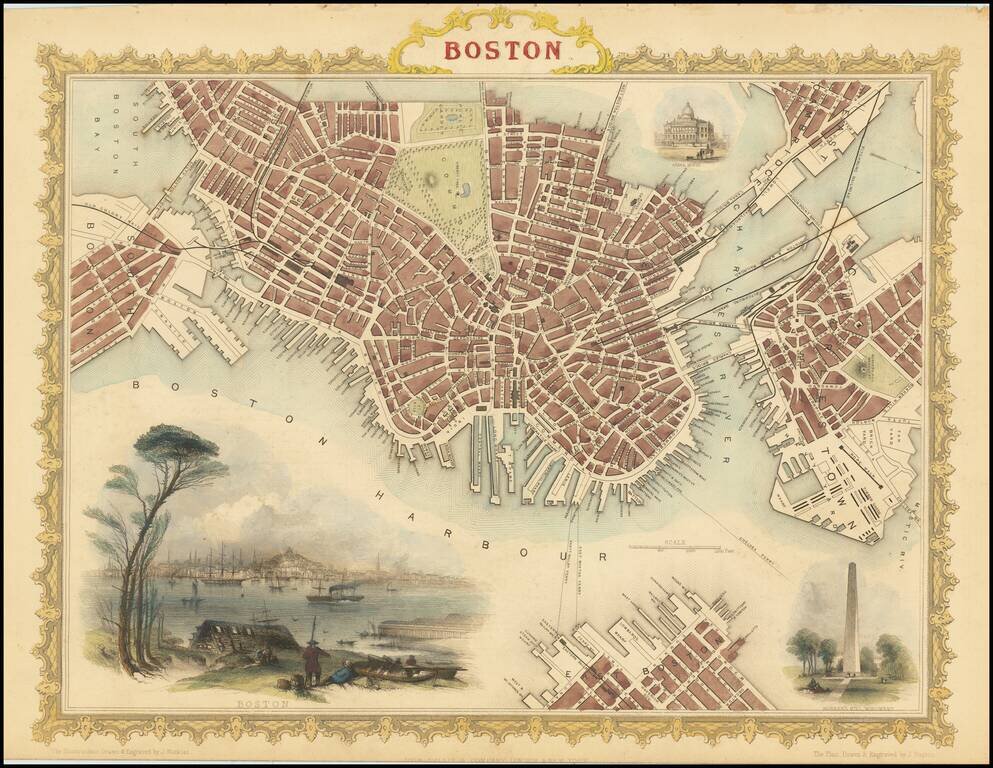
Striking full color example of Tallis's town plan of Boston, with a massive view and vignettes of Bunker Hill Monument and the State House. One of the most decorative and sought after town plans of the City to appear in an atlas in the mid-19th...
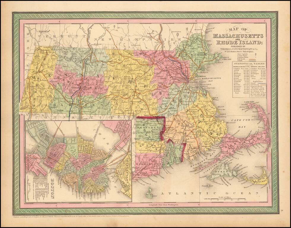
Striking map of Massachusetts and Rhode Island, hand colored by counties, from Thomas Cowperthwait & Co.'s New Universal Atlas. The map names towns, rivers, lakes, islands, etc. and shows roads with distances, railroads and other details. Large...
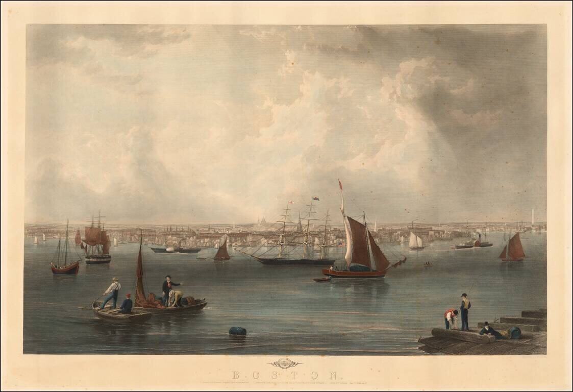
Fine view of Boston engraved by Charles Mottram, based upon a painting by John W. Hill. Originally published by Smith Brothers & Co. in 1857, the view is one of the finest 19th Century views of Boston and its harbor, with the statehouse dome...
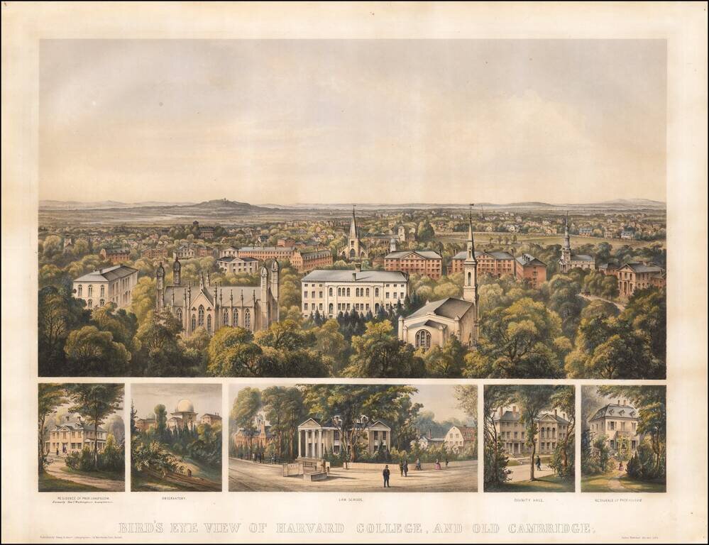
Finely colored early view of Harvard College, published in Boston in 1858. Includes a fine overview of Harvard, with 5 smaller views showing: Residence of Prof. Longfellow, formally Genl. Washington's Headquarters Observatory Law School Divinity...
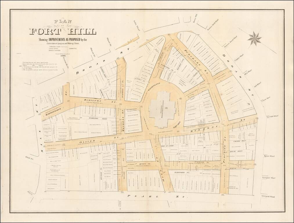
Fascinating large format map of part of downtown Boston, published for the Common Council. Detailed planning map showing part of downtown Boston, near the modern day Aquarium, Harbor Towers, Norman B. Leventhal Park, and Boston Harbor Sailing Club....
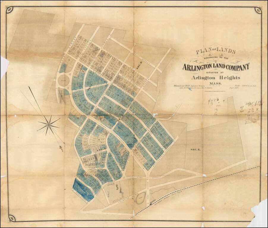
Rare early development map of Arlington Heights, Massachusetts. The map is oriented with Southwest at the top. The Park Circle Water Tower site is located. The Lexington Branch Railroad is shown looping around a Pond near the present site of the...
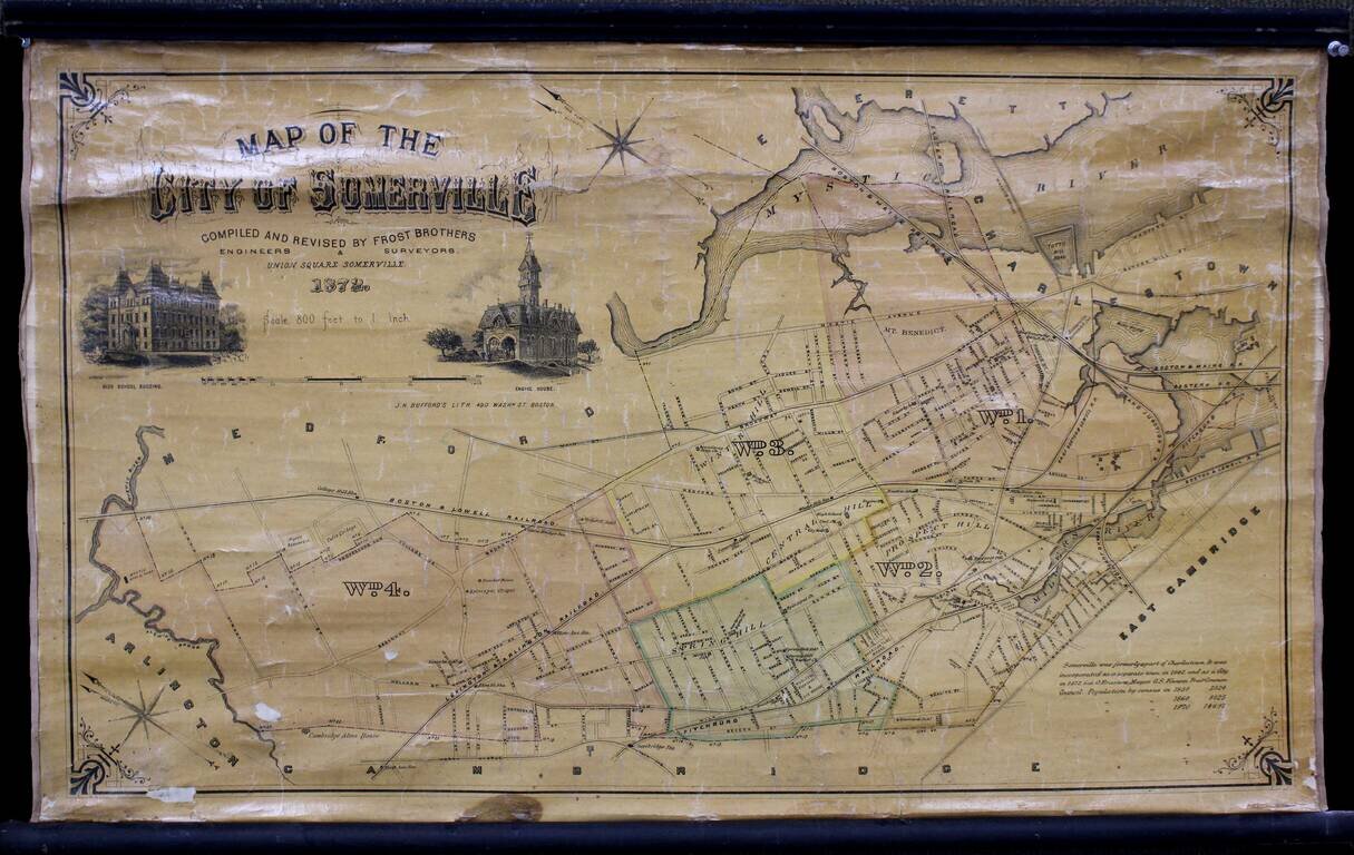
Wonderful separately issued map of Somerville, Massachusetts, in the Boston metropolitan area. Tufts College is shown on the border between Somerville and Medford. The Mystic Reservoir is named and illustrated. College Hill Station is labeled....
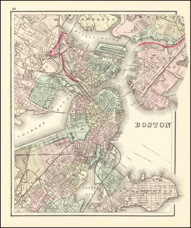
Fine example of OW Gray's map of Boston and the neighboring cities, showing marvelous local details throughout. Extends to Brookline, Cambridge, Somerville, Everett, Chelsea, etc. From one of the leading American map publisher's of the 1870s.
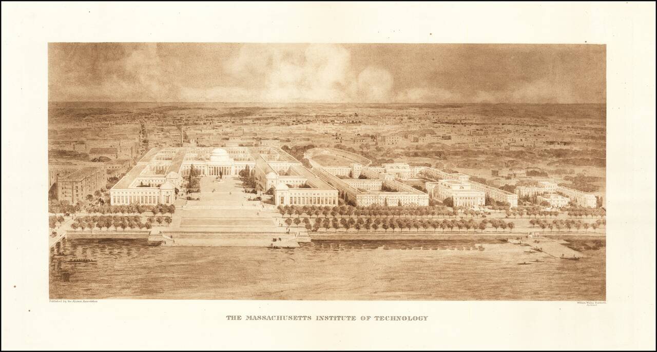
Rare Early View of MIT Fine example of William Welles Bosworth bird's-eye view of the Massachusetts Institute of Technology (MIT) campus in Cambridge, Massachusetts, published by the Alumni Association. Bosworth's view shows MIT from across the...
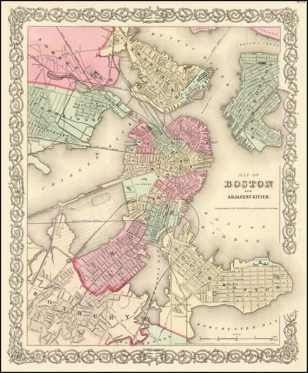
Detailed map of Boston and vicinity, extending to the Mystic River, Chelsea Creek, Sommerville, Cambridge, Roxbury and South Boston. Shows streets, roads, railroads, bridges, buidings, wharfs, etc. An excellent map of Boston during the Civil War. JH...
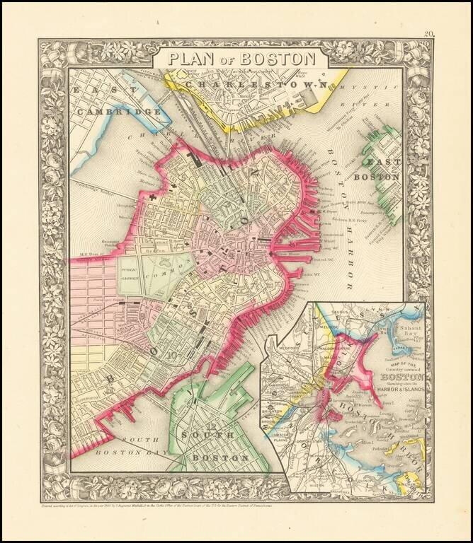
Highly detailed large format map of the city of Boston and environs, hand colored by wards. Shows railroad lines, roads, streets, wharfs, bridges, buildings, rivers and other landmarks. Extends to Charlestown. Large inset of Boston Harbor and Islands....
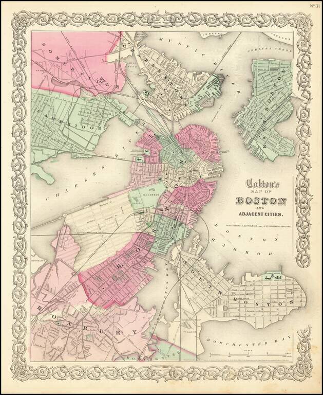
Detailed map of Boston and vicinity, extending to the Mystic River, Chelsea Creek, Sommerville, Cambridge, Roxbury and South Boston. Shows streets, roads, railroads, bridges, buidings, wharfs, etc. An excellent map of Boston during the Civil War. JH...