
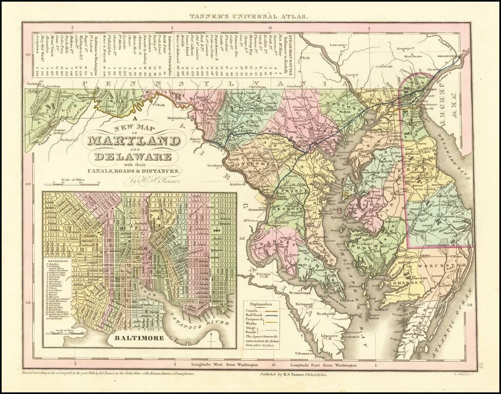
Scarce Carey & Hart edition of Tanner's map of Maryland and Delaware, from Tanner's Universal Atlas. Detailed and interesting map, hand colored by county and showing towns, rivers, bays, lakes, railroads, roads, distances, etc. Tables of Steam...
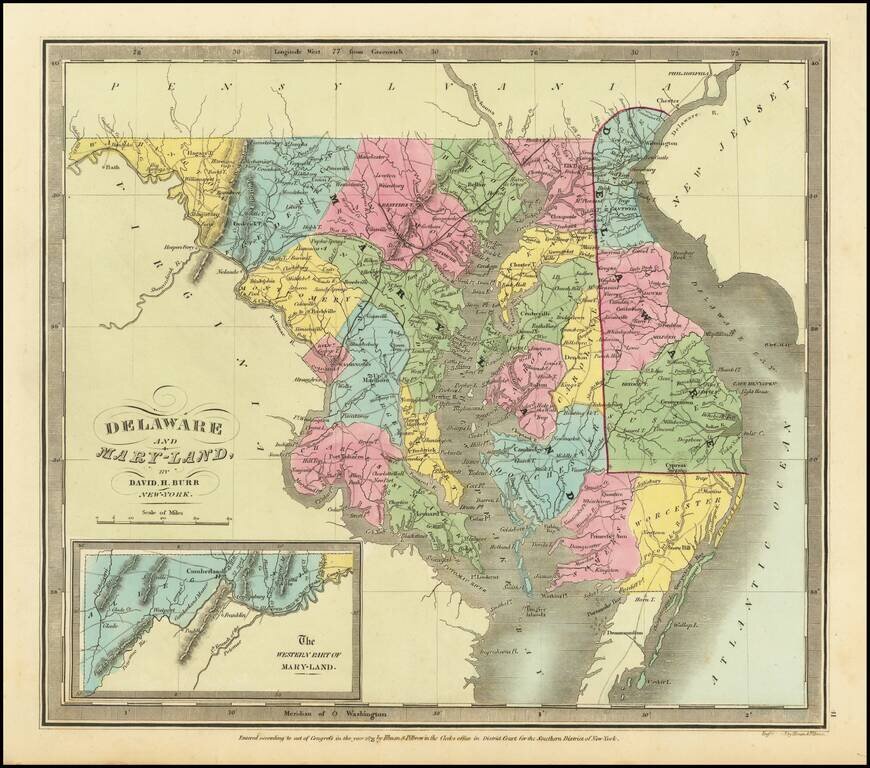
Rare example of the first edition of David Burr's map of Maryland and Delaware, which appeared in his Universal Atlas, first issued in 1836. Shows counties, towns, rivers, roads, courthouses and other details. Burr's Atlas was perhaps the most...
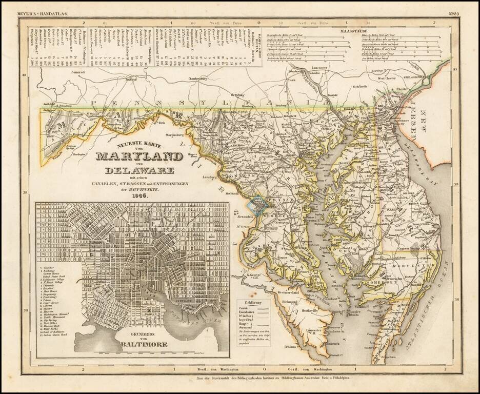
An elegantly engraved and highly detailed map of Maryland and Delaware, with a large inset plan of Baltimore. The map is based upon Tanner's work in the early 1840s. Shows counties, towns, roads, canals, lakes, etc. While often referred to as the...
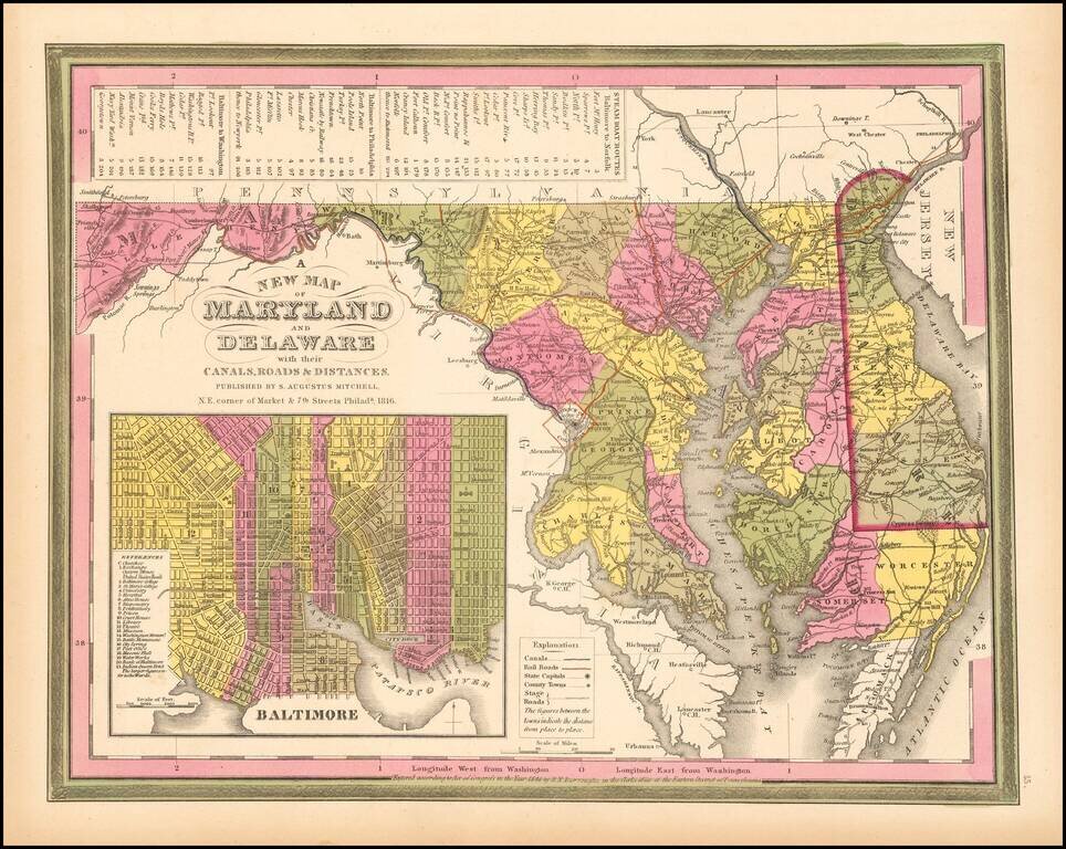
Detailed and interesting map of Maryland and Delaware, hand colored by county and showing towns, rivers, bays, lakes, railroads, roads, distances, etc. This 1849 state of the map includes for the first time a number of railroads not present in earlier...
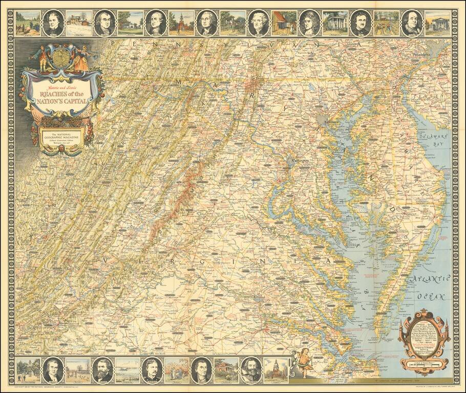
Entertaining map of the the Chesapeake Region, topped with portraits of 8 of the founding fathers and vignettes of important places in American history.
![[ Wilmington, Delaware -- Colonial Manuscript Map and Indenture ]](/map/small/36737.jpg)
Manuscript indenture with seal, signed by Peter Peterson and Rebecah R. Peterson, conveying land in the central part of Wilmington, Delaware, just southwest of Brandywine Creek and dated May, 1761. The land in question, bounded by Brandywine Creek,...
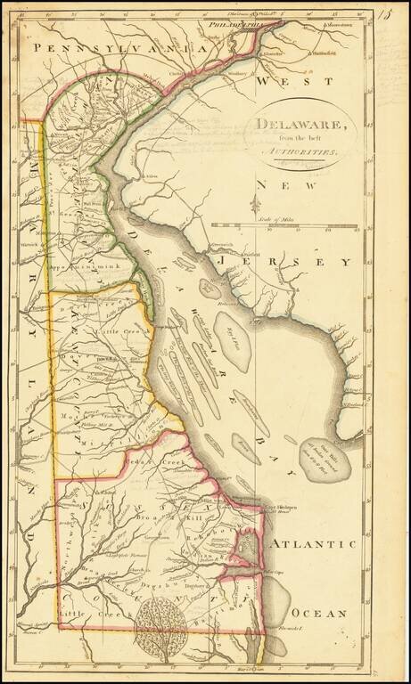
Including Extensive Early Pencil Annotations Annotated example of Matthew Carey's map of the State of Delaware, from the scarce 1816 edition of Carey's General Atlas. The map shows counties, early roads, towns and other details. One of the earliest...
Nice example of Matthew Carey's early map of Delaware. A highly detailed map, which includes towns, roads, rivers and many other details.
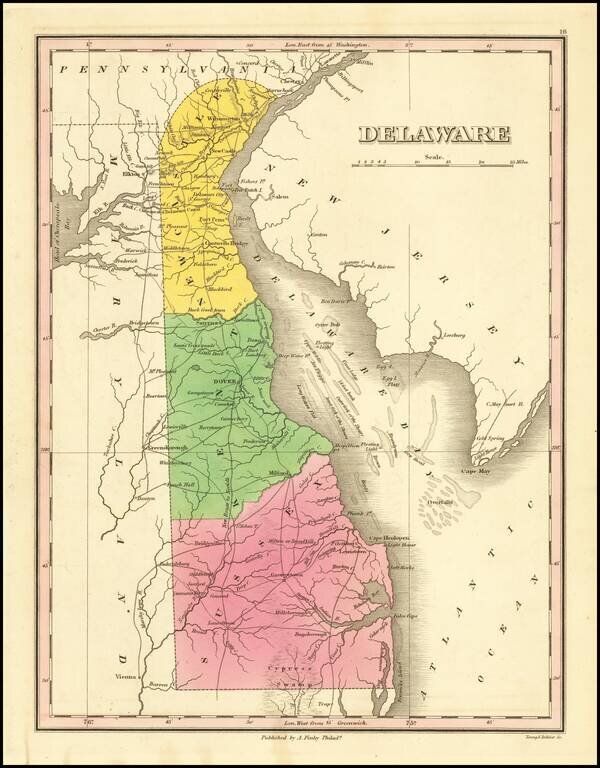
Nice example of this fine map of Delaware, from Finley's General Atlas. The map is hand colored by counties and showing towns, roads, rivers, mountains and other geographical features.
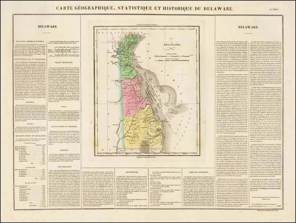
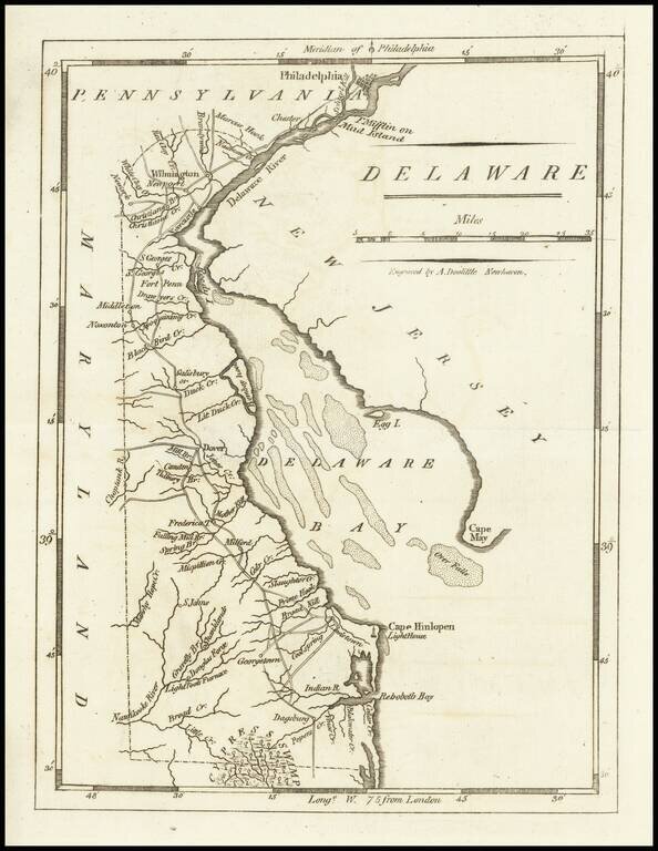
Nice example of the French edition of this early map of Delaware from Carey & Lea's Atlas. Includes wonderful contemporary details concerning the topography, indigenous lands, rivers, climate, towns, manufacturing, commerce, education, history,...
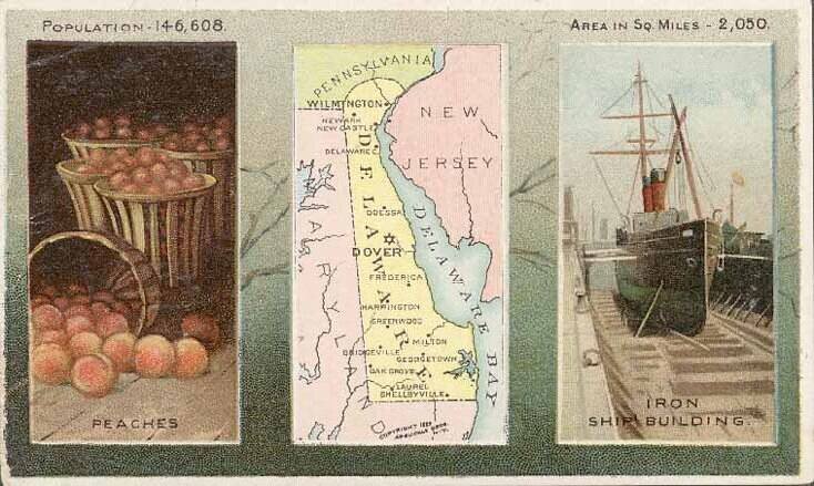
Decorative and unusual trading card map from this famous series. Map is surrounded by decorative vignette, showing Iron Ship Building and Peaches. Includes population statistics.