
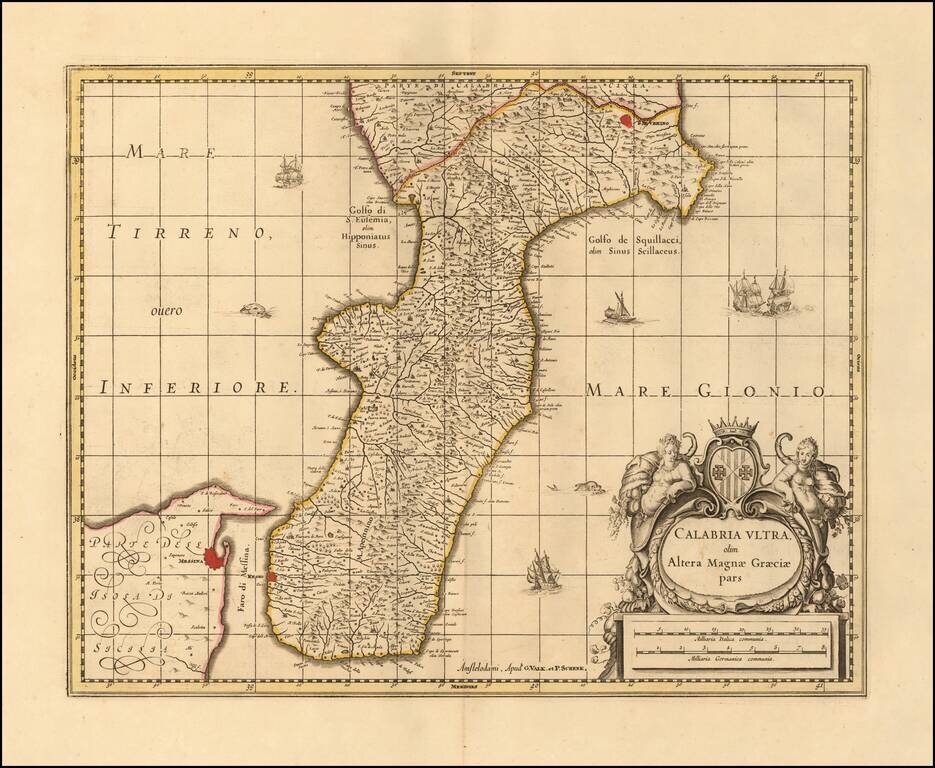
Nice example of Valk & Schenk's map of Calabria and the northern tip of Sicily. Includes sailing ships, a sea monster and decorative cartouche. Larger cities include Reggio Calabria, Bova, Fiumara, Gerace, Oppida, Nicotera, Isola (di Capo...
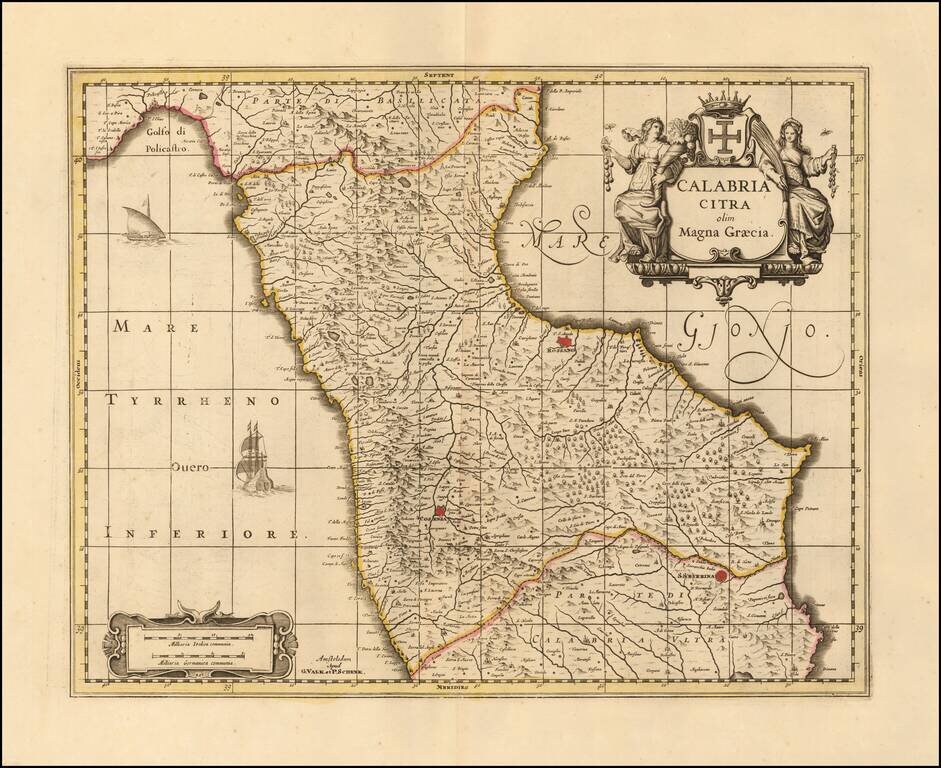
Nice old color example of Valk & Schenk's map of the north part Calabria. Includes sailing ships and decorative cartouche. Larger towns include Cosenza and Rossano.
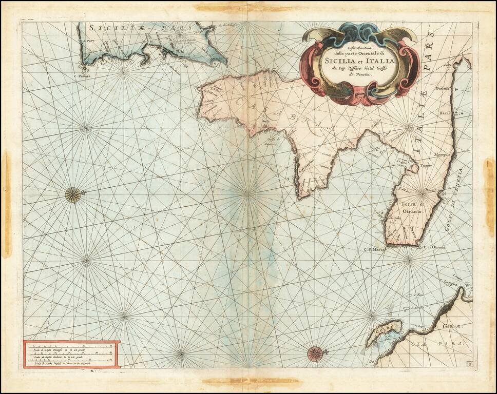
Fine chart of the Mediterranean coastline Southern Italy and southern part of Sicily, which appeared in Volume 1 of Coronelli's Corso Geographico, published in Venice. The sea chart would appear to be the chart originally issued in 1663 by Francesco...
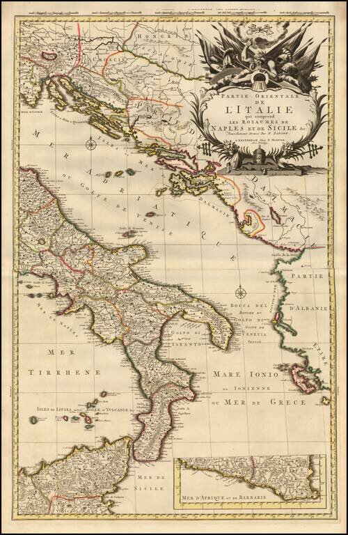
A fine example of Pieter Mortier's map of Eastern Italy which includes the Kingdoms of Naples and Sicily. The map details the surrounding areas of Italy such as the Dalmatian Islands in the Adriatic, the Aeolian Islands north of Sicily in the...
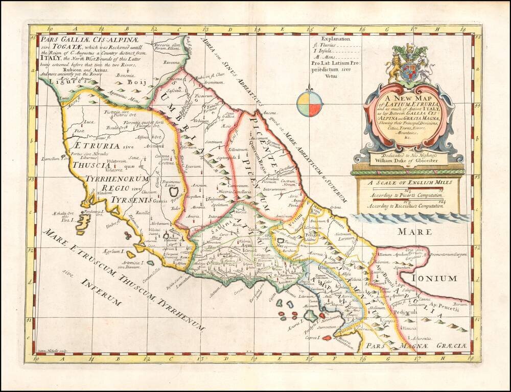
Decorative regional map of the Central and Southen Regions of Italy, as known in ancient times. This decorative map was part of a set of 22 maps dedicated to William, Duke of Glouchester, who was then an 11 year old student at Oxford.
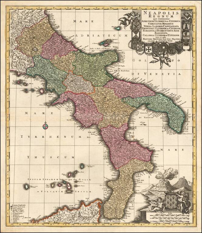
Striking example of Homann's map of the Kingdom of Naples. Includes a spectacular decorative cartouche with sea monsters, cherubs and flying horses, and a second cartouche with Mt. Vesuvius erupting.
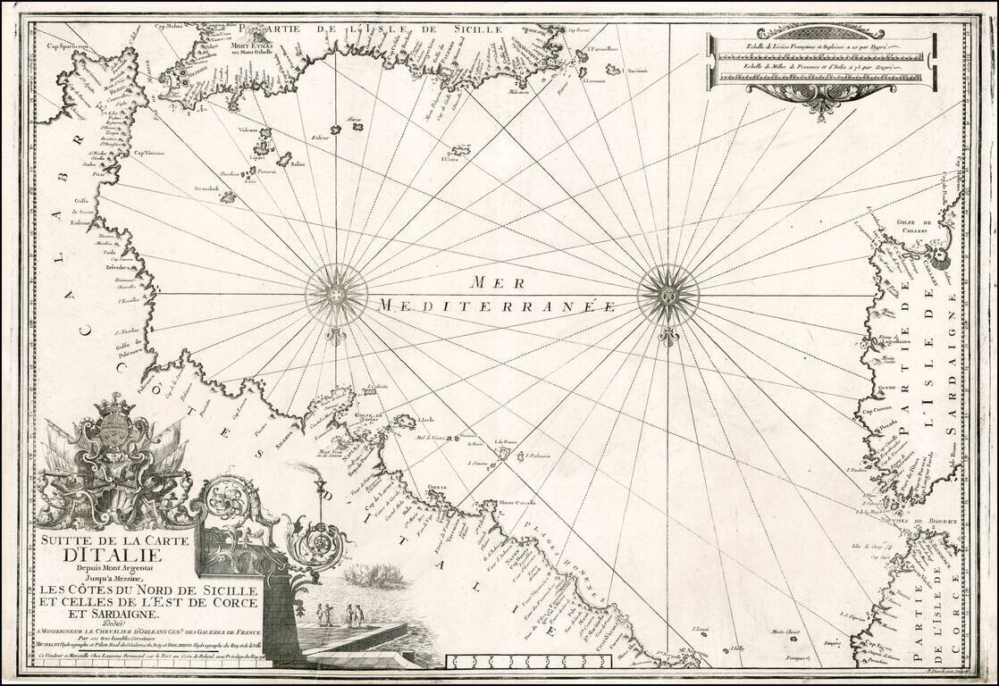
Striking chart of the Southern Italian Mediterranean coastline, from Mt. Argentate and Plages Romenes to the south tip of Calabria, north coast of Sicily, east coat of Sardinia and southeast coast of Corsica. Nice example of this scarce chart, one of...
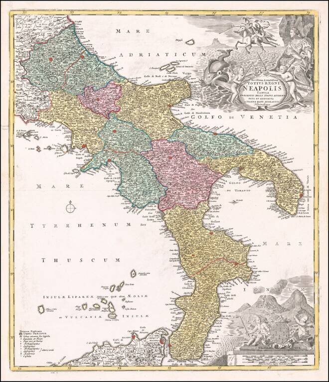
A Fine Dark Impression of Seutter's Map of the Kingdom of Naples Finely engraved map of the Kingdom of Naples, published by Mattheus Seutter in Augsburg. The region is depicted extending from Aprutium to Calabria and including part of Sicily....
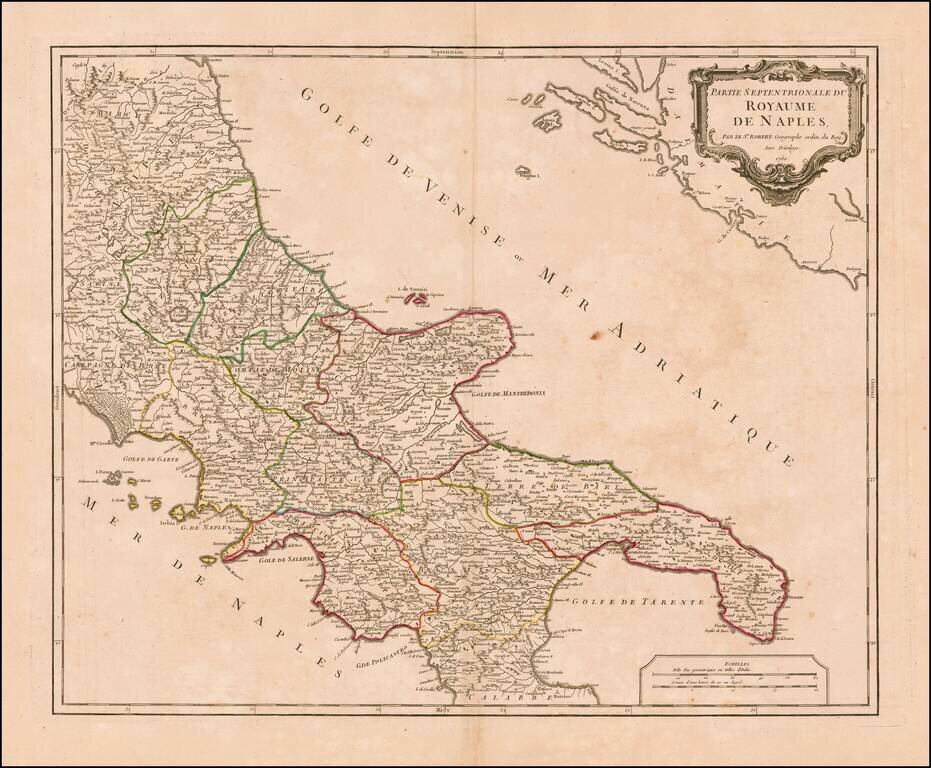
Striking map of the northern portion of the Kingdom of Naples, from an early edition of De Vaugondy's Atlas Universel. Includes towns, mountains, rivers, lakes and a host of other details. De Vaugondy's atlas was one of the most successful and...
Decorative map of Sicily with title cartouche and ornate picture frame border surrounding the map. Shows counties, towns, rivers, lakes, islands, etc. Nice example of a deluxe edition of Brion's maps, which were also offered with plain borders.
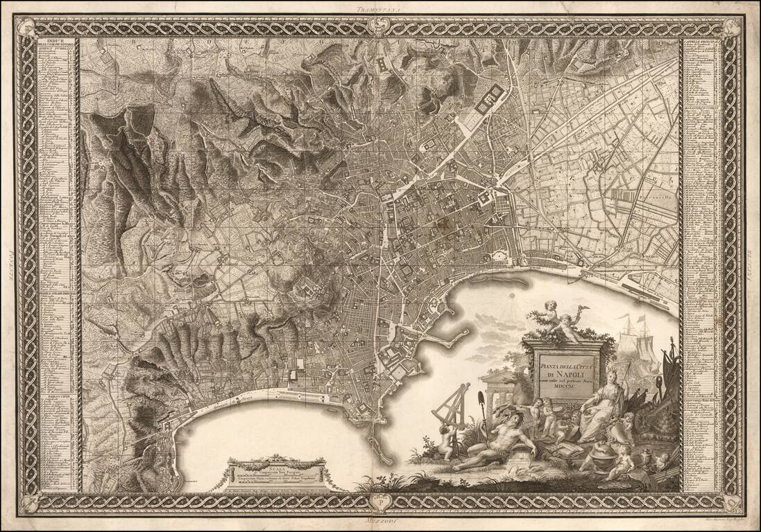
Nice example of Rizzi Zannoni's fine early Plan of Naples and vicinity, engraved by Giuseppe Guerra and published in Naples in 1790. The map is a marvelous blend of engraving artistry and topographical detail, capturing the rugged topography...
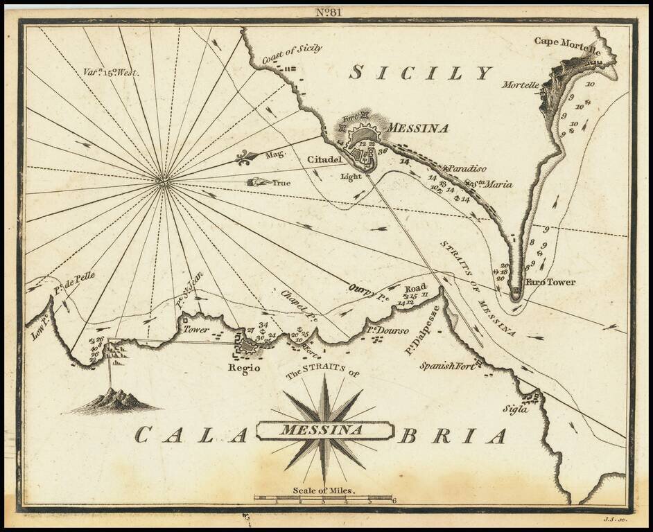
Rare chart of the Strait of Messina, separating Sicily and Calabria in Italy, published by William Heather in London. The chart is oriented with west at the top. It includes soundings, some topographical features, anchorages, and currents. The towns...
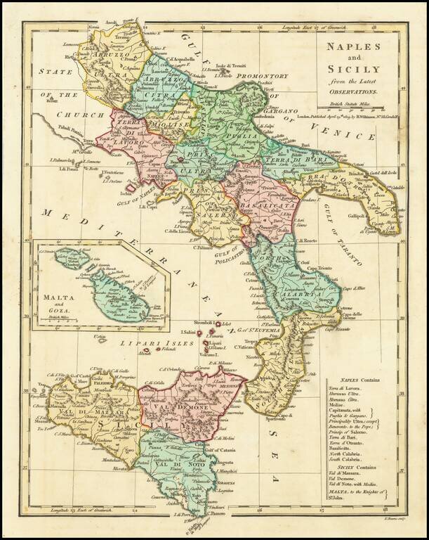
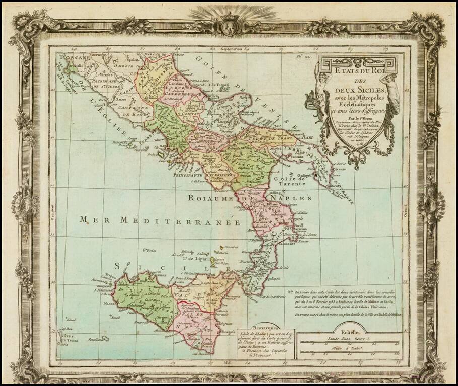
Excellent map of Southern Italy and Sicily extending North to Abruzzo Ultra, Citra and Terra Di Lavorao and showing all of Sicily. Nice detailed inset of Malta and Goza. Includes a number of place names and is colored by kingdoms. Large key shows the...
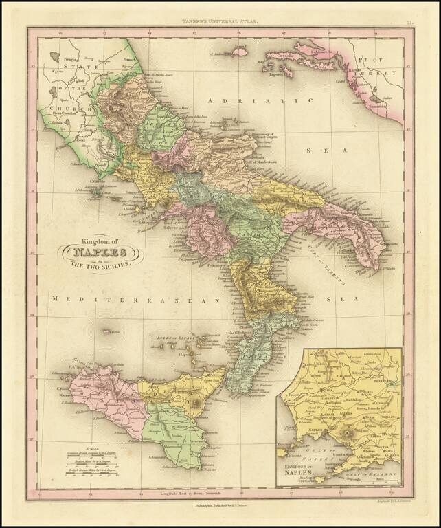
Interesting map of Naples and Sicily, divided into regions. Shows towns, rivers, roads, lakes, mountains, volcanoes, islands, bays, etc. Large inset of the Naples region. This map is from an early edition of Tanner's New Universal Atlas, first issued...
![Southern Italy [Sicily, Sardinia, Corsica]](/map/small/70958.jpg)
Striking decorative map, which includes Corsica, Sardinia and Sicily. Vignettes show the Carnival, Benevento, Naples & Vesuvius and the Festival of the Vintage, along with several costumed dancers in the borders and a human figure. Engraved for...
![[Pompei] Nuova Pianta Degli Scavi di Pompei](/map/small/70053.jpg)
This is a fascinating map of the Ruins of Pompeii, published in Naples during an era of important discoveries in the classical age of archeology. The map shows the extent of extensive excavations to the ancient city, covering about four-fifths of what...