
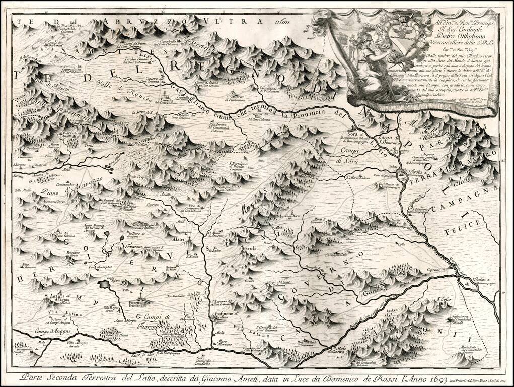
Scarce map of a portion of part of the Kingdom of Napoli, centered on the Gargliano River. The map is a tremendous example of the fine topograpical style of Rossi's maps, elegantly tracing rivers through steep defined mountain valleys. Includes a key...
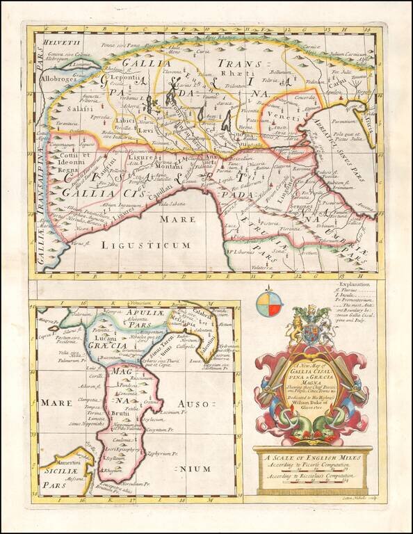
Decorative map of parts of France and Northern Italy and a second map of Southern Italy, with a decorative cartouche. From a special geographical text prepared for William, Duke of Glouchester, during his time at Oxford.

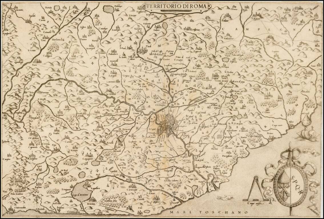
Fascinating map tableau, showing the water supply of Rome, including its many aqueducts.
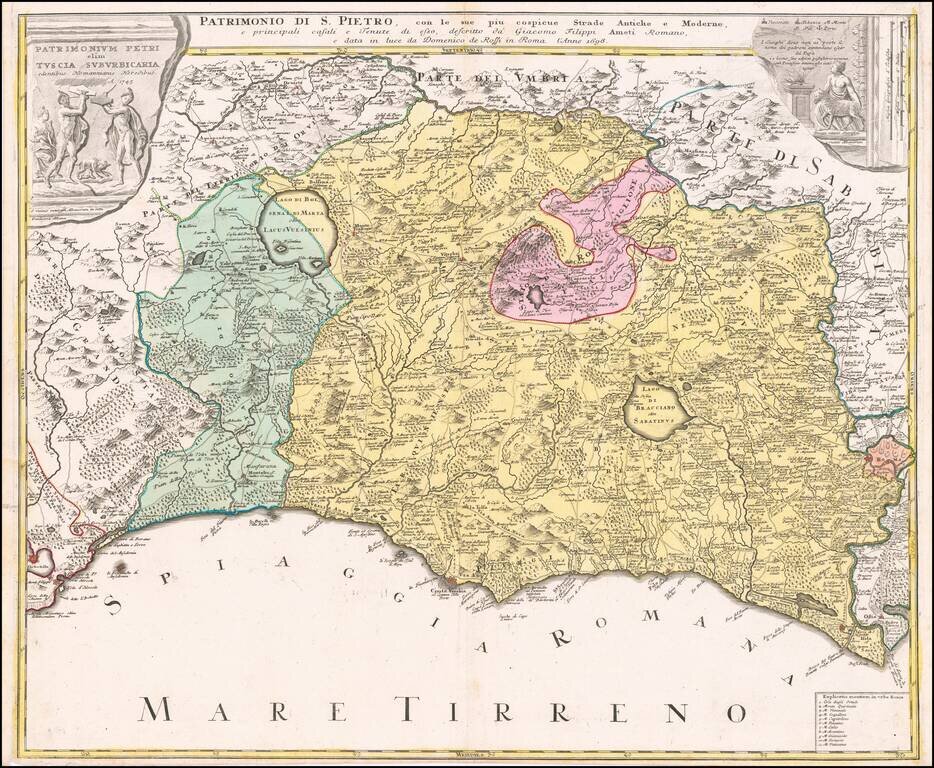
Decorative regional map of Tuscany and the northern part of Lazio, centered on Lago Bolseno and including a massive decorative cartouche. The map is based upon Giovanni Giacomo Rossi's 4-sheet map of the region, published in 1696.
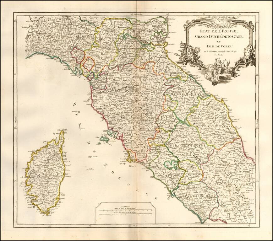
Interesting regional map of Central Italy, Tuscany and Corsica, from an early edition of DeVaugondy's Atlas Universel. Includes towns, mountains, rivers, lakes and a host of other details. De Vaugondy's Atlas Universel was one of the most...
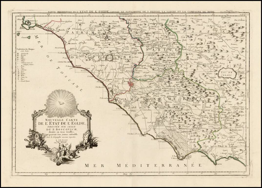
Scarce regional map of the State of the Church (Rome at the center) and environs, published in Venice by Francois Santini. Unlike many of the maps in Santini's atlas, this regional map of Italy is not drawn from De Vaugondy and is based upon Italian...
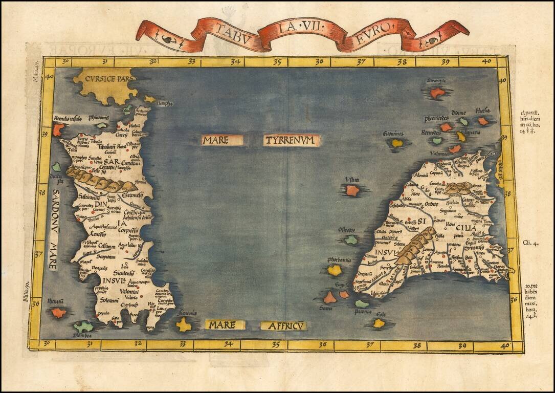
Nice example of the 1525 edition of Lorenz Fries map of Sicily and Sardinia. First published in Strasbourg by Johannes Gruninger in 1522, Fries map is based upon Waldseemuller's map of 1513.
A rare and finely engraved 'Lafreri School' map of Rome and Latium, by the Venetian master Giovanni Francesco Camocio, after the cartography of Eufrosino della Volpaia. This fine map is the first state of one of the earliest printed maps of Latium...
![[Pozzoli] Explicatio aliquot locorum quae Puteolis spectantur](/map/small/58733.jpg)
Lafreri map Of The Bay of Pozzoli Rare separately published chart of the environs of Pozzoli, immediately to the west of Naples, published in Rome in 1586. The map is oriented with west towards the top of the map and includes Roman ruins, mountains,...
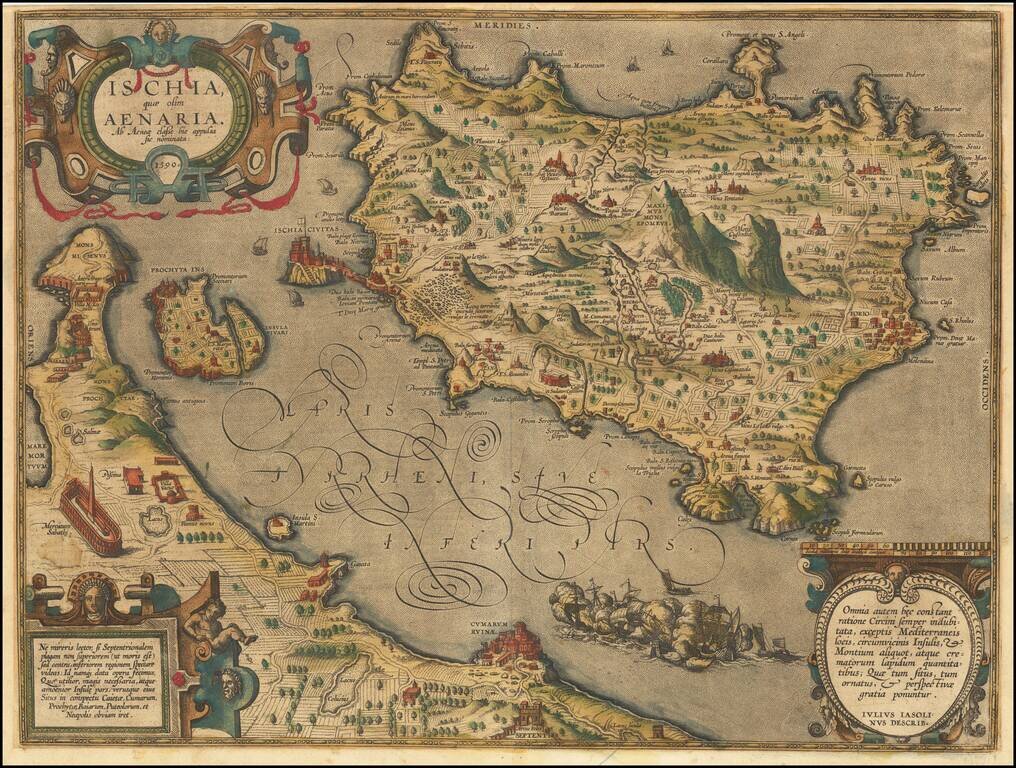
Striking old color example of Ortelius' map of Ischia, from Ortelius' Theatrum Orbis Terrarum. The map is based on a map engraved by Mario Cartario, in a book about Ischia, written by Guilio Iasolino in 1568.
![[Pozzuoli / Bay of Naples]](/map/small/67742.jpg)
Striking map of the area around Pozzuoli and the northwestern part of the Bay of Naples. Includes a key identifying 42 place names.
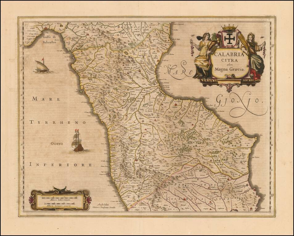
Nice old color example of Jansson's map of the north part Calabria. Includes sailing ships and decorative cartouche. Larger towns include Cosenza and Rossano.
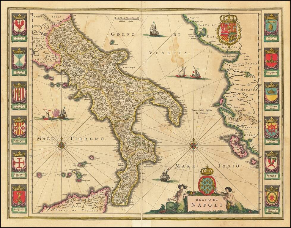
Finely engraved map of the Kingdom of Naples. Includes 12 coats of arms of the local regions on left and right, along with the coat of arms of the Kingdom of Naples above the cartouche and the coat of arms of Spain at the top right.
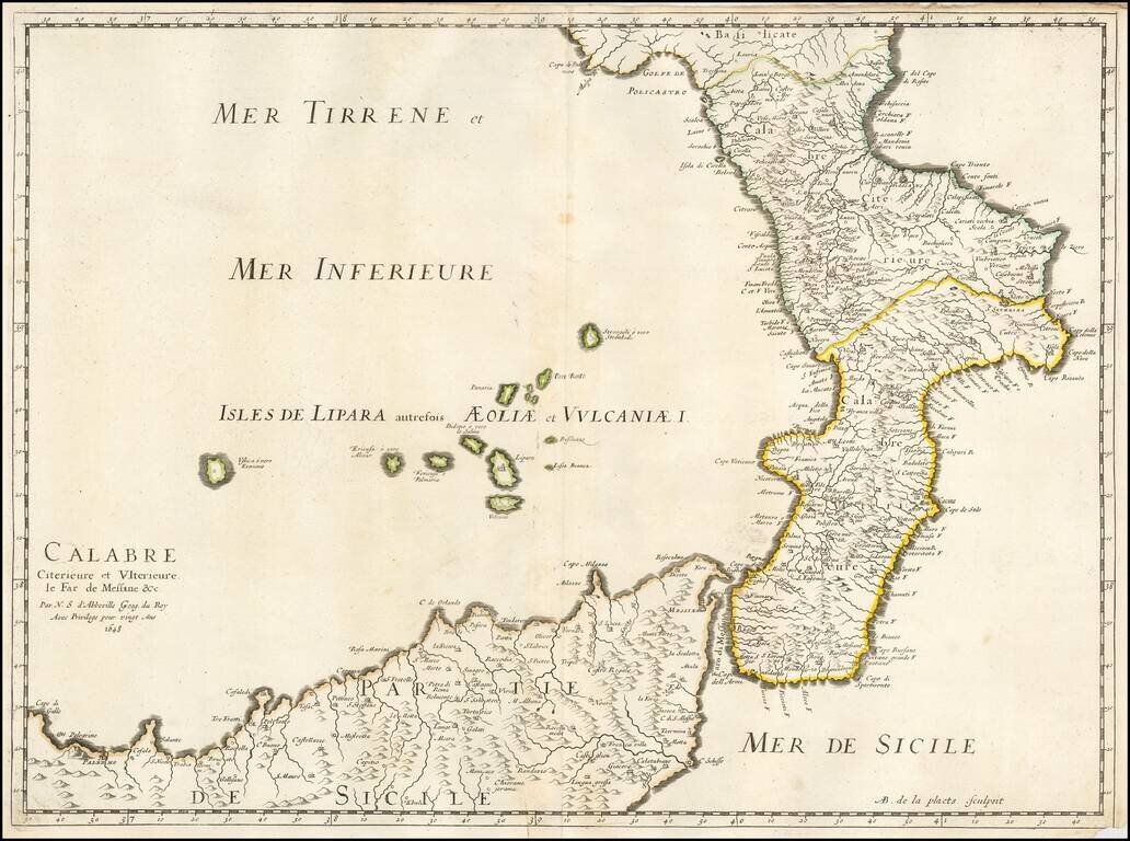
Nicolas Sanson's 1648 double-page engraved map of Calabria, the Strait of Messina, and northern Sicily.
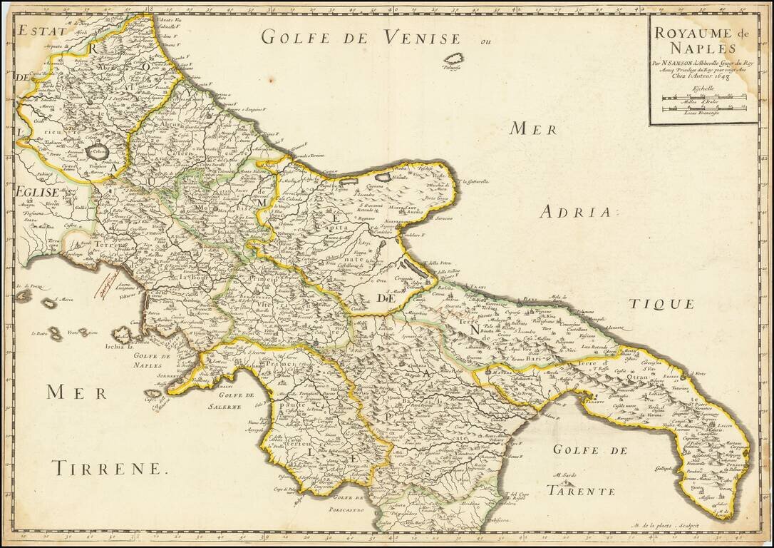
Nicolas Sanson's 1648 double-page engraved map of the Kingdom of Naples.
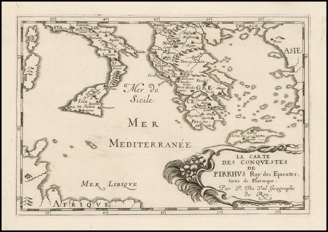
Antique engraved map of the conquests of Pyrrhus of Epirus, covering Greece, Southern Italy, and Sicily. The map was published in Paris in 1660 by Pierre Du Val.