
![[Petit Goave] Plan de la Rade et Ville du Petit Goave dans L'Isle S. Domingue](/map/small/59779.jpg)
Detailed map of area around Petit Goave Bay in Haiti, published in Nicholas Bellin's Petit Atlas Maritime. The chart is oriented with southwest at the top. The plan shows the town, fortifications, anchorages, soundings, buildings, topographical...
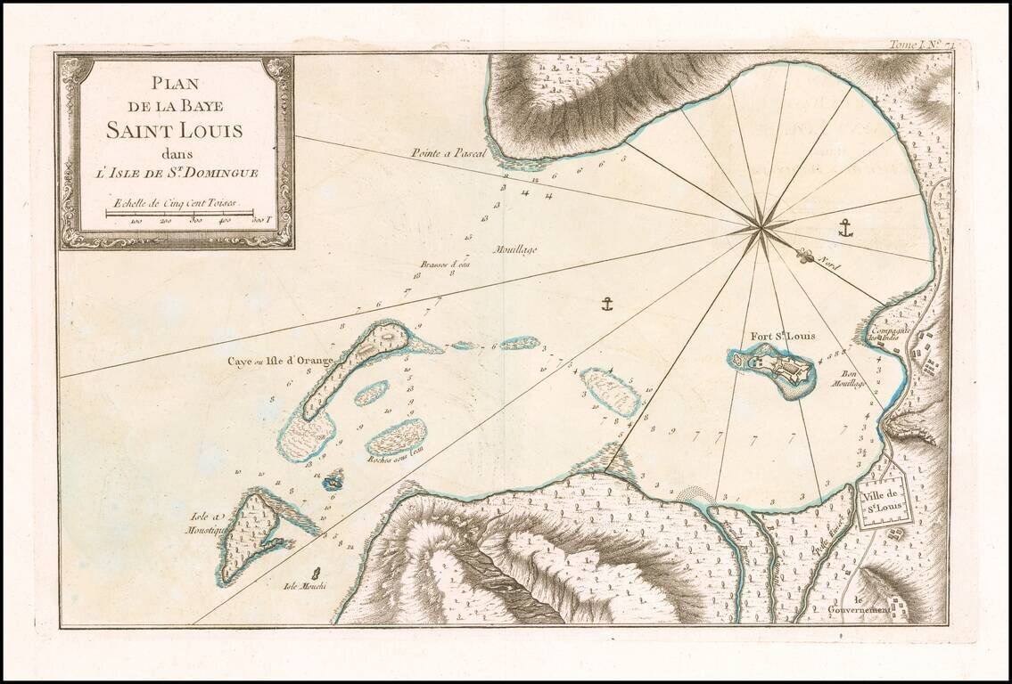
Detailed map of area around Saint Louis Bay, published in Nicholas Bellin's Petit Atlas Maritime. The chart is oriented with southwest at the top. The plan shows the town, anchorages, soundings, buildings, topographical details, etc. Bellin was the...

Detailed map of area on the southwest coast of Haiti, north of Ile a Vache, published in Nicholas Bellin's Petit Atlas Maritime. Bellin was the first Ingenieur Hydrographe de la Marine, and also Official Hydrographer to the French King.
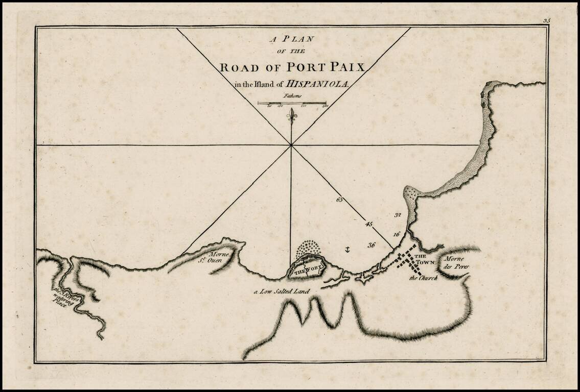
Rare early plan of Port Paix, first published by Sayer & Bennett, one of the earliest obtainable English Plans of the harbor. Includes a detailed charting of the harbor, fort and town, with soundings and anchorages, and place names.
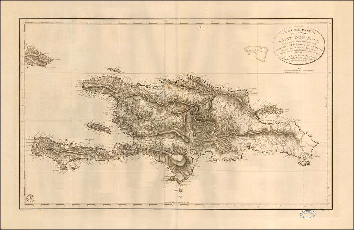
Fine sea chart of Hispaniola, published by the French Depot de la Marine. The map is based upon the work of Antoine-François Sorrel des Revières and Antoine-Hyacinthe-Anne de Chastenet de Puységur. Antoine Sorrel Des Revieres, rose to the...
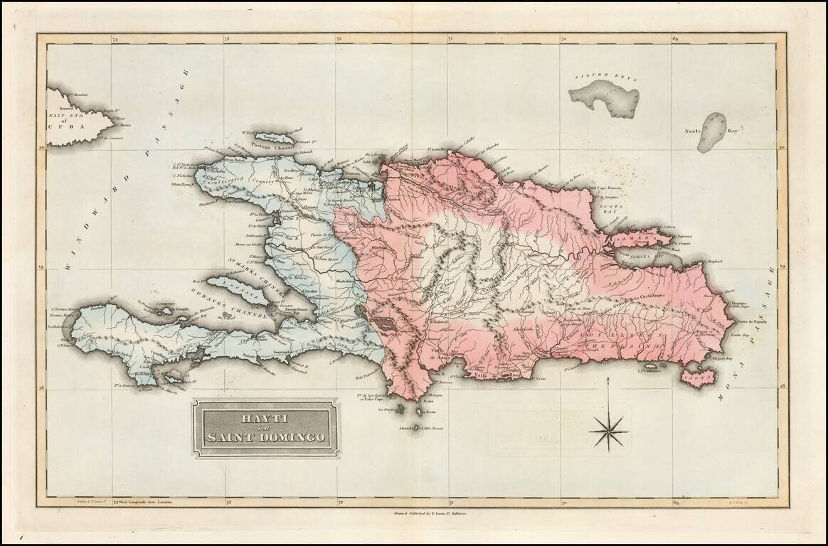
Fielding Lucas's 1823 engraved map of Hispaniola. The map shows the Republic of Spanish Haiti in the east and the Kingdom of Haiti in the west. Just as the map was published the two polities were joined as one. Fielding Lucas' fine work distinguished...
![Amer. Sep. No. 68. Haiti ou St. Domingue [includes Bahamas and Eastern Cuba]](/map/small/41790.jpg)
Highly detailed map of Haiti, the Eastern portion of Cuba, and the eastern part of the Bahamas. In the Bahamas, the map shows Watlings, Conception, Long Island, Exuma and Little Exuma, Hog Cay, Atwoods Cay, the Crooked Isles, French Cays, Mariguana,...
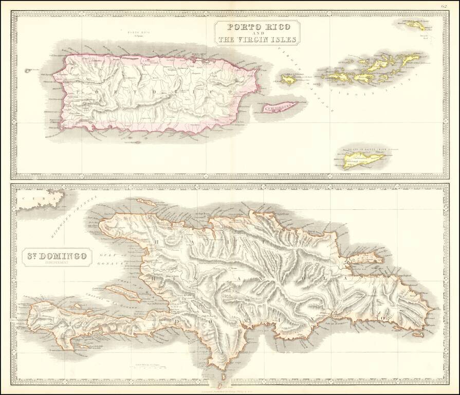
Scarce pair of maps of the Virgin Islands, Puerto Rico and Hispaniola. The top map extends to St. Croix, Anegada and Virgin Gorda.